The best traffic-free bike rides in Floyd County
4.8
(4)
175
riders
20
rides
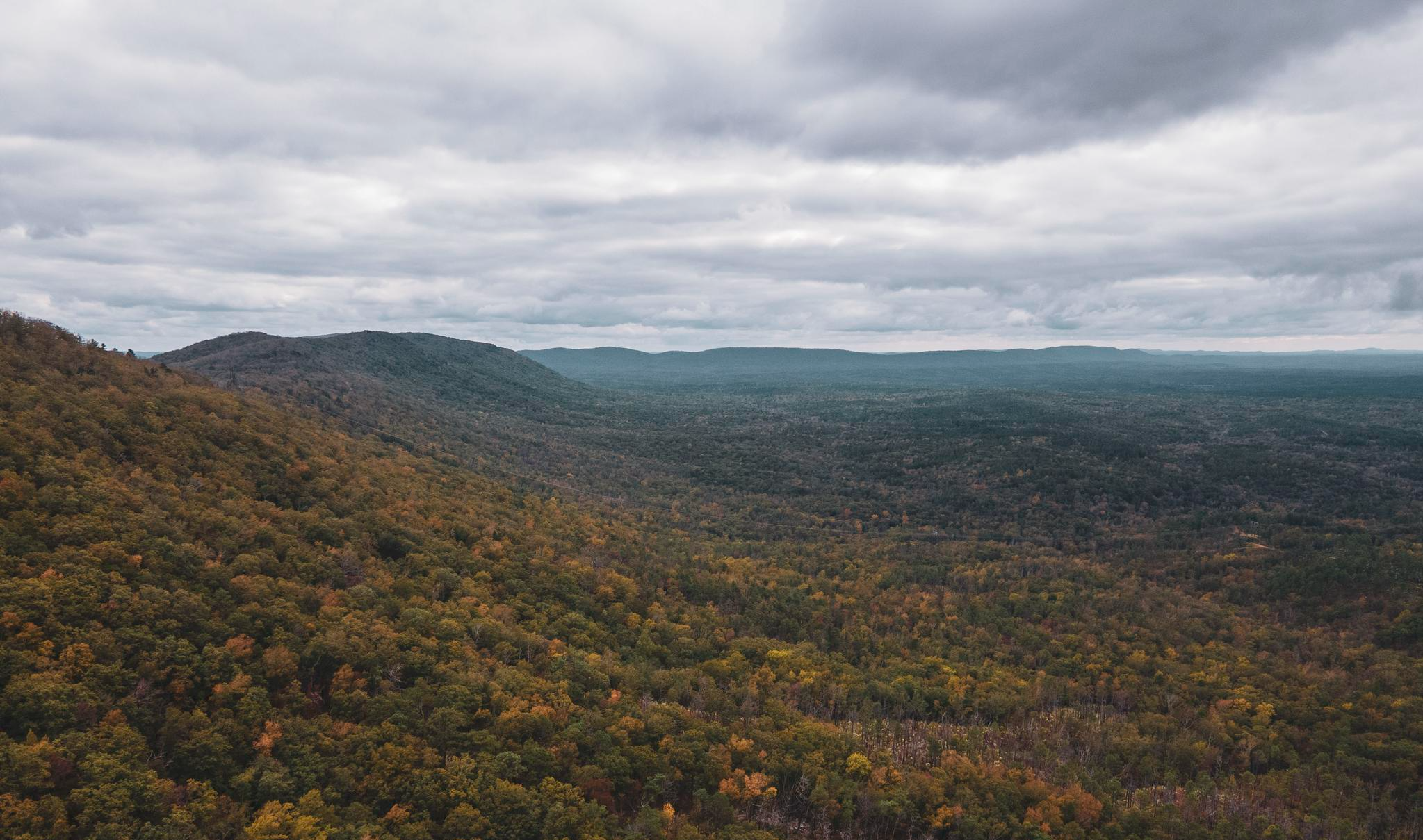
Road cycling in Floyd County, Virginia, is characterized by its location on a high rolling plateau of the Blue Ridge Mountains, approximately 1,500 feet above the Roanoke Valley. The county features a diverse landscape of small mountains, valleys, ridges, and streams. A significant portion of the Blue Ridge Parkway, an iconic fully paved route, runs through the county, offering long-range views of the Virginia Piedmont. This terrain provides varied elevation changes suitable for different levels of road cycling.
Best no traffic road cycling routes in Floyd County
- The most popular no traffic road cycling route is East Armuchee Road loop from Fairfield Inn & Suites, a 60.4 miles (97.2 km) trail that takes 4 hours 12 minutes to complete. This route offers extensive road cycling through the county's varied terrain.
- Another top favourite among local road cyclists is Roadbike loop from Pasquale's Pizza and Pasta, an easy 21.1 miles (33.9 km) path. This route provides a more accessible option with rolling hills and scenic views.
- Local road cyclists also love the Boggs Lake loop from Berry College, a 31.3 miles (50.3 km) trail leading through the region's characteristic valleys and ridges, often completed in about 2 hours 28 minutes.
- Road cycling in Floyd County is defined by its Blue Ridge Mountain setting, rolling plateaus, and access to the Blue Ridge Parkway. The network offers options for easy, moderate, and difficult routes.
- The routes in Floyd County are highly rated by the komoot community with an average score of 4.8 stars from 5 reviews. More than 160 road cyclists have used komoot to explore Floyd County's varied terrain.
Last updated: July 7, 2026
13
riders
97.2km
04:13
540m
540m
The East Armuchee Road loop from Fairfield Inn & Suites offers a unique road cycling experience through the dense forested areas of the Chattahoochee National Forest. Expect a journey with rolling ups and downs, where scenic creek crossings are a notable feature, adding to the natural beauty of the route. While listed as road cycling, be ready for varied terrain, including potential gravel or dirt sections, which makes for an engaging and adventurous ride.
Starting conveniently from the Fairfield Inn & Suites, this moderate 60.4-mile (97.2 km) loop involves 1779 feet (542 metres) of elevation gain and typically takes about 4 hours and 12 minutes to complete. It's a substantial ride, so plan to carry enough water and supplies, especially during warmer months. Checking local conditions, particularly after rain, is advisable due to the possibility of muddy or rocky sections on the unpaved portions.
This route is part of the broader East Armuchee area, known for its multi-use trails and connections to the Pinhoti Trail. It's an excellent option for cyclists looking for a longer, less crowded road cycling route in Northwest Georgia, offering a blend of paved and unpaved surfaces that challenge both endurance and bike handling skills. The mix of terrain and the natural setting make it a memorable ride for those seeking something beyond typical asphalt loops.
6
riders
33.9km
01:28
180m
180m
Easy road ride. Great for any fitness level. Mostly well-paved surfaces and easy to ride.

Sign up for free
6
riders
75.2km
03:44
700m
700m
Moderate road ride. Good fitness required. Mostly well-paved surfaces and easy to ride.
8
riders
51.4km
02:08
360m
360m
The "Lake Julianne – Mathis Lake loop from Lake Conasauga Dam" offers a deep dive into the Cohutta Wilderness, but don't let the name fool you; this 32.0-mile (51.4 km) route with 1186 feet (361 metres) of elevation gain is a moderate challenge best tackled on a gravel or mountain bike, not a road bike. You'll experience dense forests, tunnels of rhododendron, and the tranquil beauty of Lake Conasauga, Georgia's highest lake, all while navigating unpaved, sometimes gnarly, mountain roads. It's a demanding ride, taking about 2 hours and 7 minutes, but rewards you with profound natural serenity.
Planning your visit to this remote area means preparing for challenging access. The Forest Service Roads (FSRs 18, 68, 17) leading to Lake Conasauga Dam are predominantly gravel and can be steep, making for a slow drive even before you start cycling. Cell service is unreliable, so bring everything you need, including navigation tools. Parking is available, but the journey to the trailhead itself is part of the adventure, requiring a robust vehicle and a patient approach.
This region is home to the Cohutta Wilderness, the largest federally protected wilderness east of the Mississippi River, offering a truly wild experience. Lake Conasauga, built by the Civilian Conservation Corps, adds a touch of history to the natural grandeur. While the route name suggests road cycling, the reality is a rugged, high-elevation environment perfect for those seeking a true off-road cycling challenge amidst stunning natural beauty, far from paved paths.
5.0
(1)
7
riders
16.7km
01:05
90m
90m
Easy road ride. Great for any fitness level. Mostly well-paved surfaces and easy to ride.
Get access to more routes and recommendations from other explorers.
Sign up for free
Already have an account?
Our route recommendations are based on thousands of hikes, rides, and runs completed by other people on komoot.
Start today with a free account
Your next adventure awaits.
Login or Signup


Other adventures in Floyd County

Tips from the Community

East Armuchee Road is a paved road that crosses the Pinhoti Trail. There's room for about two cars at the trailhead. The trailhead and East Armuchee Road are relatively quiet.
0
0
Frequently Asked Questions
How many no-traffic road cycling routes are available in Floyd County?
Floyd County offers around 20 dedicated no-traffic road cycling routes. These routes cater to various skill levels, with options ranging from easy to challenging.
What is the best time of year for no-traffic road cycling in Floyd County?
The spring and fall months generally offer the most pleasant conditions for road cycling in Floyd County, with mild temperatures and beautiful scenery. Summer can be warm, but the higher elevation of the Blue Ridge Mountains often provides cooler air. Winter cycling is possible, but be mindful of potential ice or snow, especially on higher elevations or less-traveled roads.
Are there any easy no-traffic road cycling routes suitable for beginners or families?
Yes, Floyd County has several easy no-traffic road cycling routes. For instance, the Roadbike loop from Pasquale's Pizza and Pasta is an easy option, covering about 34 km with gentle elevation changes. The region also features routes like the 'Appalachian Farm Flyer' and 'Fretboard Flyer' which are noted for being beginner-friendly with gentle climbs and descents, often incorporating sections of the Blue Ridge Parkway.
What kind of terrain can I expect on no-traffic road cycling routes in Floyd County?
Floyd County's no-traffic road cycling routes offer a diverse terrain. Situated on a high plateau of the Blue Ridge Mountains, you'll encounter rolling hills, gentle climbs, and descents. While many routes are fully paved, some may include mixed-surface sections, so checking route details is always recommended. The Blue Ridge Parkway sections provide smooth, well-maintained surfaces with consistent grades.
What do other cyclists say about no-traffic road cycling in Floyd County?
The komoot community highly rates the cycling experience in Floyd County, with an average score of 4.8 out of 5 stars. Cyclists frequently praise the region for its quiet roads, stunning Blue Ridge Mountain scenery, and the variety of routes available for different skill levels, especially those seeking a peaceful ride away from traffic.
Are there any challenging no-traffic road cycling routes for experienced riders?
Yes, experienced riders will find challenging options. Routes like the 'Rocky Knob Classic' offer a significant 6-mile climb with substantial elevation gain as it incorporates sections of the Blue Ridge Parkway towards Rocky Knob. Other routes, such as the East Armuchee Road loop from Fairfield Inn & Suites, provide a moderate challenge over nearly 100 km with over 500 meters of elevation gain.
Can I find loop routes for no-traffic road cycling in Floyd County?
Many of the no-traffic road cycling routes in Floyd County are designed as loops, allowing you to start and end at the same point. Examples include the Boggs Lake loop from Berry College and the Lumpkin Hill loop from Mount Berry Square Mall, which offer circular journeys through the scenic landscape.
What natural attractions can I see along no-traffic road cycling routes in Floyd County?
Cycling in Floyd County offers access to numerous natural attractions. Many routes incorporate sections of the iconic Blue Ridge Parkway, providing breathtaking long-range views. You can also enjoy views of Buffalo Mountain, the highest point in the county, and pass through areas like the Rocky Knob Recreation Area. Mabry Mill, one of the most photographed sites on the Parkway, is also within Floyd County and makes for a picturesque stop.
Are there places to stop for breaks or refreshments along the no-traffic routes?
Yes, several spots along or near the no-traffic routes offer opportunities for breaks. The Smart View Recreation Area and various overlooks along the Blue Ridge Parkway, such as Rock Castle Gorge and The Saddle, are ideal for scenic stops. The town of Floyd itself also offers cafes and pubs for refreshments.
Where can I find parking for no-traffic road cycling routes in Floyd County?
Parking availability varies by route. For routes that utilize the Blue Ridge Parkway, designated parking areas and overlooks are common. For other routes, it's advisable to check the specific route details on komoot for recommended starting points and parking information. Downtown Floyd also offers parking options, with some routes starting or passing through the town.
Are there any specific permits required for cycling on no-traffic roads in Floyd County?
Generally, no specific permits are required for cycling on public roads or the Blue Ridge Parkway in Floyd County. However, it's always a good practice to check for any local regulations or event-specific requirements if you plan to participate in organized rides or access private lands.
What should I wear for no-traffic road biking in Floyd County?
Given the varied terrain and mountain climate, layering is recommended. Even on warm days, temperatures can change, especially at higher elevations or in shaded areas. Essential gear includes a helmet, appropriate cycling attire, sunglasses, and sun protection. Always check the weather forecast before heading out.
Does Floyd County have any bike-friendly infrastructure or services?
Yes, Floyd County is increasingly bike-friendly. Initiatives like 'Cycle Floyd' provide mapped routes and resources. You can find bike repair stations in downtown Floyd and at Tuggle's Gap, demonstrating the county's commitment to supporting cyclists.

Get inspired with the komoot mobile app


Didn’t find what you were looking for?
Check out more Road cycling routes throughout Floyd County below and find the perfect route in your destination.
Explore more
Browse the best Road cycling routes in other regions.
