The best hikes from bus stations around Valencia De Alcantara
4.7
(322)
1,068
hikers
15
hikes
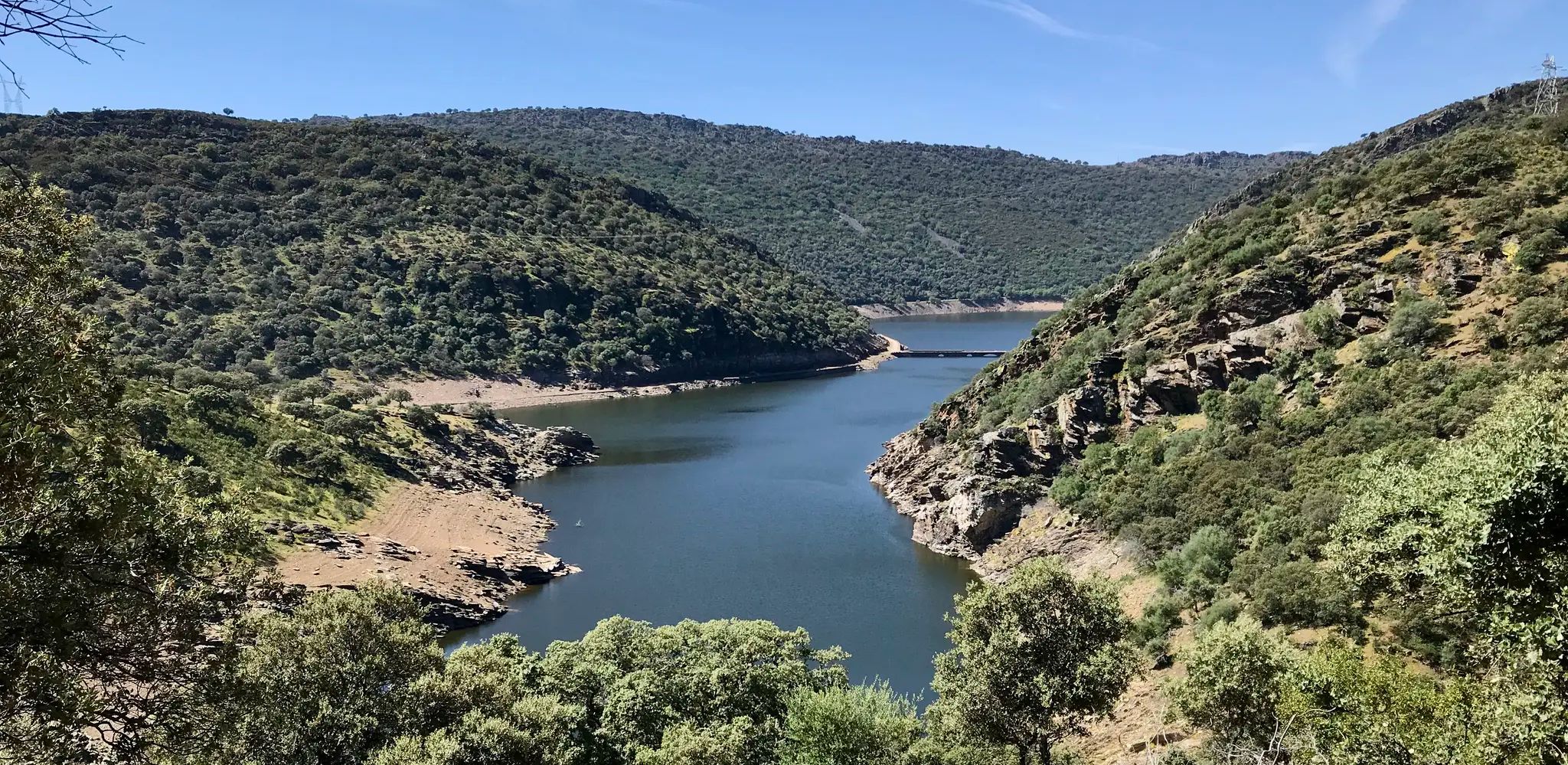
Bus station hiking trails around Valencia De Alcantara offer access to a landscape characterized by ancient megalithic complexes, granite formations, and extensive cork oak forests. The region is part of Extremadura, featuring a mix of low, narrow residual alignments and wide plains, forming the characteristic "dehesa" environment. Hikers will encounter varied geology, including granite batholiths with unique "canchales" and Paleozoic slates. The area is also influenced by the Tajo river system, including the Sever river, which borders Portugal.
Best bus…
Last updated: May 26, 2026
4.7
(22)
106
hikers
9.32km
02:56
370m
370m
Hike the 5.8-mile (9.3 km) Marvão Hiking Trail (PR 1) for a moderate journey through Serra de São Mamede, featuring historic paths and Marvã
5.0
(5)
30
hikers
7.64km
02:06
130m
130m
Hike the Route of the Dolmens of Aceña de la Borrega, a 4.7-mile moderate trail exploring ancient megalithic sites and granite formations.

Sign up for free
4.6
(5)
11
hikers
Moderate hike. Good fitness required. Easily-accessible paths. Suitable for all skill levels.
5.0
(2)
4
hikers
Moderate hike. Good fitness required. Mostly accessible paths. Sure-footedness required.
4
hikers
5.88km
01:39
120m
120m
Easy hike. Great for any fitness level. Easily-accessible paths. Suitable for all skill levels.
Get access to more routes and recommendations from other explorers.
Sign up for free
Already have an account?
Our route recommendations are based on thousands of hikes, rides, and runs completed by other people on komoot.
Start today with a free account
Your next adventure awaits.
Login or Signup

Other adventures around Valencia De Alcantara


Tips from the Community

This vaulted cistern is located within the castle walls and was probably built around the 9th century to store rainwater for the then Arab village of Ibn Maruán, despite clear signs of remodeling in the late Middle Ages. An impressive site. http://www.monumentos.gov.pt/site/app_pagesuser/SIPA.aspx?id=36148
2
0

Unfortunately, the owner no longer permits use of the path. He makes this very clear.
1
0

A place to visit every month. It's wonderful.
2
0
The current pillory dates from the years immediately following the granting of the New Charter by King Manuel in 1512 and reflects his Manueline, albeit very rustic, style. The monument stands in front of the 16th-century district jail building and next to the clock tower, also from the 16th century, in the square that bears his name. It stands on a base with four octagonal steps and consists of an octagonal shaft set directly into the upper step, formed by five drums with mortar joints.
2
0
The Convent of Our Lady of the Star is a 15th-century Franciscan monastery. Founded in 1448 by Pope Nicholas V, the monastery was built on the site of a chapel dedicated to Nossa Senhora da Estrela. It is located on the periphery of Marvão's city walls. A late 15th-century Manueline cross stands in the churchyard, with a spiral column containing figures of Christ and Nossa Senhora da Piedade. https://pt.wikipedia.org/wiki/Convento_de_Nossa_Senhora_da_Estrela The complex now functions as a nursing home, run by Santa Casa da Misericirdia, which provides care for elderly residents of the region.
2
0
A lovely little area in the middle of this picturesque, historic castle town. A beautifully maintained garden with a refreshing pond-like fountain in the lower middle section. The small hedges surrounding the flowerbeds, with their narrow patches of space between them, invite you to wander. The view of the castle and the surrounding countryside is breathtaking. I highly recommend a visit to this small but perfectly landscaped park.
2
0
The fortified town of Marvão, 12 kilometers from Quinta do Pomarinho, is also known as the "Eagle's Nest." It boasts a spectacular location on a granite cliff, atop one of the peaks of the Serra de São de Mamede mountain range. Completely walled, Marvão is situated in the Alto Alentejo region, near the Spanish border, which was once controlled from the village. The town of Marvão owes its name to Ibn Maruane, an Arab military leader who sought refuge here in the 11th century. He hid on Mount Ammaia and built a castle there, in the most remote and inaccessible spot he could find. Years later, the castle was transformed into a medieval fortress. Its location made it a strategic defensive position, nestled among hills with slopes to the north, south, and west, accessible only on foot from the village. For many years, Marvão was a municipality heavily and significantly involved in numerous military conflicts in the region. Today, Marvão is a rather sleepy town, but one where you can enjoy wonderful walks. More information can be found here: https://www.feriasemportugal.com/marvao
3
0
A lovely spot for a photo stop in Marvao. Beautiful views of the Alentejo region and the surrounding countryside. It's not a swing, but rather a fixed, rocking chair. Furthermore, this elevated spot features a beautiful waterfall with a well-maintained pool.
1
0
Frequently Asked Questions
How many bus station hiking trails are available in Valencia de Alcántara?
There are 15 hiking trails accessible from bus stations around Valencia de Alcántara. These include 6 easy routes perfect for a relaxed stroll and 9 moderate trails for those seeking a bit more challenge.
What kind of natural landscapes can I expect to see on these bus-accessible trails?
The trails accessible from Valencia de Alcántara's bus stations traverse a diverse landscape. You'll encounter the characteristic 'dehesa' (wooded pasture) with ancient cork oaks, impressive granite formations, and the unique 'canchales' (rocky outcrops). Many routes also lead through areas rich in biodiversity, bordering the Sierra de San Pedro, a significant Special Protection Area for Birds.
Are there any family-friendly hiking trails accessible from the bus station?
Yes, several trails are suitable for families. The Hiking loop from El Pino is an easy option, offering a pleasant walk without significant elevation changes. For a slightly longer but still manageable adventure, the Route of the Dolmens of Aceña de la Borrega provides an engaging experience with historical sites.
Can I bring my dog on these bus-accessible hiking trails?
Most trails in the Valencia de Alcántara region are dog-friendly, provided your dog is kept under control, especially in areas with livestock or wildlife. The Hiking loop from El Pino and the Route of the Dolmens of Aceña de la Borrega are popular choices for hikers with canine companions. Always ensure you carry water for your dog and clean up after them.
What historical sites or landmarks can I visit along the bus station hiking routes?
Many routes offer a journey through history. The Route of the Dolmens of Aceña de la Borrega is a prime example, leading you past several ancient megalithic monuments like the Dolmen del Mellizo-Anta de la Marquesa and Dolmen Datas 1 and 2. The region is home to one of Europe's best-preserved megalithic complexes, offering a unique blend of nature and prehistoric heritage.
What is the best time of year to hike from Valencia de Alcántara's bus stations?
Spring is widely considered the best time for hiking in Valencia de Alcántara. During this season, the landscape transforms with vibrant green grass and a profusion of red, white, and yellow wildflowers under clear blue skies. The temperatures are also pleasantly mild, making for ideal hiking conditions.
Are there any circular hiking routes accessible by bus?
Yes, several circular routes are accessible. The Hiking loop from El Pino is an easy circular option. For a moderate challenge, the View from Marvão Castle Walls – Historic Village of Marvão loop from Santo António das Areias and the Marvão Castle – Historic Village of Marvão loop from Santo António das Areias offer scenic loops, though they are longer and involve more elevation.
What do other hikers enjoy most about the bus-accessible trails in Valencia de Alcántara?
The komoot community highly rates the trails in this area, with an average score of 4.76 stars. Hikers frequently praise the unique combination of ancient megalithic sites nestled within beautiful natural settings, the peaceful 'dehesa' landscapes, and the opportunity to explore a region rich in history and biodiversity.
Are there any permits required for hiking on these trails?
Generally, no specific permits are required for hiking on the established trails around Valencia de Alcántara. However, always respect private property, follow marked paths, and adhere to any local regulations, especially concerning protected natural areas like the Sierra de San Pedro.
What is the terrain like on the bus-accessible hiking trails?
The terrain varies but often features a mix of well-trodden paths through 'dehesa' woodlands, rocky sections with impressive granite formations, and some gentle ascents and descents. You can expect to walk on natural earth paths, gravel, and occasionally paved sections, especially near villages or historical sites. The region's unique geology includes large granite batholiths and ancient slate and quartzite crests.
Are there any longer, more challenging routes that can be reached by bus?
Yes, for those seeking a longer and more challenging experience, routes like the Marvão Hiking Trail offer moderate difficulty with significant elevation gain and distance. These trails provide a deeper immersion into the region's natural beauty and can extend into the Portuguese border area, offering expansive views.
Most popular routes around Valencia De Alcantara
Most popular attractions around Valencia De Alcantara

Get inspired with the komoot mobile app


Didn’t find what you were looking for?
Check out more Hikes throughout Valencia De Alcantara below and find the perfect route in your destination.
Explore more
Browse the best Hikes in other regions.
