The best hikes from bus stations around Sayago
4.6
(124)
760
hikers
25
hikes
Bus station hiking trails around Sayago offer access to a diverse landscape shaped by the Duero River and its tributaries. The region is characterized by impressive geological formations within the Arribes del Duero Natural Park, featuring deep river canyons and elevated viewpoints. Hikers can explore areas with varied terrain, from riverine paths to more open, undulating landscapes, often providing scenic vistas over the natural park and the Almendra Reservoir.
Best bus station hiking trails around Sayago
- The most popular bus station hiking route is São João das Arribas Trail (PR1 MDR), an 11.8 miles (19.0 km) trail that takes 5 hours 14 minutes to complete. This difficult route features significant elevation gain and panoramic views.
- Another top favourite among local hikers is São Fagundo Trail (PR3), a moderate 8.8 miles (14.2 km) path. This trail offers a balanced experience with varied terrain and scenic stretches.
- Local hikers also love the Calle Balborraz – Plaza Mayor, Zamora loop from Zamora, a 5.7 miles (9.2 km) trail leading through urban and riverside areas, often completed in about 2 hours 24 minutes.
- Hiking around Sayago is defined by river canyons, elevated viewpoints, and the natural beauty of the Arribes del Duero Natural Park. The network offers options for different ability levels, from easy strolls to more challenging climbs.
- The routes in Sayago are highly rated by the komoot community with an average score of 4.6 stars from more than 100 reviews. More than 700 hikers have used komoot to explore Sayago's varied terrain.
Last updated: May 26, 2026
4.7
(16)
63
hikers
19.0km
05:15
320m
320m
Hike the difficult 11.8-mile São João das Arribas Trail (PR1 MDR) for panoramic Douro valley views and historical sites in Portugal.
5.0
(3)
16
hikers
14.2km
04:01
310m
310m
Hike the moderate 8.8-mile São Fagundo Trail (PR 3) in Douro Internacional Natural Park, featuring stunning river views and ancient ruins.

Sign up for free
5.0
(2)
36
hikers
9.18km
02:24
70m
70m
Moderate hike. Good fitness required. Easily-accessible paths. Suitable for all skill levels.
5.0
(1)
23
hikers
4.77km
01:16
50m
50m
Easy hike. Great for any fitness level. Easily-accessible paths. Suitable for all skill levels.
10
hikers
Easy hike. Great for any fitness level. Easily-accessible paths. Suitable for all skill levels.
Get access to more routes and recommendations from other explorers.
Sign up for free
Already have an account?
Our route recommendations are based on thousands of hikes, rides, and runs completed by other people on komoot.
Start today with a free account
Your next adventure awaits.
Login or Signup


Tips from the Community

It spans the Duero River in Zamora (Castilla y León), connecting Avenida de Portugal (Pinilla neighborhood) with Calle de Salamanca in the city. The project began in 1882, with construction starting in 1892, under the direction of engineer Prudencio Guadalajara, to alleviate the overloading of the old Stone Bridge. Inaugurated in 1900, it represented a significant improvement in handling the growing traffic in the city. It was designed in steel, using a metal lattice structure of the St. Andrew's Cross type, typical of the late 19th century.
3
0
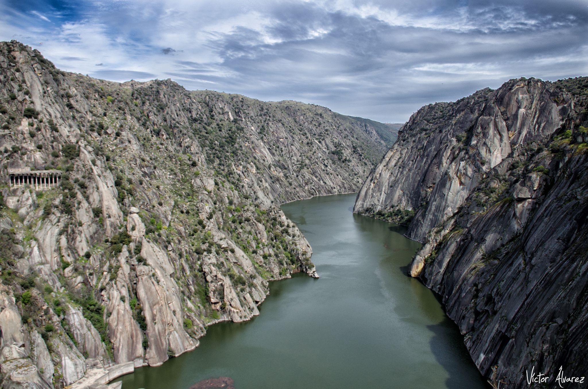
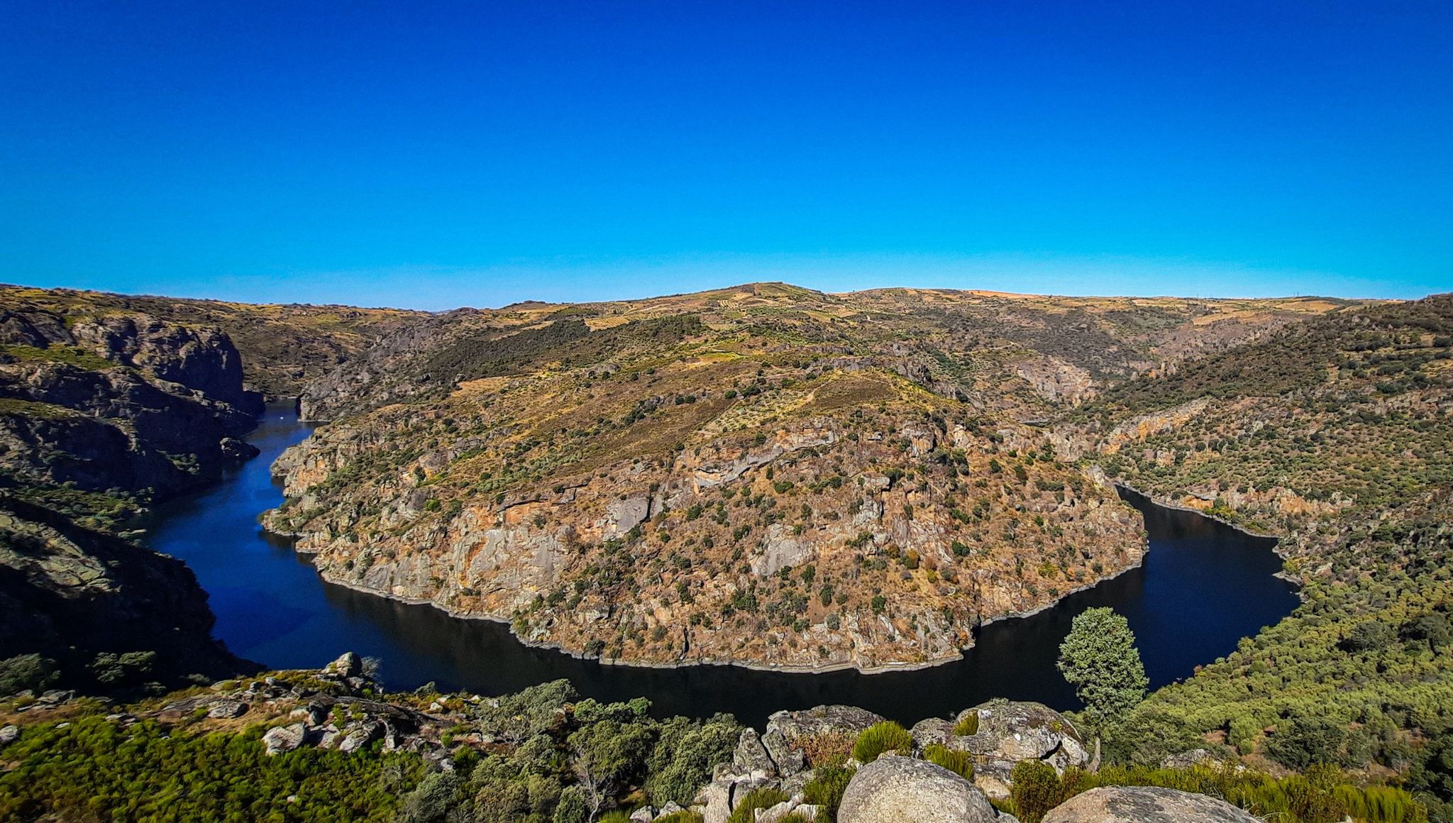
From the Vale de Águia hill fort, there is a natural viewpoint with spectacular views of one of the meanders of the Douro. At the São João das Arribas hermitage, you can also enjoy stunning panoramic views of the canyon and waterfalls on the Spanish slope. The landscape includes cliffs, meadows, oak groves, and pastures, with abundant flora and fauna.
5
0
The GR-36 trail in the Miranda do Douro area is one of the most spectacular routes in northern Portugal, especially for its views of the Douro Canyon, which forms the natural border with Spain.
6
0
The Miradouro da Cerca, located in the village of Urrós (municipality of Mogadouro, near Miranda do Douro), is one of the most spectacular viewpoints in the Douro International Natural Park and is part of a route that many consider worthy of the title of “Europe’s Grand Canyon.” It offers stunning views of the deep and rugged valley of the Douro River, which marks the natural border between Portugal and Spain.
4
0

A beautiful square. It gets really busy from 8 p.m. onwards, when the Spanish nightlife begins.
3
0

At the northern end of the Douro Internacional Natural Park, nature reveals itself in all its splendor. Approaching the course of the Fresno River, the trail takes you through breathtaking scenery, where the beauty of the landscape blends with echoes of the past and vibrant biodiversity.
1
0
Near the village of Urrós, the Cerca Viewpoint awaits you with a breathtaking view. From the top of an imposing rock, you are treated to a dramatic view of the Douro River Gorge, where the steep cliffs form the natural border between the Mirandese Plateau and the Spanish mainland. A magnificent view, impossible to forget!
2
0
Zamora Castle is a historic fortification located in the city of Zamora, in Castile and León. Built in the 11th century, the castle has witnessed numerous historical events and has undergone several modifications over the centuries. It has a rhomboidal plan and is surrounded by a deep moat. Its thick walls and the keep, which is the highest and served as the last defensive redoubt, stand out. The castle is a fascinating place to explore history and enjoy panoramic views of the city.
1
0
Frequently Asked Questions
How many bus station hiking trails are available in Sayago?
There are 25 hiking trails in Sayago that are accessible from bus stations. These routes offer a variety of experiences, from easy strolls to more challenging treks through the region's diverse landscapes.
Are there easy hiking trails accessible by bus in Sayago?
Yes, Sayago offers 10 easy hiking trails that are perfect for beginners or those looking for a relaxed walk. An example is the Castle of Zamora – Plaza Mayor, Zamora loop from Zamora, which is just under 5 km and provides a pleasant urban exploration.
What kind of natural features can I expect to see on bus-accessible trails in Sayago?
Sayago is renowned for its connection to the Arribes del Duero Natural Park, featuring impressive geological formations carved by the Duero River. Many trails offer stunning viewpoints like Mirador de las Barrancas and São João das Arribas Viewpoint, providing panoramic vistas of the river gorges.
Are there any circular walks available from bus stations in Sayago?
Yes, many of the bus-accessible routes in Sayago are circular, allowing you to start and end your hike at the same point. For instance, the Calle Balborraz – Plaza Mayor, Zamora loop from Zamora is a moderate 9 km circular route that explores the city's historic center.
What do other hikers say about the bus station trails in Sayago?
The trails in Sayago are highly regarded by the komoot community, boasting an average rating of 4.6 out of 5 stars from 113 reviews. Hikers frequently praise the scenic beauty, the tranquility of the natural park, and the well-maintained paths.
Are there any longer or more challenging bus-accessible hikes in Sayago?
For experienced hikers, Sayago offers 2 difficult trails accessible by bus. The São João das Arribas Trail (PR1 MDR) is a challenging nearly 19 km route that takes you through varied terrain with significant elevation changes, offering a rewarding experience.
Can I find trails that pass by water features or reservoirs?
Absolutely. The region features the picturesque Almendra Reservoir, which provides beautiful scenery for walks. You can find trails that lead to or along its shores, such as near Salce Beach – Almendra Reservoir.
What is the best time of year to hike in Sayago?
The spring and autumn months are generally ideal for hiking in Sayago. The weather is milder, and the natural landscapes of the Arribes del Duero Natural Park are particularly vibrant with blooming flora or rich autumnal colors. Summers can be hot, so early mornings or late afternoons are recommended if hiking during this season.
Are there any trails suitable for families with children?
Many of the easy and moderate trails are suitable for families. Routes like the Castle of Zamora – Plaza Mayor, Zamora loop from Zamora are shorter and less strenuous, making them enjoyable for all ages. Always check the specific route details for distance and elevation to ensure it matches your family's capabilities.
Are there any trails that offer historical or cultural points of interest?
Yes, some trails will lead you through areas with historical significance. While Fermoselle's Castle is a notable historical attraction in the region, routes like the Hermitage of Peña de Francia – Puente de Hierro de Zamora loop from Zamora offer glimpses of local heritage and architecture along the way.
Can I find trails that are part of a larger network?
Yes, some trails in Sayago connect to or are part of larger networks. For example, you might encounter sections of the Senda del Duero (GR-14), which is a long-distance trail following the Duero River, offering extensive hiking opportunities.
Most popular routes around Sayago
Most popular attractions around Sayago

Get inspired with the komoot mobile app


Explore more
Browse the best Hikes in other regions.
