The best traffic-free bike rides around Señorío de Molina
4.8
(19)
414
riders
20
rides
Gravel biking around Señorío de Molina features expansive high plains and deep river valleys carved by the Tajo, Gallo, and Mesa rivers. These rivers have sculpted impressive gorges and canyons, creating varied terrain for cyclists. The region also presents unique geological formations, including striking red sandstone rocky crests and diverse ecosystems with juniper, pine, oak, and holly groves. This landscape offers a wide array of no traffic gravel bike trails.
Best no traffic gravel bike trails around Señorío de Molina
…Last updated: July 7, 2026
4.8
(4)
117
riders
140km
10:25
2,290m
2,290m
Hard gravel ride. Very good fitness required. Mostly paved surfaces. Suitable for all skill levels.
5.0
(2)
46
riders
73.2km
05:56
1,060m
1,050m
Hard gravel ride. Very good fitness required. Mostly paved surfaces. Suitable for all skill levels.

Sign up for free
40
riders
152km
11:35
2,530m
2,530m
Hard gravel ride. Very good fitness required. Mostly paved surfaces. Suitable for all skill levels.
3
riders
Hard gravel ride. Very good fitness required. Mostly paved surfaces. Suitable for all skill levels.
5.0
(2)
8
riders
83.7km
06:36
1,550m
1,550m
Hard gravel ride. Very good fitness required. Mostly paved surfaces. Suitable for all skill levels.
Get access to more routes and recommendations from other explorers.
Sign up for free
Already have an account?
Our route recommendations are based on thousands of hikes, rides, and runs completed by other people on komoot.
Start today with a free account
Your next adventure awaits.
Login or Signup
Popular around Señorío de Molina

Traffic-free bike rides around Checa

Traffic-free bike rides in Alto Tajo

Traffic-free bike rides around Orea

Traffic-free bike rides in Zec Sabinares Rastreros De Alustante-Tordesilos

Traffic-free bike rides around Alustante

Traffic-free bike rides around Alcoroches

Traffic-free bike rides around Corduente

Traffic-free bike rides in Zec Montes De Picaza
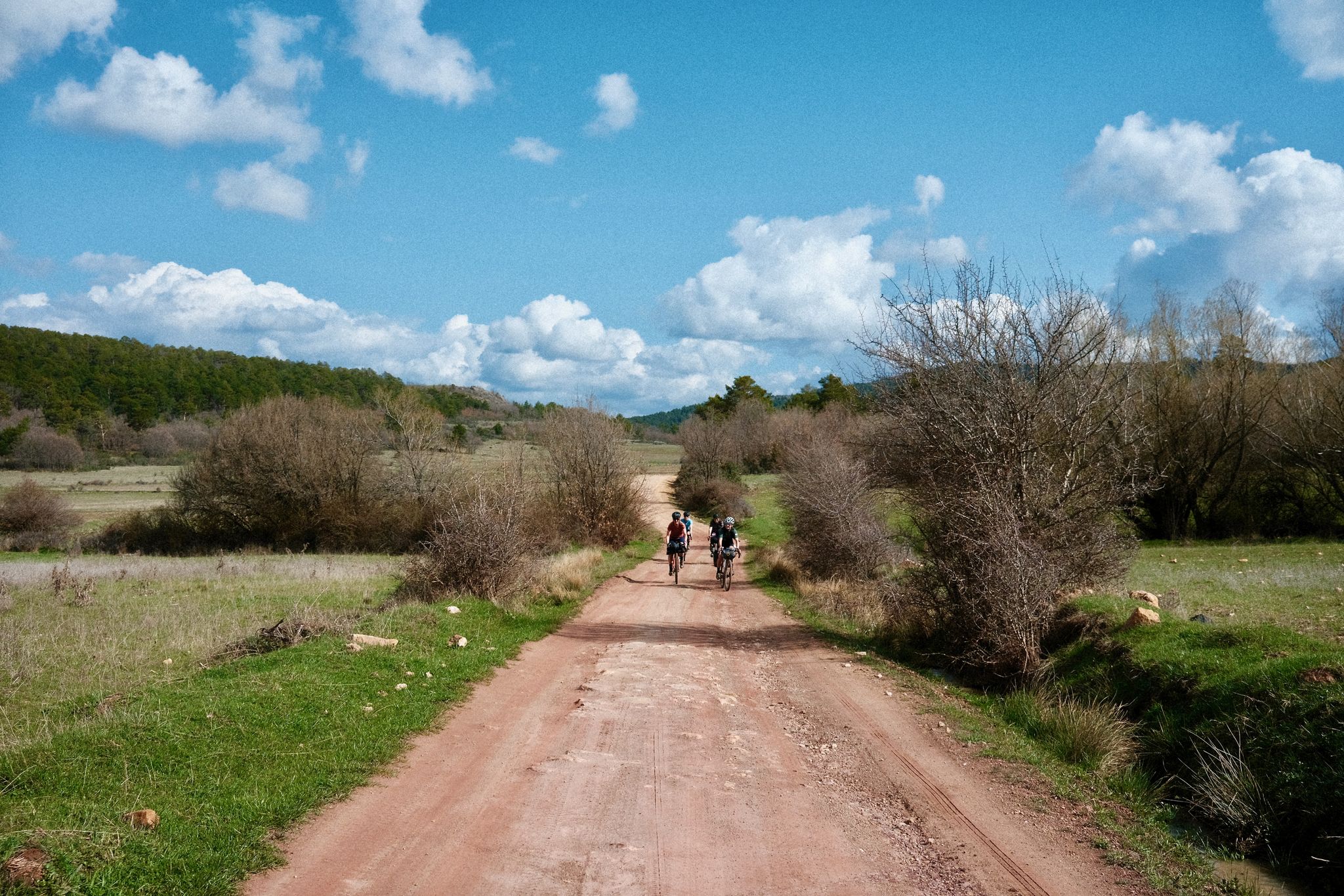
Women's Montañas Vacías 2022 — bikepack in rural Spain

MontañasVacías official — bikepacking across the Spanish Lapland
Other adventures around Señorío de Molina


Tips from the Community

The Jucar River is approximately 500 km long and flows from the Montes Universales to Cullera, where it flows into the Gulf of Valencia.
4
0

Refuge in perfect condition for spending a night, it had four bunk beds, a fireplace area, and a small stable.
0
0
Emblematic place, with natural sculptures, visible from the road itself
0
0

It is located in Plaza del Pino, one of the main squares of Tragacete. The fountain is part of the urban walking tour, which also includes the church, the Town Hall, and the visitor center. It is a traditional urban fountain, integrated into the historic center. It serves as a water source for residents and visitors. It is mentioned as one of the highlights to see in the town along the tourist route.
13
0
The Town Hall Square in Tragacete is located at Plaza de la Constitución, nº1, which is the official address of the Town Hall. Plaza de la Constitución is a central square in the town center of Tragacete, near: Hostal El Gamo Plaza de María Luisa Vallejo Municipal pelota court
11
0
Tragacete is a wonderful destination to visit! This small village is nestled in the Serranía de Cuenca mountains and offers a stunning natural setting. Nearby, you'll find the source of the Cuervo River, a spectacular waterfall surrounded by a beautiful forest, ideal for walks and enjoying nature. The Parish Church of San Miguel Arcángel, built in the 16th century, is one of the village's most emblematic monuments. 😎⛪🌄🚶♀️🚵🚴
11
0

Within the great beauty of the Enchanted City of Chequilla are the Towers, near the Church Square.
0
0

This shelter serves as a resting place and even as a place to spend the night during hikes. The surrounding area features stone tables and benches where you can sit and eat while enjoying the surroundings.
10
0
Frequently Asked Questions
How many no traffic gravel bike trails are available in Señorío de Molina?
There are over 10 dedicated no-traffic gravel bike trails in Señorío de Molina, offering a range of experiences from moderate to difficult. The region is highly regarded by the komoot community, with an average rating of 4.9 stars for its gravel biking routes.
What is the best time of year for gravel biking in Señorío de Molina?
The varied terrain and diverse ecosystems of Señorío de Molina make it enjoyable across seasons, but spring and autumn generally offer the most pleasant temperatures for gravel biking. These seasons avoid the intense heat of summer and the colder, potentially wetter conditions of winter, providing ideal conditions to explore the high plains and river valleys.
What kind of terrain can I expect on the no traffic gravel bike trails?
The no-traffic gravel bike trails in Señorío de Molina feature a diverse and dramatic landscape. You'll encounter expansive high plains, deep river valleys carved by the Tajo, Gallo, and Mesa rivers, and impressive gorges and canyons. The routes often traverse unique geological formations, including striking red sandstone rocky crests, and pass through juniper, pine, oak, and holly groves.
Are there any circular gravel bike routes available?
Yes, Señorío de Molina offers several excellent circular gravel bike routes. For example, the challenging Puente de Peñalén – Trail along the Tajo River loop from Peñalén is a 73.2 km route that takes you through the Tajo River valley. Another option is the Beteta – Refugio de la Alconera loop from Estacionamiento de tierra / Escalón pronunciado para bajar!, a difficult 105 km path with scenic views.
What natural features or landmarks can I see along the trails?
The trails often pass through or near significant natural attractions. You might encounter the impressive red sandstone formations like The towers of Chequilla, or the dramatic Barranco de la Hoz with its unique rock formations. The Laguna de Taravilla is another beautiful natural highlight you could pass by.
Are there any waterfalls along the gravel bike routes?
While not directly on every gravel route, the region is home to beautiful waterfalls such as Poveda Waterfall (Salto de Poveda) and Escaleruela waterfall. These natural attractions add to the scenic beauty of the area and can be explored as detours or part of a broader visit to the Alto Tajo Natural Park.
Are these no traffic gravel bike trails suitable for families?
While many of the listed routes are rated as 'difficult' due to their length and elevation, Señorío de Molina does offer options for families. Look for shorter, less challenging sections or consider routes with lower elevation gain. Always check the specific route details for distance and elevation to ensure it matches your family's capabilities. The region's quiet roads and natural parks can be ideal for family cycling if the right route is chosen.
Can I bring my dog on these gravel bike trails?
The Alto Tajo Natural Park, which many of these trails traverse, generally allows dogs, but it's crucial to keep them under control, preferably on a leash, to protect wildlife and ensure the safety of other users. Always check specific regulations for any protected areas or private lands you plan to cross, as rules can vary.
Where can I park for these gravel bike trails?
Parking facilities are generally available in the villages and towns that serve as starting points for many routes. For example, you can often find parking in places like Peñalén or Bronchales. It's advisable to check the specific starting point of your chosen route on komoot for detailed parking information, as some trailheads might have designated parking areas.
Is public transport an option to reach the gravel trails in Señorío de Molina?
Public transport options to reach the more remote gravel trailheads in Señorío de Molina can be limited. While some larger towns in the region might have bus services, direct connections to specific trail starting points, especially within the Alto Tajo Natural Park, are not always frequent. Planning to drive or arrange local transport is often the most practical way to access many of these routes.
Are there any permits required for gravel biking in the Alto Tajo Natural Park?
Generally, no specific permits are required for gravel biking on established trails within the Alto Tajo Natural Park. However, it's always good practice to respect park regulations, stay on marked paths, and be mindful of environmental protection. For any specific activities or large groups, it's advisable to consult the park's official guidelines.
Most popular routes around Señorío de Molina
Most popular attractions around Señorío de Molina

Get inspired with the komoot mobile app


Didn’t find what you were looking for?
Check out more Gravel rides throughout Señorío de Molina below and find the perfect route in your destination.
Explore more
Browse the best Gravel rides in other regions.
