The best traffic-free bike rides around Fozzano
4.5
(268)
3,315
riders
16
rides
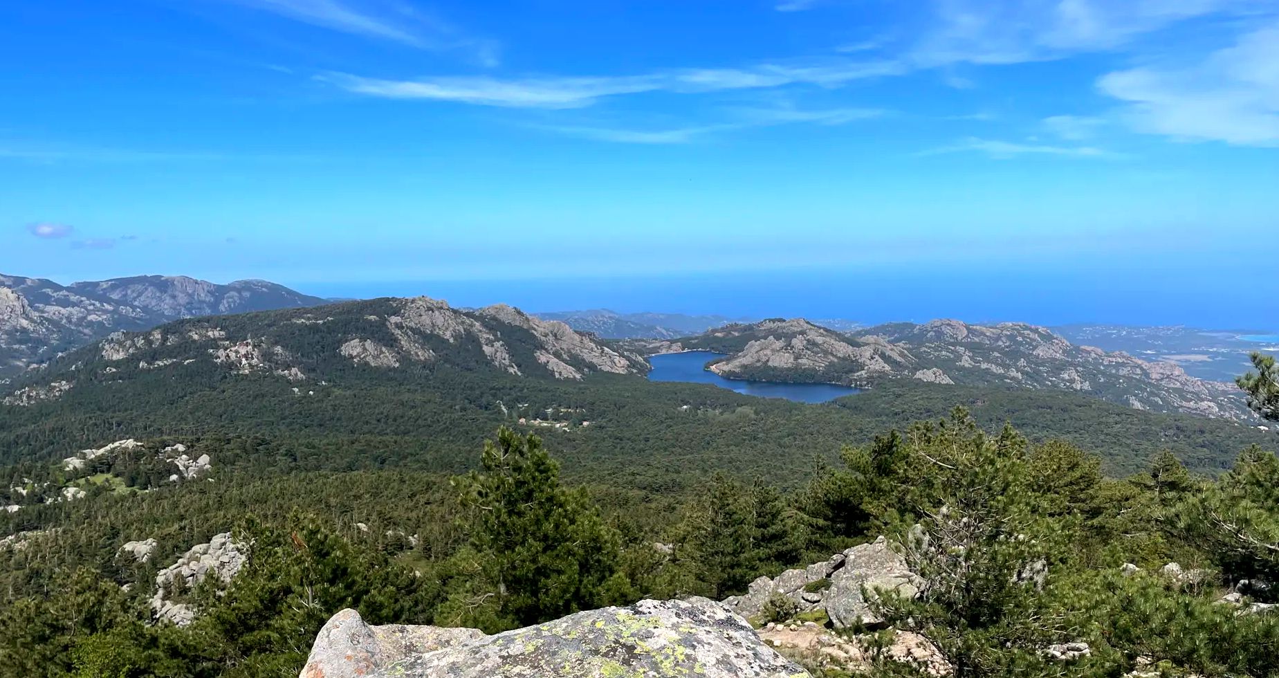
No traffic touring cycling routes around Fozzano are set within Southern Corsica's Sartenais Valinco Taravo region, characterized by mountainous terrain, dramatic gorges, and dense pine forests. The landscape transitions to Mediterranean coastal views, offering varied geography with significant elevation changes. Situated at 390 meters above sea level, Fozzano provides clear views over the Baracci valley and the Gulf of Valinco. This area offers quiet, paved secondary roads suitable for touring cyclists.
Best no traffic touring cycling routes around Fozzano
- The most popular no traffic touring cycling route is Col de Siu – Propriano loop from Parking Olmeto Plage, a 31.5 miles (50.7 km) trail that takes 3 hours 48 minutes to complete. This route features substantial elevation gain through mountainous terrain.
- Another top favourite among local touring cyclists is Viggianello – Fountain in Arbellara loop from Propriano / Prupià, a difficult 29.0 miles (46.6 km) path. This route guides cyclists through traditional Corsican villages and offers panoramic views.
- Local touring cyclists also love the Propriano – Lion Fountain at Arbellara loop from Propriano / Prupià, a 16.0 miles (25.8 km) trail leading through varied Corsican landscapes, often completed in about 2 hours 5 minutes.
- Touring cycling around Fozzano is defined by mountainous terrain, dense pine forests, and Mediterranean coastal views. The network offers options for different ability levels, from moderate to difficult.
- The routes in Fozzano are highly rated by the komoot community with an average score of 4.3 stars from over 200 reviews. More than 3000 touring cyclists have used komoot to explore Fozzano's varied terrain.
Last updated: July 6, 2026
4.7
(16)
185
riders
Hard bike ride. Very good fitness required. Mostly paved surfaces. Suitable for all skill levels.
3.0
(2)
21
riders
6.22km
00:26
80m
80m
Easy bike ride. Great for any fitness level. Mostly paved surfaces. Suitable for all skill levels.

Sign up for free
5.0
(2)
31
riders
51.5km
04:00
1,340m
1,350m
Hard bike ride. Very good fitness required. Mostly paved surfaces. Suitable for all skill levels.
18
riders
Hard bike ride. Very good fitness required. Mostly paved surfaces. Suitable for all skill levels.
5.0
(2)
12
riders
50.6km
04:46
1,340m
1,340m
Hard bike ride. Very good fitness required. Mostly paved surfaces. Suitable for all skill levels.
Get access to more routes and recommendations from other explorers.
Sign up for free
Already have an account?
Our route recommendations are based on thousands of hikes, rides, and runs completed by other people on komoot.
Start today with a free account
Your next adventure awaits.
Login or Signup

Other adventures around Fozzano

Tips from the Community

Col with a name this time. Although it's received the title 'col', the road does not really cross it. The ride up this 12km climb does not serve to cross into inland territorities, and at best gives you a remarkable detour to reach Sarte, south of Propriano. Climbing it from the seaside roundabout makes this a classic self imposed challenge for legs and mind. After a rolling start through the fields and meadows, the first of many rampas starts after the bridge at the right turn. Double digit sections are mingled with easy parts and even downhill parts, while the road surface gradually degrades. The villages are small and sparse as you climb deeper into the valley. Ever higher, the forest makes way for a stunning view of the Valinco bay and imposing red rock formations towering around you. The road goes steep, the switchbacks follow up quickly, double digits are carved into the legs. Creating another steep bit offers a dive into a dark pine forest. Remarkably, it offers a tree climb adv
0
0

A superb pass, not a single car, a superb view, only red granite rocks above Propriano; it's sublime. I recommend going up the D557, whose road is quite damaged, and going down the D19, which is in perfect condition. The view of Propriano becomes increasingly open and unobstructed as you descend the D19.
2
0

The prehistoric site of Filitosa is a historical monument and is included in the list of one hundred historical sites of general interest for the Mediterranean countries. Filitosa fascinates with the beauty of the archaeological finds and the diversity of the natural environment.
1
0
The settlement area is on average 450 meters above sea level. It consists of the villages Sollacaro, I Calanchi and Filitosa. In the latter there is a metal age site with relics from the Bronze Age. Another site is in the I Calanchi district - with objects from the Chalcolithic period. Sollacaro was touched by the former Route nationale 851.
1
0
Sollacaro (Corsican Suddacarò; Italian Sollacarò) is a French commune with 383 inhabitants (as of January 1, 2022) on the Mediterranean island of Corsica. It belongs to the department of Corse-du-Sud, the arrondissement of Sartène and the canton of Taravo-Ornano. The inhabitants call themselves Sollacarais or Suddacarinchi.
1
0
8000 years of history and mysteries Discover the roots of Corsica in the footsteps of the first Corsicans. Filitosa is considered the most important site of the megalithic culture of Corsica. It is home to one of the most beautiful collections of prehistoric works of art in Europe. At the same time, the cultural site still poses many questions for researchers. Filitosa offers an overview of 8000 years of human history in the Mediterranean region.
1
0

Corsica also has great things to offer in the hinterland.
0
0

If you wear sturdy shoes and it's dry, you'll have a magnificent panorama from the large rock at the apex of a bend. The very brave will also notice the traditional return of old vehicles to the Corsican material cycle if they step very close to the edge of the rock (downhill).
0
0
Frequently Asked Questions
How many no traffic touring cycling routes are available around Fozzano?
There are over 10 dedicated no traffic touring cycling routes around Fozzano. These routes are designed to offer peaceful rides away from heavy vehicle traffic, allowing you to fully immerse yourself in the stunning Corsican landscape.
What is the typical difficulty level of touring cycling routes in Fozzano?
The routes around Fozzano primarily feature difficult terrain, with significant elevation changes characteristic of the mountainous Corsican landscape. Out of the 14 available routes, 10 are classified as difficult. However, there are also 3 easy routes and 1 moderate option for those seeking less challenging rides. For example, the River course on the beach – Roccapina Beach loop from Propriano / Prupià is an easy option.
When is the best time of year for no traffic touring cycling in Fozzano?
The best time for touring cycling in Fozzano is typically during the spring (April to June) and autumn (September to October). During these periods, the weather is pleasantly mild, and the landscapes are vibrant, offering ideal conditions for cycling without the intense heat of summer or the chill of winter. This also helps avoid peak tourist crowds, ensuring quieter roads.
Are there any easy no traffic touring cycling routes suitable for beginners or families?
Yes, while many routes are challenging, there are 3 easy no traffic touring cycling routes available around Fozzano. These are generally shorter with less elevation gain, making them suitable for beginners or families looking for a more relaxed experience. One such route is the River course on the beach – Roccapina Beach loop from Propriano / Prupià, which is 6.2 km long.
What historical sites or natural landmarks can I see along no traffic touring cycling routes near Fozzano?
The region around Fozzano is rich in history and natural beauty. Along your rides, you can discover significant sites such as the ancient Bronze Age archaeological site of Castellu di Cucuruzzu or the fascinating Filitosa Archaeological Site with its ancient stone structures. You might also encounter natural monuments like the Ancient Chestnut Tree (Circa 1200) or the Ancient Cork Oak of Filitosa. The characterful town of Sartène, known for its granite houses, is also a notable cultural stop.
Are there any circular no traffic touring cycling routes around Fozzano?
Yes, many of the no traffic touring cycling routes around Fozzano are designed as loops, allowing you to start and end at the same point without retracing your path. Examples include the challenging Col de Siu – Propriano loop from Parking Olmeto Plage (50.7 km) or the Beach and camping place – U Fracintu loop from Parking Olmeto Plage (43.6 km).
What do other touring cyclists appreciate most about the no traffic routes in Fozzano?
The no traffic touring cycling routes in Fozzano are highly rated by the komoot community, with an average score of 4.3 stars from over 240 ratings. Cyclists frequently praise the stunning panoramic views of the Valinco Gulf and Baracci valley, the peaceful experience on quiet secondary roads, and the opportunity to explore traditional Corsican villages and dramatic mountainous terrain away from car traffic.
Is parking available for accessing these quiet cycling routes?
Yes, parking is generally available near the starting points of many routes. For instance, the Col de Siu – Propriano loop starts from Parking Olmeto Plage, indicating designated parking facilities. It's advisable to check specific route details on komoot for precise parking information at each trailhead.
Can I reach the starting points of these routes by public transport?
While Fozzano is a village nestled in a mountainous region, public transport options might be limited compared to larger towns. It's best to check local bus schedules or consider a taxi service from larger hubs like Propriano or Sartène to reach specific starting points if you're not arriving by car. Always verify current transport availability before planning your trip.
Are there options for food and drink along the no traffic touring routes?
Many routes pass through or near traditional Corsican villages where you can find small cafes, bakeries, or local shops to refuel. Fozzano itself, and nearby towns like Sartène and Propriano, offer a wider range of dining options. It's always a good idea to carry sufficient water and snacks, especially on longer or more remote sections of the routes, as services might be sparse in between villages.
What kind of terrain should I expect on these no traffic touring routes?
Expect a diverse and often challenging terrain. The routes feature paved secondary roads that wind through mountainous landscapes, dense pine forests, and dramatic gorges. You will encounter significant elevation changes, including both demanding climbs and rewarding descents, offering varied cycling experiences and panoramic viewpoints.
Most popular attractions around Fozzano

Get inspired with the komoot mobile app


Explore more
Browse the best Cycling routes in other regions.
