The best traffic-free bike rides around Sigottier
4.4
(187)
3,845
riders
17
rides
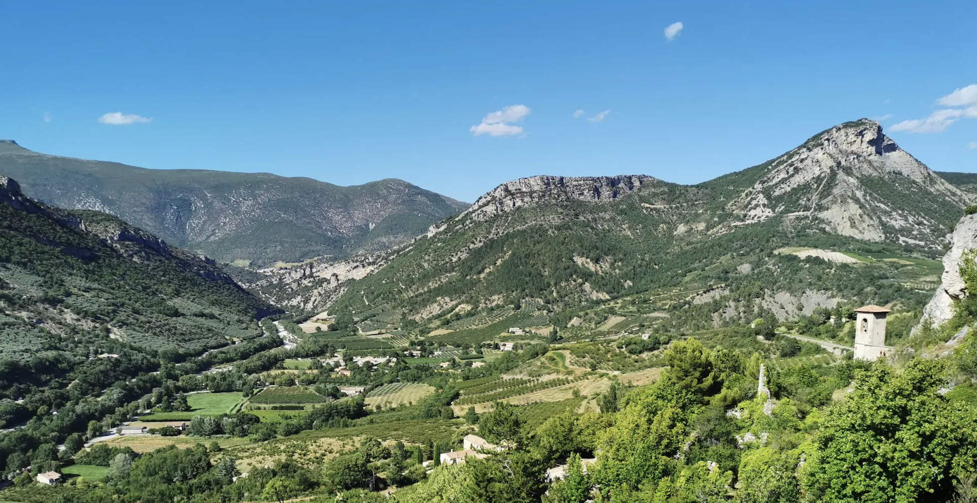
Road cycling around Sigottier offers diverse no traffic road cycling routes through the authentic and mountainous terrain of the Southern French Alps. The region is characterized by its unique geological setting within a "cluse," a narrow passage carved through limestone rocks by the Torrent d'Aiguebelle. Dramatic erosion has sculpted the upper layers of Tithonian limestone into spectacular pinnacles and summital cliffs, with lush forests covering much of the land. This landscape provides varied terrain for road cyclists, from valley routes…
Last updated: July 5, 2026
5.0
(5)
105
riders
95.2km
05:04
1,840m
1,840m
Hard road ride. Very good fitness required. Mostly well-paved surfaces and easy to ride.
4.1
(11)
113
riders
46.5km
02:16
640m
640m
Moderate road ride. Good fitness required. Mostly well-paved surfaces and easy to ride.

Sign up for free
5.0
(1)
19
riders
110km
05:56
2,190m
2,190m
Hard road ride. Very good fitness required. Mostly well-paved surfaces and easy to ride.
5.0
(3)
23
riders
83.3km
04:11
1,310m
1,310m
Hard road ride. Very good fitness required. Mostly well-paved surfaces and easy to ride.
22
riders
90.7km
04:39
1,580m
1,580m
Hard road ride. Very good fitness required. Mostly well-paved surfaces and easy to ride.
Get access to more routes and recommendations from other explorers.
Sign up for free
Already have an account?
Our route recommendations are based on thousands of hikes, rides, and runs completed by other people on komoot.
Start today with a free account
Your next adventure awaits.
Login or Signup


Other adventures around Sigottier

Tips from the Community

Secondary road with excellent asphalt.
7
0
A road that cuts out the traffic, Unforgettable panoramas
10
0
Exceptional viewpoint for taking amazing photos
14
0
Panoramic viewpoint for memorable photos
8
0
Road without traffic with perfect asphalt.
13
0
The Col du Reychasset is a pass located at an altitude of 1,052 m, in the Drôme department, within the Regional Natural Park of the Baronnies provençales. It connects the Armalause valley with the Céans valley, between the municipalities of Chauvac-Laux-Montaux and Villebois-les-Pins.
8
0
The Col de Faye is a mountain pass in the Southern Alps, located in the department of Hautes-Alpes at an altitude of approximately 922 to 924 meters. It connects the Buëch valley to the Durance valley — between the municipalities of Savournon and Ventavon — via the departmental road D21.
13
0
Orpierre is a small medieval village located in the Hautes-Alpes department in the Provence-Alpes-Côte d’Azur region of southeastern France. It has a population of between 300 and 330 inhabitants and stands in the Céans valley, surrounded by limestone cliffs and mountains that give it a unique landscape setting.
11
0
Frequently Asked Questions
How many no-traffic road cycling routes are available around Sigottier?
There are 8 dedicated no-traffic road cycling routes around Sigottier, offering a variety of experiences for different skill levels. You can find routes ranging from easy to difficult, ensuring there's something for every cyclist looking for a peaceful ride.
What kind of terrain can I expect on no-traffic road cycling routes near Sigottier?
The region around Sigottier, nestled in the Hautes-Alpes, offers diverse and striking natural landscapes. You can expect routes that traverse authentic mountainous terrain, narrow passages carved through limestone rocks, and areas with lush forests. Some routes will feature significant elevation gains, including mountain passes like Collet de Guiauch and Col de Chaumiane, while others offer more gentle, rolling hills.
Are there any easy no-traffic road cycling routes suitable for beginners or families?
Yes, there are 3 easy no-traffic road cycling routes around Sigottier. A great option for beginners or families is the Bachassette Pass – View of L'Aujour loop from Chabestan. This route covers 14.3 km with a manageable elevation gain of around 200 meters, making it a pleasant and accessible ride.
What are some notable landmarks or attractions I might see along these routes?
The no-traffic routes around Sigottier offer glimpses of the region's unique geological features and historical sites. You might encounter impressive summital cliffs sculpted by erosion, or pass by the historic village of Sigottier itself. Specific highlights include the Col de Carabès, which is featured on several routes, and the serene Clausonne Abbey. The town of Serres is also a charming stop along some longer loops.
What is the best time of year for no-traffic road cycling in Sigottier?
The Southern French Alps, including the area around Sigottier, are generally best for road cycling from late spring through early autumn. During these months, the weather is typically mild, and mountain passes are clear of snow. This allows for optimal enjoyment of the diverse landscapes and challenging terrain without the harsh conditions of winter.
Are there any challenging no-traffic road cycling routes for experienced cyclists?
Absolutely. For experienced cyclists seeking a challenge, there are 2 difficult no-traffic road cycling routes available. One such route is the demanding La Charce Castle – Col de Carabès loop from Serres, which spans over 95 km with an elevation gain of approximately 1840 meters. Another challenging option is the Route de Sigottier – Col de Carabès loop from Valdrôme, covering 47 km with over 1100 meters of climbing.
What do other road cyclists enjoy most about the no-traffic routes in Sigottier?
The komoot community highly rates the road cycling experience in Sigottier, with an average score of 4.56 out of 5 stars. Reviewers often praise the tranquility of the routes, the stunning mountainous scenery, and the opportunity to explore the unique geological formations of the Hautes-Alpes without the disturbance of heavy traffic. The well-paved surfaces on many routes also contribute to a smooth and enjoyable ride.
Are there any circular no-traffic road cycling routes available?
Yes, many of the no-traffic road cycling routes around Sigottier are designed as circular loops, allowing you to start and end at the same point. For example, the View of L'Aujour – Verniers Pass loop from La Bâtie-Montsaléon is a moderate 39 km circular route, and the Route de Sigottier – Col de Carabès loop from Serres offers a 30 km moderate loop.
Is public transport an option for reaching the starting points of these routes?
While Sigottier is a charming, somewhat secluded village, public transport options directly to specific route starting points might be limited. It's advisable to check local bus schedules for the Hautes-Alpes region, particularly services connecting to larger towns like Serres or Veynes-Dévoluy, which may offer better access. However, for maximum flexibility on no-traffic routes, driving to a starting point with parking is often the most convenient option.
Where can I find parking for no-traffic road cycling routes near Sigottier?
Parking availability will vary depending on the specific starting point of your chosen route. Many routes begin from or pass through villages like Serres, La Bâtie-Montsaléon, Chabestan, or Valdrôme, where you can typically find public parking areas. It's recommended to check the specific route details on komoot for suggested parking locations near the trailhead.
Are there any cafes or places to stop for refreshments along the no-traffic routes?
While the focus is on no-traffic roads, many routes will pass through or near small villages where you can find local cafes, bakeries, or small shops. The historic village of Sigottier itself offers a charming atmosphere. Larger towns like Serres, which is a starting point for several routes, will have more options for refreshments and accommodation. Always plan your stops in advance, especially on longer or more remote routes.
Most popular attractions around Sigottier

Get inspired with the komoot mobile app


Explore more
Browse the best Road cycling routes in other regions.
