The best traffic-free bike rides around Viala-Du-Tarn
4.4
(11)
125
riders
9
rides
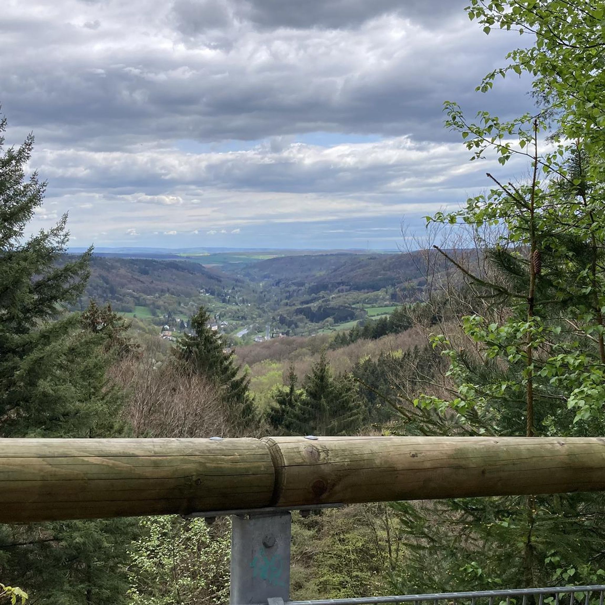
No traffic gravel bike trails around Viala-Du-Tarn traverse a landscape shaped by the Tarn River and its "Raspes" gorges, set within the Parc Naturel Régional des Grands Causses. The region features varied terrain, including rustic roads, rolling trails, and forest tracks. Elevations range from 300 meters along the Tarn to 1,050 meters on the Lévézou, offering diverse riding experiences. The area is characterized by limestone plateaus, such as the Causse Noir and Causse du Larzac, alongside dramatic rock formations.
Best…
Last updated: November 5, 2026
3.0
(4)
41
riders
28.3km
01:47
240m
240m
Moderate gravel ride. Good fitness required. Mostly paved surfaces.
15
riders
67.8km
05:06
980m
980m
Hard gravel ride. Very good fitness required. Mostly paved surfaces.

13
riders
89.1km
06:18
1,220m
1,220m
Hard gravel ride. Very good fitness required. You may need to push your bike for some segments of this route.
2
riders
89.8km
06:59
1,680m
1,680m
Hard gravel ride. Very good fitness required. Mostly paved surfaces.
5.0
(1)
2
riders
28.0km
02:19
650m
650m
Hard gravel ride. Very good fitness required. Mostly paved surfaces.
Get access to more routes and recommendations from other explorers.
Already have an account?
Our route recommendations are based on thousands of hikes, rides, and runs completed by other people on komoot.
Start today with a free account
Your next adventure awaits.
Popular around Viala-Du-Tarn

Tips from the Community

In the heart of Creissels, the Pesquié basin forms a surprisingly vast body of water (1,000 m²) compared to the modest stream that feeds it. Its name, which comes from Occitan and means "fish pond", recalls the ancient purpose of the place, linked to fish farming. The town hall now occupies the premises of a former fish farm. The basin is fed by the Creissels waterfall, a typical resurgence of the karst functioning of the Larzac: the water infiltrated into the limestones of the plateau reappears after an underground journey. In September 2023, the municipality dredged the basin and created a spawning ground for brown trout (Salmo trutta). The restoration has borne fruit, as trout have since recolonized the body of water, alongside amphibians and other aquatic organisms that find refuge in the surrounding wetland.
3
0
Built between 1818 and 1821, the Lerouge bridge became one of the main structures for crossing the Tarn in Millau. It replaced the Pont Vieux, several arches of which had been destroyed by a flood in 1758, leaving the town without a permanent bridge for over sixty years. During this long period, crossing the Tarn was mainly done by ferry. The project was launched on the initiative of the prefect of Aveyron, d’Estourmel. The plans were drawn up by Pierre-Jacques Le Rouge, an engineer for the district. The first stone was laid on June 20, 1818, and the bridge was opened to traffic in January 1821. Its name therefore comes from its designer, not from the color of its stones. A curious detail: its construction was largely financed by private individuals, and a toll was collected until 1875. This tax even caused tensions with the inhabitants of Creissels, some of whom continued to cross the Tarn on foot or by boat to avoid paying it.
3
0
This place is the starting point of the Voie Verte which runs along the Tarn and leads to Creissels. You can discover the troglodytic village of Peyre in particular, a very pleasant forest section which, in places, forms a real green tunnel. Further on, you can enjoy a magnificent view of the Millau Viaduct.
3
0
From the Larzac plateau, the Brunas site offers a vast panorama of the Millau valley. Stretched between the two banks of the Tarn, the viaduct with its seven concrete piers appears in its entirety. Behind it unfolds the entire causse Rouge, a large limestone plateau whose undulations dominate the valley. Then, the Puech d’Andan is distinguished by its wooded silhouette, cut in two by a clear central notch. Further to the right stands the Pouncho d'Agast, a pyramidal promontory marking the beginning of the causse Noir at an altitude of 841 m. Brunas is also a true site for free flight. The take-off area is located directly on the plateau; the site is mainly used with a north wind and allows paragliders to take off and then land in the vicinity of the same sector, with approximately 370 m of elevation difference down to the valley. The spectacle of the sails evolving in front of the viaduct adds a particular dimension to this panorama.
3
0
Isolated in the middle of the open landscapes of the Larzac, the fortified farm of Brouzes is a remarkable testimony to medieval rural architecture. The complex, whose construction began in 1491, is organized in a rectangle around three courtyards. It was later remodeled, notably in 1628, then in the 18th century. Behind its appearance as a large farm lies a true defensive architecture: the buildings are largely vaulted, a stable has loopholes, two towers reinforce the south side, and a dovecote tower as well as an old bread oven complete the complex. The farm nevertheless experienced a long period of abandonment. Uninhabited from 1922 to 1970, it was progressively looted and severely degraded. In the 1970s, an artist couple, Élisabeth and Claude Baillon, bought it and began its restoration. Their intervention largely contributed to saving the complex, which was finally classified as a historic monument in 1990.
3
0
Perched at an altitude of about 730 meters, the Cap de Coste viewpoint overlooks the eastern end of the Boundoulaou cirque. It reveals a vast panorama of the Millau basin and its surrounding massifs. To the left, the easily recognizable Millau Viaduct spans the Tarn valley to connect the Larzac to the Causse Rouge. Further to the right stretches the latter: a large limestone plateau whose undulations dominate the valley. Then, the Puech d’Andan stands out with its wooded silhouette, cut in two by a clear central notch. Finally, further away, the Pouncho d’Agast, an emblematic relief of the Causse Noir, is easily recognized by its profile like a true limestone pyramid.
3
0
Perché at an altitude of approximately 730 meters, the Cap de Coste viewpoint overlooks the eastern end of the Boundoulaou cirque. It reveals a vast panorama of the Millau basin and its surrounding massifs. To the left, the easily recognizable Millau Viaduct spans the Tarn valley, connecting the Larzac to the Causse Rouge. Further to the right stretches the latter: a large limestone plateau whose undulations dominate the valley. Then, the Puech d’Andan stands out with its wooded silhouette, cut in two by a clear central notch. Finally, further away, the Pouncho d’Agast, an emblematic relief of the Causse Noir, is easily recognized by its profile like a true limestone pyramid.
3
0
From this switchback on the road to Labro, the Larzac plateau suddenly opens up to reveal the spectacular cirque of Saint-Geniez-de-Bertrand. This has been progressively formed by the erosion of the limestone series that make up the Larzac. The water, by infiltrating the fractures in the limestone, gradually dissolves the rock and circulates at depth before emerging at the foot of the slopes. This underground action, associated with runoff and valley erosion, causes a progressive retreat of the cliffs and slopes: this is the phenomenon of regressive erosion. Over time, the limestone reliefs recede towards the interior of the plateau and a vast indentation forms, giving birth to the cirque.
3
0
Frequently Asked Questions
How many no-traffic gravel bike trails are available in Viala-Du-Tarn?
The Viala-Du-Tarn area, within the Parc Naturel Régional des Grands Causses, is a renowned gravel biking destination. While this guide features 5 specific no-traffic routes, the broader "Terre de Gravel Grands Causses" initiative has developed an impressive network of 500 kilometers of routes, including 11 FFC-labeled itineraries, ensuring a wide variety of options for traffic-free gravel biking.
Are there easy no-traffic gravel bike trails suitable for beginners or families in Viala-Du-Tarn?
Yes, the region offers routes catering to all skill levels. While many routes can be challenging, there are options like the Lac de Villefranche-de-Panat loop from Alrance, which is relatively short at 10.9 km with minimal elevation gain, making it suitable for beginners or families looking for a gentler, traffic-free gravel experience.
What kind of landscapes can I expect on the no-traffic gravel bike trails around Viala-Du-Tarn?
You'll experience a dramatic and diverse landscape. The trails traverse rustic roads, rolling trails, singletracks through undergrowth, and forest tracks, often offering stunning views of the Tarn Valley, the impressive "Raspes" gorges, and the expansive Causses Plateaus like Causse Noir and Causse du Larzac. The region's topography ranges from 300 meters along the Tarn to 1,050 meters on the Lévézou mountains.
Are there any circular no-traffic gravel bike routes in the Viala-Du-Tarn area?
Yes, several routes in the area are circular, allowing you to start and end at the same point without retracing your steps. An example is the Millau Viaduct – View of the Millau Viaduct loop from Saint-Georges-de-Luzençon, which offers a substantial circular ride with iconic views.
What are some notable attractions or landmarks I can see along the no-traffic gravel bike trails?
The region is rich in natural and man-made wonders. You might encounter the iconic Millau Viaduct, the historic Tour de Peyrebrune, or enjoy panoramic views from the Roc Saint-Jean lookout. The Cascade des Raspes du Tarn is another beautiful natural feature to look out for.
What is the best time of year for gravel biking in Viala-Du-Tarn?
The region is generally suitable for gravel biking for much of the year. Spring and autumn offer pleasant temperatures and vibrant scenery, making them ideal. Summer can be warm, but the varied terrain with forest tracks provides shade. Winter conditions can vary, with higher elevations potentially experiencing colder weather, so checking local forecasts is always recommended.
Are there challenging no-traffic gravel bike routes for experienced riders?
Absolutely. The Viala-Du-Tarn area is known for its rugged terrain, offering challenging routes with significant elevation gains. For instance, the Pont des anglais – Causses d’Hermilix loop from Saint-Rome-de-Cernon covers over 64 km with more than 1200 meters of climbing, providing a demanding experience for advanced gravel bikers.
What kind of wildlife might I encounter on the trails?
The Tarn Valley is a Natura 2000 site, known for its rich biodiversity. You might spot unique vegetation, various bird species, and even bats in the caves. The area's natural beauty supports diverse ecosystems, making wildlife encounters a possibility, especially in quieter sections of the trails.
Where can I park when accessing no-traffic gravel bike trails in Viala-Du-Tarn?
Many of the routes start from villages or towns like Saint-Georges-de-Luzençon, Alrance, Saint-Rome-de-Tarn, Saint-Rome-de-Cernon, or Montjaux. These locations typically offer public parking facilities, often near the starting points of the trails. It's advisable to check specific starting points for the most convenient parking options.
What do other gravel bikers enjoy most about gravel biking in Viala-Du-Tarn?
The area is highly rated by the komoot community, with an average score of 4.8 stars. Reviewers often praise the stunning and varied landscapes, the sense of adventure on the diverse terrain, and the opportunity to explore the natural beauty of the Grands Causses away from traffic. The well-maintained network of gravel paths and the challenging climbs are frequently highlighted.
Are there any specific geological formations or natural wonders to look out for?
Beyond the dramatic gorges, the region is famous for its unique geological heritage. While not directly on every gravel route, nearby attractions include the Chaos de Montpellier-le-Vieux, Aven Armand (a grotto), Trou de Bozouls, and Tindoul de la Vayssière, showcasing the impressive limestone plateaus and their formations.
Most popular routes around Viala-Du-Tarn
Most popular attractions around Viala-Du-Tarn

Get inspired with the komoot mobile app


Explore more
Browse the best Gravel rides in other regions.
