The best traffic-free bike rides around Lucéram
4.8
(13)
227
riders
16
rides
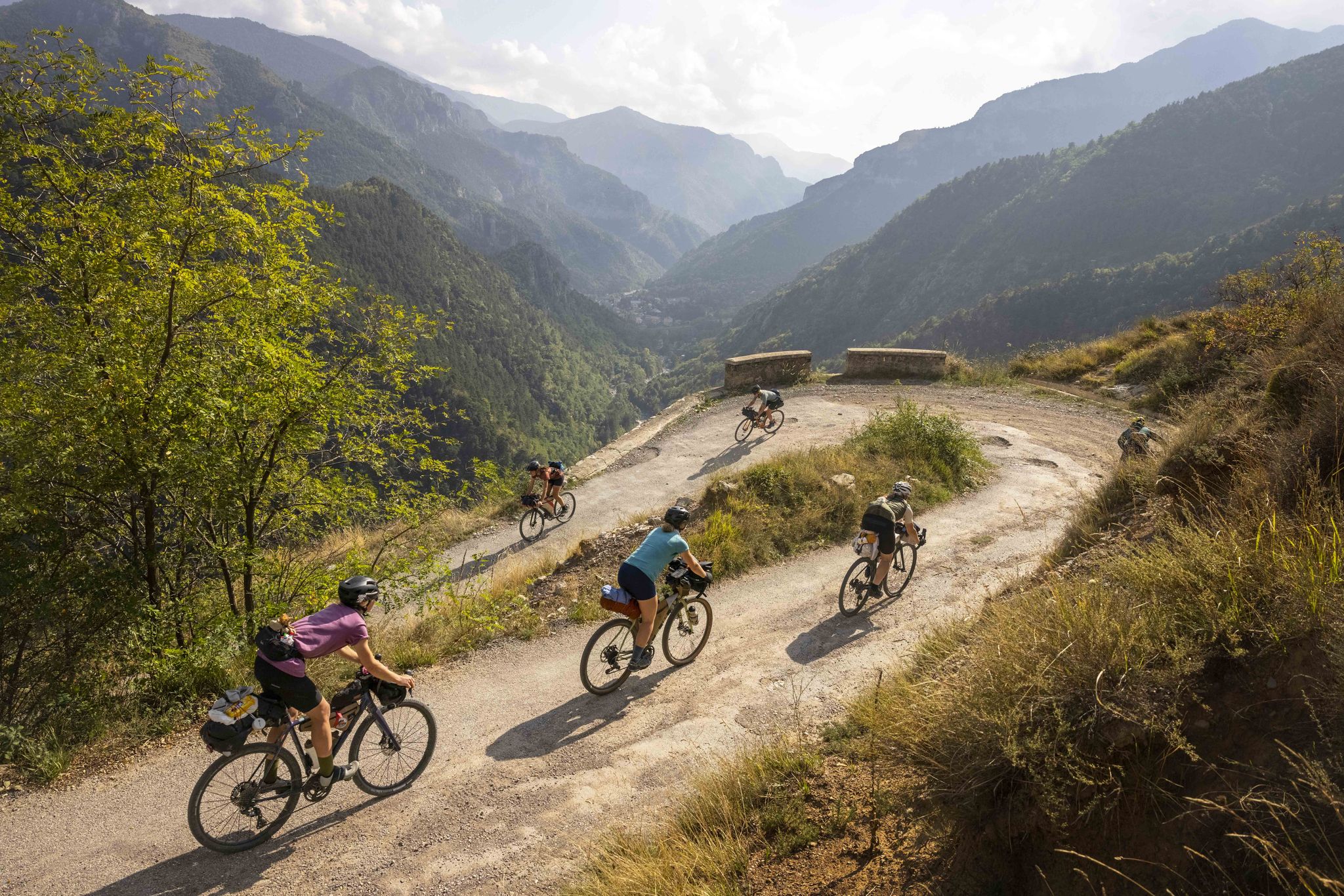
Gravel biking around Lucéram is characterized by its diverse and challenging terrain within the Alpes-Maritimes department of France. The region features significant elevation changes, with routes traversing mountain passes, verdant valleys, and dense forests. This landscape provides a network of paths suitable for gravel biking, often utilizing historic trails and quiet roads. The area's physical features include numerous peaks and passes, offering varied surfaces and demanding ascents.
Best no traffic gravel bike trails around Lucéram
- The most popular no traffic gravel bike trail is Braus Pass – Castillon Pass loop from Peille, a 41.5 miles (66.8 km) trail that takes about 5 hours 28 minutes to complete. This route features substantial elevation gain as it navigates between two prominent mountain passes.
- Another top favourite among local gravel bikers is Crete du ferion – Saut des Français Viewpoint loop from Utelle, a difficult 24.7 miles (39.8 km) path. This route offers panoramic viewpoints and traverses rugged mountain terrain.
- Local gravel bikers also love the Peille Village – Tunnel entrance to Peille loop from Peille, a 29.9 miles (48.2 km) trail leading through varied landscapes and past local villages, often completed in about 4 hours 26 minutes.
- Gravel biking around Lucéram is defined by challenging mountain passes like Col de Braus, verdant valleys, and extensive forest paths. The network offers options for experienced gravel bikers seeking significant elevation and varied terrain.
- The routes in Lucéram are highly rated by the komoot community with an average score of 4.8 stars from more than 10 reviews. More than 200 gravel bikers have used komoot to explore Lucéram's varied terrain.
Last updated: July 5, 2026
4.0
(1)
46
riders
57.8km
05:07
1,580m
1,580m
Hard gravel ride. Very good fitness required. Mostly paved surfaces. Suitable for all skill levels.
5.0
(2)
18
riders
36.2km
03:28
1,040m
1,040m
Hard gravel ride. Very good fitness required. Mostly paved surfaces. Suitable for all skill levels.

Sign up for free
4.5
(2)
21
riders
39.8km
03:29
1,290m
1,290m
Hard gravel ride. Very good fitness required. You may need to push your bike for some segments of this route.
5.0
(1)
16
riders
48.1km
04:20
1,400m
1,400m
Hard gravel ride. Very good fitness required. Mostly paved surfaces. Suitable for all skill levels.
8
riders
38.2km
03:51
1,300m
1,300m
Hard gravel ride. Very good fitness required. Mostly paved surfaces. Suitable for all skill levels.
Get access to more routes and recommendations from other explorers.
Sign up for free
Already have an account?
Our route recommendations are based on thousands of hikes, rides, and runs completed by other people on komoot.
Start today with a free account
Your next adventure awaits.
Login or Signup
Other adventures around Lucéram

Tips from the Community

Because it is located at an altitude of 630 metres, equidistant from Nice and Monaco, Peille can be seen from the summit of La Madone. Its chapels, converted into a town hall or a bakery, set the tone: the medieval heritage is still inhabited. Léo Ferré liked to stay there and dedicated a song to it.
0
0

I did it via Coaraze. Magnificent scenery and a beautiful view of the event and its surrounding area from the top of Ferion. A moderately easy hike. The elevation changes from 500 meters to 1400 meters.
0
0

Corniche road. Magnificent views of the Mediterranean, Nice... At the Col du Farguet, views of the Mercantour. To reach the Col de Braus, gravel road accessible to classic electric bikes (not mountain bikes)
0
0

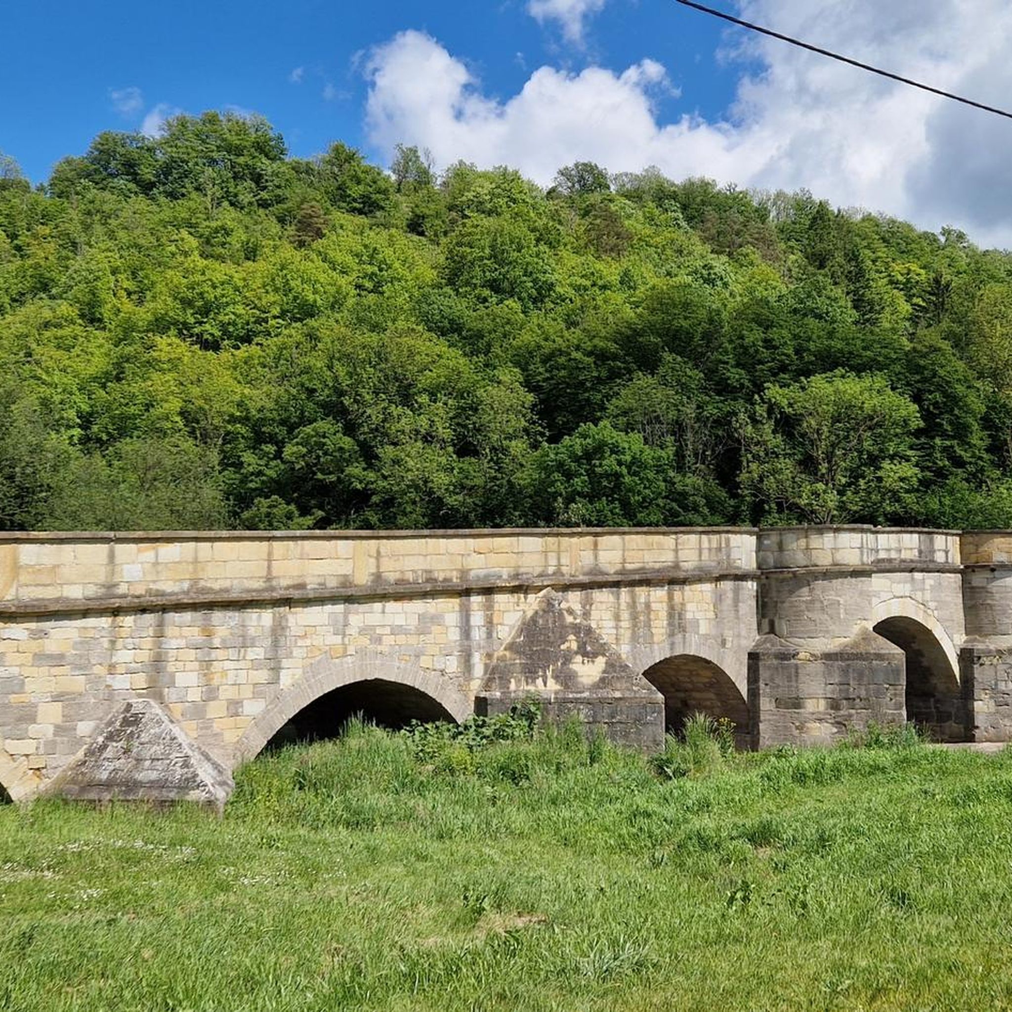
The Sospel bridge is located on a major road linking Nice to Piedmont via the Roya valley and the Col de Tende.
0
0

To be done only in the uphill direction. I wanted to do it in the downhill direction to reach Sospel and it's much too rough, no fun, back wrecked. I'm a 45 on a titanium.
1
0

Depending on your route: I crossed the pass on the way back from the Col de Turini via Paira Cava and Col de d'L'Orme. You reach the top of the pass well rested and can enjoy the wonderful descent to Sospel.
0
0

Easy to ride, with only a slight incline. After that, it's all downhill on the way to the sea.
0
0
Frequently Asked Questions
How many traffic-free gravel bike trails are available around Lucéram?
Our guide features 12 dedicated traffic-free gravel bike trails around Lucéram. These routes are carefully selected to offer a peaceful and immersive cycling experience away from vehicular traffic, allowing you to fully enjoy the stunning landscapes of the Alpes-Maritimes.
What is the typical difficulty level of gravel bike trails near Lucéram?
The gravel bike trails around Lucéram are generally challenging, with 11 out of 12 routes rated as 'difficult'. These often involve significant elevation changes, traversing mountain passes like the Col de la Madone and Col de Turini, and offer a rewarding experience for experienced gravel bikers. For example, the Braus Pass – Castillon Pass loop from Peille covers over 66 km with more than 1800 m of elevation gain.
What kind of terrain can I expect on the traffic-free gravel routes in Lucéram?
You can expect a diverse range of terrain, from historic paths like sections of the 'Salt Road' to forest tracks and mountain passes. The region is known for its significant elevation changes, so routes often combine challenging climbs with scenic descents through verdant valleys, dense forests, and olive groves. Surfaces can vary from well-packed gravel to more rugged, rocky sections.
Are there any family-friendly or easier traffic-free gravel routes around Lucéram?
While most routes in this guide are rated 'difficult', there is one 'moderate' route available. For families or those seeking a less strenuous ride, it's advisable to check the specific route details on komoot for elevation profiles and surface conditions. The region's terrain is generally quite hilly, so even easier routes may involve some climbing.
What natural features or landmarks can I see along the gravel bike trails?
The trails offer breathtaking views and pass by significant natural and historical landmarks. You can encounter iconic mountain passes such as Col de la Madone, Col de Turini, and Braus Pass. You might also spot various mountain peaks like Férion Summit or Roc de l'Orméa, offering panoramic views of the Côte d'Azur and the Mediterranean Sea. The routes often wind through picturesque valleys and dense forests.
What is the best time of year for gravel biking in Lucéram to avoid traffic?
The best times are typically spring (April-June) and autumn (September-October). During these seasons, the weather is generally pleasant, and the trails are less crowded than in peak summer. Winter can also offer quiet routes, but higher passes may be subject to snow or ice, requiring careful planning. Always check local weather and trail conditions before heading out.
Are there any loop routes among the traffic-free gravel trails?
Yes, many of the routes are designed as loops, allowing you to start and finish in the same location. For example, the Crete du ferion – Saut des Français Viewpoint loop from Utelle is a challenging loop that takes you through diverse landscapes. Loop routes are convenient for parking and offer a continuous cycling experience.
Where can I park when accessing gravel bike trails around Lucéram?
Parking is generally available in or near the starting points of the routes, often in the villages themselves or at designated trailheads. For instance, routes like the Peille Village – Tunnel entrance to Peille loop from Peille typically start from a village where parking options can be found. It's always recommended to check specific parking information for your chosen route on komoot before you go.
What do other gravel bikers enjoy most about cycling in Lucéram?
The area is highly rated by the komoot community, with an average score of 4.9 stars. Reviewers often praise the challenging climbs, the stunning panoramic views from mountain passes, and the sense of tranquility found on the traffic-free routes. The diverse terrain and the opportunity to explore the beautiful Alpes-Maritimes region away from busy roads are frequently highlighted.
Are there any specific regulations or permits needed for gravel biking in the Lucéram area?
Generally, no specific permits are required for gravel biking on public trails around Lucéram. However, it's always important to respect local regulations, especially concerning protected natural areas like the Mercantour National Park, which may have specific rules regarding trail access or wildlife protection. Always stay on marked trails and practice Leave No Trace principles.
Can I reach the starting points of these trails by public transport?
While Lucéram itself is accessible by public transport (e.g., bus services from Nice), direct public transport access to all specific trailheads can be limited, especially for routes starting in more remote locations. It's advisable to research public transport options to your chosen starting point in advance, as some routes may require a short ride or transfer to reach the exact trailhead.
Most popular attractions around Lucéram

Get inspired with the komoot mobile app


Explore more
Browse the best Gravel rides in other regions.
