The best traffic-free bike rides around Mont-Saint-Éloi
4.4
(379)
7,117
riders
148
rides
Road cycling around Mont-Saint-Éloi features undulating hills and varied terrain, offering panoramic views over the Scarpe Valley and the Artois plain from its elevated position. The landscape is characterized by rolling hills, diverse woods, and picturesque rural scenery. Cyclists can expect routes with significant elevation gains, traversing areas with historical significance and natural beauty. The region's geology includes chalk quarries, and its paths often wind through peaceful rural settings.
Best no traffic road cycling routes around Mont-Saint-Éloi
- The most popular…
Last updated: July 5, 2026
4.4
(7)
52
riders
29.5km
01:27
300m
300m
Moderate road ride. Good fitness required. Mostly well-paved surfaces and easy to ride.
5.0
(6)
33
riders
Moderate road ride. Good fitness required. Mostly well-paved surfaces and easy to ride.

Sign up for free
5.0
(1)
51
riders
Moderate road ride. Good fitness required. Some segments of this route may be unpaved and difficult to ride.
23
riders
89.1km
04:24
680m
680m
Moderate road ride. Good fitness required. Mostly well-paved surfaces and easy to ride.
23
riders
87.4km
04:55
550m
550m
Moderate road ride. Good fitness required. Some segments of this route may be unpaved and difficult to ride.
Get access to more routes and recommendations from other explorers.
Sign up for free
Already have an account?
Our route recommendations are based on thousands of hikes, rides, and runs completed by other people on komoot.
Start today with a free account
Your next adventure awaits.
Login or Signup
Popular around Mont-Saint-Éloi

Tips from the Community

Mont César rises to a height of 138 meters on the left bank of the Thérain River, near the hamlet of Froidmont, in the municipality of Bailleul-sur-Thérain, in the Oise department. The hill, which overlooks the valley and surrounding marshes, has been inhabited since the Bronze Age and was likely a Gallo-Roman oppidum on an ancient, fortified Gallic camp. Archaeological excavations carried out since the 18th century have unearthed numerous objects and remains of fortifications. During excavations conducted in 1878 by Isidore Berton, Gallic coins and various objects from the Roman period were discovered. Want to know more? Click through to the source: https://fr.wikipedia.org/wiki/Mont_C%C3%A9sar
0
0


The Canadian National Vimy Memorial (Vimy, Pas-de-Calais department) is a memorial dedicated to those who were missing or killed in World War I in the Canadian Expeditionary Force. The monument is located on the site of a well-preserved or partially reconstructed battlefield, including trenches and tunnels. Guided tours are offered in French and English, there are several memorials, a permanent and a temporary exhibition, a museum shop and a marked hiking trail that conveys the history of the site.
0
0

Be careful, it's a steep climb but it's just fun
0
0

You absolutely have to see it. The climb is worth it ;-)
0
0

The church dedicated to the Mother of God under the title "Notre-Dame de Lorette" rises in brilliant white and is visible from far away. But the brilliant impression is deceptive, at the latest when the visitor to the site realizes that they are in a huge military cemetery. Around 20,000 individual graves and a further 23,000 victims of war and tyranny buried in ossuaries are deeply disturbing.
0
0

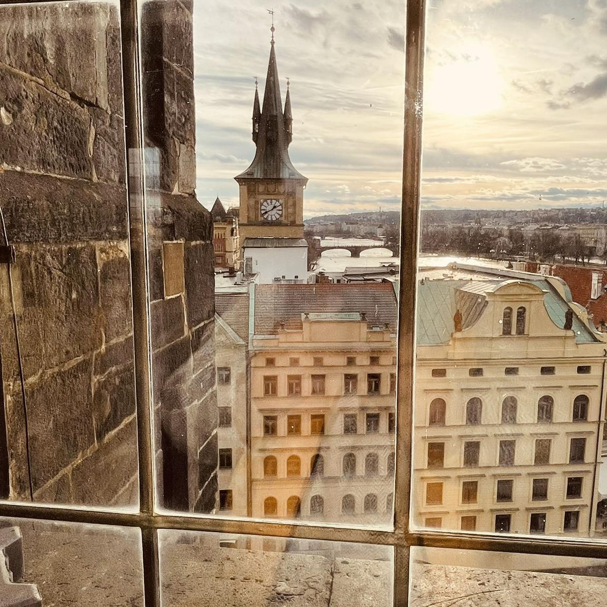
From the top of a hill, the panorama from Mont-Saint-Eloi extends over the entire Scarpe valley and the Artois plain. The village is known for the ruins of its abbey, and the two towers dominate the surrounding landscape.
0
0

The two towers of Mont-Saint-Éloi dominate the Arras region. They can be seen from afar. They shape the landscape of the Artois plains. They are a landmark for those walking in the surrounding area. Located on a hill seven kilometers northwest of Arras, the two towers of Mont-Saint-Éloi are the monumental remains of an abbey with a thousand-year history. Listed as a historical monument since 1921 and owned by the Pas-de-Calais Department since 2008, the two towers are the subject of a scientific and cultural project to raise awareness and promote their heritage. Between 2010 and 2015, the Department carried out restoration work, and its archaeology department conducted six excavations.
0
0
Frequently Asked Questions
How many no-traffic road cycling routes are available around Mont-Saint-Éloi?
There are over 130 no-traffic road cycling routes around Mont-Saint-Éloi, offering a wide range of options for cyclists. These routes vary in difficulty, with approximately 30 easy, 100 moderate, and a few more challenging options.
What kind of terrain can I expect on the no-traffic road cycling routes in Mont-Saint-Éloi?
Mont-Saint-Éloi is known for its undulating hills and varied terrain, making it ideal for road cycling. You can expect significant elevation gains, with routes featuring rolling hills and picturesque rural scenery. The region has even hosted stages of the Tour de France, indicating its challenging yet rewarding landscape.
Are there any notable landmarks or viewpoints along the no-traffic road cycling routes?
Yes, many routes offer stunning views and pass by significant landmarks. You can cycle past the iconic ruined towers of the Abbey of Mont-Saint-Éloi, which dominate the plain. Other points of interest include the historically significant Ecoivres Wood and the fascinating Passage dolmen: The Fairy Table. For panoramic views, the elevated position of Mont-Saint-Éloi itself provides splendid vistas over the Scarpe Valley and the Artois plain.
What is the best season for road cycling in Mont-Saint-Éloi?
The best time for road cycling in Mont-Saint-Éloi is generally from spring to autumn. During these seasons, the weather is more favorable, and the natural landscapes are at their most vibrant. The region's varied terrain can be enjoyed without the challenges of winter conditions.
Are there any family-friendly no-traffic road cycling routes in the area?
While many routes feature undulating terrain, there are easier options available. Approximately 30 of the no-traffic road cycling routes are classified as easy, making them more suitable for families or those looking for a less strenuous ride. Look for routes with lower elevation gains and shorter distances.
Can I bring my dog on these no-traffic road cycling routes?
Most road cycling routes are on paved surfaces and public roads, which are generally accessible for cyclists with dogs, provided the dog is safely secured (e.g., in a trailer or basket). However, it's always best to check local regulations or specific route details if you plan to bring your dog, especially in nature reserves like the Maroeuil marsh.
Where can I find parking for my car when starting a no-traffic road cycling route?
Mont-Saint-Éloi, being a Heritage Village, typically offers parking options within the commune, especially near the Abbey. For specific routes, you can often find parking in the starting villages or towns. For example, routes starting from Frévin-Capelle or Marœuil would have local parking facilities.
Are there any dedicated cycle paths or 'Voie Verte' suitable for road bikes near Mont-Saint-Éloi?
While the focus of this guide is on low-traffic roads, the region does have a network of trails. The 'Sentier des 3 Abbayes' and 'Sentier des Pierres du Diable' are examples of marked trails. For dedicated paved cycle paths, you might need to explore the wider Arras region, as Mont-Saint-Éloi's charm lies in its quiet rural roads.
What do other cyclists say about road cycling in Mont-Saint-Éloi?
The komoot community highly rates the cycling experience in Mont-Saint-Éloi, with an average score of 4.3 stars from over 360 ratings. Reviewers often praise the region's challenging climbs, stunning panoramic views, and the historical significance of landmarks like the Abbey, all while enjoying the tranquility of low-traffic roads.
Are there any cafes or accommodation options for cyclists near the routes?
Mont-Saint-Éloi and its surrounding villages offer local amenities including cafes and restaurants where cyclists can refuel. As a Heritage Village, you can also find charming guesthouses or small hotels for accommodation. Larger towns like Arras, a short distance away, provide a wider range of services for cyclists.
Can you recommend a moderate no-traffic road cycling route that explores the region's history?
Certainly. The Circuit des Hauts-Lieux de la Grande Guerre en Artois is a moderate 29.5 km route with about 300m of elevation gain. It allows you to explore historical sites related to the Great War while enjoying the quiet roads of the Artois region.
Is there a longer, more challenging no-traffic route that includes the Abbey?
For a longer and more challenging ride, consider the Ruins of Mont-Saint-Eloi Abbey – Abbey of Mont Saint-Éloi loop from Frévin-Capelle. This route covers over 90 km with more than 800m of elevation, offering a substantial workout and passing directly by the iconic Abbey ruins.
Most popular routes around Mont-Saint-Éloi
Most popular attractions around Mont-Saint-Éloi

Get inspired with the komoot mobile app


Explore more
Browse the best Road cycling routes in other regions.
