The best traffic-free bike rides around Saint-Cyr-Le-Chatoux
4.6
(147)
2,347
riders
52
rides
No traffic touring cycling routes around Saint-Cyr-Le-Chatoux traverse a landscape characterized by undulating hills, wooded areas, and river valleys. The region offers panoramic views of the Beaujolais vineyards and the Saône valley. The Massif de la Cantinière, a Sensitive Natural Area, features diverse ecosystems and forest tracks suitable for cycling. This area provides varied terrain for touring cyclists.
Best no traffic touring cycling routes around Saint-Cyr-Le-Chatoux
- The most popular no traffic touring cycling route is Ville-sur-Jarnioux – Oingt loop from…
Last updated: May 24, 2026
4.0
(1)
13
riders
32.5km
03:23
1,100m
1,100m
Hard bike ride. Very good fitness required. Mostly paved surfaces. Suitable for all skill levels.
14
riders
40.5km
04:07
1,090m
1,090m
Hard bike ride. Very good fitness required. You may need to push your bike for some segments of this route.

Sign up for free
15
riders
Hard bike ride. Very good fitness required. Mostly paved surfaces. Suitable for all skill levels.
11
riders
32.2km
03:09
840m
840m
Hard bike ride. Very good fitness required. Mostly paved surfaces. Suitable for all skill levels.
10
riders
40.3km
04:04
1,170m
1,170m
Hard bike ride. Very good fitness required. Mostly paved surfaces. Suitable for all skill levels.
Get access to more routes and recommendations from other explorers.
Sign up for free
Already have an account?
Our route recommendations are based on thousands of hikes, rides, and runs completed by other people on komoot.
Start today with a free account
Your next adventure awaits.
Login or Signup
Popular around Saint-Cyr-Le-Chatoux
Other adventures around Saint-Cyr-Le-Chatoux

Tips from the Community

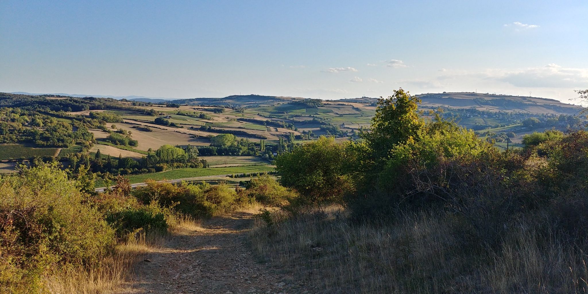
At the gates of Saint-Étienne-la-Varenne, you have many viewpoints like this one. This panorama lays before your eyes a typical landscape of the Beaujolais mountains, with vineyards undulating to the foot of the mountains.
0
0


Beautiful pass at 736 m, quite gentle, 6.1% average. Nice to do by mixing with the 76 gravel hiking trail.
3
0
Nice pass with an average gradient of around 5% and little traffic.
0
0

Know that you are heading down a path that is no longer really maintained. The water gullies the path and makes it impassable (on gravel). Perhaps the most determined will manage to climb this on a mountain bike or e-MTB, but it's not a sure thing!
0
0
The track which goes down to Cherfeux is rather stony on the upper part. It gets smoother on the second half (bottom). Not very pleasant on gravel (but it's okay), on the other hand with a mountain bike it must be more pleasant.
0
0

The Col de la Croix-Rosier is a road pass in the Massif Central, located in the Rhône department. Its altitude is 721 meters.
0
0
Pass at 685 m altitude located in Beaujolais Vert, it is possible to continue to the Col de la Croix du Rozier.
0
0
Frequently Asked Questions
How many no-traffic touring cycling routes are available in Saint-Cyr-Le-Chatoux?
There are nearly 50 dedicated no-traffic touring cycling routes around Saint-Cyr-Le-Chatoux. These routes cater to various skill levels, with a strong emphasis on challenging rides through the region's undulating hills and scenic landscapes.
What kind of terrain can I expect on these no-traffic touring routes?
The routes primarily feature undulating hills, wooded areas, and river valleys, offering a diverse and engaging cycling experience. You'll find both gentle gradients along waterways and more challenging sections, often leading to rewarding views from mountain passes like the Col du Parasoir.
Are there any family-friendly no-traffic cycling routes suitable for beginners or children?
While many routes in the region are rated as difficult, there is at least one easy touring cycling route available. For families or beginners, look for routes that stick to the flatter river valleys or designated 'voie verte' sections, which are typically car-free and less strenuous. The broader Auvergne-Rhône-Alpes region also features major cycle routes like "La Belle Via" which are known for being easy through Alpine valleys, suggesting a general infrastructure for accessible cycling.
What are some notable attractions or landmarks I can visit along these routes?
The region is rich in attractions. You can cycle past charming villages like Oingt, recognized as one of France's most beautiful medieval villages, or explore historical sites such as Montmelas Castle. Many routes also pass by scenic mountain passes, including Le relais du Parasoir, which offers stunning vistas and a restaurant.
Are there any circular no-traffic touring routes in the area?
Yes, many of the no-traffic touring routes in Saint-Cyr-Le-Chatoux are designed as loops, allowing you to start and end in the same location. An example is the challenging Ville-sur-Jarnioux – Oingt loop from Rivolet, which covers over 36 km with significant elevation gain.
What do other touring cyclists enjoy most about cycling in Saint-Cyr-Le-Chatoux?
The area is highly rated by the komoot community, with an average score of 4.6 stars from over 160 ratings. Reviewers often praise the region's breathtaking panoramic views, the quiet roads through vineyards and forests, and the challenging yet rewarding climbs to various cols.
Can I access these routes using public transport?
While specific public transport links directly to trailheads are not detailed, the broader Auvergne-Rhône-Alpes region has a well-developed cycling infrastructure. It's advisable to check local public transport options in nearby towns like Le Bois-d'Oingt, Beaujeu, Anse, or Belleville, which may offer connections to the starting points of some routes.
Where can I find parking for these no-traffic touring cycling routes?
Many routes start from villages or towns in the region, such as Vaux-en-Beaujolais or Rivolet, where public parking is generally available. It's recommended to check the specific starting point of your chosen route for detailed parking information.
What is the best season for no-traffic touring cycling in Saint-Cyr-Le-Chatoux?
The region's climate makes spring and autumn ideal for touring cycling, offering pleasant temperatures and vibrant landscapes. Summer can also be enjoyable, especially in the mornings or late afternoons, though some climbs might be more strenuous in higher temperatures. Winter cycling is possible but requires appropriate gear for colder conditions.
Are there any routes that pass through the Massif de la Cantinière?
Yes, the Massif de la Cantinière, a Sensitive Natural Area, features forest tracks ideal for cycling. This area is known for its remarkable biodiversity, including rare species and diverse ecosystems, offering a unique natural experience. For more information on this forest, you can visit Beaujolais Tourisme.
Are there any challenging routes for experienced touring cyclists?
Absolutely. The Saint-Cyr-Le-Chatoux area is well-suited for experienced cyclists seeking a challenge. Many routes feature significant elevation gains and cover substantial distances. For example, the La Place aux Filles – Château de Varennes loop from Vaux-en-Beaujolais is a difficult route spanning over 32 km with more than 1000 meters of elevation gain.
Most popular routes around Saint-Cyr-Le-Chatoux
Most popular attractions around Saint-Cyr-Le-Chatoux

Get inspired with the komoot mobile app


Explore more
Browse the best Cycling routes in other regions.
