The best traffic-free bike rides around Saint-Bonnet-De-Montauroux
4.4
(26)
1,184
riders
3
rides
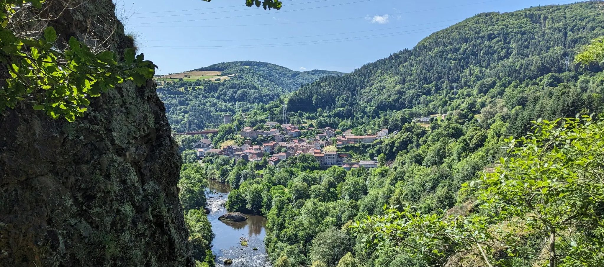
Road cycling around Saint-Bonnet-De-Montauroux offers no traffic road cycling routes through the mountainous terrain of the Massif Central, specifically within the Margeride plateau. The region is characterized by elevations ranging from 729 to 1180 meters, providing varied profiles for cyclists. Cyclists can expect well-paved roads with minimal traffic, traversing dramatic river gorges like the Chapeauroux and Allier, vast green spaces, and forests. The area also features proximity to Lac de Naussac, offering scenic routes around the lake.
Best no traffic…
Last updated: July 5, 2026
13
riders
23.5km
01:19
390m
390m
Moderate road ride. Good fitness required. Some segments of this route may be unpaved and difficult to ride.
2
riders
47.5km
02:40
840m
840m
Moderate road ride. Good fitness required. Mostly well-paved surfaces and easy to ride.

Sign up for free
2
riders
34.7km
01:46
480m
480m
Moderate road ride. Good fitness required. Mostly well-paved surfaces and easy to ride.
Our route recommendations are based on thousands of hikes, rides, and runs completed by other people on komoot.
Start today with a free account
Your next adventure awaits.
Login or Signup


Other adventures around Saint-Bonnet-De-Montauroux

Tips from the Community

In one of the best-preserved parts of the Margeride massif, the Three Sisters pass is said to have been named after the story of three sisters born in the parish of La Panouse, all three of whom were hired as servants in the local barracks. According to the dictionary of the rural world, these barracks refer to old inns located at the start of steep roads. This allowed the wagoners to reinforce their teams before setting off.
2
0


This charming rural town located in the heart of Margeride offers an ideal setting for cycling. Its cafes and restaurants allow you to stop there in the middle or end of your outing.
1
0

multiple caves that you can explore
1
0

Sitting at 920 metres (3,018 ft), Langogne is a picturesque rural commune with plentiful food and accommodation options. You can take a break in one of its numerous cafés in the old centre.
0
0

Transit link between Vivarais, Velay and South of France, Langogne emerges from its ramparts in the 18th century century. In 1743, Dom Ambroise de Fleury, Prior of the city, made build the Hall, with its fourteen pillars, one of the most large preserved in France. It is a place for the exchange of cereals, farm products, leather, local wool, for chestnuts from the Cévennes, wines and oils from Provence, and other goods from the South and the Mediterranean.
3
0

Langogne is at the heart of many sites perfect for hiking and outdoor activities. It is a territory with a thousand facets, in the middle of Margeride, a few steps from Lake Naussac and the Haut-Allier gorges. The town is also home to some cultural gems that are worth a visit such as the Chastanier sacred art museum, the thousand-year-old city of Langogne or the Filature des Calquières museum.
4
0
Frequently Asked Questions
How many no-traffic road cycling routes are available around Saint-Bonnet-de-Montauroux?
There are currently 3 curated no-traffic road cycling routes available around Saint-Bonnet-de-Montauroux. These routes offer a range of distances and elevations, catering to different fitness levels.
Are there any challenging no-traffic road cycling routes for experienced riders?
Yes, for experienced riders seeking a challenge, the region offers routes with significant elevation gain. An example is the Malzieu-Ville – Saugues Town Center loop from Chambon-le-Château, which covers 88.4 km with over 1700 meters of ascent, providing a demanding ride through the mountainous terrain of the Lozère department.
What kind of landscapes can I expect on these no-traffic road cycling routes?
The no-traffic road cycling routes around Saint-Bonnet-de-Montauroux traverse diverse and scenic landscapes. You'll experience the granite plateau of the Margeride, vast green spaces, meadows, and forests. Many routes also offer views of the dramatic Chapeauroux and Allier valleys, with the Allier Gorges providing particularly spectacular scenery.
Are there any circular no-traffic road cycling routes?
Yes, several routes are designed as loops, allowing you to start and finish in the same location. For example, the Langogne commune – La Halle aux Grains loop from Naussac is a moderate 23.5 km circular route, and the Col des Trois Sœurs loop from Auroux offers a 47.5 km ride with notable climbs.
What attractions can I see along the no-traffic road cycling routes?
While cycling, you can discover various natural and historical points of interest. Keep an eye out for highlights such as the serene Lake Bouchet, the charming settlement of Chapeauroux, and the impressive Le Pont d'Alleyras. You might even encounter the beautiful Donozau Waterfall.
What is the best time of year for no-traffic road cycling in Saint-Bonnet-de-Montauroux?
The region is ideal for cycling from spring through autumn. The summer months offer warm weather, while spring and autumn provide cooler temperatures and vibrant scenery. Given the mountainous terrain, it's advisable to check local weather forecasts, especially for higher elevations, before planning your ride.
What do other road cyclists enjoy most about cycling in Saint-Bonnet-de-Montauroux?
The komoot community highly rates the cycling experience in this area, with an average score of 4.5 stars from 21 ratings. Reviewers often praise the quiet, well-maintained roads, the stunning natural beauty of the Lozère department, and the challenging yet rewarding climbs through the mountainous landscape.
Are there any long-distance cycling routes that incorporate no-traffic sections near Saint-Bonnet-de-Montauroux?
Yes, the region is close to the "Via Allier" cycle route, a 455 km path that largely follows the Allier River on quiet country roads. This route offers a mix of gentle valleys and steeper sections, providing an excellent option for longer rides with minimal traffic. You can find more information about the Via Allier on France Vélo Tourisme.
Is there parking available near the starting points of these routes?
While specific parking details for each route's starting point are not provided here, Saint-Bonnet-de-Montauroux and nearby villages typically offer public parking options. It's recommended to check local maps or resources for parking facilities closest to your chosen route's start.
Can I find family-friendly no-traffic cycling options in the area?
While the listed routes include moderate and difficult options, the broader region of Lozère is known for its extensive network of quiet roads and varied terrain. For family-friendly options, look for routes with less elevation gain or consider exploring paths around natural features like Lac de Naussac, which often have gentler sections suitable for a wider range of abilities.
What are the typical elevations and distances for no-traffic road cycling routes here?
The routes vary significantly. You can find moderate rides like the Langogne commune – La Halle aux Grains loop at 23.5 km with about 395 meters of ascent, up to difficult routes such as the Malzieu-Ville – Saugues Town Center loop, which spans 88.4 km with over 1700 meters of climbing. The region's elevations range from 729 to 1180 meters, ensuring varied profiles.
Most popular routes around Saint-Bonnet-De-Montauroux
Most popular attractions around Saint-Bonnet-De-Montauroux

Get inspired with the komoot mobile app


Explore more
Browse the best Road cycling routes in other regions.
