The best traffic-free bike rides around Longemaison
4.6
(12)
96
riders
15
rides
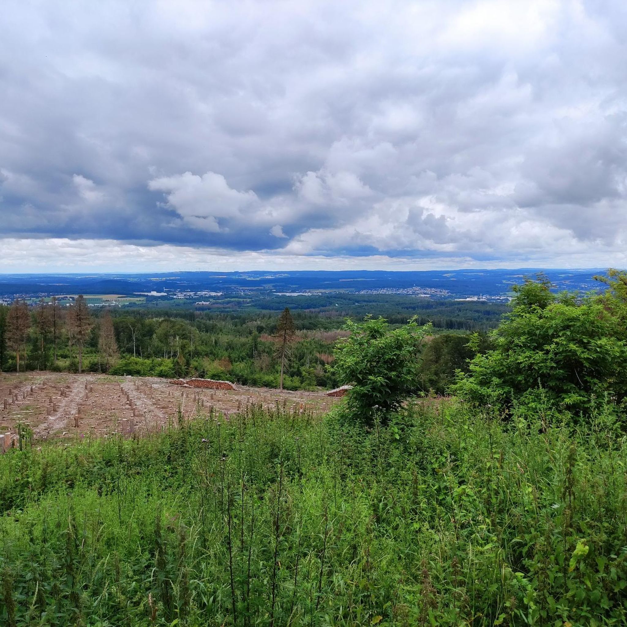
Gravel biking around Longemaison offers diverse landscapes in the Doubs department of Burgundy-Franche-Comté. The region is characterized by deep gorges like the Gorges de Remonot and Gorges du Doubs, carved by the Doubs river, providing varied terrain and scenic riverside routes. Karst topography, evidenced by features such as the Gouffre de Poudrey, contributes to unique geological formations and elevation changes. Dense forests, including the Forêt de la Joux, offer shaded paths, while elevated viewpoints like Belvédère du Mont Vouillot provide panoramic vistas of the Val de Morteau and the Swiss Jura.
Best no traffic gravel bike trails around Longemaison
- The most popular no traffic gravel bike trail is Gilley at the end of my dreams, a 10.6 miles (17.1 km) trail that takes 1 hour 17 minutes to complete. This moderate route features rolling terrain through the local countryside.
- Another top favourite among local gravel bikers is Pic nic 🙂🍷🚴🏻♂️ – Papy Gaby's smokehouse loop from Avoudrey, a difficult 51.3 miles (82.5 km) path. This route explores extensive forest sections and offers significant elevation gains.
- Local gravel bikers also love the Loue River – The Loue loop from Le Valdahon, a 51.8 miles (83.4 km) trail leading through river valleys and forested hills, often completed in about 6 hours 14 minutes.
- Gravel biking around Longemaison is defined by river valleys, dense woodlands, and elevated plateaus. The network offers options for both moderate and challenging ability levels.
- The routes in Longemaison are highly rated by the komoot community with an average score of 4.7 stars from 8 reviews. More than 70 gravel bikers have used komoot to explore Longemaison's varied terrain.
Last updated: July 5, 2026
5.0
(1)
4
riders
17.1km
01:17
190m
190m
Moderate gravel ride. Good fitness required. Mostly paved surfaces. Suitable for all skill levels.
3.0
(1)
38
riders
95.5km
06:41
1,820m
1,820m
Hard gravel ride. Very good fitness required. Mostly paved surfaces. Suitable for all skill levels.

Sign up for free
9
riders
82.8km
06:07
1,300m
1,300m
Hard gravel ride. Very good fitness required. Mostly paved surfaces. Suitable for all skill levels.
5.0
(2)
14
riders
65.6km
04:31
1,210m
1,210m
Hard gravel ride. Very good fitness required. Mostly paved surfaces. Suitable for all skill levels.
5.0
(2)
3
riders
20.1km
01:25
240m
240m
Moderate gravel ride. Good fitness required. Mostly paved surfaces. Suitable for all skill levels.
Get access to more routes and recommendations from other explorers.
Sign up for free
Already have an account?
Our route recommendations are based on thousands of hikes, rides, and runs completed by other people on komoot.
Start today with a free account
Your next adventure awaits.
Login or Signup
Popular around Longemaison

Tips from the Community

Old railway line
0
0

Hut in the picture is not a shelter
0
0

This path along the edge of fields and the forest leading to Cornabey is very pleasant. You cross a small bridge to span the stream.
0
0

This Green Way is a pleasant gentle slope in the middle of the forest, with smooth asphalt
0
0

The church was built in the 15th century and enlarged and supplemented in the 16th century with gifts from Cardinal Granvelle (the bell tower and the spire in local tuff). Pay special attention to the woodwork (altarpiece, choir stalls, confessional, pulpit and the wooden statues (13th and 14th centuries).
6
0
Ornans is situated on the banks of the River Loue, surrounded by hills and forests. It is situated in a picturesque area and is renowned for its attractive landscape.
9
0
The Viaduc de la Brème (also known as the Viaduc de Bois Joli) is an impressive viaduct in the Bourgogne-Franche-Comte region. ie: The Viaduc de la Brème is located near the Château de la Malcôte and the Chapelle Notre-Dame-du-Chêne. It offers magnificent views of the surrounding landscape. This viaduct spans the Brême River and is part of a historic railway line. It is an architectural masterpiece that is both functional and aesthetic. It offers panoramic views of the natural beauty of the area.
7
0
Frequently Asked Questions
How many no-traffic gravel bike trails are available around Longemaison?
There are 14 dedicated no-traffic gravel bike trails around Longemaison, offering a variety of experiences for different skill levels. You'll find 6 moderate routes and 8 more challenging options to explore.
What makes the Longemaison area particularly good for no-traffic gravel biking?
The region around Longemaison is characterized by its diverse natural landscape, including dramatic gorges, dense forests, and elevated viewpoints. This provides a wide range of terrain for gravel biking, from challenging climbs to scenic riverside paths, all while minimizing encounters with vehicle traffic.
What do other gravel bikers enjoy most about the trails near Longemaison?
The komoot community highly rates the gravel biking experience around Longemaison, with an average score of 4.7 out of 5 stars. Riders often praise the stunning natural beauty, the quiet and immersive forest sections, and the rewarding panoramic views from elevated points like the Belvédère du Mont Vouillot.
Are there any beginner-friendly or easy no-traffic gravel routes near Longemaison?
While the guide focuses on moderate to difficult routes, some of the moderate trails can be suitable for beginners with a reasonable level of fitness. For instance, the route "Gilley at the end of my dreams" offers a manageable 17 km distance with less elevation gain, making it a good starting point.
Are there challenging no-traffic gravel bike trails for experienced riders?
Yes, the Longemaison area offers 8 difficult gravel bike trails that will test experienced riders. Routes like "Loue River – The Loue loop from Le Valdahon" cover over 83 km with significant elevation changes, providing a demanding and rewarding adventure through varied terrain.
Can I find circular no-traffic gravel bike routes around Longemaison?
Many of the no-traffic gravel bike routes in this guide are designed as loops, allowing you to start and finish at the same point. For example, the "Col sur le Mont – Bridge over the Doubs loop from Pays-de-Montbenoît" is a substantial circular route that takes you through diverse landscapes.
What kind of natural scenery can I expect on these no-traffic gravel bike trails?
You can expect a rich tapestry of natural scenery. The routes often traverse dense sections of the Forêt de la Joux, follow the dramatic Gorges du Doubs, and offer glimpses of karst topography. The presence of rivers like the Doubs ensures picturesque waterside stretches and stunning geological formations.
Are there specific viewpoints or natural attractions accessible from these routes?
Absolutely. Many routes offer access to breathtaking vistas. You can reach the Mont Vouillot Viewpoint, which provides exceptional panoramic views of the Val de Morteau and the Swiss Jura. The Roche Barchey viewpoint is another notable spot for scenic overlooks. Additionally, the Col sur le Mont is a point of interest for cyclists seeking elevated terrain.
Can I explore charming villages or historical sites on these gravel routes?
Yes, some routes pass near or through charming local villages, offering opportunities to experience local life and culture. While not directly on every trail, the region is dotted with picturesque settlements like Mouthier-Haute-Pierre and Lods. You might also encounter historical landmarks such as the Sainte-Radegonde Chapel, adding a cultural dimension to your ride.
Are there any routes that follow old railway lines for a smoother experience?
Yes, for a unique and often flatter gravel biking experience, you can find sections that utilize old railway lines. The Chemin du Train near Hauterive-la-Fresse is an example of such a path, providing a relatively smooth surface and a distinct historical atmosphere for your ride.
What is the best season for gravel biking around Longemaison?
Spring and autumn generally offer the most pleasant conditions for gravel biking around Longemaison, with mild temperatures and vibrant scenery. Summer can also be excellent, especially in the shaded forest sections, but be prepared for potentially warmer weather. Winter riding is possible, but trail conditions can vary greatly with snow and ice, especially at higher elevations.
Are there any routes that feature waterfalls or dramatic river gorges?
The region is renowned for its water-carved landscapes. While specific waterfalls are not directly linked to every route, the proximity to the Gorges de Remonot, Défilé d'Entre-Roches, and the Gorges du Doubs means many trails offer dramatic views of river gorges and the powerful Doubs river itself. The famous Saut du Doubs waterfall is also within the broader regional context, though not directly on a listed route.
Most popular routes around Longemaison
Most popular attractions around Longemaison

Get inspired with the komoot mobile app


Explore more
Browse the best Gravel rides in other regions.
