The best traffic-free bike rides around Gottesthal
4.5
(91)
2,288
riders
97
rides
No traffic road cycling routes around Gottesthal offer a variety of options for cyclists. The region provides a selection of routes with varying distances and elevation gains. These routes are designed for road cyclists seeking paths away from vehicle traffic. The terrain includes both flatter sections and routes with notable climbs.
Best no traffic road cycling routes around Gottesthal
- The most popular no traffic road cycling route is Memorial to the fallen 🕊️ – Place d'Armes, Belfort loop from Montreux-Vieux, a 33.3 miles (53.6 km) trail that takes 2 hours 12 minutes to complete. This moderate route features an elevation gain of 258 meters.
- Another top favourite among local road cyclists is Hundsruck – Roading - Guewenheim loop from Montreux-Vieux, a moderate 40.1 miles (64.5 km) path. This route includes a significant elevation gain of 825 meters, offering a more challenging ride.
- Local road cyclists also love the Canal du Rhône au Rhin loop from Montreux-Vieux, a 21.4 miles (34.5 km) trail leading through varied terrain, often completed in about 1 hour 26 minutes.
- Road cycling around Gottesthal is defined by a network of routes that cater to different fitness levels, from easy to difficult. The available routes include options with minimal elevation as well as those with substantial climbs.
- The routes in Gottesthal are highly rated by the komoot community with an average score of 4.4 stars from over 80 reviews. More than 2000 road cyclists have used komoot to explore Gottesthal's varied terrain.
Last updated: May 24, 2026
4.8
(6)
89
riders
Easy road ride. Great for any fitness level. Mostly well-paved surfaces and easy to ride.
4.3
(3)
51
riders
Moderate road ride. Good fitness required. Some segments of this route may be unpaved and difficult to ride.

Sign up for free
4.0
(1)
19
riders
69.7km
03:20
930m
930m
Hard road ride. Very good fitness required. Mostly well-paved surfaces and easy to ride.
17
riders
34.5km
01:26
210m
210m
Easy road ride. Great for any fitness level. Mostly well-paved surfaces and easy to ride.
16
riders
Easy road ride. Great for any fitness level. Mostly well-paved surfaces and easy to ride.
Get access to more routes and recommendations from other explorers.
Sign up for free
Already have an account?
Our route recommendations are based on thousands of hikes, rides, and runs completed by other people on komoot.
Start today with a free account
Your next adventure awaits.
Login or Signup
Popular around Gottesthal

Tips from the Community

The cycle path along the canal is superbly maintained and runs through beautiful countryside. However, the starting and finishing points near Bourgogne and Bretagne raise geographical questions as to whether one is still truly in Alsace...
0
0

There are also toilets and a water point
0
0


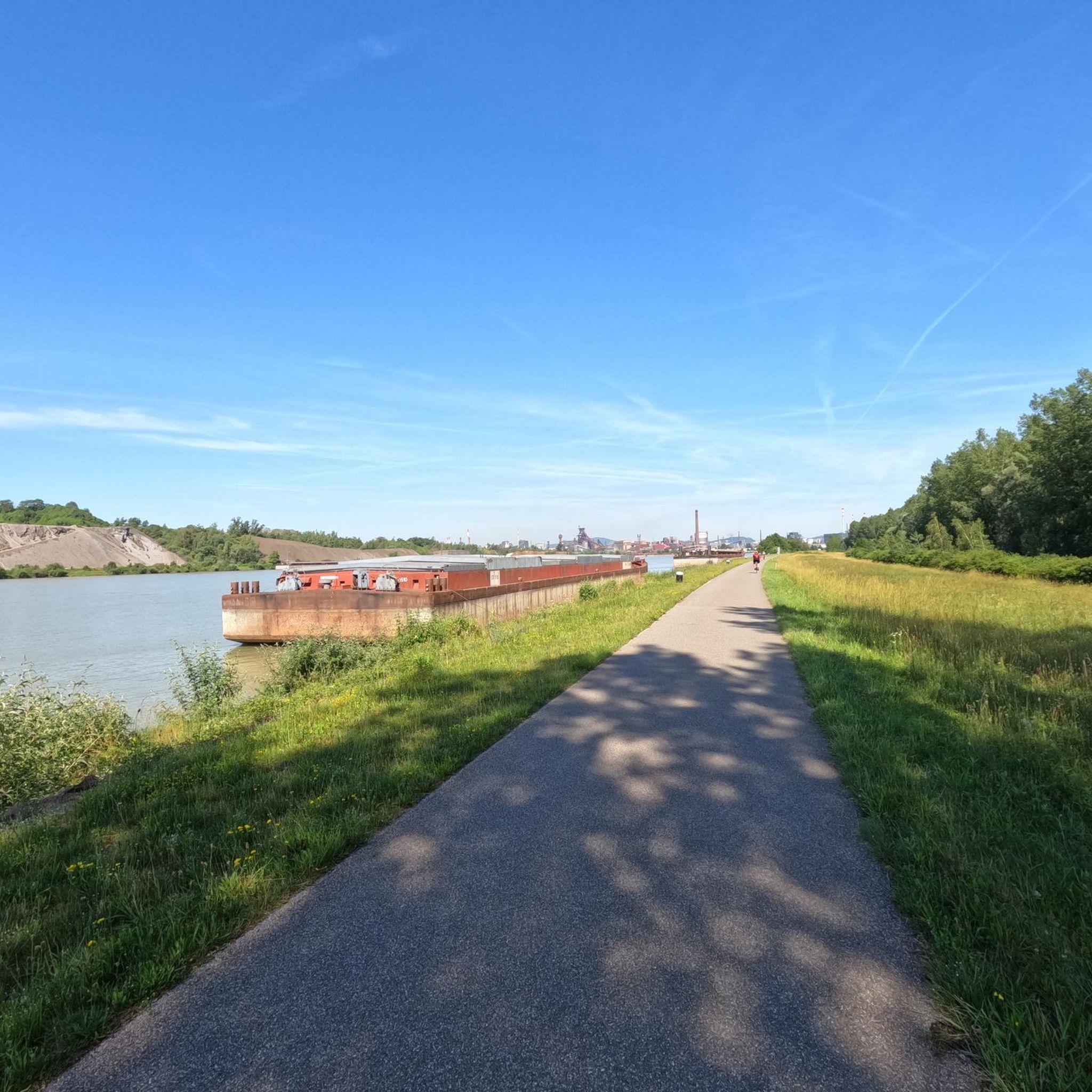
These 🚤⛵️🛥 are the welcome change on the EV6
2
0


I noticed this highlight during my search. However, it is not on the Haute Saône Canal but on an independent river, the Savoureuse. According to Wikipedia: The Savoureuse is a right tributary of the Allan, around 41 kilometers long, in the French department of Territoire de Belfort in the Bourgogne-Franche-Comté region. It flows through the city of Belfort and drains the western part of the department to the Mediterranean via the Allan, Doubs, Saône and Rhône water system. The Savoureuse catchment area covers an area of around 225 km². The river name comes from the Patois expression savour (saw). https://de.m.wikipedia.org/wiki/Savoureuse
2
0

The fortress of Belfort is very impressive and worth seeing. A particular eye-catcher is the mighty lion at the foot of the fortress.
1
0

Nice, very pleasant walk.
0
0
Frequently Asked Questions
How many no-traffic road cycling routes are available in the Gottesthal area?
There are over 80 dedicated no-traffic road cycling routes around Gottesthal, offering a wide range of options for different skill levels. You'll find 36 easy routes, 48 moderate routes, and 5 more challenging options to explore.
What kind of terrain and elevation can I expect on these no-traffic road cycling routes?
The routes offer varied terrain. For example, the Col Amic Pass – Climb to Col Amic loop from Montreux-Vieux is a difficult route with significant elevation gain of over 1400 meters, while the Canal du Rhône au Rhin loop from Montreux-Vieux is an easier ride with only about 210 meters of ascent, making it suitable for a more relaxed experience.
Are there any interesting landmarks or natural features to see along the no-traffic road cycling routes?
Yes, several routes pass by notable points of interest. You can cycle alongside the historic Canal du Rhône au Rhin, or visit the Port of Dannemarie. Other attractions include the Valdieu-Lutran lock scale and the Eglingen Lock, offering glimpses into the region's waterways and engineering.
What do other road cyclists enjoy most about the no-traffic routes in this area?
The komoot community highly rates these routes, with an average score of 4.4 out of 5 stars from 86 ratings. Cyclists often praise the quiet roads and scenic views, especially on routes like the Réchésy Church – View of the Vosges loop from Montreux-Vieux, which offers beautiful vistas.
Are there any easy no-traffic road cycling routes suitable for beginners or families?
Absolutely! There are 36 easy routes available. A great option for a relaxed ride is the Canal du Rhône au Rhin loop from Montreux-Vieux, which is just over 34 km long with minimal elevation, making it very accessible for those looking for a gentle, traffic-free experience.
Can I find longer no-traffic road cycling routes for endurance training?
Yes, for longer rides, consider routes like the Col Amic Pass – Climb to Col Amic loop from Montreux-Vieux, which spans nearly 100 km and features significant climbs, ideal for endurance cyclists seeking a challenge on quiet roads.
Are there any circular no-traffic road cycling routes available?
Many of the routes are designed as loops, allowing you to start and finish at the same point. For instance, the Memorial to the fallen 🕊️ – Place d'Armes, Belfort loop from Montreux-Vieux is a moderate circular route of over 53 km, perfect for a day trip without retracing your steps.
What is the best time of year to enjoy no-traffic road cycling in this region?
While specific regional climate data for Gottesthal is not available, generally, spring and autumn offer pleasant temperatures and beautiful scenery for road cycling. Summer can also be enjoyable, especially in the mornings or late afternoons to avoid peak heat.
Are there any routes that offer particularly good views?
Many routes provide scenic vistas. The Réchésy Church – View of the Vosges loop from Montreux-Vieux is specifically highlighted for its views, suggesting a rewarding experience for cyclists looking for picturesque landscapes.
Are there any moderate no-traffic road cycling routes for intermediate cyclists?
Yes, there are 48 moderate routes available. A good example is the Hundsruck – Roading - Guewenheim loop from Montreux-Vieux, which covers over 64 km with a substantial elevation gain of over 800 meters, offering a good workout for intermediate riders.
What should I wear for no-traffic road biking in this area?
Given the varied terrain and potential for elevation changes, it's advisable to wear appropriate cycling attire, including padded shorts, a moisture-wicking jersey, and layers that can be adjusted to changing weather conditions. Always bring a helmet and consider sunglasses and gloves for comfort and safety.
Most popular attractions around Gottesthal

Get inspired with the komoot mobile app


Explore more
Browse the best Road cycling routes in other regions.
