The best traffic-free bike rides around Gildweiler
4.5
(355)
3,189
riders
201
rides
Traffic-free touring cycling routes around Gildweiler traverse a landscape characterized by gentle hills, river valleys, and agricultural areas. The region features routes along waterways, through rural settings, and past historical sites. These paths are designed to avoid main roads and motor traffic, utilizing separated bike paths, forest tracks, and quiet country lanes. The terrain is generally accessible, making it suitable for a range of riders, including families and less confident cyclists.
Best traffic-free touring cycling routes around Gildweiler
- The most…
Last updated: May 24, 2026
5.0
(1)
24
riders
Easy bike ride. Great for any fitness level. Mostly paved surfaces. Suitable for all skill levels.
5.0
(4)
12
riders
33.0km
01:59
160m
160m
Moderate bike ride. Good fitness required. Mostly paved surfaces. Suitable for all skill levels.

Sign up for free
5.0
(1)
16
riders
33.4km
02:23
270m
260m
Moderate bike ride. Good fitness required. Mostly paved surfaces. Suitable for all skill levels.
5.0
(1)
7
riders
Easy bike ride. Great for any fitness level. Mostly paved surfaces. Suitable for all skill levels.
5.0
(1)
7
riders
22.1km
01:46
150m
150m
Moderate bike ride. Good fitness required. Mostly paved surfaces. Suitable for all skill levels.
Get access to more routes and recommendations from other explorers.
Sign up for free
Already have an account?
Our route recommendations are based on thousands of hikes, rides, and runs completed by other people on komoot.
Start today with a free account
Your next adventure awaits.
Login or Signup
Popular around Gildweiler

Tips from the Community

Thann's sloping vineyards are famous for their south-facing orientation with slopes that can reach 45°, offering spectacular and dizzying landscapes. These hillsides, located between 350 and 450 meters above sea level, extend over an area of 22 hectares and are renowned for their volcanic terroir and their proximity to the Thur River, which provides the humidity necessary for the grapes to ripen. Among the grape varieties cultivated are Riesling, Pinot Gris, Gewürztraminer, and Muscat, all grown in often rocky and well-exposed soil, which gives the wines great finesse. Viticulture on these steep terrains requires harvests that are often carried out with ropes to ensure safety on these very steep slopes. These vineyards, particularly the Grand Cru Rangen, are among the most emblematic of the region.
0
0


The World War I Bunker Trail in Burnhaupt-le-Bas On the Bunker Trail, you can discover World War I fortifications built by the German army. After the fighting in the summer and autumn of 1914, the front in Upper Alsace stabilized on the Cernay-Dannemarie line. The municipal district of Burnhaupt-le-Bas remained on the German side. In December 1914 and January 1915, French offensives in this sector regularly clashed with the German lines. Numerous bunkers, command posts, and artillery posts. The tour can be done by mountain bike or on foot (hiking boots).
0
0

Burnhaupt-le-Haut, is a bourg rural (a rural centre with urban influences) in the Doller valley, on the edge of the Vosges. In 1917, it was almost completely destroyed during WWI. The Saint-Boniface church, originally from the 18th century, was rebuilt after WWII in a striking art deco style. Inside you will find, among other things, an organ from 1930 and Byzantine-inspired wood carvings.
6
0

Camping Les Cigognes in Cernay is an ideal stopover for long-distance cyclists travelling through Alsace. Located close to the centre, the campsite offers quiet, shady pitches, a heated swimming pool to relax your legs, and basic facilities such as a shop and bread service. With its flat access, nearby supermarkets and restaurants, it is a practical and pleasant place to recharge your batteries for the next stage."
8
0

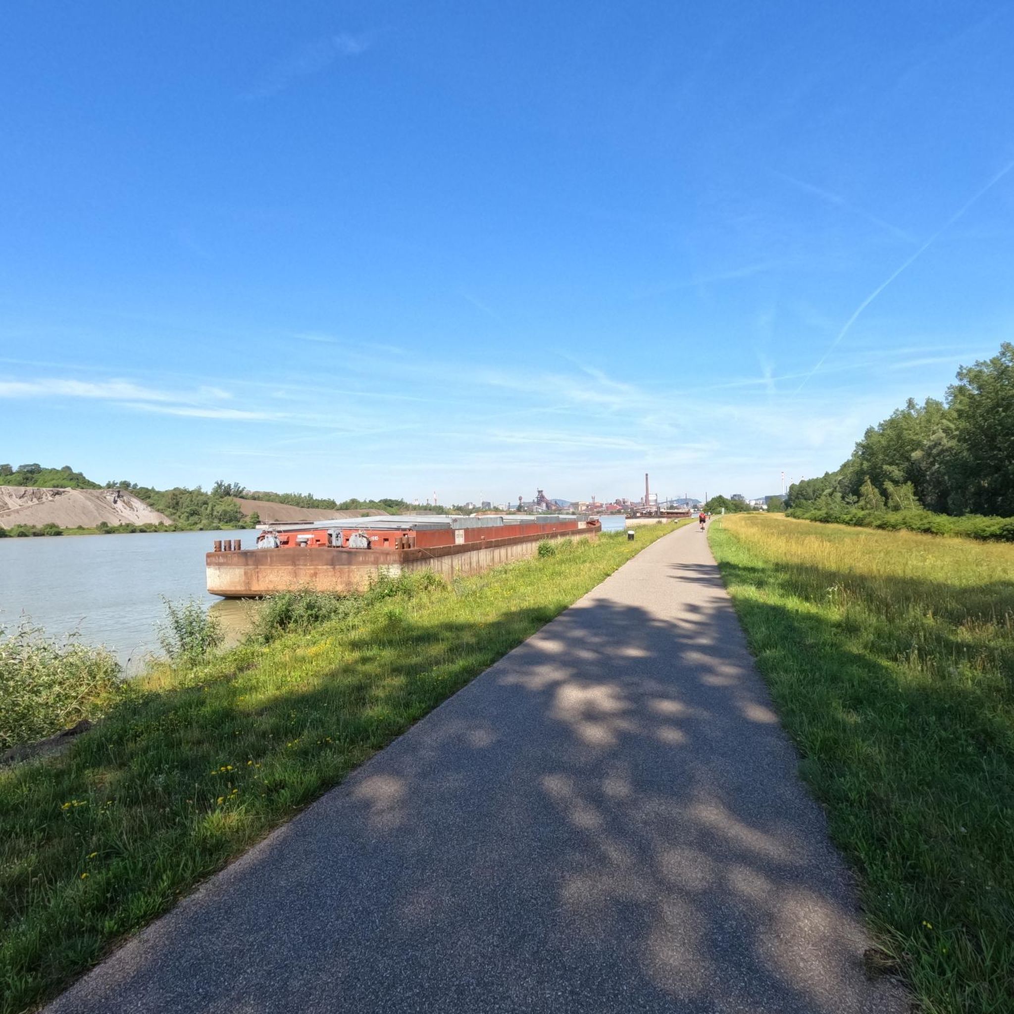
This bike path is very, very nice, and there's even a bench. The bike path is also under trees.
0
0
Frequently Asked Questions
How many traffic-free touring cycling routes are available in the Gildweiler area?
There are over 10 dedicated traffic-free touring cycling routes around Gildweiler, offering a variety of distances and difficulties for a pleasant ride away from motor traffic.
Are there any easy, family-friendly traffic-free routes suitable for children or less confident riders?
Yes, several routes are ideal for families and those seeking an easier ride. For example, the Positions of the 1st World War loop from Burnhaupt-le-Bas is an easy 9.4 km route with minimal elevation gain. Another great option is the Burnhaupt Station – Sentheim Train Station loop from Burnhaupt-le-Haut, which is also easy and just under 20 km.
What kind of surfaces can I expect on these traffic-free cycling paths?
The traffic-free routes in the Gildweiler area often utilize dedicated cycle paths, old rail trails, and quiet country lanes. While specific surface types vary, you can expect well-maintained paths suitable for touring bikes, often paved or with smooth gravel sections, ensuring a comfortable ride away from main roads.
Are there any circular traffic-free bike routes in Gildweiler?
Yes, many of the routes are designed as loops, allowing you to start and end at the same point without retracing your steps. Examples include the Saint-Thiébaut Collegiate Church – Thur River loop from Burnhaupt-le-Bas and the Michelbach Lake – A beautiful place... loop from Burnhaupt-le-Bas, both offering scenic circular journeys.
What interesting places or landmarks can I see along the traffic-free routes?
The routes often pass by charming local attractions. You might encounter the historic Eglingen Lock, the serene Michelbach Lake, or the Port of Dannemarie. The Largue Valley Cycle Path itself is a notable feature, providing a scenic corridor for cycling.
Can I access these traffic-free bike trails using public transport?
While specific public transport connections to every trailhead may vary, many routes start near towns or villages that could be accessible by local bus services. For example, the Burnhaupt Station – Sentheim Train Station loop starts near Burnhaupt Station, suggesting rail access might be an option for some routes.
Where can I park my car to access the traffic-free bike routes?
Many routes start from villages like Burnhaupt-le-Bas or Burnhaupt-le-Haut, where public parking is generally available. Look for designated parking areas near the starting points of routes such as the Camping de la Doller – Lake Michelbach loop or the La Chaumière Campsite – Burnhaupt-le-Haut loop.
What do other touring cyclists enjoy most about the traffic-free routes in Gildweiler?
The area is highly rated by the komoot community, with an average score of 4.47 stars. Reviewers often praise the peacefulness of the routes, the absence of motor traffic, and the beautiful, varied landscapes that make for a relaxing and enjoyable cycling experience.
Are there any longer, more challenging traffic-free routes for experienced cyclists?
Yes, for those seeking a greater challenge, the Health park – Saint-Pantale Church loop from Gildwiller is a difficult 52.2 km route with over 500 meters of elevation gain, offering a more demanding but still traffic-free adventure.
Are dogs allowed on the traffic-free bike trails?
While specific regulations can vary by local path, generally, dogs on a leash are permitted on many public cycle paths and forest tracks in the region. It's always advisable to check local signage or specific route details if you plan to bring your dog, especially on shared-use paths.
What is the best time of year to cycle these traffic-free routes?
Spring, summer, and early autumn generally offer the most pleasant conditions for cycling in the Gildweiler area. The weather is typically mild, and the natural scenery is at its best. Always check the local weather forecast before heading out.
Can I connect different traffic-free sections to create a longer tour?
Yes, the network of routes in the area, including sections of the Largue Valley Cycle Path, often allows for combining shorter loops or segments to create extended, custom traffic-free tours. This provides flexibility for cyclists looking for longer distances.
Most popular attractions around Gildweiler

Get inspired with the komoot mobile app


Explore more
Browse the best Cycling routes in other regions.
