The best traffic-free bike rides around Saint-Loup-Nantouard
3.6
(58)
626
riders
14
rides
No traffic road cycling routes around Saint-Loup-Nantouard offer access to the varied landscapes of the Haute-Saône department in eastern France. The region features a mix of hilly terrain, winding roads, and scenic pathways, with elevations ranging from 192 to 243 meters. Cyclists can explore rural settings, often passing through charming villages and alongside waterways like the La Morte river. The area's infrastructure includes connections to broader cycling networks, providing options for diverse no traffic road cycling routes.
Best no traffic…
Last updated: July 4, 2026
4.0
(1)
26
riders
51.4km
02:21
160m
160m
Moderate road ride. Good fitness required. Mostly well-paved surfaces and easy to ride.
18
riders
Moderate road ride. Great for any fitness level. Some segments of this route may be unpaved and difficult to ride.

Sign up for free
8
riders
39.8km
01:49
390m
390m
Moderate road ride. Good fitness required. Mostly well-paved surfaces and easy to ride.
4
riders
27.5km
01:20
220m
220m
Easy road ride. Great for any fitness level. Mostly well-paved surfaces and easy to ride.
3
riders
29.6km
01:22
240m
240m
Easy road ride. Great for any fitness level. Mostly well-paved surfaces and easy to ride.
Get access to more routes and recommendations from other explorers.
Sign up for free
Already have an account?
Our route recommendations are based on thousands of hikes, rides, and runs completed by other people on komoot.
Start today with a free account
Your next adventure awaits.
Login or Signup
Popular around Saint-Loup-Nantouard
Tips from the Community

The highlight here is taken from the resting point above the exit. There is also a table here.
11
4

This beautiful bucolic place is ideal for a break. Benches and picnic tables have been installed by the town hall.
0
0
The Savoyeux tunnel was built during the July Monarchy, in 1837. It facilitates navigation on the Saône. The dimensions of the work are impressive: 642.5 meters long, and only 6.55 meters wide. It passes under the hill and makes it possible to cut a meander in the river, and to avoid a dam located a little higher up.
0
0
The Tunnel de Savoyeux is an underground canal that diverts the Saône between two of its meanders near Savoyeux, in Haute-Saône, France. It was completed in 1843 and made it possible to sail the small Saône to the Saône. It is 642.5 meters long and 6.55 meters wide. It has no path for pulling the boats, so the skippers had to pull the boats with chains attached to the walls of the tunnel. It also has a lock at the end of the tunnel
12
4

Village which dates back to Gaulle (Gallic burials have been unearthed there) and of which we also find traces under the Gallo-Roman Empire. There we find the source of the Colombine and some beautiful buildings, including the cemetery chapel (listed as a Historic Monument) and the Notre-Dame de Leffond Chapel which dates from the 13th century. However, the village is best known for its vineyards. In the Middle Ages, the wines of Gy and Charcenne were already exported and we found them on the tables of nobles in the 16th century. The Guillaume family has been cultivating vines there since 1732 and has developed a highly specialized nursery business since 1895, recognized worldwide. The 43 hectares of vines therefore produce wine, awarded several times, but also serve as a support for the multiplication of vine plants. They therefore cultivate other grape varieties than those necessary for their production. And if you want to accompany your wine with a cheese, head to the Millet cheese dairy to taste a Charcennais or an Ortolan.
1
0
The Salon borders Autet and once turned the paddle wheels of the village's two mills. Near the old stone bridge, benches and tables have been installed for a rural break. If you feel like swimming, Autet has a beach equipped and supervised on the Saône: follow the Route de la Plage to the south exit of the village.
0
0
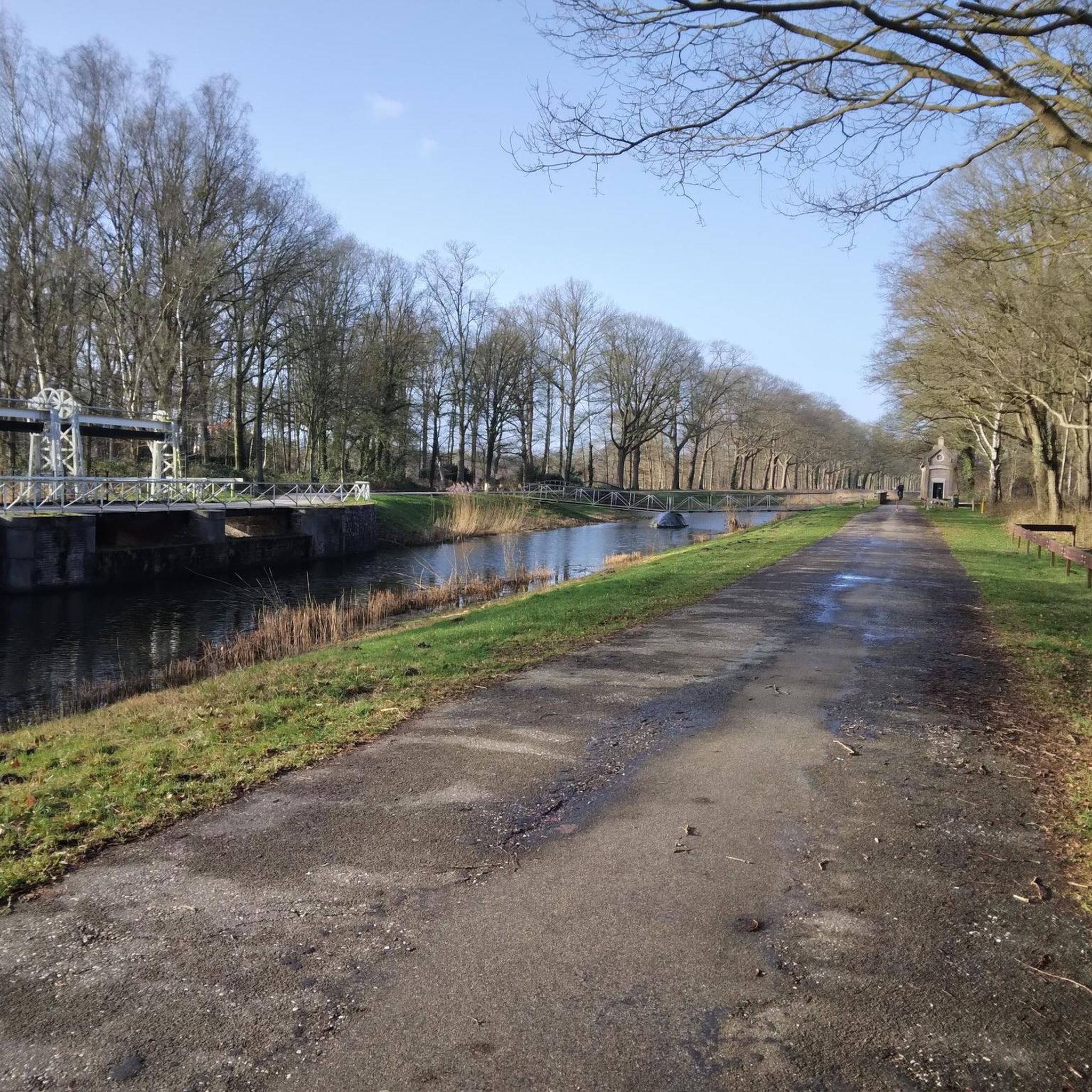
Locked diversion of the Saône built in two stages, in 1840 and 1880. This reach is one of the areas developed to make the Saône navigable.
0
0

This magnificent stone bridge built in 1647 was destroyed several times. It is the main entrance to the town of Gray. The extract from the city's cadastre dated 1851 mentions: "The Saône bridge is one of the buildings which cost the city of Gray the most. In 1358, water and ice having completely ruined it, it was necessary , to restore it, more than three hundred gold florins. "
1
0
Frequently Asked Questions
How many no-traffic road cycling routes are available around Saint-Loup-Nantouard?
There are 9 dedicated no-traffic road cycling routes around Saint-Loup-Nantouard, offering a variety of experiences for cyclists seeking quiet roads.
Are there any easy, traffic-free road cycling routes suitable for beginners or families?
Yes, 5 of the routes are rated as easy. For example, the Gy Castle loop from Bucey-lès-Gy is an easy 29.6 km ride, and the Bridge over the Salon loop from Beaujeu-Saint-Vallier-Pierrejux-et-Quitteur offers a gentle 34 km experience.
What kind of terrain can I expect on these no-traffic road cycling routes?
The Haute-Saône department, where Saint-Loup-Nantouard is located, offers diverse topography. You can expect a mix of hilly terrain and winding roads, providing varied landscapes for your ride. While some routes are flatter, others will include moderate climbs.
What do other cyclists say about the no-traffic road cycling routes in this area?
The no-traffic road cycling routes around Saint-Loup-Nantouard are highly rated by the komoot community, with an average score of 3.83 out of 5 stars from 27 reviews. Cyclists often praise the quiet roads and scenic pathways through charming villages and natural settings.
Are there any notable landmarks or attractions along these routes?
Yes, several routes pass by interesting points. For instance, the Saint-Loup Castle – Charcenne loop from Velesmes-Échevanne takes you near the historic Château de Saint-Loup-Nantouard. You might also encounter places like Charcenne or the Notre-Dame du Calvaire Chapel on other routes.
Can I find longer, more challenging no-traffic road cycling routes?
Yes, there are 4 moderate routes for those seeking a greater challenge. The Apremont Dam – Pont de Pierre of Gray loop from Cresancey is the longest at 51 km with significant elevation gain, while the Gy Castle loop from Gy also offers a moderate 32.5 km ride with over 600m of ascent.
Is there a specific long-distance cycling route nearby that offers traffic-free sections?
Yes, the renowned Voie Bleue (Moselle-Saône by bike) traverses the Haute-Saône department, running alongside the Saône River. This route offers largely flat and secure paths, making it excellent for leisurely, traffic-free cycling and connecting to beautiful riverside landscapes. Saint-Loup-Nantouard's proximity allows for easy access to this scenic artery. You can find more information about the Voie Bleue on the Haute-Saône tourism website.
What is the best time of year for no-traffic road cycling in this region?
The region is generally pleasant for cycling from spring through autumn. Spring offers blooming landscapes, while autumn provides beautiful foliage. Summer is also suitable, but it's always wise to check local weather forecasts, especially for warmer days.
Are there any circular no-traffic road cycling routes available?
All the listed no-traffic road cycling routes around Saint-Loup-Nantouard are designed as loops, allowing you to start and finish at the same point. Examples include the Saint-Loup Castle – Charcenne loop and the Gy Castle loop.
Where can I find more information about cycling in the broader Haute-Saône department?
The Haute-Saône department is a well-established cycling destination. You can explore more about the extensive network of cycling routes, including dedicated cycle paths and greenways, on the Haute-Saône tourism website.
Most popular attractions around Saint-Loup-Nantouard

Get inspired with the komoot mobile app


Explore more
Browse the best Road cycling routes in other regions.
