The best traffic-free bike rides around Montblanc
4.2
(110)
737
riders
79
rides
Gravel biking around Montblanc offers a diverse landscape characterized by its proximity to the Mediterranean coast, featuring a mix of natural reserves, canals, and agricultural lands. The region includes extensive flat sections along waterways like the Canal du Midi, providing smooth gravel paths. Further inland, the terrain can introduce gentle hills and vineyards, offering varied riding experiences. This area is known for its network of quiet routes, ideal for no traffic gravel bike trails.
Best no traffic gravel bike trails around Montblanc
- The most popular no traffic gravel bike trail is Bagnas Nature Reserve – Voie Verte Canal du Midi loop from Portiragnes Plage, a 30.2 miles (48.6 km) trail that takes 2 hours 58 minutes to complete. This route navigates through a nature reserve and along the historic Canal du Midi.
- Another top favourite among local gravel bikers is Canal du Midi – Canal du Midi at Vias loop from Vias, an easy 21.8 miles (35.1 km) path. This route offers flat, car-free sections along the famous canal, suitable for relaxed rides.
- Local gravel bikers also love the La Font du Loup – The Fairy Stretcher loop from Castelnau-de-Guers, a 21.7 miles (34.9 km) trail leading through rural landscapes and vineyards, often completed in about 2 hours 47 minutes.
- Gravel biking around Montblanc is defined by canal paths, nature reserves, and agricultural plains. The network offers options for different ability levels, from easy, flat rides to moderate routes with gentle ascents.
- The routes in Montblanc are highly rated by the komoot community with an average score of 4.2 stars from over 70 reviews. More than 500 gravel bikers have used komoot to explore Montblanc's varied terrain.
Last updated: July 4, 2026
4.2
(5)
41
riders
Moderate gravel ride. Good fitness required. Mostly paved surfaces. Suitable for all skill levels.
5.0
(2)
37
riders
111km
07:40
1,290m
1,290m
Hard gravel ride. Very good fitness required. Mostly paved surfaces. Suitable for all skill levels.

Sign up for free
4.7
(3)
23
riders
60.3km
03:37
170m
170m
Moderate gravel ride. Good fitness required. Mostly paved surfaces. Suitable for all skill levels.
4.0
(12)
42
riders
37.2km
01:52
30m
30m
Easy gravel ride. Great for any fitness level. Mostly paved surfaces. Suitable for all skill levels.
3.0
(1)
7
riders
38.2km
03:05
450m
450m
Hard gravel ride. Very good fitness required. Mostly paved surfaces. Suitable for all skill levels.
Get access to more routes and recommendations from other explorers.
Sign up for free
Already have an account?
Our route recommendations are based on thousands of hikes, rides, and runs completed by other people on komoot.
Start today with a free account
Your next adventure awaits.
Login or Signup
Popular around Montblanc
Tips from the Community

It is difficult to imagine that between Agde and Marseillan lies one of the largest protected wetland areas on the coast. The Bagnas nature reserve, the former delta of the Hérault, long exploited for salt and then for viticulture, is today a space entirely dedicated to fauna and flora. Between lagoons, salt marshes and reed beds, this changing landscape hosts hundreds of migratory bird species each year.
0
0
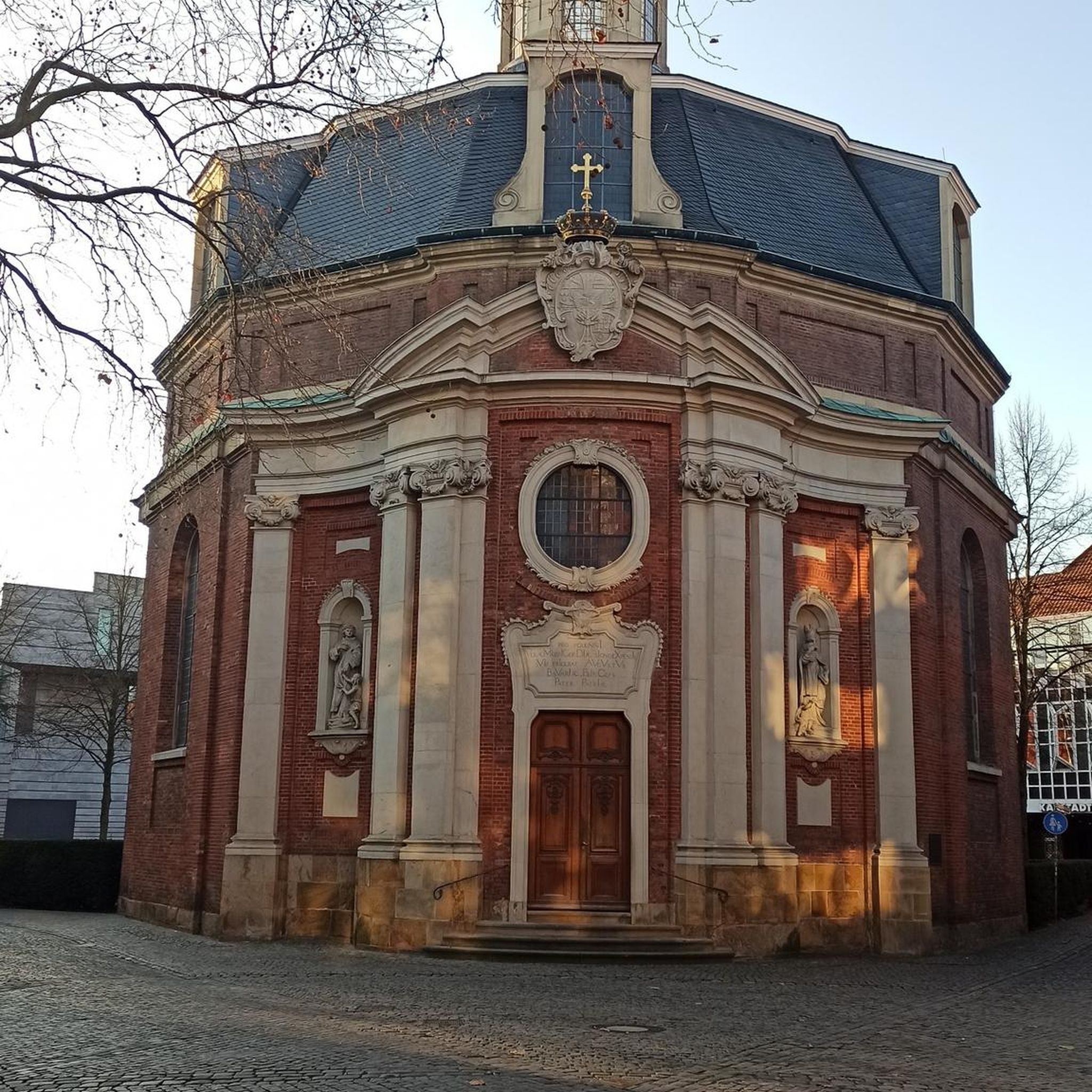
Perched on a promontory overlooking the Hérault valley, the Saint-Antoine hermitage seems out of time. Mentioned as early as the 17th century, this secluded place once welcomed hermits seeking isolation and spiritual life in the heart of the garrigue. Today in ruins, the chapel and its remains still tell of this austere life focused on contemplation and the surrounding landscapes.
0
0
It is difficult to imagine that waterways cross here like at a crossroads. Built in 1676 by engineer Pierre-Paul Riquet, the round lock of Agde is unique on the Canal du Midi: its circular shape and its three gates allow boats to choose between three different directions. Depending on their course, they head back towards Béziers, towards Agde, or towards the Étang de Thau. An ingenious river junction at the entrance to the town.
0
0
A remarkable geological site, worthy of the fairy legend! It is actually a sandstone (clastic rock) with a carbonate cement and not a limestone. Differential erosion has shaped this landscape into natural basins.
1
0
It is nicknamed the "Bridge of Three Eyes". Three openings designed within the logic of the Canal du Midi: navigation, water drainage, and continuity of local circulation. A work from Pierre-Paul Riquet's project, to be discovered in the landscape between Vias and Agde.
0
0

The Cassafières port, established in the 1980s in a basin right next to the campsites, allows you to rent a boat to navigate the canal and visit the Languedoc coastal plain.
0
0
The Saint-Antoine hermitage, located in the commune of Castelnau-de-Guers, was built on a promontory overlooking the Hérault river floodplain. The riverbed is 500 m to the west. Access to the site is facilitated by the presence of two paths that meet at its summit.
0
0
The dinosaur egg-laying sites, the red lands, the white rocks, and the Étendoir des fées are among the most remarkable geological sites in the municipality. The Étendoir des fées is worth the detour as it is an original formation of limestone rocks, deposited at the beginning of the Tertiary era, during the folding of the Pyrenean-Provençal chain, on a continental plain episodically crossed by rivers.
0
0
Frequently Asked Questions
How many no-traffic gravel bike trails are available in the Mont Blanc region?
There are over 70 dedicated no-traffic gravel bike trails around Mont Blanc listed in this guide. These routes offer a variety of experiences, from easy rides along canals to more moderate explorations through diverse landscapes.
What kind of terrain can I expect on no-traffic gravel bike trails around Mont Blanc?
The Mont Blanc region offers a diverse range of terrain for gravel biking. You can expect country roads, dedicated gravel paths, and forest trails. While some routes stick to lower elevations and valleys, the broader region is known for its varied landscape, including alpine meadows and coniferous forests, providing a constantly changing environment.
Are there any easy, family-friendly no-traffic gravel bike trails in Mont Blanc?
Yes, there are several easy routes suitable for families. For instance, the Canal du Midi – Canal du Midi at Vias loop from Vias is an easy option, offering a pleasant ride with minimal elevation gain. Another great choice is the Portiragnes Ponds – Nature Trail by the Wetlands loop from Portiragnes Plage, which is also rated as easy.
What are the best times of year for no-traffic gravel biking around Mont Blanc?
The best time for gravel biking around Mont Blanc is typically from spring through autumn. During these seasons, the alpine meadows are lush, and the weather is generally favorable for exploring the diverse terrain, from valleys to forest trails. Winter can be challenging due to snow and ice at higher elevations.
What kind of scenic viewpoints or landmarks can I expect along these routes?
Many routes offer stunning views of the Mont Blanc massif and its surrounding natural beauty. You might encounter picturesque valleys, lush alpine meadows, and coniferous forests. Some trails, like those near the Canal du Midi, feature historic waterways and structures. For example, you can see the Canal du Midi itself, the Portiragnes lock, and the Orb Canal Bridge.
Are there any circular no-traffic gravel bike routes available?
Yes, many of the no-traffic gravel bike trails in this guide are circular, allowing you to start and end at the same point. Examples include the Bagnas Nature Reserve – Voie Verte Canal du Midi loop from Portiragnes Plage and the La Font du Loup – The Fairy Stretcher loop from Castelnau-de-Guers.
What do other gravel bikers enjoy most about the no-traffic routes in Mont Blanc?
The komoot community highly rates the no-traffic gravel bike trails around Mont Blanc, with an average score of 4.24 stars. Reviewers often praise the tranquility of the routes, the stunning natural scenery, and the variety of terrain that keeps rides engaging without the disturbance of vehicle traffic.
Are there any routes that pass by lakes or water features?
Yes, several routes incorporate water features. For instance, the Portiragnes Ponds – Vendres Pond loop from Bicentenaire takes you past scenic ponds. The region is also known for its high-altitude lakes like Lac Blanc and Lacs des Chéserys, though specific gravel routes to these may involve more challenging terrain.
Is public transport an option to reach the starting points of these trails?
While specific public transport details for each trail's starting point are not provided here, the Mont Blanc region, particularly areas like Chamonix, is well-served by public transport options. It's advisable to check local bus or train schedules for connections to the specific trailheads you plan to visit.
Are there any cafes or places to stop for refreshments along the no-traffic gravel routes?
Many of the routes, especially those passing through or near towns and villages, will have opportunities for refreshments. While specific cafes are not listed for each trail, popular areas like Chamonix and other valley towns offer a range of amenities. Planning your route in advance can help identify suitable stops.
What is the typical elevation gain on these no-traffic gravel bike trails?
The elevation gain varies significantly. Many easy routes, particularly those along canals or wetlands, have minimal elevation gain, such as the Canal du Midi – Canal du Midi at Vias loop from Vias with only 33 meters. More moderate routes, like the La Font du Loup – The Fairy Stretcher loop from Castelnau-de-Guers, can have over 400 meters of ascent, offering a greater challenge.
Most popular attractions around Montblanc

Get inspired with the komoot mobile app


Explore more
Browse the best Gravel rides in other regions.
