The best traffic-free bike rides around Landry
4.5
(12)
181
riders
8
rides
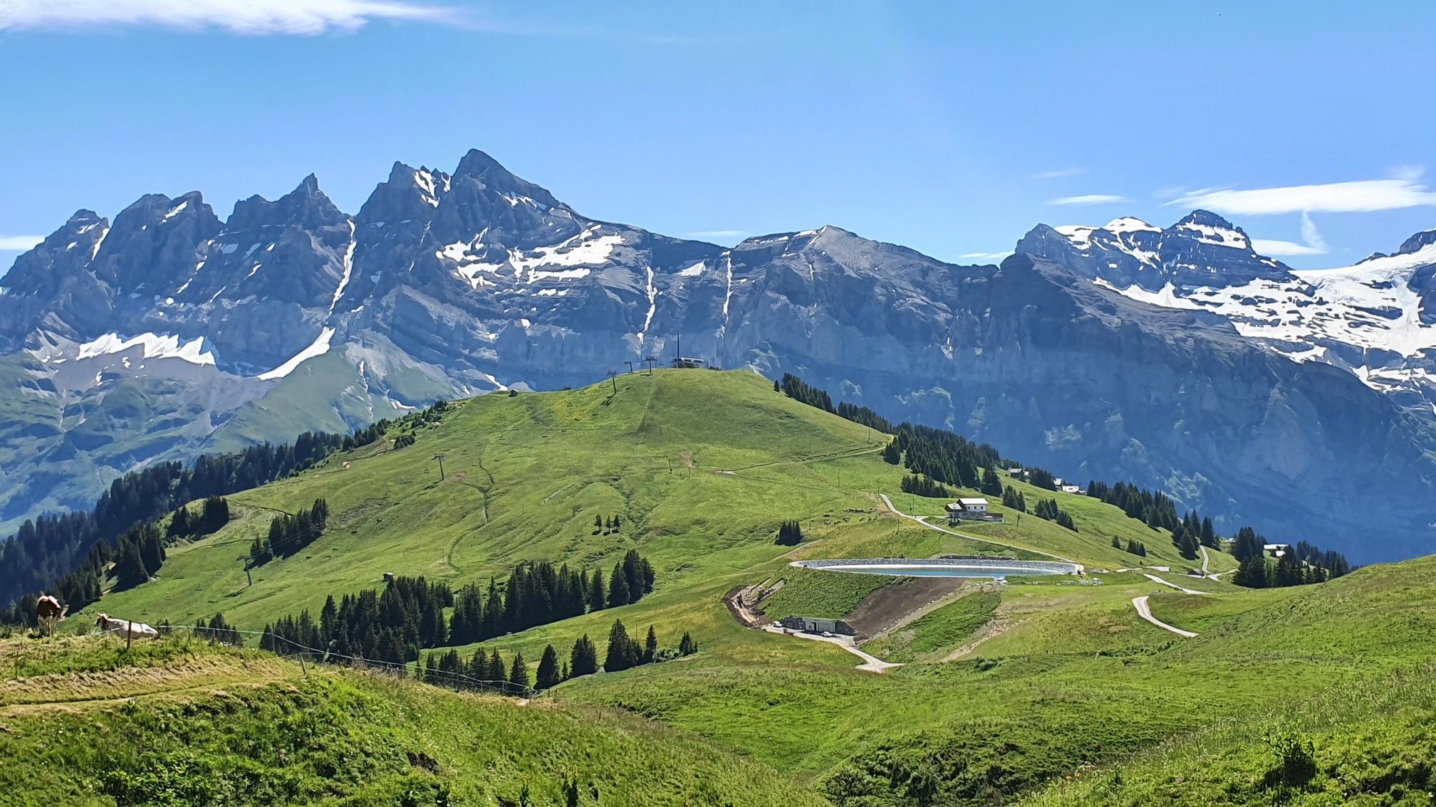
No traffic gravel bike trails around Landry are found in the Tarentaise Valley, a mountainous region in the Auvergne-Rhône-Alpes of France. The area is characterized by its alpine landscapes, with routes often traversing valleys, ascending mountain slopes, and offering views towards the Vanoise National Park. The Isère River flows through the region, providing a natural corridor for some routes. This terrain offers varied surfaces suitable for gravel biking, from compacted earth to forest tracks.
Best no traffic gravel bike trails around Landry
- The most popular no traffic gravel bike trail is View of Les Arcs Landscape – Arc 1950 Mountaineer's Refuge loop from Arc 1800, a 28.0 miles (45.1 km) trail that takes 4 hours 46 minutes to complete. This difficult route offers extensive views of the Les Arcs landscape and climbs towards the Mountaineer's Refuge.
- Another top favourite among local gravel bikers is Gravel toward Nancroix – Start of Whitelines MTB Trail loop from Bellentre, a difficult 18.6 miles (30.0 km) path. This route explores the terrain towards Nancroix, featuring varied gravel surfaces and significant elevation changes.
- Local gravel bikers also love the Chapelle des Vernettes – View of Col d'Entreporte loop from Arc 1800, a 9.4 miles (15.1 km) trail leading through alpine scenery, often completed in about 1 hour 19 minutes.
- Gravel biking around Landry is defined by mountainous terrain, river valleys, and forest tracks, with options for challenging climbs and scenic descents. The network offers routes for experienced gravel bikers seeking significant elevation gain and technical sections.
- The routes in Landry are highly rated by the komoot community with an average score of 4.3 stars from more than 4 reviews. More than 70 gravel bikers have used komoot to explore Landry's varied terrain.
Last updated: July 3, 2026
15
riders
45.1km
04:46
1,890m
1,890m
Hard gravel ride. Very good fitness required. Mostly paved surfaces. Suitable for all skill levels.
4.5
(2)
22
riders
43.0km
03:21
990m
990m
Hard gravel ride. Very good fitness required. Mostly paved surfaces. Suitable for all skill levels.

Sign up for free
4.0
(1)
5
riders
30.1km
03:08
1,150m
1,140m
Hard gravel ride. Very good fitness required. Mostly paved surfaces. Suitable for all skill levels.
4.0
(2)
6
riders
Hard gravel ride. Very good fitness required. Mostly paved surfaces. Suitable for all skill levels.
5.0
(1)
4
riders
39.7km
03:50
1,330m
1,330m
Hard gravel ride. Very good fitness required. Mostly paved surfaces. Suitable for all skill levels.
Get access to more routes and recommendations from other explorers.
Sign up for free
Already have an account?
Our route recommendations are based on thousands of hikes, rides, and runs completed by other people on komoot.
Start today with a free account
Your next adventure awaits.
Login or Signup



Other adventures around Landry


Tips from the Community

It allows you to go from Bourg Saint-Maurice to Moutiers away from the road except for two points.
0
0

By bike and cable car to Src1600
2
0
Beautiful place of Beaufort cheese, even with a restaurant.
2
0
Cycle path along the Isere.
2
0

The Montrigon Bridge crosses the Isère River and provides access to various trails along the river or up to Les Arcs. The funicular railway can also be seen ascending to the resort. A lovely starting point for mountain biking.
0
0
Frequently Asked Questions
How many no traffic gravel bike trails are available around Landry?
There are several dedicated no traffic gravel bike trails around Landry, with at least 4 routes detailed in this guide. These routes offer a variety of experiences, from scenic loops to more challenging mountain biking adventures.
What is the general difficulty level of gravel biking trails in Landry?
The no traffic gravel bike trails around Landry tend to be on the more challenging side, often featuring significant elevation gains. For example, the View of Les Arcs Landscape – Arc 1950 Mountaineer's Refuge loop from Arc 1800 is rated as difficult, covering over 45 km with nearly 1900 meters of ascent.
What kind of landscapes can I expect on no traffic gravel bike trails in Landry?
You can expect breathtaking mountainous and scenic landscapes. The region is situated in the Tarentaise Valley, with the Isère River flowing through it, and is close to the Vanoise National Park. Trails often offer views of majestic peaks and alpine environments, transitioning from river valleys to higher elevations.
Are there any circular no traffic gravel bike trails in Landry?
Yes, several routes are designed as loops, allowing you to start and finish in the same location. For instance, the Gravel toward Nancroix – Start of Whitelines MTB Trail loop from Bellentre is a challenging circular route covering about 30 km with over 1100 meters of elevation gain.
What do other gravel bikers enjoy the most about the trails in Landry?
The area is highly rated by the komoot community, with an average score of 4.3 stars. Reviewers often praise the stunning mountain views, the challenging yet rewarding climbs, and the sense of tranquility found on these car-free routes through the Tarentaise Valley.
Are there any interesting landmarks or natural attractions along these routes?
Absolutely! The region is rich in natural beauty. While riding, you might encounter highlights such as the Passage de la Mantaz or enjoy views towards the Entreport Pass. The trails often pass through or near charming alpine villages and offer panoramic vistas of the surrounding peaks like Aiguille Grive.
What is the best season for gravel biking in the Tarentaise Valley around Landry?
The best season for gravel biking in the Tarentaise Valley, including Landry, is typically from late spring to early autumn (May to October). During these months, the weather is generally favorable, and most mountain passes and trails are free of snow. Always check local conditions before heading out, especially in the shoulder seasons.
Are there any options for long-distance car-free gravel routes near Landry?
Yes, some routes offer significant distances for those looking for longer adventures. The Church of Aime – Switchbacks loop from Aime - La Plagne, for example, covers over 37 km with substantial elevation, providing a good long-distance option away from traffic.
Can I find parking easily for these no traffic gravel bike trails?
While specific parking details for each starting point are best checked on the individual route pages, areas like Arc 1800, Bellentre, and Aime - La Plagne, which serve as starting points for many routes, generally offer parking facilities due to their nature as ski resorts or larger villages in the Tarentaise Valley.
Are there any shorter, less strenuous no traffic gravel bike trails suitable for a quicker ride?
For a shorter, yet still challenging, no traffic gravel experience, consider the Chapelle des Vernettes – View of Col d'Entreporte loop from Arc 1800. This route is about 15 km long with nearly 500 meters of ascent, offering a condensed but rewarding ride through scenic landscapes.
Most popular attractions around Landry

Get inspired with the komoot mobile app


Explore more
Browse the best Gravel rides in other regions.
