The best traffic-free bike rides around Isigny-Sur-Mer
4.3
(41)
1,407
riders
37
rides
No traffic road cycling routes around Isigny-Sur-Mer are situated in Normandy, France, nestled between the historic D-Day beaches and the expansive Cotentin and Bessin Marshes Regional Natural Park. The terrain is predominantly flat, characterized by marshlands, riverbanks, and coastal stretches along the Baie des Veys. This region offers a network of paved paths and quiet roads suitable for road cycling, providing access to diverse natural landscapes and historical sites.
Best no traffic road cycling routes around Isigny-Sur-Mer
- The most popular…
Last updated: May 22, 2026
5.0
(1)
149
riders
26.3km
01:05
120m
120m
Easy road ride. Great for any fitness level. Mostly well-paved surfaces and easy to ride.
4.5
(2)
40
riders
64.2km
03:38
190m
190m
Moderate road ride. Good fitness required. Some segments of this route may be unpaved and difficult to ride.

Sign up for free
5.0
(2)
10
riders
43.7km
01:53
230m
230m
Easy road ride. Great for any fitness level. Mostly well-paved surfaces and easy to ride.
13
riders
Moderate road ride. Good fitness required. Some segments of this route may be unpaved and difficult to ride.
10
riders
66.4km
03:06
330m
330m
Moderate road ride. Good fitness required. Some segments of this route may be unpaved and difficult to ride.
Get access to more routes and recommendations from other explorers.
Sign up for free
Already have an account?
Our route recommendations are based on thousands of hikes, rides, and runs completed by other people on komoot.
Start today with a free account
Your next adventure awaits.
Login or Signup

Other adventures around Isigny-Sur-Mer

Tips from the Community

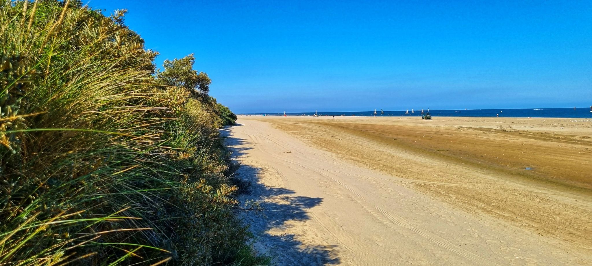
Utah Beach was the first of the five D-Day landing beaches to be recaptured by the Allies. It was chosen to retake Cherbourg and its deep-water port. Several memorials along the beach allow visitors to rediscover the history of the landings.
0
0

This bridge is closed due to its poor condition. 23/07/2025
0
0


This is a survivor from World War 2: an historic artefact still in daily use.
0
0

A beautiful, expansive beach steeped in history.
2
1
Memorials that remind you again and again "NEVER AGAIN WAR" that is something the warmongers from 🇩🇪 and the 🇪🇺 should especially make their motto.
3
0
A place steeped in history, one of the five landing zones.
2
0
The landing craft used during the invasion of Normandy on June 6, 1944 (D-Day) were essential for the successful landing of the Allied troops. LCVP (Landing Craft, Vehicle, Personnel) – "Higgins Boat": The most widely used landing craft. Capacity: 36 soldiers or one jeep, or 8,000 pounds of cargo. Length: approximately 11 meters. Special feature: Front hatch for quick unloading of troops.
2
0
Frequently Asked Questions
How many no-traffic road cycling routes are available around Isigny-sur-Mer?
There are over 30 dedicated no-traffic road cycling routes around Isigny-sur-Mer, offering a variety of experiences. Most of these routes are easy to moderate, making them accessible for many cyclists.
Are there any easy, traffic-free road cycling routes suitable for beginners or families?
Yes, many of the routes are classified as easy. For instance, the Haut Dick Lock – Bailey bridge near Carentan loop is an easy 26 km ride, perfect for a relaxed outing. Another great option is the Pont de L'Aure – Isigny-sur-Mer loop, which covers 44 km through pleasant scenery.
What kind of landscapes can I expect on these no-traffic routes?
The no-traffic routes around Isigny-sur-Mer primarily take you through the serene marshlands and along riverbanks within the Regional Natural Park of Cotentin and Bessin Marshes. You'll also find paths offering views of the Normandy coastline and the Baie des Veys, a significant natural site where four rivers converge. The terrain is generally flat, providing a smooth cycling experience.
Are there any circular no-traffic road cycling routes?
Yes, many of the no-traffic routes are designed as loops, allowing you to start and end at the same point. Examples include the Haut Dick Lock – Bailey bridge near Carentan loop and the Traversée du Grand Marais – Pointe du Hoc loop, which offers a longer, moderate challenge.
What historical sites or attractions can I see along the no-traffic routes?
The region is rich in history. While cycling, you might encounter sites related to the D-Day landings. For example, the Traversée du Grand Marais – Pointe du Hoc loop offers views towards Pointe du Hoc. You can also find highlights like the La Cambe German military cemetery or the Notre-Dame de Carentan nearby.
What do other cyclists enjoy most about the no-traffic road cycling routes in Isigny-sur-Mer?
The komoot community highly rates the cycling experience here, with an average score of 4.3 stars. Reviewers often praise the quiet, flat terrain, the picturesque marshland scenery, and the opportunity to explore the region's natural beauty and historical significance without the disturbance of vehicle traffic.
Is it possible to access these routes using public transport with a bike?
While specific public transport options for bikes can vary, the region is generally bike-friendly. It's advisable to check local train or bus services for their bike carriage policies, especially if you plan to start a route further afield from Isigny-sur-Mer. Many routes are accessible from towns with local transport links.
Are there places to park near the no-traffic road cycling trailheads?
Yes, many of the routes, especially those that are part of larger networks like the Vélomaritime, often have designated parking areas at their starting points or in nearby towns. For example, routes starting from Carentan or Lison would typically have parking available in those localities.
What is the best time of year to cycle these no-traffic routes?
The region's generally mild climate makes it suitable for cycling for much of the year. Spring and early autumn often offer pleasant temperatures and less crowded paths. Summer is also popular, but can be warmer. Always check local weather conditions before heading out.
Are there any cafes or restaurants along or near the no-traffic bike trails?
Yes, many routes pass through or near charming villages and towns where you can find local cafes, bakeries, and restaurants. Isigny-sur-Mer itself offers various dining options, and smaller establishments can often be found in places like Grandcamp-Maisy or Carentan, which serve as starting or passing points for several routes.
Can I rent a bike in Isigny-sur-Mer to explore these routes?
While specific rental shops can change, Isigny-sur-Mer and surrounding tourist-focused towns often have options for bike rental, especially during peak season. It's recommended to check with the local tourist office or search online for current rental services to ensure availability for your visit.
Most popular routes around Isigny-Sur-Mer
Most popular attractions around Isigny-Sur-Mer

Get inspired with the komoot mobile app


Explore more
Browse the best Road cycling routes in other regions.
