The best traffic-free bike rides around Chapareillan
5.0
(4)
38
riders
10
rides
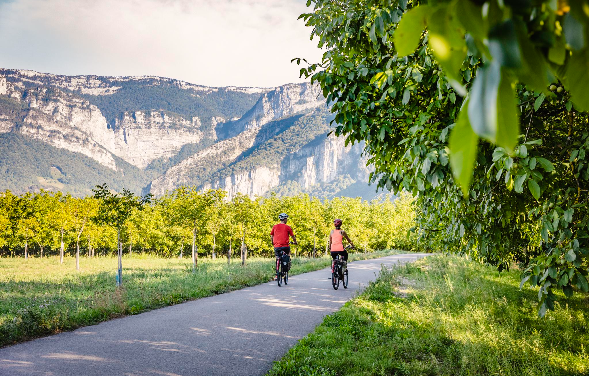
Gravel biking around Chapareillan offers diverse terrain at the foot of the Chartreuse Massif. The region is characterized by limestone cliffs, dense forests, and verdant valleys, providing varied elevation changes. Trails often follow forest paths, agricultural tracks, and quiet roads, with the Isère river and vineyards adding to the landscape. This environment is well-suited for mixed-surface cycling.
Best no traffic gravel bike trails around Chapareillan
- The most popular no traffic gravel bike trail is Allevard – View of the Flumet…
Last updated: May 22, 2026
7
riders
28.6km
01:56
560m
560m
Hard gravel ride. Very good fitness required. Mostly paved surfaces. Suitable for all skill levels.
5.0
(1)
8
riders
28.2km
01:32
60m
60m
Easy gravel ride. Great for any fitness level. Mostly paved surfaces. Suitable for all skill levels.

Sign up for free
5
riders
48.9km
03:17
720m
720m
Hard gravel ride. Very good fitness required. Mostly paved surfaces. Suitable for all skill levels.
6
riders
61.0km
04:20
1,290m
1,290m
Hard gravel ride. Very good fitness required. Mostly paved surfaces. Suitable for all skill levels.
5
riders
22.7km
01:40
570m
570m
Hard gravel ride. Very good fitness required. You may need to push your bike for some segments of this route.
Get access to more routes and recommendations from other explorers.
Sign up for free
Already have an account?
Our route recommendations are based on thousands of hikes, rides, and runs completed by other people on komoot.
Start today with a free account
Your next adventure awaits.
Login or Signup
Other adventures around Chapareillan

Tips from the Community

quiet route, away from the main road
0
0

Allevard is a former spa resort nestled at the foot of Belledonne. Its quiet streets alternate between old villas, tree-lined parks, and unobstructed views of the peaks. A great starting point for exploring the surrounding area... or simply taking your time.
0
0
Between Belledonne and the valleys, the Flumet basin is an artificial body of water nestled in a natural setting. Easily accessible from Allevard, it offers a flat, shaded path, perfect for a short bike ride or a moment of relaxation. Along the way, you'll walk along the tranquil banks, with views of the surrounding peaks.
0
0

Beautiful loop suitable for athletes and families and which can be modulated as desired.
0
0

Small pleasant road above the valley lined with a few vines and old buildings
1
0

high ridge view of Pontcharra and Bramefarine. Watch out for the many hikers during the descent.
0
0

Departure from Le Pleynet uphill on an easy forest track to Pincerie then downhill to the Merdaret pass, there, take the path on the right on the hillside. Beautiful track on pastures and meadows on the greater part until the Crêt du Poulet, then descent in the forest until the crossroads of the Jeu de Paume by path then forest track. From there very technical descent directly on Allevard by Montouvrard, but in alternative, possibility of taking the beautiful easy forest track by Vaugraine to join Allevard.
1
0

The Avalon Tower – 33 meters high, an internal diameter of about 8 meters and walls 2 meters thick. http://www.gresivaudan-tourisme.com/la-tour-d-avallon.html
0
0
Frequently Asked Questions
How many no-traffic gravel bike trails are available around Chapareillan?
There are 6 dedicated no-traffic gravel bike trails around Chapareillan featured in this guide. These routes offer a mix of easy and more challenging options, allowing you to explore the beautiful Chartreuse Massif region without vehicle interference.
What kind of terrain can I expect on these gravel bike trails near Chapareillan?
The terrain around Chapareillan is quite varied, ranging from the banks of the Isère river to the slopes of Mont Granier. You'll encounter a mix of forest paths, agricultural tracks, and trails. The region is part of the Chartreuse Massif, so expect some significant elevation changes and panoramic views, especially on the more difficult routes.
Are there any easy, beginner-friendly no-traffic gravel routes?
Yes, for those looking for a gentler ride, the Des Lônes Pond – Lake Lône loop from Le Cheylas is classified as easy. This route offers a pleasant experience with minimal elevation gain, perfect for beginners or a relaxed outing.
What are some challenging no-traffic gravel routes for experienced riders?
Experienced riders seeking a challenge will find several options. The Lovely road in the valley – Le Moutaret loop from Saint-Vincent-de-Mercuze is a difficult route spanning over 66 km with significant elevation. Another demanding option is the Route des Vignes – Lac de Sainte Hélène loop from Montmélian, which covers nearly 49 km with over 700 meters of ascent.
Are there any circular no-traffic gravel bike routes around Chapareillan?
Yes, all the routes listed in this guide are circular, allowing you to start and end your ride at the same point. Examples include the Allevard – View of the Flumet basin loop from Saint-Pierre-d'Allevard and the Bayard Castle – Crête d'Avallon loop from Pontcharra.
What natural attractions can I see along these no-traffic gravel bike trails?
The region is rich in natural beauty. You can encounter stunning waterfalls like the Saint-Même Cirque Waterfalls or the Gouille Waterfall. The Lake Saint-André is another beautiful spot. The trails often offer views of the dramatic Chartreuse Massif and Mont Granier.
Are there any historical landmarks or points of interest near the trails?
While the focus is on natural landscapes, the region has historical significance. You might pass by sites like the Notre-Dame du Frou Statue or the historic The Sarde Road, which offers a glimpse into the area's past. The vineyards in the northern part of Chapareillan also tell a story of the region's agricultural heritage.
What is the best time of year for gravel biking in Chapareillan?
The spring and autumn months generally offer the most pleasant conditions for gravel biking in Chapareillan, with milder temperatures and beautiful scenery. Summer can be warm, especially at lower elevations, while winter can bring snow to higher parts of the Chartreuse Massif, making some trails inaccessible or requiring specialized gear.
Is Chapareillan a good destination for family-friendly gravel biking?
Chapareillan offers options for various skill levels. While some routes are quite challenging, the easier trails, such as the Des Lônes Pond – Lake Lône loop, can be suitable for families with older children or those comfortable with longer distances on mixed terrain. Always check the route details for distance and elevation to ensure it matches your family's capabilities.
What do other gravel bikers enjoy most about the trails around Chapareillan?
The komoot community highly rates the routes around Chapareillan, with an average score of 5.0 stars. Riders often praise the tranquility of the no-traffic routes, the stunning views of the Chartreuse Massif, and the diverse terrain that makes for an engaging gravel biking experience. The natural beauty, including waterfalls and lakes, is frequently highlighted.
Are there options for public transport access to the gravel trails in Chapareillan?
While Chapareillan is accessible by road, public transport options directly to trailheads might be limited. It's advisable to check local bus schedules or consider driving to a suitable starting point with parking. The region is well-connected by road, making it easy to reach by car from nearby towns.
Can I find places to eat or stay near the gravel bike trails in Chapareillan?
Chapareillan and the surrounding villages offer various amenities. You can find local cafes, restaurants, and accommodation options to refuel and rest after your ride. It's a good idea to check in advance, especially during off-peak seasons, for opening hours and availability.
Most popular routes around Chapareillan
Most popular attractions around Chapareillan

Get inspired with the komoot mobile app


Explore more
Browse the best Gravel rides in other regions.
