The best traffic-free bike rides around Saint-Georges-De-Luzençon
4.3
(340)
3,632
riders
69
rides
No traffic touring cycling routes around Saint-Georges-De-Luzençon navigate a diverse landscape within the Grands Causses Regional Natural Park. The region features the Cernon valley, the foothills of the Larzac plateau, and extends towards the Gorges du Tarn. Cyclists encounter a mix of limestone plateaus, river valleys, and varied elevations, offering routes from gentle riverside paths to more challenging ascents. This area is characterized by its natural features, including the Viaduc de Millau and the Causses du Larzac.
Best no traffic…
Last updated: November 2, 2026
38
riders
29.5km
02:34
700m
700m
Hard bike ride. Very good fitness required. Mostly paved surfaces.
5.0
(3)
30
riders
Hard bike ride. Very good fitness required. Mostly paved surfaces.

18
riders
55.1km
05:21
1,410m
1,410m
Hard bike ride. Very good fitness required. Mostly paved surfaces.
9
riders
51.9km
03:41
970m
970m
Hard bike ride. Very good fitness required. Mostly paved surfaces.
4.3
(3)
9
riders
Hard bike ride. Very good fitness required. Mostly paved surfaces.
Get access to more routes and recommendations from other explorers.
Already have an account?
Our route recommendations are based on thousands of hikes, rides, and runs completed by other people on komoot.
Start today with a free account
Your next adventure awaits.
Popular around Saint-Georges-De-Luzençon

Tips from the Community

Built between 1818 and 1821, the Lerouge bridge became one of the main structures for crossing the Tarn in Millau. It replaced the Pont Vieux, several arches of which had been destroyed by a flood in 1758, leaving the town without a permanent bridge for over sixty years. During this long period, crossing the Tarn was mainly done by ferry. The project was launched on the initiative of the prefect of Aveyron, d’Estourmel. The plans were drawn up by Pierre-Jacques Le Rouge, an engineer for the district. The first stone was laid on June 20, 1818, and the bridge was opened to traffic in January 1821. Its name therefore comes from its designer, not from the color of its stones. A curious detail: its construction was largely financed by private individuals, and a toll was collected until 1875. This tax even caused tensions with the inhabitants of Creissels, some of whom continued to cross the Tarn on foot or by boat to avoid paying it.
3
0
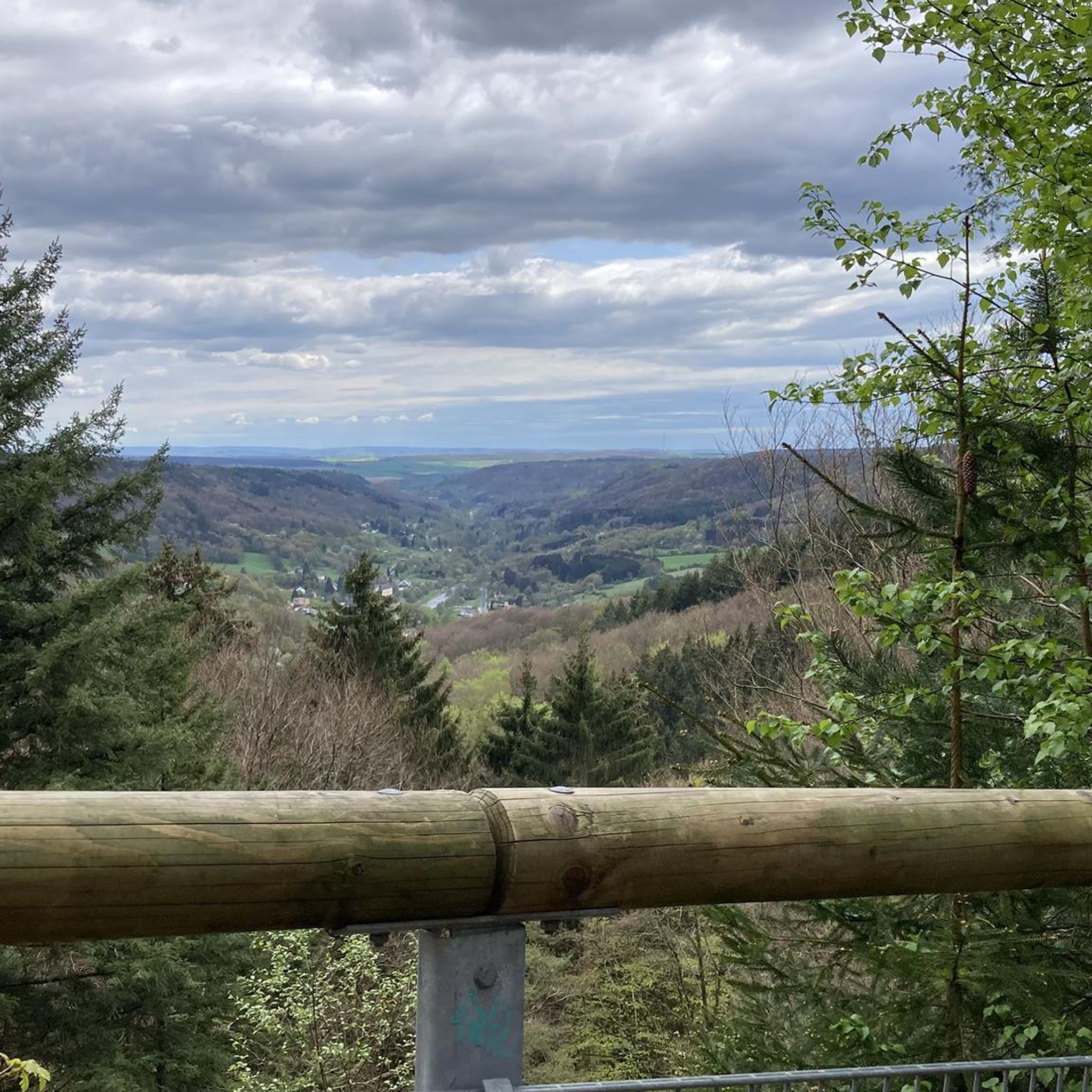
Perched at an altitude of about 730 meters, the Cap de Coste viewpoint overlooks the eastern end of the Boundoulaou cirque. It reveals a vast panorama of the Millau basin and its surrounding massifs. To the left, the easily recognizable Millau Viaduct spans the Tarn valley to connect the Larzac to the Causse Rouge. Further to the right stretches the latter: a large limestone plateau whose undulations dominate the valley. Then, the Puech d’Andan stands out with its wooded silhouette, cut in two by a clear central notch. Finally, further away, the Pouncho d’Agast, an emblematic relief of the Causse Noir, is easily recognized by its profile like a true limestone pyramid.
3
0
Perché at an altitude of approximately 730 meters, the Cap de Coste viewpoint overlooks the eastern end of the Boundoulaou cirque. It reveals a vast panorama of the Millau basin and its surrounding massifs. To the left, the easily recognizable Millau Viaduct spans the Tarn valley, connecting the Larzac to the Causse Rouge. Further to the right stretches the latter: a large limestone plateau whose undulations dominate the valley. Then, the Puech d’Andan stands out with its wooded silhouette, cut in two by a clear central notch. Finally, further away, the Pouncho d’Agast, an emblematic relief of the Causse Noir, is easily recognized by its profile like a true limestone pyramid.
3
0
From this switchback on the road to Labro, the Larzac plateau suddenly opens up to reveal the spectacular cirque of Saint-Geniez-de-Bertrand. This has been progressively formed by the erosion of the limestone series that make up the Larzac. The water, by infiltrating the fractures in the limestone, gradually dissolves the rock and circulates at depth before emerging at the foot of the slopes. This underground action, associated with runoff and valley erosion, causes a progressive retreat of the cliffs and slopes: this is the phenomenon of regressive erosion. Over time, the limestone reliefs recede towards the interior of the plateau and a vast indentation forms, giving birth to the cirque.
3
0
On the Maladrerie, the Parc Aquavagues transforms an arm of the Tarn into a real whitewater stadium. Over about 300 m, waves, currents and counter-currents allow for kayaking, rafting and hydrospeed, up to the training of experienced practitioners and competitions.
3
0
A small cultivated garden, a mini-greenhouse and two donkeys at liberty: a bucolic and unexpected scene by the greenway.
3
0
From this point at the foot of the structure, the regular succession of piers and guyed pylons can be particularly well distinguished. The deck, 2,460 m long, crosses the valley at a height of approximately 270 m above the Tarn. Pier P2, the tallest, culminates at 245 m, while the assembly formed by the pier and its pylon reaches 343 m: a height greater than that of the Eiffel Tower. This perspective also recalls the technical feat that the construction of the viaduct represented. The metal deck was assembled in sections from either side of the valley, then progressively launched across the void. The joining of the two parts was carried out on May 28, 2004, 268 m above the Tarn, before the official inauguration a few months later. An interesting detail can be discerned here: despite its exceptional dimensions, the structure appears remarkably light. This impression is not accidental. The viaduct was specifically designed to blend into the valley by limiting the visual impact of its structure, with a very slender deck and piers that branch out in a "Y" shape.
3
0
From the greenway, the Millau Viaduct is revealed from a particularly spectacular angle! One becomes aware of the extraordinary dimensions of the structure. Built between 2001 and 2004, the viaduct crosses the Tarn valley over 2,460 m and connects the Causse Rouge to the north with the Causse du Larzac to the south. Its metal deck, approximately 32 m wide, rests on seven concrete piers extended by seven cable-stayed pylons. At its highest point, the entire structure reaches 343 m above the ground; the deck is up to about 270 m above the Tarn. Designed by engineer Michel Virlogeux and British architect Sir Norman Foster, the viaduct combines a very slender metal structure with piers whose "Y" shape helps to visually lighten the whole. The deck was manufactured in metal elements and then gradually launched from both ends of the valley. The joining of the two parts was finally carried out on May 28, 2004, at 268 m above the Tarn.
3
0
Frequently Asked Questions
How many no traffic touring cycling routes are available around Saint-Georges-De-Luzençon?
There are over 70 dedicated no traffic touring cycling routes around Saint-Georges-De-Luzençon. These routes offer a variety of experiences, from easier rides to more challenging ascents across the diverse landscapes of the Grands Causses Regional Natural Park.
What kind of landscapes can I expect on these traffic-free cycling routes?
The routes traverse a rich variety of landscapes, from the Cernon valley where Saint-Georges-De-Luzençon is nestled, to the dramatic limestone plateaus of the Causses du Larzac and Causse Noir. You'll encounter scenic river valleys, rocky foothills, and elevated viewpoints offering panoramic vistas, especially towards the Gorges du Tarn and the impressive Millau Viaduct.
Are there any family-friendly traffic-free cycling routes?
While many routes in the area are challenging, there are some easier options suitable for families. The "Trace Verte du Viaduc" is a notable cycling path that connects Saint-Georges-De-Luzençon to Millau, following the Cernon stream and the Tarn River. This route offers gentler terrain and views of the troglodytic village of Peyre, making it a good choice for a more relaxed family outing.
What are some notable landmarks or viewpoints along the routes?
Many routes offer spectacular sights. You can cycle past the iconic Millau Viaduct, or visit the Millau Viaduct Viewpoint for breathtaking perspectives. The Pas Destrech Cross on the Causse du Larzac also provides dizzying panoramas. For a unique natural feature, consider a route that passes by the Cap de Coste Viewpoint.
Are there any routes that feature waterfalls?
Yes, some routes will bring you close to refreshing natural features. For example, the route Saint-Rome-de-Tarn – Cascade des Raspes du Tarn loop from Saint-Rome-de-Tarn includes the Cascade des Raspes du Tarn, offering a pleasant stop amidst your ride.
What is the best time of year for touring cycling in Saint-Georges-De-Luzençon?
The region experiences varied weather. Spring and autumn generally offer the most pleasant conditions for touring cycling, with milder temperatures and beautiful scenery. Summers can be hot, especially in the valleys, so early morning or late afternoon rides are recommended. Winters can be cold, and some higher routes on the plateaus might be exposed to wind or occasional snow.
Are there any circular routes available?
Yes, many of the no traffic touring cycling routes around Saint-Georges-De-Luzençon are designed as loops, allowing you to start and finish at the same point. An example is the Old bridge – Millau loop from Millau, which offers a comprehensive tour of the area's highlights.
What do other touring cyclists enjoy most about the routes in this area?
The area is highly rated by the komoot community, with an average score of 4.44 stars. Reviewers often praise the stunning and varied landscapes, the challenge of the climbs, and the sense of tranquility on the traffic-free sections. The impressive views of the Millau Viaduct and the Gorges du Tarn are frequently highlighted as memorable aspects of the rides.
Can I find routes that offer views of the Millau Viaduct?
Absolutely. The Cap de Coste Viewpoint – Millau Viaduct loop from Saint-Georges-de-Luzençon is specifically designed to offer fantastic views of this architectural marvel. Many other routes in the vicinity also provide glimpses or direct views of the viaduct as you cycle through the Cernon valley and surrounding plateaus.
Are there any routes that pass through charming villages?
Yes, the region is dotted with picturesque villages. The "Trace Verte du Viaduc" route, for instance, offers views of Peyre, listed as one of France's "Most Beautiful Villages," known for its unique troglodytic dwellings. Exploring these historical villages can be a delightful part of your cycling adventure.
What is the difficulty level of the no traffic touring cycling routes?
The routes around Saint-Georges-De-Luzençon cater to various fitness levels, though a significant number are considered challenging. There are 5 easy routes, 23 moderate routes, and 49 difficult routes. The terrain often includes significant elevation changes due to the region's plateaus and valleys, so be prepared for climbs.
Most popular routes around Saint-Georges-De-Luzençon
Most popular attractions around Saint-Georges-De-Luzençon

Get inspired with the komoot mobile app


Explore more
Browse the best Cycling routes in other regions.
