The best traffic-free bike rides around Santa Úrsula
4.5
(220)
4,204
riders
22
rides
No traffic touring cycling routes around Santa Úrsula, Tenerife, traverse a landscape characterized by volcanic topography, lush valleys, and a rugged coastline. The region features significant elevation changes, with routes climbing through pine forests and offering views of the Atlantic Ocean and Mount Teide. Cyclists can expect a mix of well-paved surfaces and unpaved segments, providing diverse terrain for exploration. The area's natural features include protected natural parks and dramatic cliffs carved by the sea.
Best no traffic touring cycling routes around Santa Úrsula
- The most popular no traffic touring cycling route is Forest double-track loop from El Pino, a 18.4 miles (29.6 km) trail that takes 2 hours 58 minutes to complete. This difficult route features significant elevation gain through forested areas.
- Another top favourite among local touring cyclists is Campamento Quimpi loop from El Pino, a difficult 16.2 miles (26.1 km) path. This route offers challenging climbs and scenic views within the natural landscape.
- Local touring cyclists also love the Gravel Path Through Forest – View of La Orotava loop from Parking La Caldera, a 19.4 miles (31.3 km) trail leading through dense forest, often completed in about 3 hours 8 minutes.
- Touring cycling around Santa Úrsula is defined by volcanic landscapes, lush valleys, and rugged coastlines. The network offers options for different ability levels, from moderate paths to difficult routes with substantial elevation.
- The routes in Santa Úrsula are highly rated by the komoot community with an average score of 4.5 stars from over 200 reviews. More than 4000 touring cyclists have used komoot to explore Santa Úrsula's varied terrain.
Last updated: July 2, 2026
4.2
(9)
63
riders
Hard bike ride. Very good fitness required. Mostly paved surfaces. Suitable for all skill levels.
5.0
(7)
56
riders
Moderate bike ride. Good fitness required. Mostly paved surfaces. Suitable for all skill levels.

Sign up for free
22
riders
Hard bike ride. Very good fitness required. Mostly paved surfaces. Suitable for all skill levels.
21
riders
39.3km
04:22
1,150m
1,150m
Hard bike ride. Very good fitness required. You may need to push your bike for some segments of this route.
5.0
(1)
15
riders
52.0km
06:03
1,720m
1,720m
Hard bike ride. Very good fitness required. You may need to push your bike for some segments of this route.
Get access to more routes and recommendations from other explorers.
Sign up for free
Already have an account?
Our route recommendations are based on thousands of hikes, rides, and runs completed by other people on komoot.
Start today with a free account
Your next adventure awaits.
Login or Signup
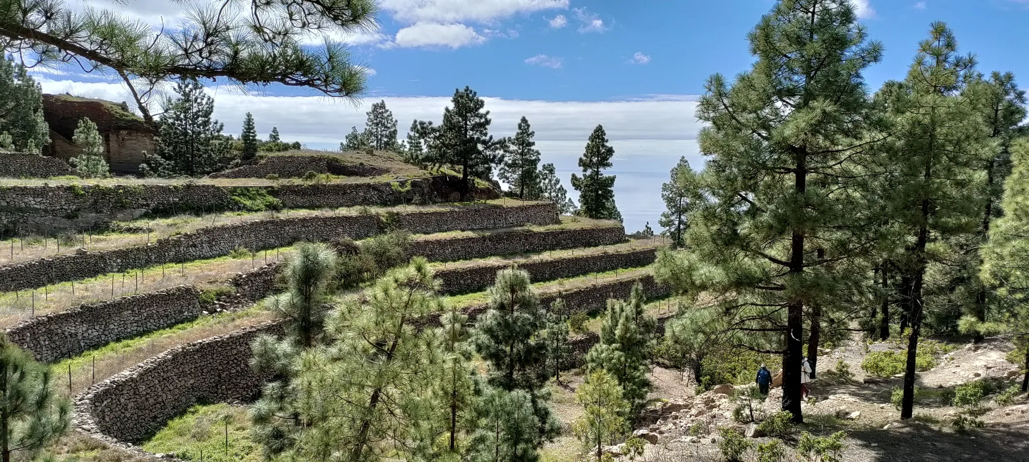



Tips from the Community

Mar-2025 Part of the hiking trails to Realejo Alto were closed due to forest fire damage. It was impossible to get through. Unfortunately, there was no information at the start of the tour in Realejo Alto either.
2
0

Stem layer in the shape of a flower...
0
0

Since the last forest fire in this part there’s a high risk of falling rocks. Some parts were unrideable with gravel bike (45mm tires) because of the large amount of rocks on the road.
0
0
Since the last forest fire in this part there’s a high risk of falling rocks. Some parts were unrideable with gravel bike (45mm tires) because of the large amount of rocks on the road.
0
0

View of a volcanic rock that resembles a rose and that leaves no one indifferent. To do this you have to walk a bit on a path that goes under the road. If you walk down from the small car park you also have direct access to "La Rosa". Very highly recommended.
7
0

Burnt down in the 2023 wildfires. I hope it will be rebuilt soon. 1.5 benches survived. So sitting down is still possible
2
0

Camino de Candelaria currently closed. Information at https://www.tenerifeon.es/de/nachrichten/itinerarios-cerrados-en-tenerife-a-raiz-del-incendio-forestal-verano-2024
1
0

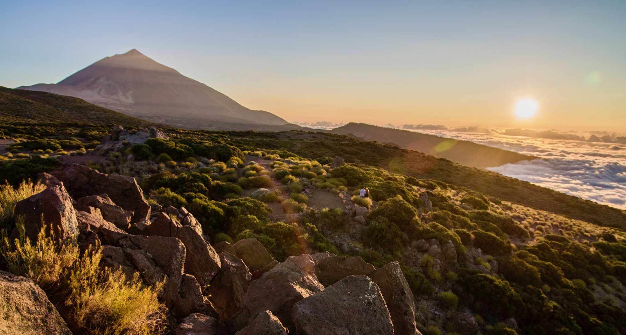
From this point there are magnificent views of Puerto de la Cruz or the sea of clouds, depending on the day.
1
0
Frequently Asked Questions
How many no-traffic touring cycling routes are available in Santa Úrsula?
Santa Úrsula offers a diverse selection of over 20 touring cycling routes designed to minimize traffic, allowing you to enjoy the region's stunning landscapes in peace. These routes cater to various skill levels, from moderate to difficult.
What kind of terrain can I expect on these no-traffic cycling routes?
The no-traffic touring cycling routes around Santa Úrsula primarily feature quiet forest tracks and unpaved segments, often with significant elevation changes. While some routes may include well-paved surfaces, many venture into the unique volcanic topography and lush valleys, providing a challenging and rewarding experience. For example, the Gravel Path Through Forest – View of La Orotava loop from Parking La Caldera offers a good mix of forest gravel paths.
Are there any easy no-traffic touring cycling routes for beginners or families?
While most routes in Santa Úrsula are rated as difficult, there is at least one easy touring cycling route available. For those seeking a less strenuous ride, it's advisable to check the route details carefully for elevation and terrain. The region's natural beauty, however, makes any effort worthwhile.
What are the typical elevation gains on these routes?
The no-traffic touring cycling routes in Santa Úrsula often involve significant elevation gains, reflecting the region's mountainous terrain. For instance, routes like the Campamento Quimpi loop from El Pino can feature over 770 meters of ascent, while the Campamento Quimpi loop from Ravelo Alto climbs over 840 meters. Be prepared for challenging climbs and rewarding descents.
What natural features or landmarks can I see along the no-traffic cycling routes?
Santa Úrsula's routes offer access to breathtaking natural features. You can explore parts of the Orotava Valley, witness volcanic landscapes, and enjoy panoramic views of Mount Teide and the Atlantic Ocean. Highlights include the Cloud Forest of La Orotava Valley and various lookout points. Some routes might also bring you close to protected areas like Las Laderas de Santa Ursula, Los Organos, and the Altos del Valle de Güímar Nature Park.
Are there any circular no-traffic touring cycling routes?
Yes, many of the no-traffic touring cycling routes in Santa Úrsula are designed as circular loops, allowing you to start and end at the same point. Examples include the Forest double-track loop from El Pino and the La Caldera Recreation Area – Chanajiga Recreation Area loop from Parking La Caldera, which offer convenient options for exploring the area.
What is the best time of year to go touring cycling in Santa Úrsula?
Santa Úrsula, being in Tenerife, generally offers pleasant cycling conditions year-round. However, for touring cycling, spring and autumn provide ideal temperatures and less extreme weather. The region's diverse topography means weather can vary with elevation, so it's always wise to check local forecasts, especially if heading towards higher altitudes like those near Teide National Park.
Where can I park my car when accessing these routes?
Many routes around Santa Úrsula start from areas with designated parking. For example, some routes begin near 'El Pino' or 'Parking La Caldera', which are common starting points for outdoor activities in the region. Always check the specific route details for recommended parking locations.
What do other touring cyclists enjoy most about the no-traffic routes in Santa Úrsula?
The no-traffic touring cycling routes in Santa Úrsula are highly rated by the komoot community, with an average score of 4.46 stars. Reviewers often praise the tranquility of the forest tracks, the challenging yet rewarding climbs, and the stunning panoramic views of the Orotava Valley, Mount Teide, and the Atlantic Ocean that these routes provide.
Are there any specific natural monuments or coastal views accessible by bike?
While many no-traffic routes focus on inland forest and mountain terrain, Santa Úrsula's proximity to the coast means you can find stunning coastal views. Nearby natural monuments include Los Roques coastal rock formation and the Rambla de Castro Protected Landscape. While not directly on the no-traffic cycling routes, these are easily accessible attractions for a combined exploration.
Most popular routes around Santa Úrsula
Most popular attractions around Santa Úrsula

Get inspired with the komoot mobile app


Explore more
Browse the best Cycling routes in other regions.
