The best traffic-free bike rides around Bujalance
14
riders
6
rides
Gravel biking around Bujalance offers diverse landscapes within the "campiña cordobesa," characterized by extensive olive groves and herbaceous fields. The region features undulating terrain, providing varied gradients for cycling. Natural areas like the Arroyo de la Zarzuela preserve remnants of Mediterranean and gallery forests, offering ecological corridors. These physical features create a network of no traffic gravel bike trails suitable for exploration.
Best no traffic gravel bike trails around Bujalance
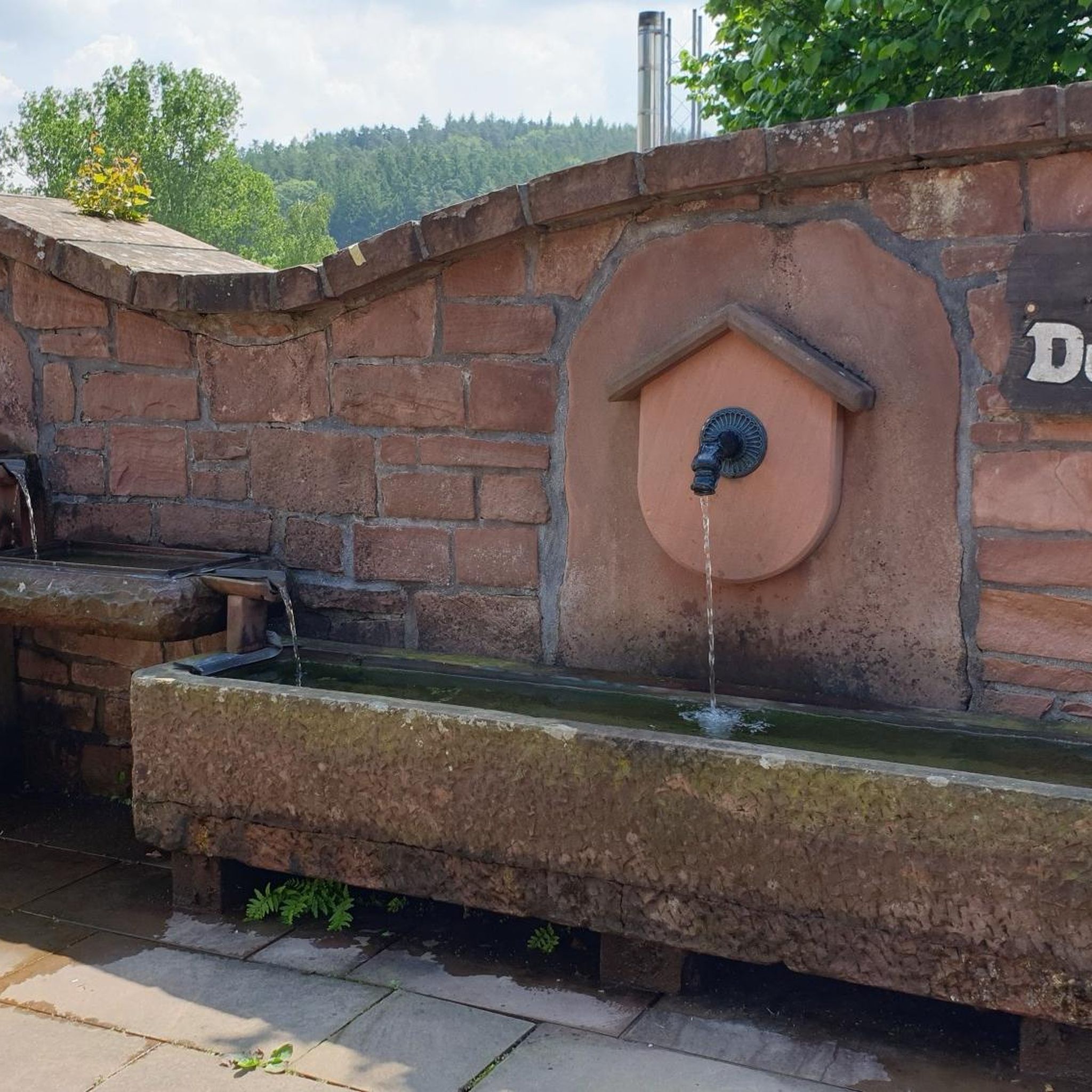
- The most popular no traffic gravel bike trail is Fountain…
Last updated: July 2, 2026
2
riders
32.5km
02:32
470m
480m
Hard gravel ride. Very good fitness required. Mostly paved surfaces. Suitable for all skill levels.
2
riders
50.2km
03:47
650m
650m
Hard gravel ride. Very good fitness required. Mostly paved surfaces. Suitable for all skill levels.

Sign up for free
2
riders
38.3km
02:27
440m
440m
Moderate gravel ride. Good fitness required. Mostly paved surfaces. Suitable for all skill levels.
3
riders
47.8km
03:22
680m
680m
Hard gravel ride. Very good fitness required. Mostly paved surfaces. Suitable for all skill levels.
2
riders
63.3km
04:39
840m
850m
Hard gravel ride. Very good fitness required. Mostly paved surfaces. Suitable for all skill levels.
Our route recommendations are based on thousands of hikes, rides, and runs completed by other people on komoot.
Start today with a free account
Your next adventure awaits.
Login or Signup
Popular around Bujalance

Tips from the Community

In Lopera, we find one of the best examples of castles built by the Military Order of Calatrava in the province of Jaén. Declared a Cultural Monument in 1991, this fortress retains its original walled enclosure, although over the years it has also served as a residence and, in the mid-20th century, even as a winery.
0
0
Porcuna is a small town and a municipality (municipio) in southern Spain with 5,907 inhabitants (as of 2024) in the west of the province of Jaén in the autonomous community of Andalusia.
0
0

Good cross-country climb
0
0

Municipality located to the east of the province of Córdoba, on the border with Jaén. Most of it is located in the foothills of Sierra Morena, making the Guadalquivir River the border with the countryside. Therefore, the mountains, the river and the countryside are the three elements that determine the landscape. The first is part of the Sierra de Cardeña y Montoro Natural Park, and in it we can find vegetation of holm oaks, wild olive trees, stone and maritime pines and a population of melojo oak, rare in Andalusia. It is also an area of great fauna, hunting and livestock value. The second, which surrounds the town, is the axis of the landscape, life and history of the town; Due to the beauty of the meander, it is also known as the Andalusian Toledo. The third, populated by olive trees, places us in a truly Cordoba environment. The town, with an Iberian, Greek, Roman, and Muslim past, is located on a small elevation that dominates the course of the river that divides it into two neighborhoods, offering an unmistakable image. Declared a Historic-Artistic Site in 1969, it brings together a multitude of attractions and tourist attractions to visit, such as the bridge over the river, the Church of San Bartolomé, the Casa de las Tercias, its steep streets of white houses, or the Torre de Villaverde. Its Holy Week, declared of Tourist Interest, reaches its greatest splendor on the afternoon of Holy Thursday with the presence of the Roman Empire. It is one of the towns included in the Baético Romana Route.
0
0
The Three Eyes Bridge or Iron Bridge is a bridge built by the French engineer Gustave Eiffel. It is located near Villa del Río in the province of Córdoba, Spain, on the A-3101 on the Guadalquivir River.
0
0
Livestock Route included in the layout of the Alto Guadalquivir MTB Cycle Tourist Circuit
0
0
Bujalance is a city in the Cordoba countryside located in the heart of Andalusia. Its location, in the middle of the natural path that goes to the south of the Iberian Peninsula, and its fertile lands rich in groundwater, have given it an important role throughout history.
0
0
Frequently Asked Questions
How many traffic-free gravel bike trails are available around Bujalance?
There are 6 dedicated traffic-free gravel bike trails around Bujalance listed in this guide. These routes utilize the region's extensive network of vías pecuarias (ancient cattle trails) and other quiet paths, offering a peaceful cycling experience through the campiña cordobesa.
What kind of terrain can I expect on the gravel bike trails near Bujalance?
The terrain around Bujalance is characterized by the undulating campiña cordobesa, featuring vast olive groves and herbaceous fields. You'll encounter a mix of well-maintained gravel paths, some of which are ancient Roman roads, and dirt tracks. The routes often include moderate ascents and descents, providing scenic views across the agricultural landscape.
Are there any circular gravel bike routes around Bujalance?
Yes, many of the gravel bike trails around Bujalance are designed as loops, allowing you to start and finish at the same point. For example, the Castillo de Lopera – Torre de Boabdil loop from Lopera offers a challenging 32 km circular ride with significant elevation changes.
What are some notable landmarks or natural features I can see along the gravel routes?
The routes often pass through or near significant points of interest. You might encounter historical structures like the Fountain in Montoro or enjoy panoramic views from spots like the Sierra Morena Viewpoint. The region also features natural havens like the Arroyo de la Zarzuela, an ecological corridor with Mediterranean forest remnants.
Are there any family-friendly traffic-free gravel trails in the area?
While many routes around Bujalance are rated moderate to difficult due to their length and elevation, the network of vías pecuarias offers potential for shorter, less strenuous sections. For a route that balances distance with a manageable challenge, consider the Cordel de Bujalance a Porcuna – Lopera Trenches loop from Villa del Rio, which is rated moderate and covers about 38 km.
What is the best time of year to go gravel biking in Bujalance?
The best time for gravel biking in Bujalance is typically during the spring (March to May) and autumn (September to November). During these seasons, temperatures are milder, and the landscape is vibrant. Summers can be very hot, making early morning or late afternoon rides essential, while winters are generally mild but can have occasional rain.
Where can I find parking for these gravel bike trails?
Many of the routes start from towns or villages like Lopera or Villa del Rio, where public parking is generally available. It's advisable to check local parking regulations upon arrival, especially in historic centers. The nature of vías pecuarias often means access points are well-distributed, allowing for flexible starting locations.
Are there any challenging gravel bike routes for experienced riders?
Absolutely. Several routes offer significant challenges for experienced gravel bikers. For instance, the Castillo de Lopera – Torre de Boabdil loop from Villa del Rio is a difficult 63 km route with over 840 meters of elevation gain, providing a demanding and rewarding experience through varied terrain.
Can I combine a gravel bike ride with exploring local culture or history?
Yes, Bujalance is a declared Historic-Artistic Site, and its surrounding area is rich in history. You can easily combine your ride with visits to the Alcazaba Fortification, the impressive Parish Church of Nuestra Señora de la Asunción, or the charming Plaza Mayor in Bujalance. Some routes, like the Fountain in Montoro – Bujalance Castle loop from Villa del Rio, even pass directly by historical points of interest.
What kind of views can I expect on the gravel trails around Bujalance?
The gravel trails offer expansive views of the picturesque campiña cordobesa, dominated by endless olive groves and agricultural fields. From elevated points, you'll often see the distinctive skyline of Bujalance, including its castle and the towering bell tower of the Parish Church of Nuestra Señora de la Asunción, providing a blend of natural beauty and historical context.
Are there any routes that pass through the town of Montoro?
Yes, the Fountain in Montoro – Bujalance Castle loop from Villa del Rio is a great option if you wish to explore the charming town of Montoro. This route passes by the Fountain in Montoro and allows you to experience the historic settlement of Montoro itself.
Most popular attractions around Bujalance

Get inspired with the komoot mobile app


Explore more
Browse the best Gravel rides in other regions.
