The best traffic-free bike rides around Pedro Martínez
4.2
(12)
155
riders
6
rides
No traffic touring cycling routes around Pedro Martínez traverse a diverse landscape characterized by valleys, rugged mountains, and unique desert formations. The region features both relatively flat paths suitable for various fitness levels and more challenging routes with significant elevation changes. Cyclists can expect to encounter areas with bromeliad forests, canyons, and vast desert expanses. The terrain offers a mix of asphalt roads and dirt tracks, providing varied experiences for touring cyclists.
Best no traffic touring cycling routes around Pedro…
Last updated: July 2, 2026
4.7
(10)
112
riders
30.7km
02:58
630m
630m
Hard bike ride. Very good fitness required. Mostly paved surfaces. Suitable for all skill levels.
7
riders
38.1km
03:34
680m
680m
Hard bike ride. Very good fitness required. Mostly paved surfaces. Suitable for all skill levels.

Sign up for free
3
riders
22.1km
01:24
260m
260m
Moderate bike ride. Good fitness required. Mostly paved surfaces. Suitable for all skill levels.
5
riders
110km
08:55
1,650m
1,650m
Hard bike ride. Very good fitness required. Mostly paved surfaces. Suitable for all skill levels.
3
riders
44.7km
03:58
740m
740m
Hard bike ride. Very good fitness required. Mostly paved surfaces. Suitable for all skill levels.
Our route recommendations are based on thousands of hikes, rides, and runs completed by other people on komoot.
Start today with a free account
Your next adventure awaits.
Login or Signup
Popular around Pedro Martínez
Tips from the Community

Double-check the trails! The river valley was completely overgrown and almost impossible to get through. It's a real ordeal to find your way back out! Not all of the trails on Komoot actually exist, and not all of the real trails are marked. Bring enough water!
0
0

The official viewpoint on Calle Goya in Dehesas de Guadix is known as the Mirador de San Bernardino. This viewpoint is located at the end of Calle Goya, on one of the highest points in the village. It offers magnificent views of the surrounding area, including the vast moorlands and dense forests of the region.
8
0
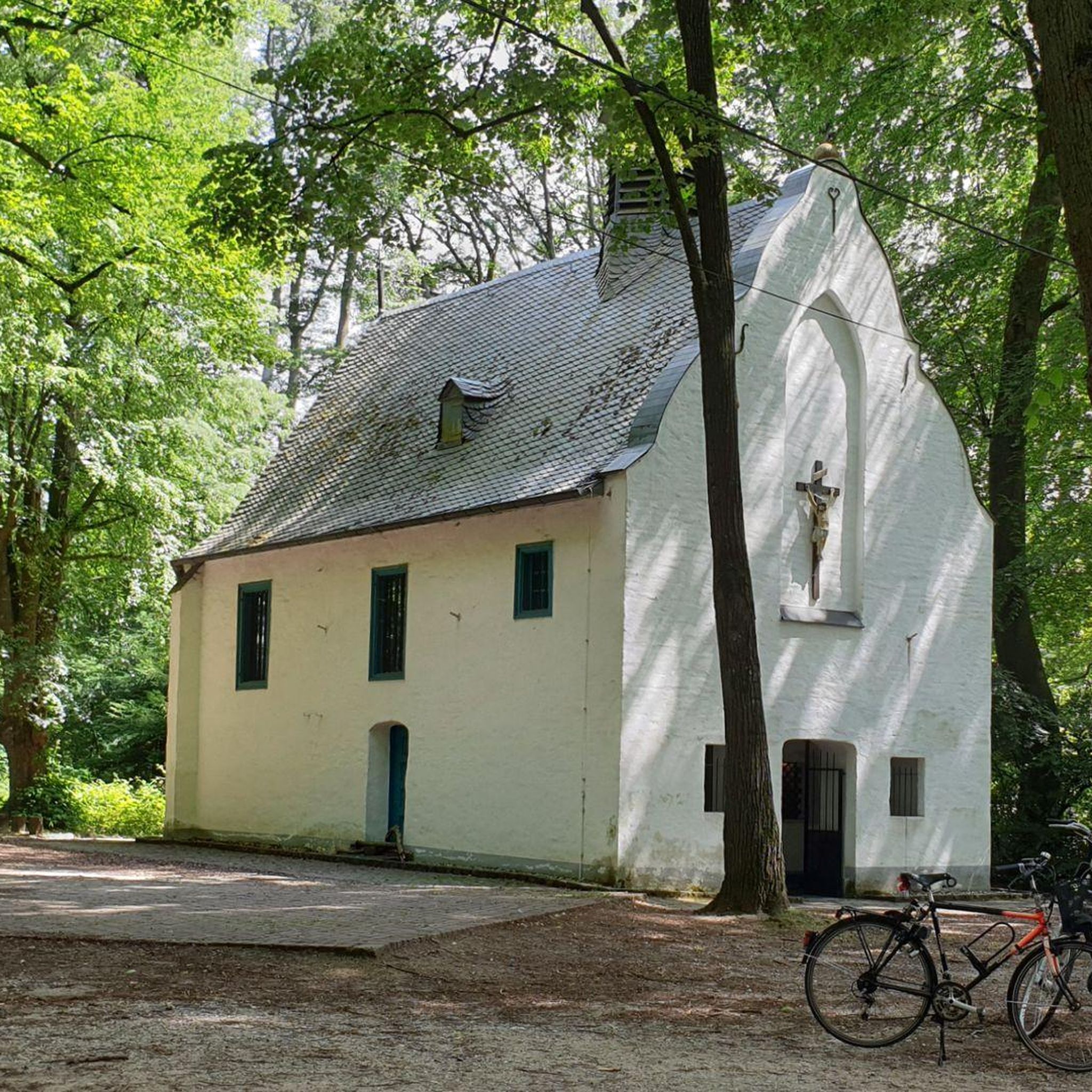
The church is now in a pitiful state. I could not find out whether this is permanent or whether they are going to restore it.
7
0
The church was built in the 16th century, during the Reconquista period. The church has undergone several restorations to preserve its original Mudéjar style and ensure its structural integrity. The church is built in the Mudéjar style, a unique combination of Islamic and Christian architecture typical of the region. The building has a basilica design with a single nave and a wooden ceiling (artesonado) typical of Mudéjar architecture. The interior is decorated with beautiful religious artwork and paintings that highlight the rich religious tradition of the church. The church is an important heritage site for Dehesas de Guadix and attracts visitors for its historical and architectural value.
7
0
Dehesas de Guadix is a small municipality. It is located in the northeast of the comarca of Los Montes and has an area of approximately 57 km²1. The municipality has approximately 426 inhabitants (2016). The history of Dehesas de Guadix goes back to the time of the Reconquista, when the kings of Spain reconquered the area from the Moors. The village was officially founded in the 15th century, when Don Diego Fernández de Iranzo received the land from the kings. One of the most remarkable features of Dehesas de Guadix is the troglodyte dwellings, which are typical of the region. These underground houses are built into the rocks and offer a unique glimpse into the traditional architecture of the area.
7
0
The coat of arms of Dehesas de Guadix is a beautiful symbol that represents the history and identity of the municipality. Here are some important elements of the coat of arms: The coat of arms is divided into three parts. First part: This part shows a mountain (monte) of sinople (green) with a house-cuve (a typical building in the region) of silver, matched with red (gules). Second part: This part shows three oliviers of sinople (green) on a field of gold (oro). Point part: This part shows wavy lines of silver and blue (azur). These elements combine natural and architectural features that are important to the region.
7
0
Beautiful striking landscape. Towards Dehesas de Guadix it starts to climb. After all we leave the valley of the Rio Fardes and drive to the valley of the rio Guadahortuna.
6
0

Gravel as it couldn't be more beautiful. Take your time and enjoy this unique landscape
0
0
Frequently Asked Questions
How many no-traffic touring cycling routes are available around Pedro Martínez?
There are 5 dedicated no-traffic touring cycling routes around Pedro Martínez, offering a variety of experiences for different skill levels. You'll find 1 moderate route and 4 difficult routes.
What kind of landscapes can I expect on these no-traffic touring routes?
The no-traffic touring routes around Pedro Martínez primarily traverse the unique landscapes of the Gorafe Desert. You can expect to cycle through badlands, canyons, and areas with impressive geological formations, offering a truly distinctive backdrop for your ride. Routes like the Los Coloraos Desert – Badlands of Gorafe loop showcase these dramatic desert environments.
Are there any moderate no-traffic touring routes for less experienced cyclists?
Yes, there are two moderate no-traffic touring routes suitable for those looking for a less strenuous ride. Consider the Bike loop from Guadahortuna, which covers 22 km with 260m of elevation gain, or the Puntal de Don Diego Viewpoint loop, a 12.1 km route with 257m of ascent.
What are some notable viewpoints or natural features along the no-traffic touring routes?
Many routes offer stunning views of the region's unique geology. The Mirador de la Escalerilla loop provides panoramic vistas. You can also visit the Puntal de Don Diego Viewpoint, which is part of one of the moderate routes. The Gorafe Desert itself, with its canyons and badlands, is a major natural attraction.
What is the typical duration for these no-traffic touring cycling routes?
The duration varies depending on the route's length and difficulty. The shortest route, the Puntal de Don Diego Viewpoint loop, takes approximately 1 hour and 18 minutes. Longer, more difficult routes like the Desert of Gorafe – Dehesas de Guadix loop can take over 4 hours to complete.
Are there any historical or cultural attractions near the cycling routes?
While the routes themselves focus on natural landscapes, the broader region of Oaxaca, where Pedro Martínez is located, is rich in cultural attractions. You can find ancient archaeological sites like Monte Albán and Mitla, traditional villages known for artisan workshops, and historical colonial towns. The Parish Church of Santa Ana is also a nearby point of interest.
What do other touring cyclists say about the no-traffic routes in Pedro Martínez?
The no-traffic touring routes in Pedro Martínez are highly regarded by the komoot community, with an average rating of 4.19 out of 5 stars. Cyclists often praise the unique desert scenery and the quiet, car-free experience these routes offer.
Are there any circular no-traffic touring routes available?
Yes, all the no-traffic touring cycling routes listed are circular loops, meaning you will start and end at the same point. This makes planning your ride and transportation more convenient.
What is the best time of year to cycle the no-traffic routes in Pedro Martínez?
Given the desert environment, spring and autumn generally offer the most pleasant temperatures for cycling in Pedro Martínez, avoiding the intense heat of summer and the cooler, potentially wetter conditions of winter. This allows for comfortable exploration of the open landscapes.
What kind of terrain should I expect on these no-traffic touring routes?
The routes primarily feature a mix of asphalt and dirt roads, winding through valleys and sometimes ascending into more rugged areas. Expect some challenging climbs and descents, especially on the difficult-rated routes that delve into the Sierra Norte and Southern Mountain Range characteristics of the broader region.
Are there any specific natural monuments to look out for?
Yes, the area is home to several natural monuments. You can explore the various sections of the Gorafe Desert, including impressive canyons. The Acequia del Toril and Cerro de la Bandera are also notable natural features in the vicinity.
Most popular attractions around Pedro Martínez

Get inspired with the komoot mobile app


Explore more
Browse the best Cycling routes in other regions.
