Argamasilla De Calatrava
Argamasilla De Calatrava
The best traffic-free bike rides around Argamasilla De Calatrava
5.0
(9)
761
riders
17
rides
Road cycling around Argamasilla De Calatrava offers diverse terrain within the Campo de Calatrava, a volcanic area featuring a Volcanic Massif. The region is characterized by volcanic outcrops, craters, and lagoons, providing varied backdrops for no traffic road cycling routes. Cyclists can explore routes winding through these unique geological formations, as well as along the slopes of the Tirteafuera River. The area also benefits from a new bike path connecting Argamasilla de Calatrava with Puertollano, enhancing connectivity for cyclists.
Best…
Last updated: July 15, 2026
70
riders
116km
06:16
2,330m
2,330m
Hard road ride. Very good fitness required. Mostly well-paved surfaces and easy to ride.
5.0
(1)
58
riders
86.8km
04:30
1,520m
1,520m
Hard road ride. Very good fitness required. Mostly well-paved surfaces and easy to ride.

Sign up for free
5.0
(1)
43
riders
59.6km
02:53
850m
850m
Moderate road ride. Good fitness required. Mostly well-paved surfaces and easy to ride.
17
riders
127km
06:29
2,190m
2,190m
Hard road ride. Very good fitness required. Mostly well-paved surfaces and easy to ride.
9
riders
29.7km
01:23
100m
100m
Moderate road ride. Great for any fitness level. Some segments of this route may be unpaved and difficult to ride.
Get access to more routes and recommendations from other explorers.
Sign up for free
Already have an account?
Our route recommendations are based on thousands of hikes, rides, and runs completed by other people on komoot.
Start today with a free account
Your next adventure awaits.
Login or Signup


Other adventures around Argamasilla De Calatrava

Tips from the Community

Puerto de los Rehoyos is a mountain pass located in Solana del Pino, in the province of Ciudad Real, Castilla-La Mancha. With an altitude of 986 metres, it offers magnificent views of the Sierra de la Solana and the Alcudia Valley. It is a popular place for hiking and cycling, with routes that allow you to enjoy the local fauna, such as deer and birds of prey. The CR-500 road, which passes through the pass, is in good condition and is ideal for those who enjoy outdoor activities.
3
0
Located at the foot of the Monumento al Minero, an imposing bronze sculpture by Pepe Noja that represents the city's mining history, it borders the volcanic area of Campo de Calatrava and is close to the Alcudia Valley. Mining activity is of particular importance with the Mining Museum, a building that surrounds an old headframe and simulates a coal selection workshop. On its two floors, the museum addresses the transformation of Puertollano into an industrial city due to the discovery of coal.
13
0

Puertollano is a Spanish town in the province of Ciudad Real, in the autonomous community of Castilla-La Mancha. Traditionally, it has been associated with oil shale and coal mining and industry. The area in which Puertollano is located has been inhabited since prehistory, with archaeological remains found that correspond to Homo heidelbergensis and Homo antecessor. During the Middle Ages the city was born, linked to the repopulation process of Castile during the 13th century. In the 16th century, Puertollano received the rank of town, a privilege granted by Philip II. At that time Puertollano was an important agricultural and livestock center. The demographic consolidation of the city occurred at the end of the 19th century, with the development of coal mining and the inauguration of the train line between Madrid and Badajoz. Its cultural heritage It corresponds mainly to religious buildings, such as the church of Nuestra Señora de la Soledad (14th century), the church of the Virgen de Gracia (15th century) and the church of the Asunción (16th century). There is also a mining museum, and an old medicinal sour water spa, known as the Bath House, which today is a municipal service to citizens.
1
0
Plaza in tribute to the UME at the entrance to Villamayor de Calatrava.
28
0
On the secondary road CM-4115 the Municipal Cemetery of Villamayor de Calatrava.
25
0

On the southern side of the Sierra de la Solana is this small town surrounded by immense forests and with beautiful views of the northern Sierra Madrona.
0
0
Right on the southern side of the Sierra de la Solana is this small town surrounded by immense forests and with beautiful views of the northern Sierra Madrona.
0
1
Population that is located in a valley and on the one hand there are the mountains of Puertollano to the north and to the south the Sierra Madrona and the Robledillo river that belong to the Marianic System.
0
1
Frequently Asked Questions
How many no-traffic road cycling routes are available around Argamasilla de Calatrava?
There are 14 dedicated no-traffic road cycling routes around Argamasilla de Calatrava, offering a variety of experiences for different skill levels. You'll find 3 easy, 6 moderate, and 5 difficult routes to explore.
What kind of landscapes can I expect on these no-traffic road cycling routes?
The routes in Argamasilla de Calatrava traverse the unique volcanic landscapes of the Campo de Calatrava. You'll cycle through areas characterized by craters, lagoons, and distinctive basaltic formations, with five volcanoes located within the municipality itself. The region also features river valleys, such as the slopes of the Tirteafuera River, and small mountain ranges, providing a diverse and picturesque backdrop for your ride.
Are there any long-distance no-traffic road cycling routes for experienced cyclists?
Yes, for experienced cyclists seeking a challenge, there are several longer, more difficult routes. For example, the Puerto Madrona from Puertollano – circular via Mestanza and the Sierra Madrona route covers over 116 km with significant elevation gain. Another demanding option is the Huertezuelas – Collado Pisa from Huertezuelas loop from Puertollano, which stretches over 126 km.
What are some scenic viewpoints or natural attractions along the routes?
Many routes offer stunning views of the volcanic landscape and natural features. Keep an eye out for the tranquil Fuente Agria and the unique Maar and Strombolian volcano of Almodóvar del Campo. The region's numerous volcanic outcrops and lagoons, including Laguna Blanca and Laguna de Lomillos, also provide picturesque spots to enjoy during your ride.
Are there any moderate no-traffic road cycling routes suitable for a less intense ride?
Absolutely. If you're looking for a moderate challenge, routes like the Mestanza Village loop from Puertollano offer a great experience. This route is around 32 km long with manageable elevation, perfect for a rewarding ride without extreme difficulty. Another moderate option is the Roadbike loop from Puertollano, which is about 31 km.
What historical or cultural sites can I visit near the no-traffic cycling routes?
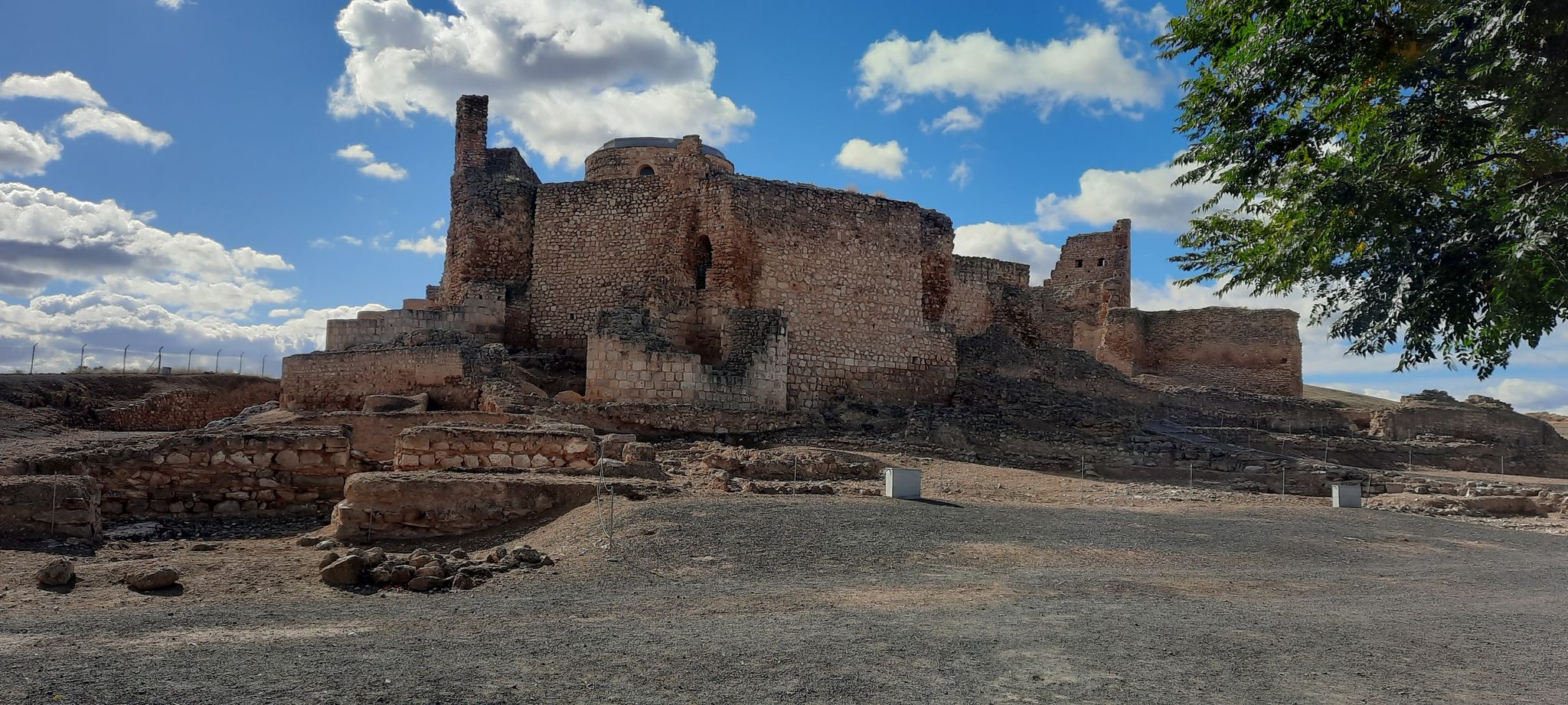
Beyond the natural beauty, you can explore several historical and cultural attractions. The well-preserved megalithic tomb, Castle of Calatrava la Nueva and Sacred Convent, offers a glimpse into the region's past. You might also encounter the Bridge over the Jabalón River, a historical landmark, or the Palacio de la Serna, a building of significant heritage value.
What do other road cyclists enjoy most about cycling in Argamasilla de Calatrava?
The komoot community highly rates the road cycling experience in Argamasilla de Calatrava, with an average score of 5.0 stars. Reviewers often praise the unique volcanic landscapes, the tranquility of the no-traffic routes, and the diverse terrain that makes for engaging rides.
Are there any circular no-traffic road cycling routes available?
Yes, many of the routes are designed as loops, allowing you to start and end in the same location. For example, the challenging Puerto Madrona from Puertollano – circular via Mestanza and the Sierra Madrona is a circular route. The Mestanza Village loop from Puertollano is another excellent circular option for a moderate ride.
Is there a dedicated bike path connecting Argamasilla de Calatrava to nearby towns?
Yes, a significant development for cyclists is the new 3.1-kilometer bike path connecting Argamasilla de Calatrava with Puertollano. This illuminated path provides a safe and dedicated route, enhancing connectivity and promoting outdoor recreation between the two towns.
What is the best time of year for no-traffic road cycling in this region?
The varied terrain and generally mild climate make Argamasilla de Calatrava suitable for cycling throughout much of the year. Spring and autumn typically offer the most pleasant temperatures for exploring the volcanic landscapes and river valleys, avoiding the peak heat of summer.
Can I find routes that pass by water features or rivers?
Yes, the region is home to several natural water features. Some routes may take you near the Presilla Jabalon or along the slopes of the Tirteafuera River. The presence of lagoons like Laguna Blanca and Laguna de Lomillos also adds to the scenic beauty of the area, offering tranquil spots to enjoy during your ride.
Most popular routes around Argamasilla De Calatrava
Most popular attractions around Argamasilla De Calatrava

Get inspired with the komoot mobile app


Explore more
Browse the best Road cycling routes in other regions.
