The best traffic-free bike rides around Alonsotegi
4.5
(491)
9,091
riders
87
rides
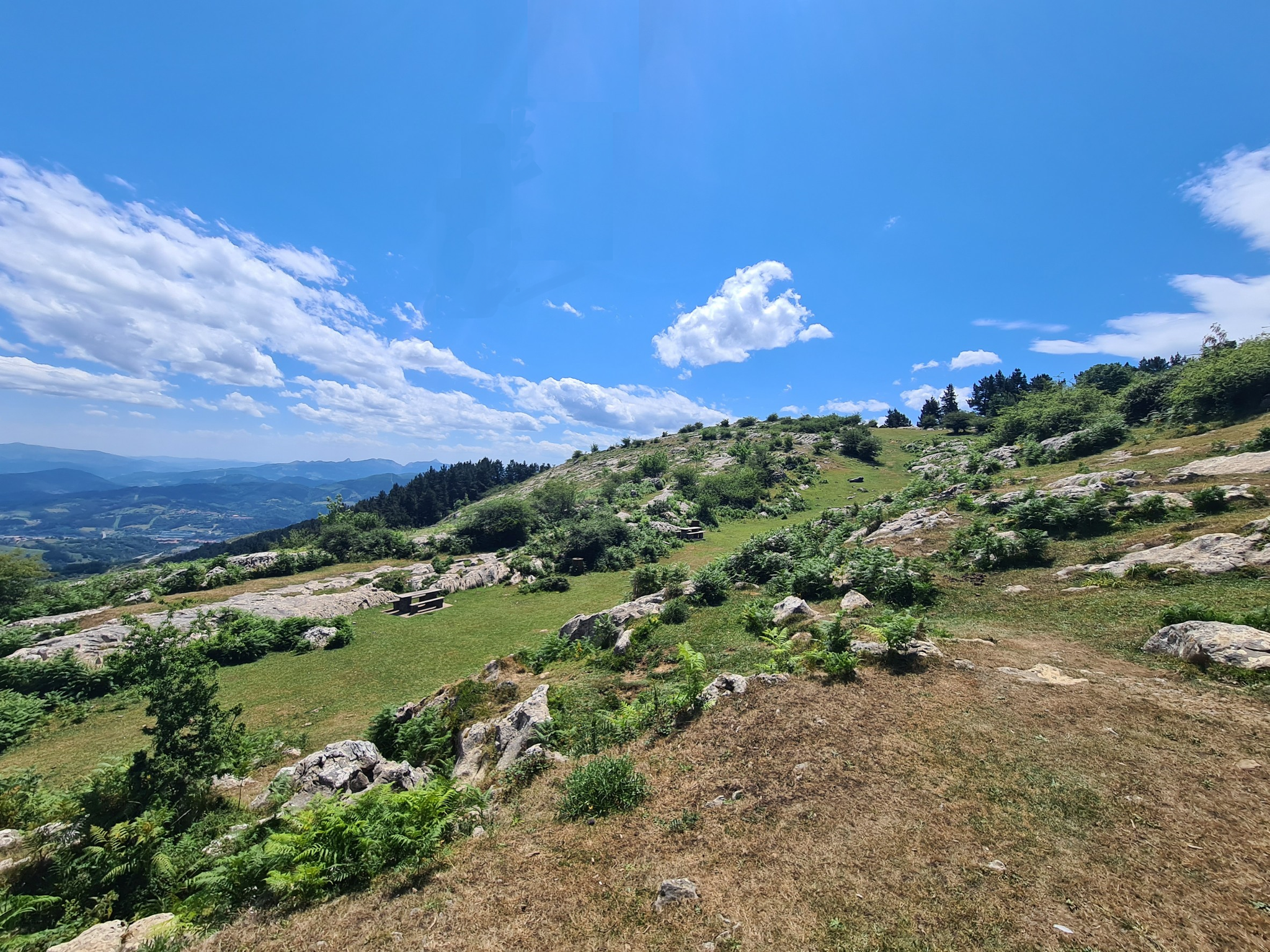
No traffic touring cycling routes around Alonsotegi traverse a diverse and mountainous landscape, situated within the Cadagua River corridor. The region is encircled by the Sasiburu, Ganekogorta, and Pagasarri mountains, offering varied terrain for cyclists. Elevations range significantly, from 50 to 1,000 meters above sea level, providing both challenging climbs and scenic descents. Cyclists can expect to navigate forest tracks through pine forests, with impressive views of the Cadagua valley and El Regato.
Best no traffic touring cycling routes around Alonsotegi
- The most popular no traffic touring cycling route is Pico Mendibil – View of Santander loop from Gurutzeta / Cruces, a 14.8 miles (23.8 km) trail that takes 2 hours 20 minutes to complete. This difficult route offers panoramic views, including distant sights of Santander.
- Another top favourite among local touring cyclists is Bike lane in Bilbao – Pagasarri Picnic Area loop from Ametzola, a difficult 17.3 miles (27.9 km) path. This route features a dedicated bike lane and leads to the Pagasarri Picnic Area, providing scenic views.
- Local touring cyclists also love the Riverside Cycle Path to Bilbao – Guggenheim Museum Bilbao loop from Ametzola, a 33.4 miles (53.8 km) trail leading along the river and past cultural landmarks, often completed in about 4 hours 53 minutes.
- Touring cycling around Alonsotegi is defined by mountainous terrain, serene river valleys, and pine forests. The network offers options for different ability levels, from easy paths to more challenging routes with significant elevation gains.
- The routes in Alonsotegi are highly rated by the komoot community with an average score of 4.4 stars from over 580 reviews. More than 10,000 touring cyclists have used komoot to explore Alonsotegi's varied terrain.
Last updated: May 20, 2026
139
riders
29.5km
03:00
880m
880m
Hard bike ride. Very good fitness required. You may need to push your bike for some segments of this route.
62
riders
23.8km
02:21
750m
750m
Hard bike ride. Very good fitness required. Mostly paved surfaces. Suitable for all skill levels.

Sign up for free
50
riders
30.7km
03:04
930m
930m
Hard bike ride. Very good fitness required. Mostly paved surfaces. Suitable for all skill levels.
37
riders
17.5km
01:41
550m
550m
Hard bike ride. Very good fitness required. Mostly paved surfaces. Suitable for all skill levels.
36
riders
51.6km
04:45
1,420m
1,420m
Hard bike ride. Very good fitness required. You may need to push your bike for some segments of this route.
Get access to more routes and recommendations from other explorers.
Sign up for free
Already have an account?
Our route recommendations are based on thousands of hikes, rides, and runs completed by other people on komoot.
Start today with a free account
Your next adventure awaits.
Login or Signup


Other adventures around Alonsotegi

Tips from the Community

Bad luck that I had fog, I could hardly see the Pirulí.
1
0

Great place to take a break, the hills are steep and life is too short, so enjoy it now.
0
0

The cycle path to Bilbao on the southwest side offers many sights
1
0

Incredible stretch of GR228 hiking route from Bilbao to Monte Pagasarri. The trail is well marked and the brave will get a panoramic view of the mountains and valleys below.
1
0

Great lane to run. Be careful with the bikes.
1
0
The effort is worth it, just to see the beautiful view.
1
0

This viewpoint is located in a spectacular setting. In the middle of a hill covered in radiant green grass and full of picnic areas, this wooden platform offers views of Bilbao and its estuary. In the recreational area it is common to see horses and cows grazing.
2
0

There are picnic tables here and it is the perfect place to take a break. There is plenty of shade and multiple trails going in many different directions. The trails are well marked so it shouldn't be too difficult to find your way.
0
0
Frequently Asked Questions
How many no-traffic touring cycling routes are available around Alonsotegi?
There are over 80 dedicated no-traffic touring cycling routes around Alonsotegi listed on komoot. These routes cater to various skill levels, with a significant number offering challenging ascents and rewarding views.
What kind of terrain can I expect on no-traffic touring cycling routes in Alonsotegi?
Alonsotegi's routes are characterized by diverse terrain, ranging from forest tracks winding through pine forests to paths along the Cadagua River. You can expect significant elevation changes, as the municipality spans from 50 to 1,000 meters above sea level, offering both challenging climbs and scenic descents. Many routes utilize former railway lines, known as Greenways, which provide smoother, accessible paths.
Are there any easy, no-traffic touring cycling routes suitable for beginners or families in Alonsotegi?
While many routes in Alonsotegi are rated as difficult, there are some moderate options available. For a less strenuous ride, consider routes that incorporate the Greenways, which are generally flatter. An example of a moderate route is the Arraizmedi Periurban Park – View of Bilbao loop from Bilbao, which offers a manageable distance and elevation gain.
What are some scenic highlights or points of interest I can visit along these routes?
Alonsotegi's routes offer a blend of natural beauty and cultural heritage. You can enjoy impressive views of the Cadagua valley and El Regato, or explore historical sites like the 17th-century "neveras" (ice boxes) on Mount Pagasarri. For cultural stops, consider routes that pass by local hermitages such as San Martín or Santa Quiteria. The Riverside Cycle Path to Bilbao – Guggenheim Museum Bilbao loop from Ametzola takes you past iconic landmarks like the Guggenheim Museum and the Zubizuri Bridge.
Are there any circular no-traffic touring cycling routes in the Alonsotegi area?
Yes, many of the no-traffic touring cycling routes around Alonsotegi are designed as loops, allowing you to start and end at the same point. Examples include the challenging Pico Mendibil – View of Santander loop from Gurutzeta / Cruces or the Bike lane in Bilbao – Pagasarri Picnic Area loop from Ametzola. These circular routes are ideal for day trips, providing varied scenery without the need for shuttle arrangements.
What do other touring cyclists enjoy most about the no-traffic routes in Alonsotegi?
The no-traffic touring cycling routes in Alonsotegi are highly rated by the komoot community, with an average score of 4.4 stars. Reviewers often praise the stunning landscapes, the quietness of the routes, and the sense of immersion in nature. The varied terrain, from river paths to mountain ascents, is also frequently highlighted as a key attraction.
Can I access these no-traffic touring cycling routes using public transport?
Alonsotegi and its surrounding areas are generally well-connected, especially to Bilbao. Many routes start from towns or urban centers like Ametzola or Bilbao, which are accessible by public transport. The region's culture is also highly respectful of cyclists, making it easier to combine cycling with public transport options.
Are there specific natural attractions or summits accessible by bike in the Alonsotegi region?
Yes, the mountainous landscape surrounding Alonsotegi offers several natural attractions and summits. You can find routes that lead to peaks like Ganekogorta Summit or Apuko Summit, providing panoramic views. The Nocedal Dam and Lingorta Reservoir also contribute to the picturesque scenery along some routes.
What is the best time of year to go touring cycling in Alonsotegi to avoid traffic and enjoy the scenery?
While specific seasonal conditions aren't detailed, the Basque Country generally offers pleasant cycling weather from spring through autumn. To best enjoy the scenery and avoid potential crowds, consider cycling during the shoulder seasons (spring and early autumn) when temperatures are mild and the natural environment is particularly vibrant. Always check local weather forecasts before heading out.
Are there any long-distance no-traffic touring cycling routes available?
Yes, for those seeking longer rides, Alonsotegi connects to an extensive network of Greenways (Vías Verdes) across the broader Basque Country, offering over 180 kilometers of accessible routes. While specific multi-day routes are not detailed here, these Greenways provide excellent opportunities for extended, traffic-free touring. An example of a longer route is the Picnic area in Gangoiti Forest – Arraiz Spring loop from Ametzola, which covers over 30 kilometers.
Most popular routes around Alonsotegi
Most popular attractions around Alonsotegi

Get inspired with the komoot mobile app


Explore more
Browse the best Cycling routes in other regions.
