The best traffic-free bike rides around Arganda Del Rey
4.3
(25)
428
riders
62
rides
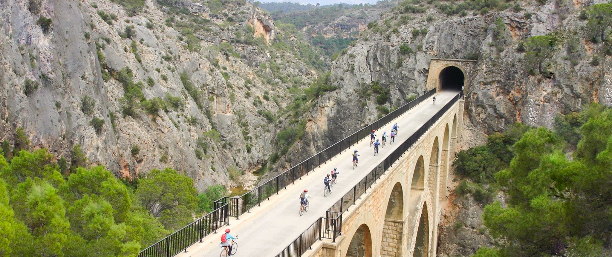
Gravel biking around Arganda Del Rey offers diverse natural landscapes within the Parque Regional del Sureste, approximately 25 kilometers from Madrid. The region is characterized by the Jarama River valley, which has sculpted ecosystems including wetlands and lagoons, alongside agricultural lands, Mediterranean forests, and scrubland. Riders can also encounter gypsum cliffs and the accessible Vía Verde del Tajuña, providing varied terrain for no traffic gravel bike trails.
Best no traffic gravel bike trails around Arganda Del Rey
- The most popular…
Last updated: November 1, 2026
4.0
(1)
14
riders
62.7km
04:57
480m
480m
Hard gravel ride. Very good fitness required. Mostly paved surfaces.
10
riders
38.3km
02:56
340m
340m
Moderate gravel ride. Good fitness required. Mostly paved surfaces.

3.5
(2)
18
riders
48.2km
03:03
280m
280m
Moderate gravel ride. Good fitness required. Mostly paved surfaces.
9
riders
15.6km
01:14
190m
190m
Moderate gravel ride. Good fitness required. Mostly paved surfaces.
12
riders
125km
08:20
890m
890m
Hard gravel ride. Very good fitness required. Mostly paved surfaces.
Get access to more routes and recommendations from other explorers.
Already have an account?
Our route recommendations are based on thousands of hikes, rides, and runs completed by other people on komoot.
Start today with a free account
Your next adventure awaits.

Other adventures around Arganda Del Rey

Tips from the Community

It is also called Puente de la Poveda or del Piul, and crossing it towards the East, you are close to EDAR La Poveda. It is a steel railway and pedestrian bridge built in 1884-85. It measures 169 m and was rebuilt after the civil war.
0
0

Located on the edge of the Vega del Jarama escarpment via the Los Cantiles path at an altitude of 671 meters above sea level is the geodetic vertex No. 56000 Campillo. Geodetic vertices establish functional points with very precise coordinates of longitude, latitude, and height, making them reference elements for subsequent calculations of all kinds. Rivas Vaciamadrid has three third-order geodetic vertices within its municipal area, named ‘Rivas’ (located on Cerro del Telégrafo, in the environment where the old telegraph tower and the municipality's old gliders school were situated), ‘Campillo’ (in the homonymous lagoon, on the edge of an escarpment in wasteland, at 671 meters above sea level), and ‘Coberteras’ (on the Casa Eulogio estate, in wasteland on Cabezo Alto de las Viñas). All are concrete pillars one meter square at the base and a cylindrical pillar 1.20 meters high and 30 centimeters in diameter. The first was installed in 1974 and the other two in 1976.
0
0

Before reaching this point, there is a sign indicating no passage. It is not clear to me if you can pass through there, and then turn right onto the path that goes along the river
0
0

Very nice tour, I liked it, although there was a bit of a bad smell from the company before crossing the bridge. Also, I found areas of the path damaged and/or blocked by logs and pebbles. It was hard for me to finish the return route. But overall, I was satisfied with the route.
0
0

it was about time they made this lane,
0
0
Super green area, and with shade for a long stretch, in summer waking up early is more enjoyable
0
0

This lagoon is artificial, created from the extraction of aggregates in the Jarama River basin during the 1960s and 1970s. It is an ideal place to enjoy nature, hike, or cycle. The lagoon's perimeter measures approximately 5.5 km, and its average depth is 6 meters, although in some areas it can reach 20 meters. It also has a natural resources interpretation center that organizes workshops and educational activities.
3
0
The Campillo Lagoon is located in Rivas Vaciamadrid, within the Southeast Regional Park, about 20 km from Madrid. It is a protected natural area, ideal for peaceful walks and outdoor activities. Origin: Artificial, formed in the 1960s and 70s after the extraction of aggregates in the Jarama River basin. Water from the aquifer filled the excavations and over time became a wetland with great biodiversity.
4
0
Frequently Asked Questions
How many no-traffic gravel bike trails are available around Arganda del Rey?
Komoot offers over 40 gravel bike trails around Arganda del Rey that prioritize low-traffic or car-free sections, providing a peaceful cycling experience. These routes range in difficulty, ensuring options for various skill levels.
What kind of terrain can I expect on the no-traffic gravel routes in Arganda del Rey?
The terrain around Arganda del Rey is quite varied, offering a mix of landscapes ideal for gravel biking. You'll encounter agricultural lands, Mediterranean forests, scrubland, and pine forests, especially within the Parque Regional del Sureste. Many routes feature unpaved segments, and you might even ride along gypsum cliffs and river valleys like the Jarama.
Are there any family-friendly no-traffic gravel routes in Arganda del Rey?
Yes, the area offers options suitable for families. The Campillo Lagoon – Campillo Lagoon loop from Rivas Futura is a moderate route that takes you around the scenic Campillo Lagoon, which is a popular spot for outdoor activities and offers a relatively gentle ride. The Vía Verde del Tajuña is also an excellent choice for families, known for its firm red tarmac and good signposting, providing an easy-to-follow, car-free path.
What are the best times of year for gravel biking in Arganda del Rey to avoid traffic and enjoy the scenery?
The most pleasant times for gravel biking in Arganda del Rey are during spring (April to June) and fall (September to November). During these seasons, the weather is mild, and the natural landscapes, such as the Mediterranean forests and river valleys, are particularly beautiful, making for an enjoyable, low-traffic experience.
What natural attractions can I see along the no-traffic gravel bike trails?
Many routes pass through or near significant natural attractions. You can explore the diverse ecosystems of the Ruins and Lagoons of Parque Regional del Sureste, cycle past the serene Campillo Lagoon, or witness the dramatic Jarama Cliffs. The View of Laguna del Campillo from the Cortados de Rivas offers stunning panoramic views.
Are there any circular no-traffic gravel routes starting from Arganda del Rey?
Yes, there are several circular routes designed to minimize traffic exposure. For example, the Morata de Tajuña Town Square – El Cuestarrón loop from Arganda del Rey offers a challenging circular ride through varied landscapes. Another option is the Jarama Canyon – Titulcia Main Square loop from Arganda del Rey, which provides a longer, scenic circular journey.
What do other gravel bikers enjoy most about the no-traffic trails in Arganda del Rey?
The komoot community highly rates the gravel biking experience in this region, with an average score of 3.95 stars. Reviewers often praise the tranquility of the routes, the diverse natural scenery found within the Parque Regional del Sureste, and the opportunity to explore historical elements and wetlands away from busy roads.
Can I find routes that offer views or viewpoints on the no-traffic gravel trails?
Absolutely. The region is known for its scenic vistas, particularly along the river valleys and cliffs. You can find routes that lead to viewpoints such as the View of Laguna del Campillo from the Cortados de Rivas or the View of the confluence of the Jarama and Manzanares rivers from the Cortados de Rivas, offering expansive views of the natural landscape.
Are there any long-distance no-traffic gravel routes suitable for a full day's ride?
For a longer, immersive ride away from traffic, consider routes that incorporate sections of the Vía Verde del Tajuña or explore deeper into the Parque Regional del Sureste. The Old Bridge of Titulcia – Presa del Rey loop from Rivas Vaciamadrid, for instance, covers over 67 km, offering a substantial ride through varied landscapes with minimal traffic.
Are there any specific areas or parks known for their car-free gravel trails?
The **Parque Regional del Sureste** is the primary area for car-free or low-traffic gravel trails. This expansive park, encompassing the Jarama River valley and various natural features like the Dehesa "El Carrascal" and numerous lagoons, offers a vast network of trails perfect for gravel biking away from urban congestion.
Where can I find parking for these quiet gravel trails in Arganda del Rey?
Many of the routes start from towns or accessible points that offer parking. For routes beginning near Rivas Futura or Rivas Vaciamadrid, you'll typically find public parking options. For trails deeper within the Parque Regional del Sureste, look for designated parking areas near trailheads or natural park entrances, often indicated on komoot tour maps.
Are there any cafes or places to stop for refreshments near the no-traffic gravel routes?
While many of the no-traffic routes venture into natural areas, you'll find cafes and restaurants in the towns and villages bordering the trails, such as Arganda del Rey itself, Morata de Tajuña, or Titulcia. Planning your route to pass through these towns can provide convenient refreshment stops.
Most popular routes around Arganda Del Rey
Most popular attractions around Arganda Del Rey

Get inspired with the komoot mobile app


Explore more
Browse the best Gravel rides in other regions.
