The best traffic-free bike rides around Whaley Bridge
4.5
(141)
7,293
riders
49
rides
No traffic road cycling routes around Whaley Bridge are situated in the High Peak district of Derbyshire, at the gateway to the Goyt Valley. The region is characterized by rolling hills, steep-sided valleys, and high moorlands, offering varied terrain for road cyclists. The landscape features the River Goyt, several reservoirs such as Toddbrook, Fernilee, and Errwood, and wooded areas like Bings Wood.
Best no traffic road cycling routes around Whaley Bridge
- The most popular no traffic road cycling route is Whaley Bridge Town Centre – Hayfield Village loop from Whaley Bridge, a 22.9 miles (36.9 km) trail that takes 2 hours 10 minutes to complete. This route features significant elevation gain through varied Peak District scenery.
- Another top favourite among local road cyclists is Whaley Bridge Town Centre – Cowlow Lane Climb loop from Whaley Bridge, a moderate 22.2 miles (35.8 km) path. This route offers challenging climbs and panoramic views across the valleys.
- Local road cyclists also love the Pym Chair – Whaley Bridge Town Centre loop from Whaley Bridge, a 9.9 miles (16.0 km) trail leading through the scenic High Peak landscape, often completed in about 1 hour.
- Road cycling around Whaley Bridge is defined by rolling hills, picturesque valleys, and historic canal paths. The network offers options for different ability levels, from moderate loops to more challenging routes with significant elevation.
- The routes in Whaley Bridge are highly rated by the komoot community with an average score of 4.6 stars from more than 10 reviews. More than 400 road cyclists have used komoot to explore Whaley Bridge's varied terrain.
Last updated: July 1, 2026
5.0
(3)
40
riders
36.9km
02:09
750m
750m
Moderate road ride. Good fitness required. Mostly well-paved surfaces and easy to ride.
5.0
(1)
15
riders
35.8km
02:01
660m
660m
Moderate road ride. Good fitness required. Mostly well-paved surfaces and easy to ride.
5
riders
16.0km
01:02
380m
390m
Moderate road ride. Good fitness required. Some segments of this route may be unpaved and difficult to ride.
Get access to more routes and recommendations from other explorers.
Sign up for free
Already have an account?
Our route recommendations are based on thousands of hikes, rides, and runs completed by other people on komoot.
Start today with a free account
Your next adventure awaits.
Login or Signup

Tips from the Community

Steep climb, just take your time, as it has a false summit
0
0
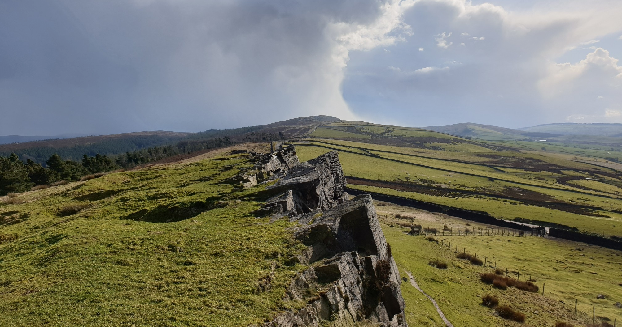
Such a challenging climb in a road bike, you soon run out of gears on a 11-32t rear cassette, but the views at the top make it worth your while & then hood onto your hats on the descent down towards Fernlee reservoir & the Goyt Valley
0
0

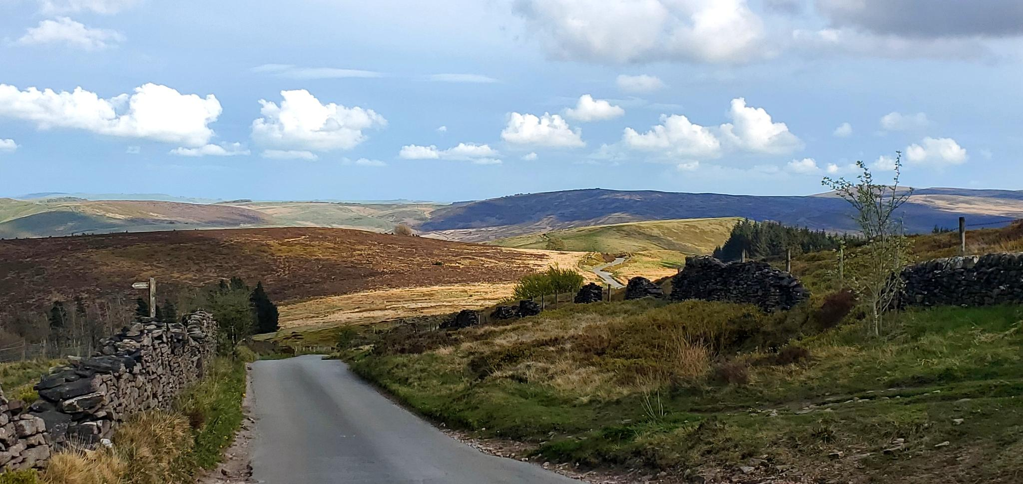
To reach Pym Chair it's a steep climb from either Lamaload Reservoir or Errwood Reservoir. Once at the top, you're rewarded with glorious views into the Goyt Valley and towards Cats Tor.
2
0

One minute your in a little town, the next minute thee amazing views.
0
0


Best way out of Whaley Bridge to head back to Chapel en Le Frith. Nice climb not to demanding, little traffic and super views. What more can you want!😃
0
0
Frequently Asked Questions
How many no-traffic road cycling routes are available around Whaley Bridge?
There are over 50 dedicated no-traffic road cycling routes around Whaley Bridge listed on komoot. These routes cater to various fitness levels, ensuring a suitable option for almost every cyclist.
What are the typical difficulty levels for no-traffic road cycling routes in this area?
The routes around Whaley Bridge offer a good mix of challenges. You'll find 7 easy routes perfect for a relaxed ride, 28 moderate routes for those looking for a bit more effort, and 18 difficult routes for experienced cyclists seeking significant climbs and longer distances.
What do other cyclists enjoy most about the no-traffic road cycling routes in Whaley Bridge?
The komoot community rates the no-traffic road cycling routes around Whaley Bridge highly, with an average score of 4.6 out of 5 stars from 13 ratings. Cyclists often praise the stunning scenery of the Goyt Valley, the challenging yet rewarding climbs, and the peaceful stretches away from vehicle traffic.
Are there any circular no-traffic road cycling routes available?
Yes, many of the no-traffic road cycling routes around Whaley Bridge are circular, allowing you to start and finish in the same location. For example, the Whaley Bridge Town Centre – Hayfield Village loop from Whaley Bridge offers a scenic circular ride, as does the Whaley Bridge Town Centre – Cowlow Lane Climb loop from Whaley Bridge.
What natural features can I expect to see along these routes?
The no-traffic routes often take you through the picturesque Goyt Valley, offering views of rolling hills and woodlands like Bings Wood. You'll also pass by several beautiful reservoirs, including Errwood Reservoir and Toddbrook Reservoir, providing tranquil stretches amidst the hills.
Are there any waterfalls or interesting water features along the no-traffic cycling routes?
Yes, the surrounding Peak District is home to several waterfalls. While some may require a short dismount, you can find routes that pass near notable features like Three Shires Head Stone Bridge and Waterfalls, a Grade II listed site, or Ingersley Vale Waterfall (Waulkmill Waterfall). For more details, check the Waterfalls around Whaley Bridge guide.
Are there any routes suitable for families or beginners looking for traffic-free cycling?
While many road cycling routes involve some elevation, there are easier options. For a gentler experience, consider routes that utilize sections of former railway lines or canal towpaths, which often have flatter gradients and are ideal for families or those new to road cycling. Look for routes marked as 'easy' in the guide.
When is the best time of year to enjoy no-traffic road cycling in Whaley Bridge?
The spring and summer months (April to September) generally offer the most pleasant conditions for road cycling, with milder weather and longer daylight hours. However, the Peak District's beauty can be enjoyed year-round, with autumn providing stunning foliage. Be prepared for changeable weather, as conditions can vary quickly in the hills.
Can I find routes with challenging climbs for advanced road cyclists?
Absolutely. Whaley Bridge is situated in the Peak District, known for its demanding ascents. Experienced road cyclists can find routes with significant elevation gains, such as the one to Kettleshulme or the Curbar Hill Climb – Longstone Edge Climb loop from Whaley Bridge, which offers over 1500 meters of climbing.
Are there historical sites or points of interest along these no-traffic routes?
Yes, the area is rich in history. You might cycle past the historic Peak Forest Canal basin in Whaley Bridge, with its Grade II* listed Transhipment Warehouse, or sections of the former Cromford and High Peak Railway line. Routes can also connect to charming villages like New Mills or Buxworth Basin, known for their heritage.
Is public transport available to reach the starting points of these routes?
Whaley Bridge is accessible by train, with a station in the town centre. This makes it convenient to reach many starting points for cycling routes without needing a car. Local bus services also connect Whaley Bridge to surrounding towns and villages, though checking specific routes and bike carriage policies is advisable.
Are there specific days when roads in the Goyt Valley are closed to traffic, enhancing the cycling experience?
Yes, the Goyt Valley, a popular area for cycling accessible from Whaley Bridge, sometimes has roads closed to vehicular traffic on Sundays. This significantly enhances the traffic-free cycling experience. It's always a good idea to check local council or Peak District National Park announcements for specific dates and times of these closures.
Most popular routes around Whaley Bridge
Most popular attractions around Whaley Bridge

Get inspired with the komoot mobile app


Explore more
Browse the best Road cycling routes in other regions.
