The best hikes from bus stations around Royston
4.4
(372)
3,103
hikers
41
hikes
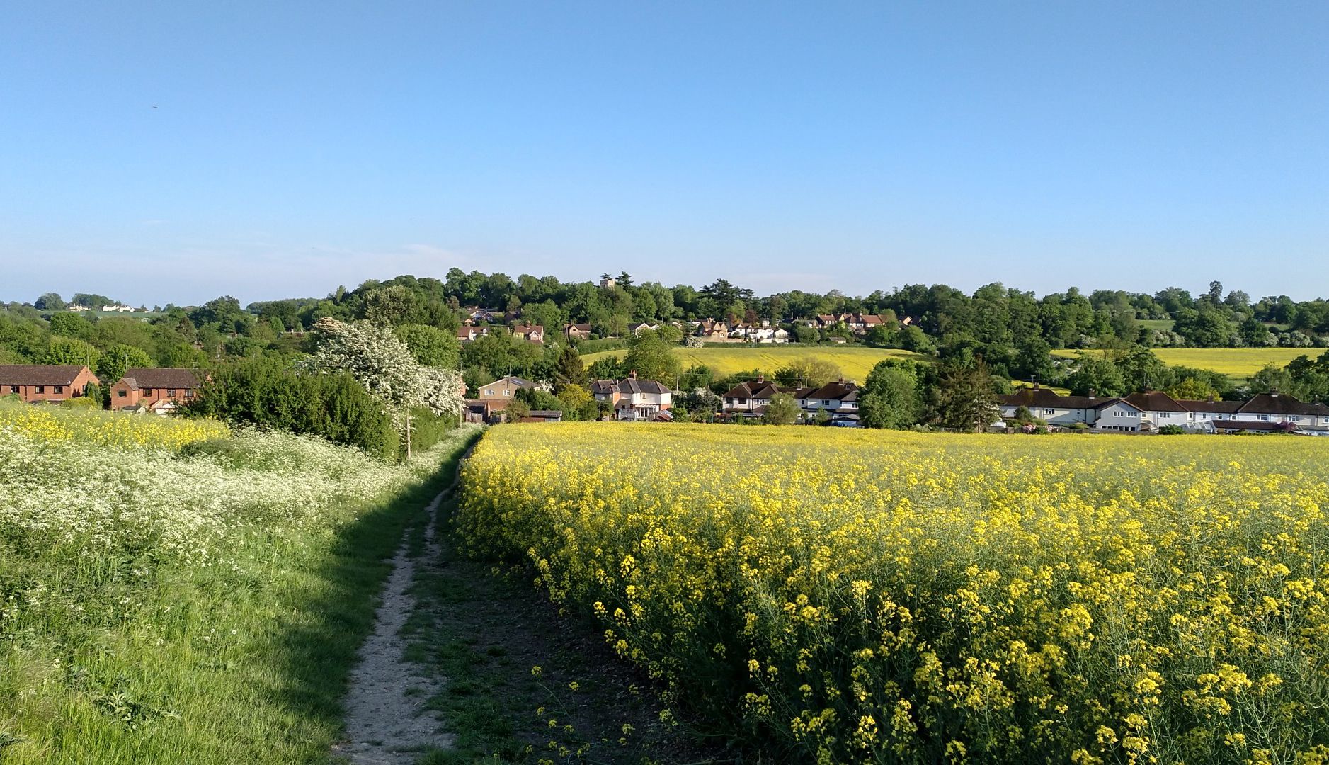
Bus station hiking trails around Royston offer access to a distinctive chalkland environment, featuring open ground and prominent chalk escarpments. The region is characterized by rolling chalk hills that provide expansive views, including across the River Cam valley. Hikers can explore diverse landscapes, from woodlands to areas near the Cambridgeshire fens. This varied terrain makes Royston a versatile destination for outdoor activities.
Best bus station hiking trails around Royston
- The most popular bus station hiking route is View of Therfield…
Last updated: July 1, 2026
4.7
(29)
140
hikers
11.9km
03:15
180m
180m
Moderate hike. Good fitness required. Easily-accessible paths. Suitable for all skill levels.
15
hikers
4.23km
01:06
20m
20m
Easy hike. Great for any fitness level. Easily-accessible paths. Suitable for all skill levels.

Sign up for free
5.0
(4)
6
hikers
20.7km
05:36
280m
280m
Hard hike. Very good fitness required. Easily-accessible paths. Suitable for all skill levels.
12
hikers
10.4km
02:51
160m
160m
Moderate hike. Good fitness required. Easily-accessible paths. Suitable for all skill levels.
10
hikers
Easy hike. Great for any fitness level. Easily-accessible paths. Suitable for all skill levels.
Get access to more routes and recommendations from other explorers.
Sign up for free
Already have an account?
Our route recommendations are based on thousands of hikes, rides, and runs completed by other people on komoot.
Start today with a free account
Your next adventure awaits.
Login or Signup


Other adventures around Royston


Tips from the Community


A brilliant pub with great food on a really nice off-road route through this areas. Definitely worth the ride and stop to “rehydrate” and refuel. The tables outside are great for stopping, getting off the bike and recapping the ride.
0
0

A great little pub serving good food and drinks.
0
0

You walk through a golf course. Be aware of players and flying balls
1
0

Also known as Royston Heath, Therfield Heath is a Site of Special Scientific Interest (SSSI) and a nature reserve on the chalk escarpment above the town of Royston. Trails here offer glorious views across the valley of the River Cam. The open ground here was a regular haunt of King James I, who would visit the region to hunt.
0
0
Frequently Asked Questions
How many bus-accessible hiking trails are there around Royston?
There are over 40 bus-accessible hiking trails around Royston, offering a wide variety of options for exploring the region's unique chalkland environment and rolling hills. These routes cater to different fitness levels, with 25 easy, 14 moderate, and 1 difficult trail available.
Are there any easy, family-friendly walks accessible from Royston bus station?
Yes, Royston offers several easy, family-friendly walks. A great option is the The Old Courthouse, Royston – Royston Town Hall and Museum loop, which is about 3.3 miles (5.3 km) long and takes around 1 hour 20 minutes. Another pleasant choice is the The Old Courthouse, Royston – Priory Memorial Gardens loop, covering approximately 3 miles (4.9 km) in about 1 hour 15 minutes, offering green spaces within the town.
What are the best circular walks starting near Royston bus station?
Many of the trails around Royston are circular, making them convenient for bus travelers. For a moderate challenge, consider the View of Therfield Heath – Fox Covert Nature Reserve loop, which is a 7.4-mile (11.9 km) route offering panoramic views across the chalk escarpment and through tranquil woodlands. For a shorter, easier option, the The Old Courthouse, Royston – Priory Memorial Gardens loop is a good choice.
Are there any challenging hikes accessible by bus from Royston?
For those seeking a more challenging experience, the Fox Covert Nature Reserve – Therfield Village Green loop is a difficult 12.9-mile (20.8 km) hike. This route takes approximately 5 hours 37 minutes to complete and features significant elevation changes, allowing you to explore more extensive sections of the chalk hills and nature reserves.
What kind of natural features can I expect to see on these trails?
The trails around Royston are characterized by a distinctive chalkland environment, featuring rolling chalk hills and open ground that provide expansive views. You'll also encounter beautiful woodlands, such as those found in Fox Covert Nature Reserve, and can explore areas like Therfield Heath, a Site of Special Scientific Interest known for its vast open spaces and panoramic vistas.
Are there any scenic viewpoints along the bus-accessible routes?
Yes, many routes offer scenic viewpoints, particularly those traversing Therfield Heath. The View of Therfield Heath – Fox Covert Nature Reserve loop is specifically designed to showcase the panoramic views across the chalk escarpment. These elevated areas provide excellent opportunities to appreciate the expansive North Hertfordshire landscape.
What do other hikers enjoy most about the bus station trails in Royston?
The hiking trails around Royston are highly rated by the komoot community, with an average score of 4.49 stars. Reviewers often praise the diverse landscapes, from open chalk hills to serene woodlands, and the accessibility of these routes from the bus station, making it easy to explore the region without a car.
Can I bring my dog on the hiking trails near Royston bus station?
Most public footpaths and trails in the Royston area are dog-friendly, provided dogs are kept under control, especially around livestock or in nature reserves. Areas like Therfield Heath and Fox Covert Nature Reserve are popular spots for dog walkers. Always check local signage for specific restrictions, particularly concerning ground-nesting birds during certain seasons.
Are there any historical landmarks or attractions to see along the routes?
While hiking, you can explore several interesting points. The ancient Icknield Way Footpath, believed to date back to Neolithic times, traverses the region, offering a connection to Britain's distant past. Nearby attractions include Wimpole Hall and Gardens and Wimpole's Folly, which offer extensive parkland and historical sites to explore. Within Royston, the Priory Memorial Gardens provide a pleasant green space.
What is the typical duration for a hike from Royston bus station?
The duration of hikes varies significantly. Easy routes like the The Old Courthouse, Royston – Priory Memorial Gardens loop can be completed in about 1 hour 15 minutes. Moderate trails, such as the View of Therfield Heath – Fox Covert Nature Reserve loop, typically take around 3 hours 15 minutes. For a more challenging and longer day out, the Fox Covert Nature Reserve – Therfield Village Green loop can take nearly 5 hours 40 minutes.
Are there any routes that pass by pubs or places to eat?
While specific routes are not detailed to pass directly by pubs in the provided data, many trails around Royston lead to or pass through villages that often have local pubs. The town of Royston itself, where many routes start and end, offers various dining options. Planning your route with a map that shows local amenities can help you find suitable refreshment stops.
Most popular routes around Royston
Most popular attractions around Royston

Get inspired with the komoot mobile app


Explore more
Browse the best Hikes in other regions.
