The best road cycling routes in the Manzano Mountains
4.5
(24)
1,039
riders
27
rides
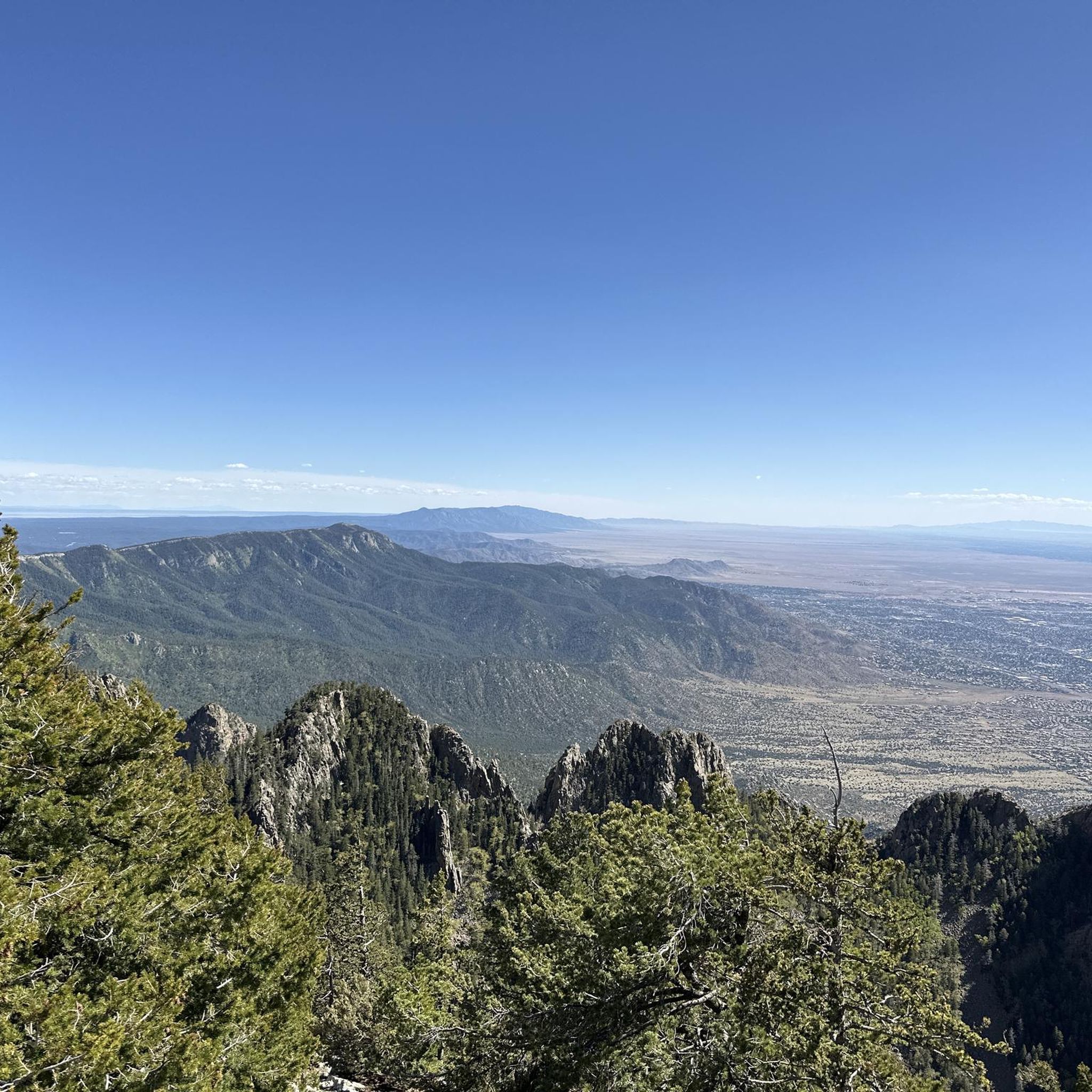
Road cycling in the Manzano Mountains offers diverse terrain characterized by significant elevation changes, transitioning from pinyon-juniper woodlands at lower altitudes to mixed conifer forests in the high country. The region features steep, rugged landscapes with numerous canyons and rocky outcrops, providing challenging climbs and rewarding descents. Roads like NM 337 and Forest Road 245 offer dedicated routes and climbs to high elevations, often with panoramic views of the Rio Grande Valley and Estancia Valley. This area provides a less congested riding experience compared to more urban areas, with varied scenery.
Best road cycling routes in the Manzano Mountains
- The most popular road cycling route is Pa-ako ruins loop from Tijeras, a 46.7 miles (75.2 km) trail that takes 3 hours 20 minutes to complete. This moderate route features varied terrain and significant elevation gain.
- Another top favourite among local road cyclists is Sunset View from Sandia Crest – Sandia Crest Overlook loop from Redbox, a difficult 59.8 miles (96.3 km) path. This route includes substantial climbs and offers expansive views from higher elevations.
- Local road cyclists also love the Cienega Canyon Pond loop from Sandia Park, a 36.0 miles (57.9 km) trail leading through diverse mountain landscapes, often completed in about 2 hours 40 minutes.
- Road cycling in the Manzano Mountains is defined by challenging climbs, forested sections, and panoramic vistas of the surrounding valleys. The network offers options for different ability levels, from moderate loops to difficult ascents.
- The routes in Manzano Mountains are highly rated by the komoot community with an average score of 4.5 stars from over 6 reviews. More than 587 road cyclists have used komoot to explore Manzano Mountains's varied terrain.
Last updated: July 10, 2026
68
riders
79.2km
03:29
850m
850m
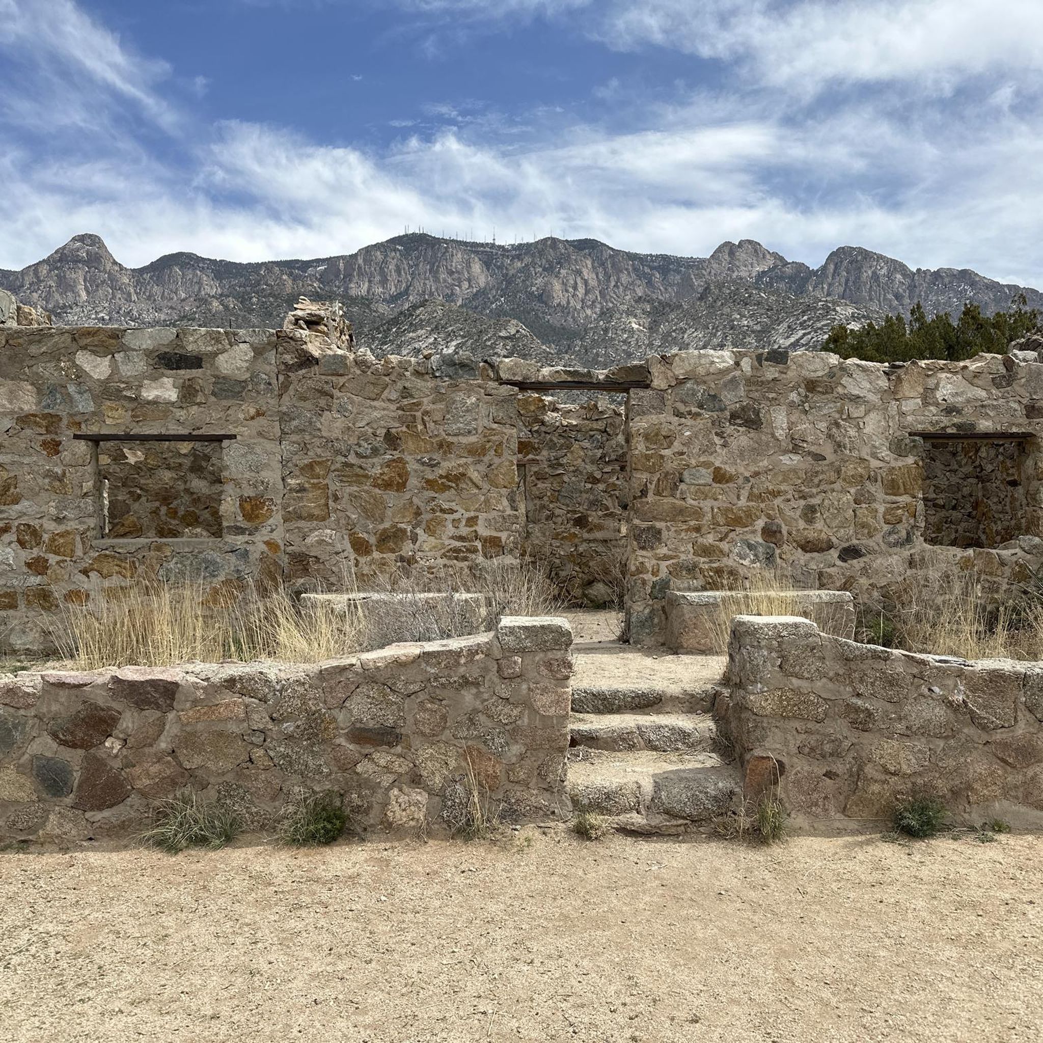
The Pa-ako ruins loop from Tunnel Canyon Trailhead offers a substantial road cycling journey through the varied terrain of the Cibola National Forest. You'll experience a mix of majestic mountains, expansive meadows, and dense forests, with the historical Paa-ko ruins adding a unique cultural dimension to your ride. This moderate route covers 49.2 miles (79.2 km) and includes 2797 feet (852 metres) of elevation gain, typically completed in about 3 hours and 29 minutes. Expect mostly well-paved roads, though some segments might be unpaved, requiring good fitness.
To plan your ride, head to the Tunnel Canyon Trailhead, which serves as the starting point for this popular loop. While the route is generally suitable for road cycling, it's wise to be prepared for potentially varied road conditions, including unpaved sections. This area is a favorite among local cyclists, so you'll likely share the road with others enjoying the scenic views.
What makes this route stand out is its connection to the ancient Paa-ko ruins, a significant Ancestral Pueblo site managed by the University of New Mexico. While the cycling route provides access to the general area, the historical context of a site occupied since the 1200s, with kivas and evidence of early metallurgy, enriches the experience. It's a challenging road cycling loop that combines natural beauty with a fascinating glimpse into New Mexico's past.
55
riders
57.9km
02:41
660m
660m
Moderate road ride. Good fitness required. Some segments of this route may be unpaved and difficult to ride.

Sign up for free
5.0
(1)
54
riders
51.8km
03:08
1,380m
1,380m
Hard road ride. Very good fitness required. Mostly well-paved surfaces and easy to ride.
50
riders
Hard road ride. Very good fitness required. Mostly well-paved surfaces and easy to ride.
46
riders
95.0km
05:09
1,920m
1,920m
This route, named "Sunset View from Sandia Crest – Sandia Crest Overlook loop from Copper Trailhead," is a truly demanding road cycling adventure, covering 59.0 miles (95.0 km) with an immense 6284 feet (1915 metres) of elevation gain. While the Komoot data lists it as a racebike route, be aware that the Copper Trailhead area is primarily known for multi-use trails, some of which are unpaved and more suitable for mountain biking. If you're an advanced cyclist seeking a monumental challenge and are prepared for varied terrain, the reward is the iconic climb to Sandia Crest, offering breathtaking panoramic views of Albuquerque and the Rio Grande Valley, especially at sunset. Expect a difficult 5 hours and 8 minutes of riding.
Starting from Copper Trailhead, this route would involve navigating terrain that might not be ideal for a typical road bike before joining the paved Sandia Crest National Scenic Byway (NM536). The ascent to Sandia Crest is a high-altitude climb, reaching 10,640 feet, so bring layers for the summit and descent, even in summer. While the Komoot route specifies Copper Trailhead, most road cyclists tackling Sandia Crest begin from towns like Tijeras or Cedar Crest to access the well-maintained paved byway.
The journey to Sandia Crest is a National Scenic Byway, transitioning through distinct vegetation zones from lower elevation scrub to dense ponderosa and aspen forests, which are particularly vibrant in the fall. Geological features like the "Great Unconformity" are visible along the way, adding to the unique character of this challenging ride. The summit provides a USFS visitor center and amenities, making it a popular destination for its spectacular sunset views over the metropolitan area.
4.0
(1)
42
riders
Moderate road ride. Good fitness required. Some segments of this route may be unpaved and difficult to ride.
5.0
(1)
24
riders
40.9km
02:02
570m
570m
Moderate road ride. Good fitness required. Mostly well-paved surfaces and easy to ride.
4.5
(2)
41
riders
Moderate road ride. Good fitness required. Some segments of this route may be unpaved and difficult to ride.
13
riders
22.5km
01:03
210m
210m
Easy road ride. Great for any fitness level. Mostly well-paved surfaces and easy to ride.
14
riders
This 43.9-mile (70.6 km) road cycling loop, starting from Piedra Lisa Canyon Trailhead Parking, offers a moderate challenge with 2756 feet (840 metres) of elevation gain, typically completed in about 3 hours and 14 minutes. You'll spend most of your time on the paved Tramway Boulevard NE, enjoying sweeping panoramic views of the Sandia Mountains and the desert landscape. Expect a ride filled with "endless hills" and significant climbs, making it a rewarding experience for cyclists seeking a good workout.
When planning your ride, be aware that while the route begins near Piedra Lisa Canyon, the canyon trails themselves are not suitable for road bikes. Stick to the dedicated bike paths and lanes along Tramway Boulevard. The area can get hot, so carry ample water and consider riding during cooler parts of the day or year. There are no specific permits mentioned for road cycling in this area.
This route stands out among Albuquerque's best road cycling routes in the foothills for its challenging elevation profile and stunning vistas. It provides a clear distinction between the paved, scenic road cycling opportunities and the rugged, unpaved terrain of the adjacent canyons. The ride offers a unique perspective of the city and surrounding natural beauty, making it a memorable outing for experienced cyclists.
Get access to more routes and recommendations from other explorers.
Sign up for free
Already have an account?
Our route recommendations are based on thousands of hikes, rides, and runs completed by other people on komoot.
Start today with a free account
Your next adventure awaits.
Login or Signup
Popular around Manzano Mountains

Grand Enchantment Trail — Slot canyons, spruce peaks & desert solitude

New Mexico Off-Road Runner

Historic Route 66 – curiosities, selfie spots and diners
Hiking in the Manzano Mountains
Running Trails in the Manzano Mountains
MTB Trails in the Manzano Mountains
Cycling in the Manzano Mountains

Gravel biking in the Manzano Mountains


Tips from the Community

I agree with Alex although I would add that because of it's popularity, road bike riders who enjoy riding at a faster pace, get out there early in the morning. By 10am there are a lot of people on a 6ft wide trail and some don't keep an eye out for cyclist. I find Fri and Sun mornings most agreeable for steady cruising
0
0

Climbing the Sandia Crest Scenic Byway near Albuquerque is a long, high-altitude ascent offering spectacular panoramic views over the Rio Grande Valley. Prepare for a sustained approximately 13.4 mile climb gaining nearly 4,800ft to the summit lookout at 10,678ft. The climb stays true at a gradient averaging around 5.5%, with maximum ramps near 9-10%, winding steadily upwards through beautiful pine and aspen forests. This iconic New Mexico climb is the hardest and highest.
1
0

Lynnwood Park in Albuquerque, NM, is a small neighborhood park with open green spaces, picnic tables, and a playground, making it a family-friendly destination. There is a paved walking path through the park, with nice views of the nearby Sandia Mountains.
0
0

The Rio Grande Nature Center State Park is a 38-acre urban wildlife preserve established in 1982, with about two-thirds dedicated to wildlife habitat. It features indoor and outdoor viewing areas, a native plant garden, a pollinator garden, and trails to the Rio Grande and Bosque. There are picnic tables along the trails, making it an ideal spot for nature lovers, and a great learning place for families with small children.
0
0

This multi-use trail stretches for 16 miles along the Rio Grande. You'll have numerous chances to enjoy views of the river and the nearby mountains. Stay alert, as you might encounter bikes and horses using the trail as well.
0
0
Sandia Foothills Open Space spans 2560 acres at the base of the Sandia Mountains. It is a desert wonderland with plenty of opportunities for hikers, runners and mountain bikers to enjoy the outdoors without heading too far from the city. There are multiple trails and steeply sloped hills to explore dotted with wildflowers, prickly pear cacti, and cane cholla amidst the juniper and piñon trees.
0
0

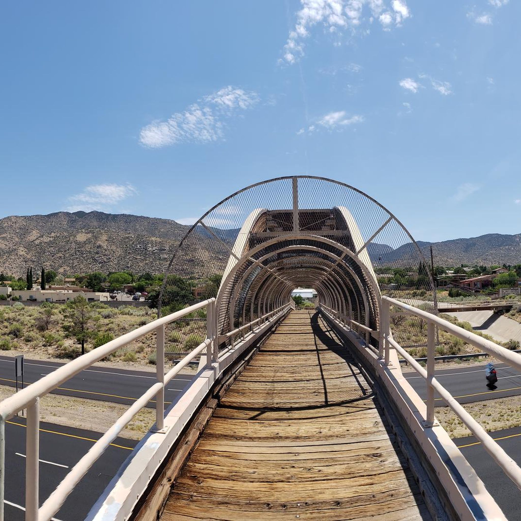
This bridge runs across busy Tramway Boulevard, giving you ready access to the nearby Tramway Trail. That bike path, in turn, offers great views of the lower Sandia Mountains.
0
0

The Paseo del Bosque Trail is Albuquerque's popular 16-mile multi-use trail, running through the Rio Grande's cottonwood bosque from the north to the south of the metro area. The trail is paved, uninterrupted by roads, and features parking and access points in a few locations. Along the way, visitors can enjoy public art at Tingley Beach, Central Avenue, and other locations, as well as the Rio Grande Nature Center and the National Hispanic Cultural Center. The trail is ideal for biking, walking, and birdwatching, offering a great escape with restrooms and picnic areas along the trail.
1
0
Frequently Asked Questions
How many road cycling routes are available in the Manzano Mountains?
There are over 20 road cycling routes in the Manzano Mountains, offering a range of experiences from moderate loops to challenging ascents. These routes are highly rated by the komoot community, with an average score of 4.5 stars.
What is the typical terrain and elevation gain for road cycling in the Manzano Mountains?
The Manzano Mountains offer diverse terrain with significant elevation changes. You'll find routes transitioning from pinyon-juniper woodlands at lower altitudes to mixed conifer forests in the high country. Expect challenging climbs and rewarding descents, often with panoramic views. For example, the difficult route Sunset View from Sandia Crest – Sandia Crest Overlook loop from Redbox features nearly 1900 meters of elevation gain over 96 kilometers.
Are there road cycling routes suitable for different skill levels?
Yes, the Manzano Mountains offer routes for various abilities. While the region is known for challenging climbs, there are also moderate options. Out of the 20 available routes, 12 are classified as moderate and 6 as difficult, ensuring options for both experienced cyclists and those looking for a less intense ride.
What scenic viewpoints can I expect to see while road cycling in the Manzano Mountains?
Road cycling in the Manzano Mountains often provides panoramic vistas of the surrounding valleys and mountain ranges. Notable viewpoints include the Sandia Crest Overlook, which offers expansive views of the Rio Grande Valley to the west and the plains to the east. Forest Road 245 to Capilla Peak also provides stunning views of the Estancia Valley.
Are there any historical or natural attractions along the road cycling routes?
Yes, the Manzano Mountains are rich in natural and historical significance. You might encounter remnants of historic apple orchards, which gave the mountains their name. The region is also part of the Rio Grande rift, showcasing unique geological features. While cycling, you could pass by the Kiwanis Cabin or the Sandia Peak Aerial Tramway.
What is the best time of year for road cycling in the Manzano Mountains?
The diverse ecosystems of the Manzano Mountains support various activities throughout the year. While specific road cycling conditions vary, spring and fall offer pleasant temperatures and beautiful scenery, with fall being particularly renowned for the vibrant foliage in areas like Fourth of July Canyon. Winter months can bring snow, making cross-country skiing or snowshoeing more suitable on some trails.
Are dogs allowed on road cycling routes in the Manzano Mountains?
The Manzano Mountains are generally dog-friendly, especially in areas like the Manzano Mountains State Park and the Manzano Wilderness. However, specific rules may apply to different trails or protected areas. It's always best to check local regulations for the particular route you plan to cycle to ensure dogs are permitted and to understand any leash requirements.
What kind of wildlife might I encounter while cycling in the Manzano Mountains?
The diverse ecosystems of the Manzano Mountains support abundant wildlife. Cyclists might spot mule deer, wild turkeys, and various bird species. The area is particularly noted for excellent birdwatching, serving as a raptor flyway during spring and fall migrations. Keep an eye out for black bears, especially in more remote forested sections.
Are the road cycling routes in the Manzano Mountains primarily paved?
Many of the road cycling opportunities in the Manzano Mountains utilize paved state roads and forest roads. For instance, NM 337 (New Mexico State Bike Route 12) offers a dedicated paved route. Forest Road 245 to Capilla Peak starts paved before transitioning to a well-maintained, lightly trafficked road that is generally suitable for road bikes, even in its unpaved sections.
Is parking available for road cyclists in the Manzano Mountains?
Yes, parking is generally available at various trailheads and access points for road cycling routes. For example, routes like Paseo del Bosque Trail loop from Sandia Peak Aerial Tramway Parking indicate parking facilities. Specific campgrounds like Fourth of July Campground and Red Canyon Campground also offer parking options.
What do other road cyclists enjoy the most about road cycling in the Manzano Mountains?
The Manzano Mountains are highly rated by the komoot community, with an average score of 4.5 stars from over 6 reviews. Reviewers often praise the challenging climbs, the less congested riding experience compared to urban areas, and the stunning panoramic views of the surrounding valleys and mountain ranges.
Are there any permits required for road cycling in the Manzano Mountains?
Generally, no specific permits are required for road cycling on public roads and designated routes within the Manzano Mountains. However, if you plan to access certain wilderness areas or private lands, it's advisable to check with the local authorities or land management agencies for any specific regulations or permits that might apply.
Can I reach the Manzano Mountains by public transport for road cycling?
Public transportation options directly into the heart of the Manzano Mountains for road cycling are limited. Most cyclists typically access the routes by car, parking at designated trailheads or starting points. Some routes, like the Pa-ako ruins loop from Tijeras, start from towns that might have limited public transport connections to larger cities.
Most popular routes in the Manzano Mountains
Most popular attractions in the Manzano Mountains

Get inspired with the komoot mobile app


