The best traffic-free bike rides around Mountsorrel
4.6
(188)
2,366
riders
9
rides
No traffic touring cycling routes around Mountsorrel traverse a landscape characterized by scenic reservoirs, expansive country parks, and the gentle floodplains of the Soar Valley. The region offers a mix of flat, accessible paths and routes with moderate elevation changes, suitable for various cycling preferences. Cyclists can explore areas featuring diverse habitats, from wetland marshes to ancient woodlands and open countryside. This varied terrain provides a range of experiences for those seeking dedicated cycling routes without vehicular traffic.
Best no…
Last updated: July 1, 2026
12
riders
17.1km
01:11
150m
140m
Easy bike ride. Great for any fitness level. Mostly paved surfaces. Suitable for all skill levels.
14
riders
26.1km
01:32
170m
170m
Moderate bike ride. Good fitness required. Mostly paved surfaces. Suitable for all skill levels.

Sign up for free
5.0
(3)
18
riders
17.3km
01:04
150m
150m
Moderate bike ride. Good fitness required. Mostly paved surfaces. Suitable for all skill levels.
10
riders
12.1km
00:44
90m
90m
Easy bike ride. Great for any fitness level. Mostly paved surfaces. Suitable for all skill levels.
5
riders
16.4km
00:59
120m
120m
Easy bike ride. Great for any fitness level. Mostly paved surfaces. Suitable for all skill levels.
Get access to more routes and recommendations from other explorers.
Sign up for free
Already have an account?
Our route recommendations are based on thousands of hikes, rides, and runs completed by other people on komoot.
Start today with a free account
Your next adventure awaits.
Login or Signup
Popular around Mountsorrel
Other adventures around Mountsorrel

Tips from the Community

This place offers a beautiful outdoor seating area with delicious meals and beverages, plus safe for cyclists
0
0

Cycling is only permitted on the one route through the park, which gets busy with walkers, take it slow in the park. Cafe and toilets in the middle.
2
0

In September 1867, 180 acres of land was purchased for a cost of £24,000. Most of the land required for the reservoir, dam and waterworks belonged to the Bradgate Estate. Lord Stamford insisted that a stone wall be built around the boundary to separate the deer park from the reservoir, instead of the proposed iron railings. This wall, 1,500 yards long was eventually built at a cost of 8s 10d per yard. Joseph Reeves, Head Gamekeeper, outside his house. Some of the Bradgate Estate land was part of the deer park, but most was farmland let out on very long leases. One farmer, Joseph Allen, lost virtually all his farm. Two members of the Matts family had theirs considerably reduced in size. The Gamekeeper’s house and land, together with a nearby bridge, were also in the area to be flooded. The house, together with its stables and outhouses, were demolished and the bricks sold. Part of the footpath between Anstey and Hallgates was submerged, as was the site of the old rabbit warren (or conery).
3
0
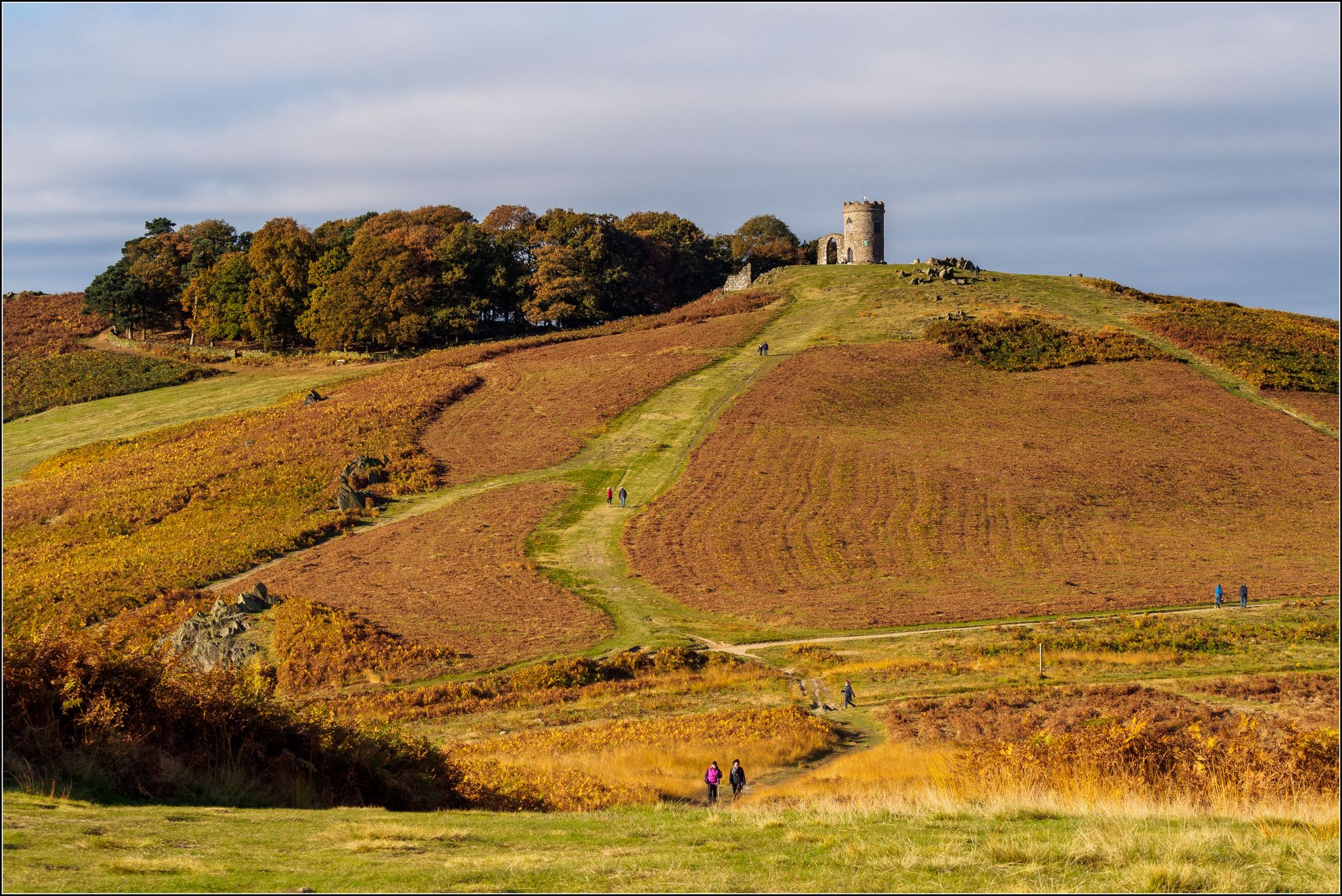
Bradgate Park was first enclosed as a deer park (for hunting) in the 12th Century. Herds of Red and Fallow Deer still roam freely across the Park's 800 acres today.The Park is designated as a Site of Special Scientific Interest for its importance as a wildlife habitat and its geological interest - the 600 million year old Precambrian rocks here are some of the oldest in England. Bradgate House, built around the year 1500, was one of the first unfortified, brick-built country houses in the country and was the childhood home of Lady Jane Grey and played an important role in the English Civil War. Abandoned in the 18th Century, the house is now an evocative ruin set in a landscape that has changed little since the house's heyday.
4
0

This is the Great Pit in Swithland Wood, a site shaped by centuries of slate quarrying, with origins tracing back to Roman times. The quarry was first officially recorded in the 1300s, with activity continuing until the 19th century. Due to the presence of deep water and sheer vertical walls, the quarry is extremely hazardous and completely closed to public access.
2
0


Frequently Asked Questions
How many no-traffic touring cycling routes are available around Mountsorrel?
There are 9 dedicated no-traffic touring cycling routes around Mountsorrel featured in this guide. These routes offer a variety of experiences, with 6 classified as easy and 3 as moderate, ensuring options for different fitness levels.
What kind of terrain can I expect on these no-traffic touring cycling routes?
The no-traffic touring cycling routes around Mountsorrel generally feature mostly paved surfaces, making them suitable for touring bikes. While many routes are relatively flat, some moderate options include gentle ascents, offering a pleasant challenge without being overly strenuous. The area is known for its 'rolling hills' as part of the broader East Midlands cycling landscape.
Are there any circular no-traffic touring cycling routes?
Yes, many of the no-traffic touring cycling routes around Mountsorrel are circular. For example, you can enjoy the Swithland Reservoir – Swithland Wood loop from Charnwood, which is an easy 17 km ride, or the slightly longer Rothley Railway Station – Cropston Reservoir loop from Charnwood, a moderate 25.5 km option.
What natural features or landmarks can I see along these routes?
The no-traffic touring cycling routes often pass by significant natural features and landmarks. You can cycle past the scenic Swithland Reservoir, enjoy the tranquility of Watermead Country Park, or explore areas near Cropston Reservoir. While not directly on all cycling paths, the wider area also boasts Beacon Hill Summit for panoramic views and the historic Old John Tower, Bradgate Park.
Are the no-traffic touring cycling routes around Mountsorrel suitable for families?
Yes, many of the no-traffic touring cycling routes are suitable for families, especially the 6 easy routes available. These often follow quiet paths through parks like Watermead Country Park or around reservoirs, providing a safe and enjoyable environment away from vehicle traffic. The relatively gentle elevation profiles make them accessible for various ages and abilities.
What do other touring cyclists enjoy most about cycling in Mountsorrel?
The area is highly rated by the komoot community, with an average score of 4.6 stars from 180 ratings. Reviewers often praise the peaceful, traffic-free nature of the routes, the beautiful reservoir views, and the opportunity to explore charming Leicestershire countryside and villages.
Where can I find parking for these no-traffic cycling routes?
Parking is generally available at key access points for popular areas. For routes around Swithland Reservoir, there are often designated parking areas. Similarly, if starting from locations like Rothley Railway Station, parking facilities are usually present. It's advisable to check specific starting points for detailed parking information.
Are there any routes that follow canal towpaths or old railway lines?
While the guide focuses on general no-traffic touring routes, the region does have connections to heritage infrastructure. The Great Central Railway runs through Mountsorrel, and while not a direct cycling path, the area's history with railways and the Soar Valley floodplain system suggests potential for quiet paths and trails that might incorporate elements of former industrial routes or canal-side cycling, such as those found around Watermead Country Park.
What is the best time of year to cycle these no-traffic routes?
The best time to cycle these no-traffic routes is typically from spring through early autumn (April to October). During these months, the weather is generally milder, and the natural landscapes, such as Swithland Wood and Watermead Country Park, are at their most vibrant. Winter cycling is possible, but conditions may be colder and paths potentially muddier in some sections.
Can I access these routes using public transport?
Mountsorrel and surrounding villages like Rothley and Barrow-upon-Soar have public transport links, including bus services. Rothley also has a heritage railway station. While direct access to every route start point by public transport might vary, it is generally possible to reach the vicinity of many routes, especially those starting from or passing through villages.
Are there any cafes or pubs along the no-traffic touring cycling routes?
Yes, the area around Mountsorrel is dotted with charming villages and market towns. Many routes pass through or near places where you can find cafes, pubs, and other amenities for refreshments. For example, routes around Swithland Reservoir or those connecting to villages like Barrow-upon-Soar will offer opportunities to stop for a break and a bite to eat.
What is the longest no-traffic touring cycling route in this guide?
The longest no-traffic touring cycling route featured in this guide is the Rothley Railway Station – Cropston Reservoir loop from Charnwood, which covers a distance of 25.5 km. This moderate route offers a good balance of distance and scenic views.
Most popular routes around Mountsorrel
Most popular attractions around Mountsorrel

Get inspired with the komoot mobile app


Explore more
Browse the best Cycling routes in other regions.
