The best hikes from bus stations around Hollingbourne
4.5
(521)
3,638
hikers
16
hikes
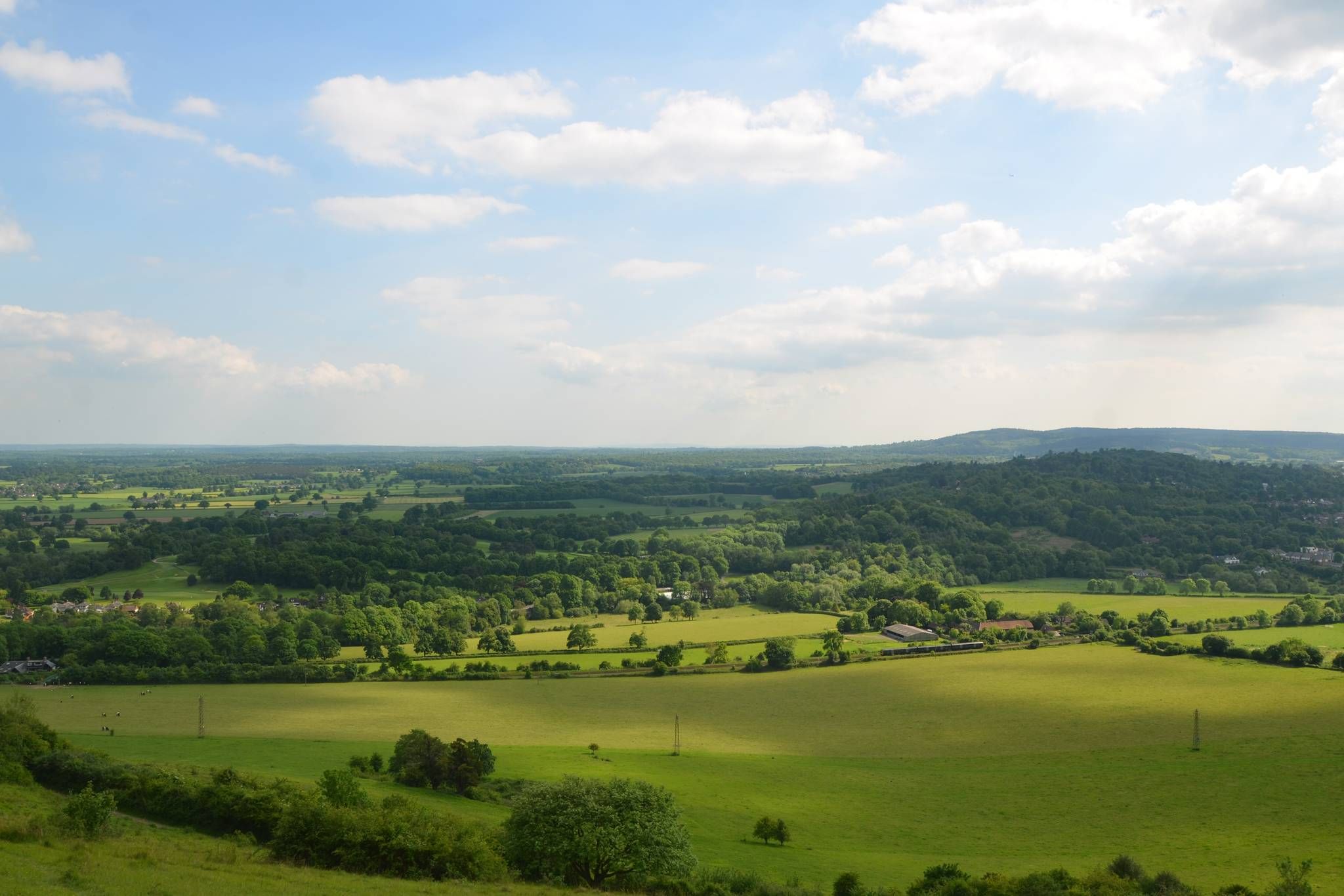
Bus station hiking trails around Hollingbourne are situated in Kent, England, on the southward slope of the North Downs. The region features diverse landscapes, including chalk grassland, ancient woodlands, and green fields, with the North Downs Way National Trail passing through. Hollingbourne Creek meanders through the village, contributing to the area's natural setting.
Best bus station hiking trails around Hollingbourne
- The most popular bus station hiking route is The Mill Pub – River Len loop from Hollingbourne, a 4.5…
Last updated: July 1, 2026
4.1
(22)
60
hikers
7.29km
01:56
70m
70m
Easy hike. Great for any fitness level. Easily-accessible paths. Suitable for all skill levels.
5
hikers
4.38km
01:16
110m
110m
Easy hike. Great for any fitness level. Easily-accessible paths. Suitable for all skill levels.

Sign up for free
5.0
(1)
3
hikers
16.2km
04:21
200m
200m
Moderate hike. Good fitness required. Easily-accessible paths. Suitable for all skill levels.
3.5
(2)
7
hikers
9.40km
02:40
210m
210m
Moderate hike. Good fitness required. Easily-accessible paths. Suitable for all skill levels.
1
hikers
12.2km
03:17
150m
150m
Moderate hike. Good fitness required. Easily-accessible paths. Suitable for all skill levels.
Get access to more routes and recommendations from other explorers.
Sign up for free
Already have an account?
Our route recommendations are based on thousands of hikes, rides, and runs completed by other people on komoot.
Start today with a free account
Your next adventure awaits.
Login or Signup
Popular around Hollingbourne
Other adventures around Hollingbourne

Tips from the Community

There's a working tap here for you. There's also so overhead cover if it's raining, but it's no good for afternoon shade. Head over the road for that.
0
0


The Pilgrims way is an excellent long distance off road route, however due to it being a bronze age track way over a couple of thousand years some parts of it have become hollow ways and are essentially impassible or very heavy going in wet conditions, at worst it's only traversable by mountain bike in wet periods.
1
0

The Dirty habbit at the foot of the climb provides refreshing hill accompaniments
1
0

This is NOT a path for the faint hearted! It's rough, very bumpy in parts, slippery when wet. I ride a hybrid - and it's not a path I would take again. It needs a specialist mountain bike.
0
0

One of my favourite climbs in the area (alongside Coldblow Land further west). From corner of Pilgrims Way it is 1km to the top. Becomes prgressivley steeper, the final ramp is around 20% gradient.
0
0
This footpath follows the southern shore of Great Water and offers wonderful, free to access views of Leeds Castle. The castle is a grade 1 listed building. It's been here since 857 and has been the favourite residence of several monarchs. The present castle is mostly 19th century. It was left to the public in 1976 and open for visits.
0
0

Brutal, brutal climb. Took the life out of me once you're 20%+. To make things worse, if you're wanting to stop, its difficult to do so as cars are coming up and down the road. I didn't stop but this isn't for the weak. However, it's largely 5-7 miles of descending afterwards and the climb is only extremely difficult for a short period.
0
0
Frequently Asked Questions
How many bus station hiking trails are available in Hollingbourne?
There are 16 hiking routes directly accessible from bus stations in Hollingbourne. These range from easy strolls to more challenging moderate hikes, offering diverse experiences for all skill levels.
What types of landscapes can I expect on hikes from Hollingbourne bus stations?
Hollingbourne is nestled on the North Downs, so you can expect a mix of rolling hills, ancient woodlands, and chalk grassland. Many routes offer expansive views across the Kent countryside. You'll also find paths along the tranquil Hollingbourne Creek and through green fields.
Are there any easy, shorter walks suitable for beginners or families from the bus station?
Yes, there are several easy routes. For a pleasant, shorter option, consider the Pilgrims Way – Hollingbourne Manor loop from Hollingbourne, which is just over 4 km. It offers a taste of the historic Pilgrim's Way without being too strenuous.
Can I find circular hiking routes starting and ending at a bus station in Hollingbourne?
Absolutely. Most of the routes from Hollingbourne's bus stations are circular, designed for convenience. For example, the The Mill Pub – River Len loop from Hollingbourne is an easy circular route that takes you along the River Len and past local landmarks.
What historical sites or attractions can I see on a bus station hike?
Many routes incorporate historical elements. You might encounter sections of the ancient Pilgrim's Way or pass by historic buildings. Some trails offer views of the famous Leeds Castle, or you could explore the ruins of Thurnham Castle Ruins. The village of Hollingbourne itself has a 12th-century church.
Are there any moderate or longer hikes for more experienced walkers?
Yes, for those seeking a longer challenge, routes like the Hollingbourne Manor – Pilgrims' Way loop from Hollingbourne cover over 12 km and offer more elevation gain. Another moderate option is the The Mill Pub – Hollingbourne Manor loop from Hollingbourne, which is over 9 km.
What is the best time of year to go hiking from Hollingbourne bus stations?
Hollingbourne is beautiful year-round. Spring (April-May) is particularly stunning when the ancient woodlands are carpeted with bluebells. Autumn offers vibrant foliage, while summer provides pleasant conditions for longer walks. Even in winter, the trails offer crisp air and unique views, though some paths might be muddy.
Are the bus station hiking trails in Hollingbourne dog-friendly?
Many of the trails in Hollingbourne are dog-friendly, especially those that traverse public footpaths and open countryside. However, always keep dogs under control, particularly near livestock, and be mindful of local signage, especially in nature reserves or private land sections. It's advisable to keep dogs on a lead in areas with wildlife or grazing animals.
What do other hikers enjoy most about the trails around Hollingbourne?
The area is highly rated by the komoot community, with an average score of 4.5 stars from over 480 ratings. Reviewers often praise the diverse landscapes, the well-maintained paths, and the stunning views from the North Downs. The convenience of starting directly from the bus station is also frequently highlighted.
Are there any viewpoints or scenic spots along the bus station routes?
Absolutely. The North Downs Way, which many routes follow, offers expansive panoramic views. Hollingbourne Downs, a Site of Special Scientific Interest, provides magnificent vistas over the surrounding countryside. You can also find scenic spots with views of Leeds Castle from Great Water Footpath.
Are there any pubs or places to eat near the bus station hiking routes?
Hollingbourne village itself has local pubs that are often conveniently located near the start or end points of many routes, making them ideal for refreshments after your hike. Some routes, like the The Mill Pub – River Len loop from Hollingbourne, are even named after local establishments, indicating their proximity.
What is the longest bus station hike available in Hollingbourne?
For a longer adventure, consider the Daisy Field View in Kent Downs – Hollingbourne Manor loop from Leeds. This moderate route spans nearly 15 km, offering an extensive exploration of the Kent Downs and surrounding areas.
Most popular attractions around Hollingbourne

Get inspired with the komoot mobile app


Explore more
Browse the best Hikes in other regions.
