The best traffic-free bike rides around Kruibeke
4.4
(170)
1,760
riders
48
rides
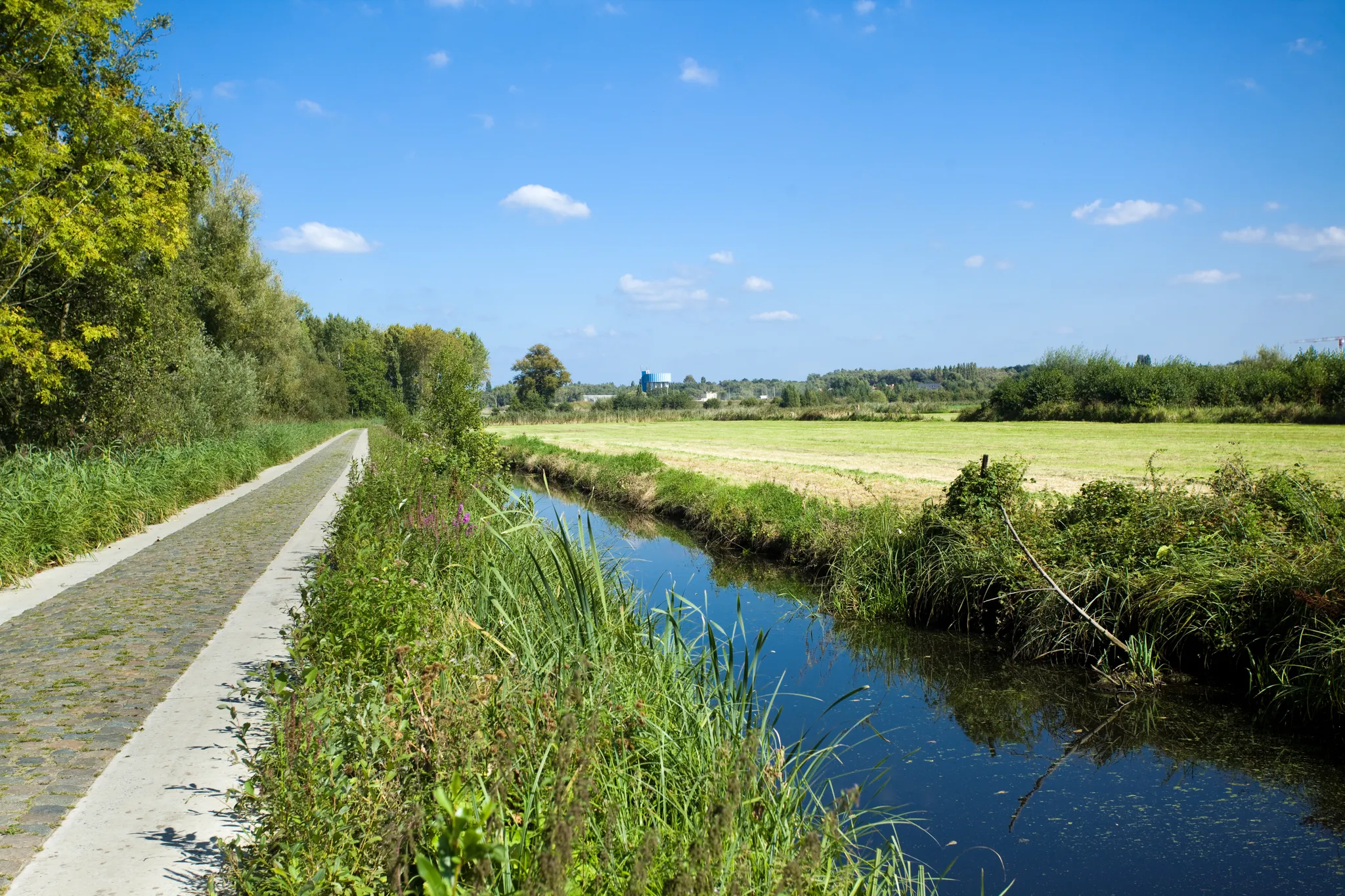
Gravel biking around Kruibeke is characterized by the expansive and ecologically rich Polders van Kruibeke, Flanders' largest flood plain. This area features diverse ecosystems including mudflats, salt marshes, and swampy alder forests, shaped by the tidal nature of the Scheldt river. The terrain is predominantly flat and varied, offering dedicated infrastructure for cyclists. Historical levees also delineate different ecological zones, providing varied surfaces for exploration.
Best no traffic gravel bike trails around Kruibeke
- The most popular no traffic gravel bike…
Last updated: August 10, 2026
4.0
(1)
20
riders
95.7km
05:23
110m
110m
Hard gravel ride. Very good fitness required. Mostly paved surfaces. Suitable for all skill levels.
4.0
(4)
59
riders
Moderate gravel ride. Good fitness required. Mostly paved surfaces. Suitable for all skill levels.

Sign up for free
4.7
(11)
30
riders
33.3km
02:06
50m
50m
Moderate gravel ride. Good fitness required. Mostly paved surfaces. Suitable for all skill levels.
5.0
(1)
13
riders
46.7km
02:47
70m
70m
Moderate gravel ride. Good fitness required. Mostly paved surfaces. Suitable for all skill levels.
7
riders
131km
07:31
200m
200m
Hard gravel ride. Very good fitness required. Mostly paved surfaces. Suitable for all skill levels.
Get access to more routes and recommendations from other explorers.
Sign up for free
Already have an account?
Our route recommendations are based on thousands of hikes, rides, and runs completed by other people on komoot.
Start today with a free account
Your next adventure awaits.
Login or Signup


Other adventures around Kruibeke

Tips from the Community

The creek area of Saleghem is more than the sum of its parts. The nature reserve consists of the Grote Saleghemgeul on one side, and the Sint-Jakobsgat and the Kieldrechtse Watergang on the other. This triumvirate of water creeks then flows into the Grote Geule in Kieldrecht. Each separately is beautiful, yes. But together they are magical. The succession of gently sloping banks, grassland and hay, rare birds and colourful flowers, rustling reeds and melancholic willows: it silences a person. It inspires awe for the magic of nature. And everyone can enjoy it – even wheelchair users, because there is a special wheelchair walk around the creek lakes. This is what waasland.be writes... and there is nothing to contradict it.
2
0
The Molenbeek forms part of the northern border of the municipality of Sint-Niklaas with the municipalities of Sint-Gillis-Waas and Stekene. Hydrographically, the Molenbeek belongs to the basin of the Gentse Kanalen. Previously, the Molenbeek originated in the center of Sint-Niklaas, at the site where the Romain De Vidtspark is now located. Nowadays, the stream flows through the entire Sint-Niklaas center from south to north in culverts, to re-emerge on the surface at the edge of Belsele and then flow through Sinaai until it flows into the Stekense Vaart. From that confluence, a path follows the banks of the stream for a considerable distance.
2
0
The wooden arch bridge over the Stekense Vaart, named after Frans Coppens, was receiver-clerk in the municipality of Sinaai for almost a quarter of a century. He played an important role in "de Groote Watering van Sinay", the name given to the project launched by the Boerenbond in 1926. This project was initiated after repeated floods and aimed to make the polders 'dry'. The construction of the pumping station near Hondsnest was one of the first achievements within this project. During the Second World War, the unemployed were employed to clean or widen ditches. Under the impetus of dike reeve Jozef "meester" Maes and... receiver-clerk Frans Coppens (!), major reclamation works were carried out in the 60s, continuing into the following decades. Thus, Hondsnest got a new pumping station in 1975. In the meantime, the watering area had been converted into a polder, pursuant to the polder law of June 3, 1957. source: info file "Polder Daknam-Sinaai"
2
0

On this segment, you will get to know the Stropersbos. A bench awaits you at the heathland restoration area. About the Stropersbos: the Stropersbos is a must-see natural gem with its stately avenues, valuable alder swamp forests, open spaces with heathland, and its large grazers! Together with the adjacent green areas, the Stropersbos forms one of the largest forest and nature complexes in East Flanders. Numerous walking and cycling opportunities allow visitors to discover the Stropersbos.
5
1
On Friday, April 5, 1867, the Spletterenbrug was officially opened. Between Moerbeke and Lokeren, trains stopped in Daknam and Eksaarde. In Moerbeke, travelers could transfer to railway line 77 towards Zelzate or towards Sint-Gillis-Waas. That the intention was to one day double the 9-kilometer railway line to two tracks is still visible on the Spletterenbrug. Both bridge abutments are indeed twice as wide as the bridge deck itself. It never came to that. On the contrary. The railway line suffered during both world wars, causing traffic to be suspended for months. For example, retreating German soldiers blew up the bridge at the end of World War I. Less than a year after the armistice, in September 1919, the line was already restored and trains could run on the route again. In 1940, the Belgian army, in turn, tried to slow down the German advance by destroying the bridge. The bridge was repaired again. In 1971, the last train chugged along the route. After more than a century of train traffic, the tracks were dismantled and the route was redeveloped as a cycling and walking path from Lokeren to Moerbeke. The Spletterenbrug itself was preserved and restored in 2017. The seven layers of paint were removed, and the bridge regained its original, dark gray color. Source: industriecultuur.be
4
0

single track that requires concentration
0
1
beautiful view over the Polders
1
0

Very well-developed cycle path
0
0
Frequently Asked Questions
What makes the gravel bike trails around Kruibeke traffic-free?
The trails primarily traverse the expansive Polders van Kruibeke, Flanders' largest flood plain. This vast nature reserve is specifically designed for recreational activities like cycling and walking, keeping motorized traffic out to preserve its natural beauty and ensure a peaceful experience. The routes often follow dedicated paths, former levees, and quiet country roads within this protected area.
How many no-traffic gravel bike trails are available in the Kruibeke area?
There are over 30 dedicated no-traffic gravel bike trails around Kruibeke, offering a wide range of distances and difficulty levels. This includes routes suitable for easy rides, as well as more challenging options for experienced gravel bikers.
What kind of terrain can I expect on the gravel trails in Kruibeke?
The terrain in Kruibeke is generally flat, making it accessible for many riders. You'll encounter a mix of gravel paths, compacted earth, and some paved sections, especially within the Polders van Kruibeke. The dynamic tidal nature of the Polders means some sections might be softer or muddier depending on recent weather and water levels, adding to the gravel biking experience.
Are there any family-friendly gravel routes in Kruibeke?
Yes, the flat and traffic-free nature of many trails in the Polders van Kruibeke makes them ideal for families. While specific 'family-friendly' routes aren't explicitly categorized, routes with 'easy' or 'moderate' difficulty grades and shorter distances are generally suitable. Always check the route details for elevation and surface conditions to ensure it matches your family's capabilities.
What natural features can I see while gravel biking in Kruibeke?
The Polders van Kruibeke are a highlight, offering diverse ecosystems including mudflats, salt marshes, and swampy alder forests. You'll encounter abundant wildlife, such as various bird species, roe deer, beavers, and otters. The dynamic interaction with the Scheldt river and the preserved former levees of Barbierbeek also create ever-changing and scenic landscapes.
Are there any historical or cultural landmarks along the gravel trails?
While the focus is on natural landscapes, you can find interesting points. For instance, unique artworks like the zigzagging arches of rust-brown corten steel by Gijs Van Vaerenbergh are integrated into the Polders landscape. Additionally, the nearby village of Bazel features the neo-Gothic Wissekerke Castle, offering a glimpse into 19th-century nobility. You might also pass by the Confluence of the Dijle and Nete = Rupel, a significant natural monument.
Where can I park my car when visiting the gravel trails in Kruibeke?
Kruibeke offers various parking options, especially near the main access points to the Polders van Kruibeke. Look for designated parking areas often found at the entrances to nature reserves or near visitor centers. It's advisable to check local signage upon arrival for the most current parking information.
What is the best time of year for gravel biking in Kruibeke?
Spring and autumn are generally considered the best seasons for gravel biking in Kruibeke. The weather is typically mild, and the natural landscapes of the Polders are particularly vibrant. Summer can also be pleasant, but be mindful of potential heat. Winter rides are possible, but some unpaved sections might be muddy or wet, especially after heavy rainfall, due to the tidal nature of the Polders.
Can I bring my dog on the gravel bike trails?
Many nature areas in Belgium, including parts of the Polders van Kruibeke, allow dogs but often require them to be kept on a leash to protect wildlife and ensure the safety of other visitors. Always check specific signage at trailheads or local regulations for the area you plan to visit with your dog.
What do other gravel bikers enjoy most about the trails in Kruibeke?
The komoot community highly rates the gravel biking experience in Kruibeke, with an average score of 4.5 stars. Reviewers often praise the tranquility and traffic-free nature of the routes, the stunning natural beauty of the Polders van Kruibeke, and the diverse wildlife encounters. The flat terrain also makes it enjoyable for various fitness levels.
Are there any long-distance gravel routes starting from Kruibeke?
Yes, Kruibeke serves as a great starting point for longer gravel adventures. For example, the Scheldt and Rupel Brick Route offers a challenging 70 km ride, while the Great Saleghem Channel – Stekense Canal loop from Melsele extends to over 96 km, providing extensive exploration opportunities without traffic.
Are there cafes or amenities along the gravel routes in Kruibeke?
While the routes themselves are often through natural, traffic-free areas, you'll find cafes, restaurants, and other amenities in the villages and towns surrounding the Polders van Kruibeke, such as Kruibeke itself or nearby Bazel. It's a good idea to plan your stops in advance, especially on longer rides, as services might not be directly on the trails.
Most popular attractions around Kruibeke

Get inspired with the komoot mobile app


Explore more
Browse the best Gravel rides in other regions.
