The best traffic-free bike rides around Vo'
4.6
(311)
8,894
riders
20
rides
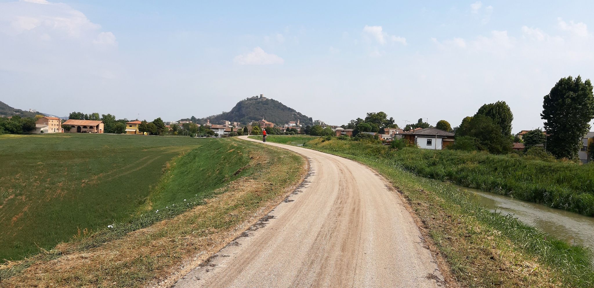
No traffic road cycling routes around Vo' feature a landscape characterized by varied terrain, including river paths and gentle climbs, connecting various villages. The region offers opportunities for road cyclists to explore rural settings away from vehicular traffic. Routes often incorporate scenic loops and provide a mix of flat sections and moderate ascents.
Best no traffic road cycling routes around Vo'
- The most popular no traffic road cycling route is Legnago Tower – Bussè River Cycle Path loop from Campiglia…
Last updated: June 30, 2026
5.0
(3)
17
riders
44.1km
02:13
460m
460m
Moderate road ride. Good fitness required. Some segments of this route may be unpaved and difficult to ride.
19
riders
Moderate road ride. Great for any fitness level. Some segments of this route may be unpaved and difficult to ride.

Sign up for free
5.0
(4)
18
riders
61.9km
02:55
650m
650m
Moderate road ride. Good fitness required. Some segments of this route may be unpaved and difficult to ride.
13
riders
38.3km
01:46
300m
300m
Moderate road ride. Good fitness required. Mostly well-paved surfaces and easy to ride.
13
riders
Easy road ride. Great for any fitness level. Mostly well-paved surfaces and easy to ride.
Get access to more routes and recommendations from other explorers.
Sign up for free
Already have an account?
Our route recommendations are based on thousands of hikes, rides, and runs completed by other people on komoot.
Start today with a free account
Your next adventure awaits.
Login or Signup


Other adventures around Vo'

Tips from the Community

Beautiful cycle path
1
0

A very beautiful and quiet cycling route leading north out of the hills. Densely wooded – perfect for rides on hot days.
1
0

ice cream shop with satispay
0
0

Descending from the Berici hills towards Nanto you can enjoy a splendid view of the Venetian plain and the pre-Alps.
1
0

Interesting tour for the new cycle path
1
0

The Bacchiglione is the longest resurgence river in the Veneto and perhaps in Italy (118 km) which originates from the natural area of the homonymous Risorgive, located just north of Vicenza in the municipality of Dueville, a beautiful and idyllic area, worth visiting, where the river originates, continuously drawing water throughout the year from the upper Vicenza plain and the Altopiano dei 7 Comuni and from where a route can start along the banks that reaches the southern lagoon of Venice, where it flows into the Brenta river near Chioggia, without particular differences in height (about 60 m), crossing the cities of Vicenza and Padua. It is an almost entirely navigable river and at the time of the Serenissima it was the main means of transporting goods between Venice, Padua and Vicenza via rafts, which were pulled by oxen along the banks as they went up the current, also thanks to the help of locks that can still be admired along its route. It interfaces with many cycling routes of considerable interest such as the Anello dei Berici, the Treviso/Ostiglia cycle route, the Anello degli Euganei and many others that allow you to discover the vast territories of central Veneto characterised by the presence of the Berici Mountains and the Euganean Hills (both candidates for recognition as a Unesco MAB Biosphere). For much of its route, the Bacchiglione itinerary is in fact one of the most significant sections of the Monaco/Venice cycle route, which after descending from the Brenner Pass and running through the Adige valley, turns east to Verona to reach the Bacchiglione river in Vicenza, which it will then follow to the sea. Following the course of the Bacchiglione it is possible to intercept 3 of the 9 places in the Veneto region included in the UNESCO World Heritage List, namely “Vicenza and the Palladian Villas in the Veneto”, “The 14th Century Fresco Cycles in Padua”, “Venice and its Lagoon”. Given the considerable length of the route, it is possible to reach primary railway stations in several points that allow for an easy return without having to resort to cars or other motorized means. The stations of Vicenza and Padua are a short distance from the route but with modest effort and following well-marked and passable cycle routes you can also reach the station of Grisignano di Zocco following the Treviso/Ostiglia or Grimana cycle paths.
1
0

Pozzolo, in the province of Vicenza, is a quiet village surrounded by nature, ideal for relaxing walks among the hills and picturesque views of the Venetian countryside.
1
0
Frequently Asked Questions
How many no traffic road cycling routes are available around Vo'?
There are over 20 dedicated no traffic road cycling routes around Vo' listed in this guide, offering a variety of options for cyclists looking to avoid cars.
What are the difficulty levels of the no traffic road cycling routes around Vo'?
The routes around Vo' cater to various skill levels. You'll find 7 easy routes perfect for a relaxed ride, and 13 moderate routes that offer a bit more challenge. There are no difficult routes listed in this selection, making it accessible for many cyclists.
Are there any circular no traffic road bike trails around Vo'?
Yes, many of the no traffic road cycling routes around Vo' are designed as loops. For example, you can explore the Legnago Tower – Bussè River Cycle Path loop from Campiglia dei Berici, which offers a scenic circular ride. Another great option is the Case Molle – Villa San Fermo Giovanelli loop from Campiglia dei Berici.
What kind of landscapes can I expect on these car-free road cycling routes?
While specific regional details for 'Vo'' are not widely documented, the routes themselves often feature diverse terrain. You can expect a mix of flat sections along rivers, gentle climbs, and descents through rural areas, providing varied cycling experiences away from traffic.
Are there any long-distance no traffic road bike routes around Vo'?
Yes, if you're looking for longer rides, routes like the Legnago Tower – Bussè River Cycle Path loop from Campiglia dei Berici cover over 61 km, offering a substantial distance without the hassle of cars. Another option is the Toara Climb – Pozzolo Village loop from Noventa Vicentina, which is also over 61 km.
What can I see along the no traffic road cycling routes around Vo'?
While enjoying your car-free ride, you can explore several interesting points. The area features historical sites like various castles, including San Martino della Vaneza Castle and Monselice Castle. You might also encounter scenic mountain passes such as Roverello Pass, offering picturesque views.
Are there beginner-friendly no traffic road bike trails in Vo'?
Absolutely. With 7 easy routes available, beginners can find suitable no traffic road cycling options. These routes typically have minimal elevation gain and shorter distances, providing a comfortable introduction to road cycling without vehicle interference.
What do other road cyclists enjoy most about road cycling in Vo'?
The area is highly rated by the komoot community, with an average score of 4.6 stars. Reviewers often praise the tranquility of the car-free routes, the varied terrain, and the opportunity to discover hidden gems and historical landmarks away from busy roads.
Are there any viewpoints along the car-free road bike routes around Vo'?
Yes, some routes offer excellent viewpoints. For instance, the View from Passo del Roccolo — Northern Euganean Hills is a notable highlight that can be incorporated into your ride, providing panoramic vistas of the surrounding landscape.
Can I find routes that include some climbing without traffic?
Yes, several moderate routes feature climbs, allowing you to challenge yourself without worrying about cars. The Toara Climb – Pozzolo Village loop from Noventa Vicentina, for example, includes a significant elevation gain, offering a rewarding workout on quiet roads.
Are there any routes suitable for families with children?
While specific 'family-friendly' designations are not provided, the 7 easy routes with minimal traffic and lower elevation gains are generally suitable for families. These routes offer a safer and more enjoyable experience for younger riders or those looking for a relaxed pace.
Where can I find parking for these no traffic road cycling routes?
Specific parking information for each route start point is best found directly on the individual route pages on komoot. When planning your ride, check the route details for suggested starting points, which often include information about nearby parking facilities.
Most popular attractions around Vo'

Get inspired with the komoot mobile app


Explore more
Browse the best Road cycling routes in other regions.
