The best traffic-free bike rides around Chiuro
4.4
(127)
11,903
riders
26
rides
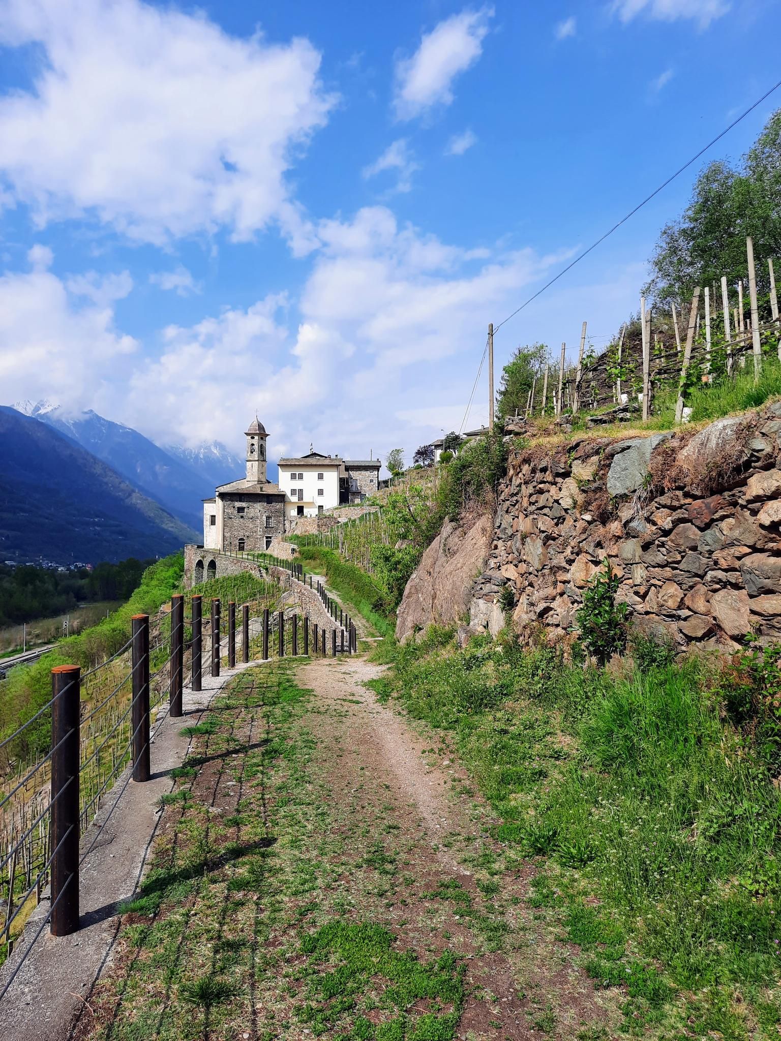
No traffic road cycling routes around Chiuro are situated within the Valtellina valley, a region characterized by the Adda River flowing through a fertile valley floor. The landscape features dramatic mountain peaks from the Orobic and Rhaetian Alps, alongside extensive terraced vineyards on the Rhaetian slopes. This combination offers a diverse cycling environment, from flat valley paths to challenging ascents through agricultural lands and historic villages.
Best no traffic road cycling routes around Chiuro
- The most popular no traffic road cycling route is Rest Area in Tresenda – Valtellina Trail loop from Castello dell'Acqua, a 28.7 miles (46.3 km) trail that takes 1 hour 58 minutes to complete. This easy route follows the Valtellina Trail, offering a relaxed ride along the Adda River.
- Another top favourite among local road cyclists is Ascent to Selva da Poschiavo, a moderate 9.3 miles (15.0 km) path. This route features a steady climb with scenic views of the surrounding Alpine landscape.
- Local road cyclists also love the Rest Area in Piateda – Via Inferno Climb loop from Ponte in Valtellina, a 22.7 miles (36.5 km) trail leading through terraced vineyards and local villages, often completed in about 2 hours 27 minutes.
- Road cycling around Chiuro is defined by the Adda River valley, terraced vineyards, and the backdrop of the Orobic and Rhaetian Alps. The network offers options for various ability levels, from leisurely valley rides to more demanding climbs.
- The routes in Chiuro are highly rated by the komoot community with an average score of 4.4 stars from more than 40 reviews. More than 5,000 road cyclists have used komoot to explore Chiuro's varied terrain.
Last updated: June 30, 2026
7
riders
15.0km
01:08
480m
480m
Moderate road ride. Good fitness required. Mostly well-paved surfaces and easy to ride.
5.0
(2)
237
riders
120km
07:18
3,040m
3,040m
Hard road ride. Very good fitness required. Mostly well-paved surfaces and easy to ride.

Sign up for free
36
riders
39.5km
02:52
1,350m
1,350m
Hard road ride. Very good fitness required. Some segments of this route may be unpaved and difficult to ride.
35
riders
26.1km
01:05
130m
130m
Easy road ride. Great for any fitness level. Mostly well-paved surfaces and easy to ride.
19
riders
43.8km
04:15
1,540m
1,540m
Hard road ride. Very good fitness required. Some segments of this route may be unpaved and difficult to ride.
Get access to more routes and recommendations from other explorers.
Sign up for free
Already have an account?
Our route recommendations are based on thousands of hikes, rides, and runs completed by other people on komoot.
Start today with a free account
Your next adventure awaits.
Login or Signup

Other adventures around Chiuro

Tips from the Community

Clean rest area with a bike rack.
0
0

A beautiful winding bike path with lovely cornfields in the summer. You ride along the river, and have beautiful views of the stunning valley. Oh yeah, and you'll definitely encounter snakes!
0
0

Lago di Poschiavo / Puschlav Lake The Lago di Poschiavo, or Puschlav Lake in German, is located in the southern Graubünden municipality of Poschiavo/Puschlav. The natural reservoir is 962 meters above sea level. The lake is approximately 2.5 km long in a north/south direction and one kilometer wide. The Poschiavino river is both an inflow and outflow of the lake, which is up to 80 m deep at most. The Rhaetian Railway line runs along the western shore towards Brusio and Tirano in Italy. The village center of Poschiavo is about five kilometers north of the Puschlav Lake. On the lake itself are the villages of Miralago in the south and Le Prese in the north end. Both villages have Rhaetian Railway stops. The approximately seven-kilometer circular route around the Lago di Poschiavo can be completed in just under two hours. Since 2016, the "Sassalbo" has been a rentable boat on Lake Poschiavo. It is considered the largest passenger ship in the canton of Graubünden. Text / Source: schweizersee.ch https://www.schweizersee.ch/lago_di_poschiavo/
15
0
Poschiavo "Mediterranean lifestyle" Mediterranean lifestyle in the midst of an alpine backdrop. A small town whose townscape is protected because of its historical significance. Poschiavo also stands for culinary delights and cultural wealth. Experience this on a village tour through narrow streets, across the most beautiful village squares or in the important art museum. Text / Source: Switzerland Tourism / Switzerland Tourism https://www.myswitzerland.com/de-ch/reiseziele/poschiavo-im-puschlav/
14
0

The Sentiero Valtellina is well connected by train (Tirano-Milan line), and Tresenda station is an excellent starting point for those who choose to arrive by train: from here you can obviously continue along the valley floor, but above all go up towards the Aprica pass or towards the Teglio and Prato Valentino area.
0
0

Municipality in the province of Sondrio
0
0
Frequently Asked Questions
How many no traffic road cycling routes are available around Chiuro?
There are over 20 traffic-free road cycling routes around Chiuro, offering a variety of experiences for different skill levels. These routes focus on providing a serene cycling environment away from vehicular traffic.
What is the best season for car-free road bike trails in Chiuro?
The best seasons for car-free road biking in Chiuro are typically spring and autumn, when the weather is mild and the landscapes are vibrant with blossoms or autumn colors. Summer also offers excellent conditions, especially for higher altitude routes, though the valley floor can be warmer. Winter cycling is possible on lower, cleared paths, but some routes may be inaccessible due to snow.
Are there easy traffic-free road bike trails suitable for beginners or families in Chiuro?
Yes, Chiuro offers several easy traffic-free routes perfect for beginners and families. A prime example is the Valtellina Trail – Smooth Asphalt Pathway loop from Tresenda-Aprica-Teglio, which provides a gentle ride on smooth asphalt. The broader Sentiero Valtellina, a predominantly traffic-free cycle path along the Adda River, is also ideal for relaxed cycling through meadows, vineyards, and orchards.
Are there challenging no traffic road biking routes for experienced cyclists in Chiuro?
Absolutely. While focusing on no-traffic, some routes offer significant climbs. For instance, the Climb from Tresivio to Boirolo – Montagna in Valtellina loop from Montagna in Valtellina is rated difficult and features substantial elevation gain. Chiuro also serves as a gateway to iconic Alpine passes like Stelvio, Gavia, and Mortirolo in the wider Valtellina area, which can be accessed via quieter roads or linked with traffic-free sections.
Are there any circular no traffic road bike trails in Chiuro?
Yes, many of the traffic-free routes around Chiuro are designed as loops, allowing you to start and end at the same point. Examples include the Rest Area in Tresenda – Valtellina Trail loop from Castello dell'Acqua and the Rest Area in Piateda – Via Inferno Climb loop from Ponte in Valtellina, providing varied terrain and scenic views.
What scenic viewpoints can I expect along no traffic road bike routes in Chiuro?
The routes around Chiuro offer stunning vistas. You'll cycle through the dramatic terraced vineyards of the Rhaetian slopes, offering panoramic views of the Adda River Valley and the surrounding Orobic and Rhaetian Alps. Routes like the ascent to Teglio provide elevated perspectives of charming villages, apple orchards, and the expansive valley.
Are there any interesting landmarks or cultural sites to see along the routes?
Yes, Chiuro and its surroundings are rich in cultural heritage. Many routes pass through historic villages with ancient churches and castles. You might spot the Tower of Teglio during your ascent, or explore the region's renowned winemaking traditions by cycling through areas like Inferno, Grumello, and Sassella. The area also features sites like the Church of the Madonna della Neve and Saint Carlo in Chiuro itself.
Are there places to stop for refreshments or facilities along the traffic-free routes?
The region is well-equipped for cyclists. Along key paths like the Sentiero Valtellina, you'll find rest areas, bike rests, and information panels. There are also cafes and bars in the villages you pass through. For example, the Bike Bar Sentiero Valtellina is a convenient stop for cyclists.
What do other road cyclists enjoy the most about no traffic road cycling in Chiuro?
The area is highly rated by the komoot community, with an average score of 4.44 stars. Reviewers often praise the tranquility of the traffic-free paths, the breathtaking scenery of the terraced vineyards and Alpine backdrop, and the variety of routes catering to all skill levels, from leisurely valley rides to challenging climbs.
Where can I find parking for no traffic road bike trails in Chiuro?
Parking is generally available in and around Chiuro, particularly in the main village areas or near access points to popular cycle paths like the Sentiero Valtellina. Specific parking information can often be found on local tourism websites or by checking the starting points of individual routes on komoot.
Can I combine cycling with wine tasting in Chiuro?
Absolutely! Chiuro is known as the 'wine capital' of Valtellina, nestled within Italy's largest terraced wine-growing area. Many traffic-free routes, such as sections of the Via dei Terrazzamenti, wind through these vineyards. You can easily combine your ride with visits to local wine producers and cellars for an immersive experience into the region's renowned winemaking traditions.
Most popular attractions around Chiuro

Get inspired with the komoot mobile app


Explore more
Browse the best Road cycling routes in other regions.
