The best traffic-free bike rides around Cencenighe Agordino
4.5
(172)
3,975
riders
13
rides
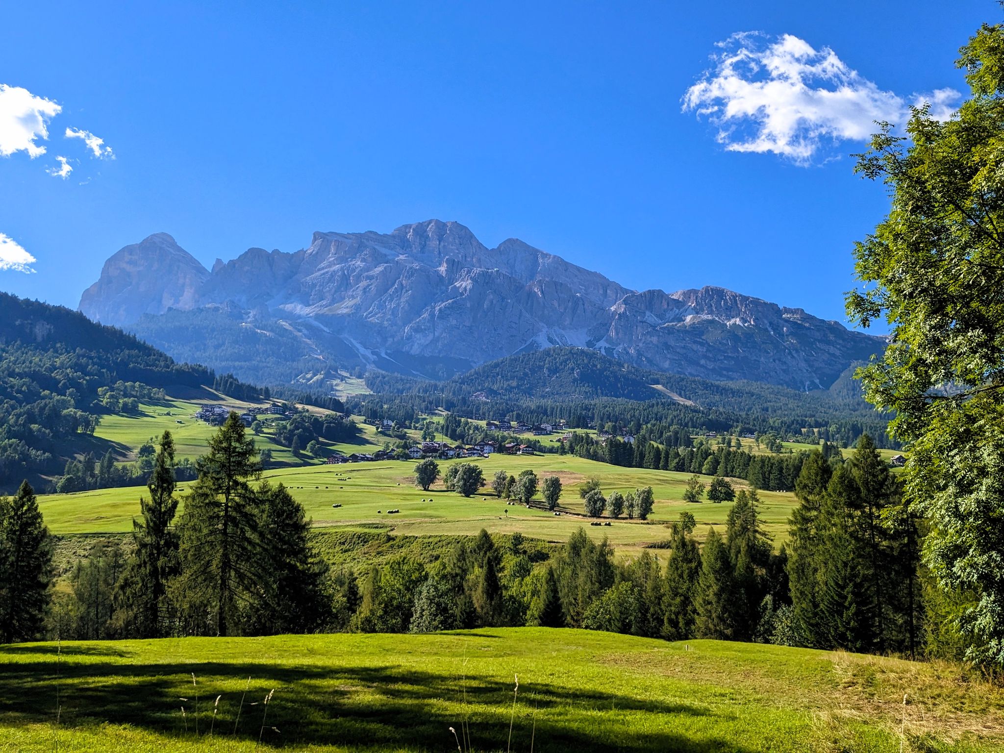
No traffic touring cycling routes around Cencenighe Agordino are set within the Dolomites UNESCO World Heritage site, characterized by imposing mountain groups such as Pale di San Martino, Civetta, and the Marmolada Group. The region features the confluence of the Biois and Cordevole rivers, creating varied valley floor settings alongside challenging ascents. This landscape offers diverse terrain for touring cyclists, from serene riverbanks to high mountain passes.
Best no traffic touring cycling routes around Cencenighe Agordino
- The most popular no…
Last updated: August 24, 2026
4.6
(5)
108
riders
22.5km
01:59
570m
570m
Hard bike ride. Very good fitness required. Mostly paved surfaces. Suitable for all skill levels.
4.8
(12)
86
riders
29.4km
02:37
690m
690m
Hard bike ride. Very good fitness required. Mostly paved surfaces. Suitable for all skill levels.

Sign up for free
5.0
(2)
45
riders
33.7km
02:48
1,050m
1,050m
Hard bike ride. Very good fitness required. Mostly paved surfaces. Suitable for all skill levels.
4.7
(3)
29
riders
22.3km
01:57
770m
770m
Hard bike ride. Very good fitness required. Mostly paved surfaces. Suitable for all skill levels.
3.3
(3)
21
riders
22.3km
02:33
1,110m
1,110m
Hard bike ride. Very good fitness required. Mostly paved surfaces. Suitable for all skill levels.
Get access to more routes and recommendations from other explorers.
Sign up for free
Already have an account?
Our route recommendations are based on thousands of hikes, rides, and runs completed by other people on komoot.
Start today with a free account
Your next adventure awaits.
Login or Signup
Popular around Cencenighe Agordino

Other adventures around Cencenighe Agordino

Tips from the Community

Beautiful panoramic view of the San Lucano Valley and the north face of Mount Agner!
0
0

Too bad there's not much snow. Wonderful in summer.
0
0

MOUNTAIN GROUP: Civetta TYPE OF REFUGE: Alpine ELEVATION: 1714 m LOCATION: Col Negro di Pelsa MUNICIPALITY: Taibon Agordino (BL) CAI SECTION: Conegliano TELEPHONE: 0437 660008 - 3288867114 E-MAIL: rifugiovazzoler@gmail.com WEB: www.rifugiovazzoler.com OPENING PERIOD: June 13 - September 30 BEDS: 50 EMERGENCY PLATFORM PLACES: 34 EMERGENCY SHELTER: 10 MANAGER: Doris Corazza MANAGER PHONE: 328 8867114 Source: https://www.caiveneto.it/rifugio/vazzoler
1
0

Relatively easy to reach shelter in an impressive location opposite the Torre Trieste. The hut is run first class and the food is excellent.
1
0

Very worth seeing, you have to see it
1
0

The Vazzoler Refuge offers a fantastic view of the western part of Monte Civetta with its Venice and Trieste Towers. But then it also ranges over other wonderful rock faces such as that of Moiazza in the cantons of Pelsa and Busazzache. These peaks make it one of the most beautiful places in the Belluno Dolomites.
0
0


Nice walkway to take you towards the hamlet of Forno di Val where there is a bar, an excellent point for a refreshment break.
0
0
Frequently Asked Questions
How many no traffic touring cycling routes are available around Cencenighe Agordino?
There are 12 dedicated no-traffic touring cycling routes around Cencenighe Agordino featured in this guide. These routes offer a range of distances and elevations, primarily catering to moderate to difficult skill levels.
What is the best time of year for traffic-free bike touring in Cencenighe Agordino?
The best time to visit for cycling is generally summer, from June to September, when temperatures are pleasant and all routes are accessible. Autumn also offers stunning foliage and comfortable conditions for touring.
What kind of terrain and elevation can I expect on these no-traffic routes?
The routes around Cencenighe Agordino traverse diverse terrain, from serene riverbanks in the Biois and Cordevole valleys to challenging ascents through the Dolomites. You can expect well-paved surfaces, with significant elevation gains on many routes, reflecting the mountainous nature of the region. For example, the Col dei Baldi loop from Alleghe features over 1300 meters of elevation gain.
Are there family-friendly or beginner-friendly no-traffic cycling routes?
While many routes in this guide are rated moderate to difficult, the region does offer options for families and beginners. The local cycle path along the Biois river, part of the wider Agordino cycle path project, provides a safe and scenic option for easier rides, connecting to nearby villages like Canale d'Agordo.
Are there any circular no-traffic touring routes?
Yes, several routes are designed as loops, allowing you to start and end in the same location. Examples include the Gares loop from Falcade, the View of the San Lucano Valley – Pont Waterfall loop from Agordo, and the Col dei Baldi loop from Alleghe.
What natural features or landmarks can I expect to see on these routes?
You'll be cycling amidst the breathtaking Dolomites UNESCO World Heritage site. Expect dramatic mountain groups like Pale di San Martino, Civetta, and the Marmolada Group. You might also encounter highlights such as Col dei Baldi or various mountain passes like Duran Pass, offering stunning panoramic views.
Are there any waterfalls along the no-traffic touring cycling routes?
Yes, the View of the San Lucano Valley – Pont Waterfall loop from Agordo specifically highlights a waterfall, offering a scenic natural attraction along your ride.
Where can I park my car when starting a no-traffic touring cycling route?
Cencenighe Agordino and surrounding villages like Falcade and Agordo, which serve as starting points for many routes, typically offer public parking facilities. It's advisable to check local signage upon arrival for specific parking regulations and availability.
Is public transport accessible to reach these traffic-free cycling routes?
Cencenighe Agordino is connected by local bus services within the Agordino area, which can help you reach various starting points for routes. However, public transport options might be limited, especially for carrying bicycles, so planning ahead is recommended.
Are the no-traffic touring cycling routes around Cencenighe Agordino dog-friendly?
While the routes themselves are generally open to all, specific rules regarding dogs may apply in certain protected areas or on private land. When cycling with a dog, always keep them on a leash and ensure they are comfortable with the distance and terrain. Always carry water for your dog and clean up after them.
What do other touring cyclists enjoy most about the no-traffic routes in Cencenighe Agordino?
The area is highly rated by the komoot community, with an average score of 4.57 stars. Reviewers often praise the stunning Dolomite scenery, the challenge of the mountain passes, and the opportunity to experience the region's natural beauty on quiet roads.
Most popular routes around Cencenighe Agordino
Most popular attractions around Cencenighe Agordino

Get inspired with the komoot mobile app


Explore more
Browse the best Cycling routes in other regions.
