The best traffic-free bike rides around Attimis
4.5
(2838)
18,633
riders
126
rides
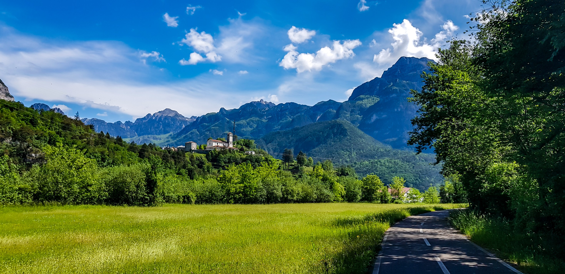
No traffic touring cycling routes around Attimis are situated in the Friuli Venezia Giulia region, characterized by its eastern piedmont location along the Malina torrent. The terrain offers a mix of forest roads, forest paths, and some asphalt segments, with routes winding through vineyards and elevated villages. The landscape features significant natural qualities, including panoramic views of the Friulian plain and distant Julian Alps.
Best no traffic touring cycling routes around Attimis
- The most popular no traffic touring cycling route…
Last updated: August 23, 2026
3.7
(3)
38
riders
19.0km
01:35
630m
630m
Hard bike ride. Very good fitness required. Mostly paved surfaces. Suitable for all skill levels.
5.0
(3)
26
riders
21.5km
01:49
710m
710m
Hard bike ride. Very good fitness required. Mostly paved surfaces. Suitable for all skill levels.

Sign up for free
19
riders
29.2km
02:37
1,000m
1,000m
Hard bike ride. Very good fitness required. Mostly paved surfaces. Suitable for all skill levels.
4.0
(1)
19
riders
31.2km
02:42
1,020m
1,020m
Hard bike ride. Very good fitness required. Mostly paved surfaces. Suitable for all skill levels.
5.0
(2)
21
riders
45.6km
04:13
1,260m
1,260m
Hard bike ride. Very good fitness required. Mostly paved surfaces. Suitable for all skill levels.
Get access to more routes and recommendations from other explorers.
Sign up for free
Already have an account?
Our route recommendations are based on thousands of hikes, rides, and runs completed by other people on komoot.
Start today with a free account
Your next adventure awaits.
Login or Signup


Other adventures around Attimis

Tips from the Community

Small chapel on the Bocchetta di Sant'Antonio
0
0

From the sign, these beautiful waterfalls are less than a minute's walk away.
0
0

From this stylish viewing bench, you can certainly see all the way to the Mediterranean - if the air is clear.
0
0

Right next to the trail is this offshoot of a waterfall, which can be reached in just a few minutes. The path to the waterfall is well signposted and a great place for a refreshing rest.
0
0
At an altitude of 780 meters, this well-known intersection of all kinds of main routes is located. It is practically a saddle from which wide views are possible to the south into the Friulian region and to the north in the direction of Stol. The former military road to Stol is also clearly visible. Memorable events took place in this area during both World Wars. A church and a monument bear witness to this time. Furthermore, the intersection point is very suitable for a short rest. More info: https://www.turismofvg.it/de/403498/canebola-bocchetta-di-sant-antonio-15-jahrhundert
0
0
The highlight is essentially a small plateau consisting of two levels. It is also a pass at 960 meters. On the upper level, there is a memorial from which there is a beautiful view of Friuli. On the lower level, there is an Alpine building and a slightly larger shrine.
0
0

an easy walk, for everyone. the view is wonderful: on a nice day you can see the ships entering/exiting the port of Trieste
0
0

Frequently Asked Questions
How many no-traffic touring cycling routes are available around Attimis?
Attimis offers a wide selection of no-traffic touring cycling routes, with over 120 tours available. These routes cater to various skill levels, ensuring there's something for everyone looking for a peaceful ride.
What is the best time of year to go touring cycling in Attimis?
The region of Friuli Venezia Giulia, where Attimis is located, generally offers pleasant cycling conditions from spring through autumn. Spring brings lush greenery and comfortable temperatures, while autumn provides vibrant foliage and cooler air. Summer can be warm, but many routes benefit from natural shade. It's always advisable to check local weather forecasts before heading out.
What kind of terrain can I expect on these no-traffic routes?
The no-traffic touring cycling routes around Attimis feature a diverse terrain. You'll find a mix of forest roads, forest paths, and some asphalt sections. The 'Passeggiata delle Rogge Cycle and Pedestrian Path' is a notable scenic gravel itinerary. While some routes are gentle, others can be more demanding, with segments that might require pushing your bike, especially on mountain routes.
How challenging are the no-traffic touring cycling routes in Attimis?
The routes vary significantly in difficulty. Approximately 30 routes are rated as easy, 24 as moderate, and 66 as difficult. For example, the Pian delle Farcadizze – Cima Porzus loop from Attimis / Atimis is a challenging 57 km ride with over 1500 meters of elevation gain, while other routes offer minimal elevation for a more relaxed experience. You can find routes suitable for any fitness level, from beginner-friendly to advanced.
Are there any circular no-traffic touring cycling routes?
Yes, many of the no-traffic touring cycling routes around Attimis are designed as loops, allowing you to start and end in the same location. Examples include the challenging Church of St. Anthony the Abbot – Zore Cheese Farm loop from Attimis / Atimis and the Church of St. Anthony the Abbot – Cima Porzus loop from Attimis / Atimis, both offering scenic circular journeys.
What natural features or viewpoints can I expect to see on these routes?
Attimis is rich in natural beauty. You can expect stunning panoramic views, especially from elevated villages like Porzus, which offers extraordinary vistas of the Friulian plain. Routes may pass by natural monuments, mountain peaks like Monte Carnizza di Porzus Summit, and mountain passes such as Sella Kriz Mountain Pass. The View from Monte Joanaz is another notable viewpoint.
Are there historical or cultural attractions along the no-traffic touring cycling routes?
Yes, the region around Attimis is dotted with historical and cultural points of interest. You might encounter the ruins of the Upper and Lower castles, or pass by the impressive Partistagno Castle. Other highlights include the Medieval Archaeological Museum in Attimis, the Thanner frescoes in the church of San Silvestro in Racchiuso, and the Sanctuary of the Madonna (de Sesule) of the Falcetto in Porzus, a destination for devotional pilgrimages.
Are there family-friendly no-traffic touring cycling routes in Attimis?
While many routes in Attimis can be challenging, there are options suitable for families, particularly among the 30 easy-rated tours. Look for routes with minimal elevation gain and well-maintained surfaces, such as sections of the 'Passeggiata delle Rogge Cycle and Pedestrian Path,' which is a scenic gravel itinerary suitable for various fitness levels.
What do other touring cyclists enjoy the most about touring cycling in Attimis?
The area is highly rated by the komoot community, with an average score of 4.8 stars. Reviewers often praise the 'enviable variety of trails and nature trails,' the 'beautiful views' through vineyards and forests, and the opportunity to experience the region's diverse terrain away from traffic. The blend of natural beauty and historical sites is frequently highlighted.
Is it possible to access these routes using public transport?
While Attimis is well-connected by road, specific public transport options directly to the start points of all no-traffic cycling routes may vary. It's recommended to check local bus schedules for connections to Attimis and surrounding villages. For routes starting further afield, such as the Little Madonna of the Domm – View from Monte Joanaz loop from Faedis, you might need to consider transport to the nearest town.
Are there places to eat or drink along the no-traffic touring cycling routes?
While many routes traverse natural and secluded areas, you can find opportunities for refreshments in the villages and towns along the way. For example, the Convivial Aperitif, Fontanabona is a highlight that suggests a cafe stop. Planning your route to pass through larger settlements will increase your chances of finding cafes, pubs, or restaurants.
Most popular attractions around Attimis

Get inspired with the komoot mobile app


Explore more
Browse the best Cycling routes in other regions.
