The best hikes from bus stations in Montes Obarenes-San Zadornil
4.6
(361)
2,410
hikers
13
hikes
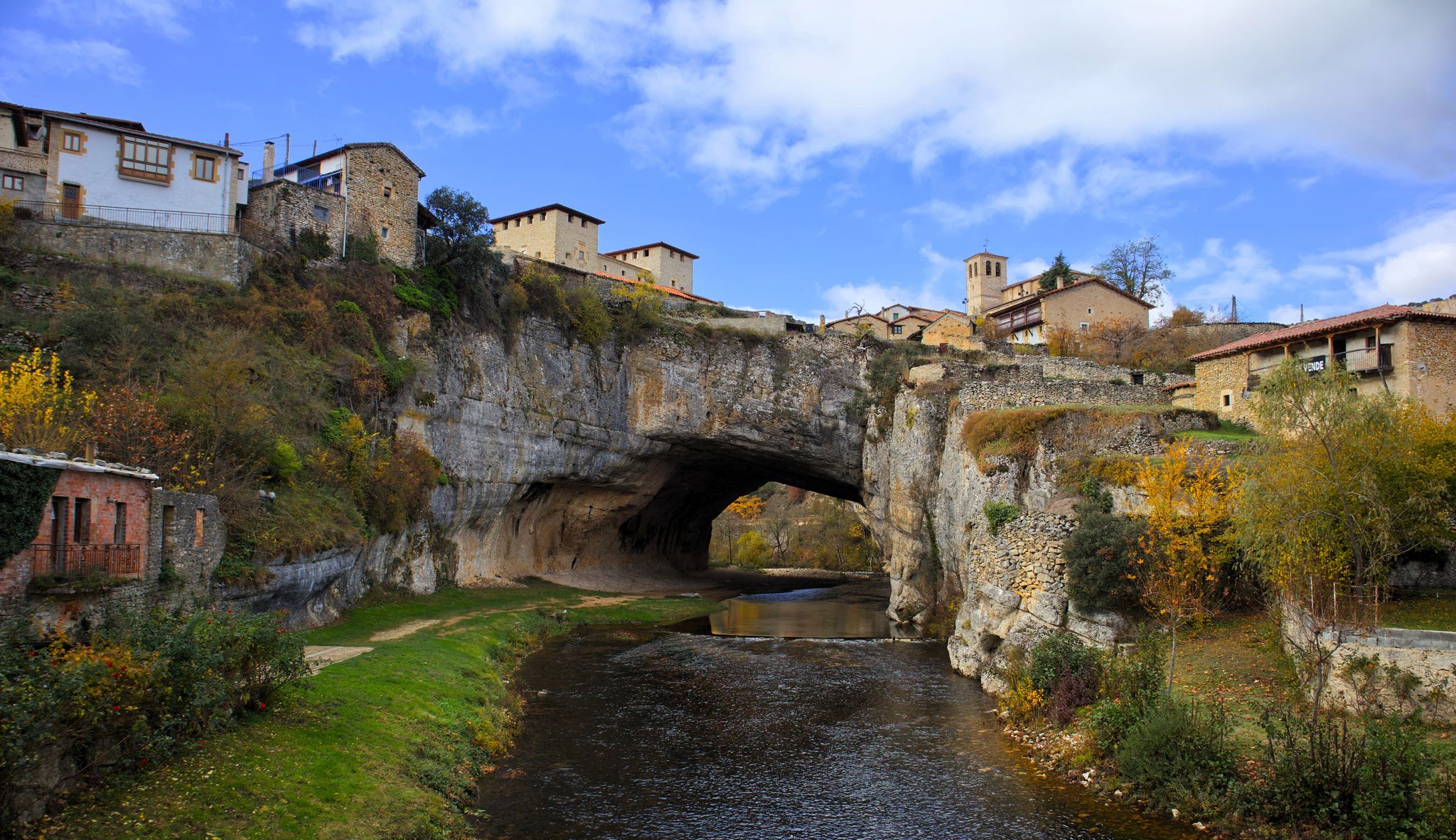
Bus station hiking trails in Montes Obarenes-San Zadornil traverse a diverse landscape at the crossroads of Atlantic and Mediterranean climates. The region is characterized by a "natural wall" of the Cantabrian Mountains, featuring deep gorges and canyons carved by rivers like the Ebro and Oca. Hikers encounter dense forests of beech, oak, and pine, alongside significant peaks such as Humión, which stands at 1,437 meters. This varied terrain offers numerous viewpoints and natural features for exploration.
Best bus station hiking…
Last updated: May 18, 2026
5.0
(1)
3
hikers
Moderate hike. Good fitness required. Mostly accessible paths. Sure-footedness required.
2
hikers
6.65km
02:10
310m
320m
Moderate hike. Good fitness required. Easily-accessible paths. Suitable for all skill levels.

Sign up for free
10.3km
03:05
330m
330m
Moderate hike. Good fitness required. Easily-accessible paths. Suitable for all skill levels.
17.1km
05:24
620m
620m
This difficult 10.6-mile (17.1 km) circular hike from Ameyugo climbs Peña de Valcavado, offering panoramic views in Montes Obarenes.
5.0
(2)
4
hikers
9.61km
03:16
500m
500m
Moderate hike. Good fitness required. Easily-accessible paths. Suitable for all skill levels.
Get access to more routes and recommendations from other explorers.
Sign up for free
Already have an account?
Our route recommendations are based on thousands of hikes, rides, and runs completed by other people on komoot.
Start today with a free account
Your next adventure awaits.
Login or Signup
Popular around Montes Obarenes-San Zadornil


Tips from the Community

Simple and with very good views.
0
0
Coming from Alto del Baragón and Peña las Yeguas.
1
0
Halfway along the SLBU97 road, with a curious mailbox.
0
0
Nice summit and nice path, and the views, couples.
3
0

Medium difficulty walk through the Angosto area... Valdegobia and etc.
1
0

The original village dates back to prehistoric times, to the Iron Age. There are some references to it during the Roman times and the Muslim times. Now it is a small town with less than 200 inhabitants.
1
0

Mountain that is close to the town of Ameyugo, where there is a direct path that goes to this peak where we find a small memorial.
0
0
At the beginning of the town, imposing in its loft
3
0
Frequently Asked Questions
How many bus station hiking trails are available in Montes Obarenes-San Zadornil?
There are 15 bus station hiking trails available in Montes Obarenes-San Zadornil. These routes cater to various fitness levels, including 3 easy, 10 moderate, and 2 difficult options, ensuring there's a suitable path for almost everyone.
Are there any easy, family-friendly hikes accessible by bus in Montes Obarenes-San Zadornil?
Yes, several easy routes are accessible by bus. A great option for families is the MonasterioDeSanSalvador – Oña Gorge loop from Oña. This easy 5.4 km trail offers a gentle walk with minimal elevation gain, perfect for exploring the historic town of Oña and its surroundings.
What kind of natural features can I expect to see on bus-accessible hikes in Montes Obarenes-San Zadornil?
The region is rich in natural beauty. You can expect to encounter deep gorges carved by rivers like the Ebro and Oca, dense forests of beech, oak, and pine, and panoramic views from elevated points. The unique blend of Atlantic and Mediterranean climates results in remarkable biodiversity, making for a varied and engaging landscape.
Are there any circular hiking routes from bus stations in Montes Obarenes-San Zadornil?
Yes, many routes are circular, allowing you to start and end at the same point, often conveniently near a bus stop. An example is the moderate Alto de Valcaliente - from Bozoó, which takes you through the Natural Park in a loop.
What are the best times of year to go hiking from bus stations in Montes Obarenes-San Zadornil?
The Montes Obarenes-San Zadornil Natural Park is enjoyable throughout much of the year. Spring and autumn offer pleasant temperatures and vibrant foliage, making them ideal for hiking. Summer can be warm, but higher elevation trails provide cooler conditions. Winter hiking is also possible, especially on lower-lying routes, though some higher paths might be affected by snow.
Can I find viewpoints or scenic overlooks on bus-accessible trails?
Absolutely. The region is known for its elevated points offering stunning vistas. For instance, the Humion peak, though part of a more challenging route, provides bird's-eye views of the Tobalina valley and the surrounding mountains. Many trails will lead you to points with panoramic views of the diverse landscapes.
Are there any historical or cultural landmarks near the bus station hiking trails?
Yes, the region is dotted with historical sites. You can explore the Oña Historic Center, visit the ancient San Salvador Monastery, or see the unique Poza de la Sal Salt Flats and Old Railway Station. The Hermitage of Saint Mary of La Hoz, nestled beneath a cliff, is another notable historical and architectural gem.
What do other hikers enjoy most about hiking in Montes Obarenes-San Zadornil?
The area is highly rated by the komoot community, with an average score of 4.6 stars from over 350 ratings. Reviewers often praise the diverse and captivating landscapes, the rich natural features, and the well-maintained network of trails that cater to various skill levels. The opportunity to combine natural exploration with visits to picturesque towns and historical sites is also frequently highlighted.
Are there any challenging bus-accessible hikes for experienced hikers?
Yes, for those seeking a challenge, there are difficult routes available. The Barbalantes and Valcavado Peak Trail is a difficult 17.1 km route with significant elevation gain, offering a rewarding experience for seasoned hikers.
Can I spot wildlife while hiking from bus stations in Montes Obarenes-San Zadornil?
Montes Obarenes-San Zadornil is a haven for wildlife. The park is home to 128 vertebrate species, including wildcats, otters, and roe deer. It's particularly significant for birdwatching, with 76 bird species, including impressive raptors like griffon vultures, golden eagles, and Egyptian vultures. Keep an eye out, especially in quieter forest sections and near water sources.
Are there any hikes that feature gorges or canyons?
Yes, the park is characterized by numerous beautiful and deep gorges and canyons. Rivers such as the Ebro (in Horadada and Sobrón) and the Oca (near Oña) have carved impressive formations. Many trails, like the MonasterioDeSanSalvador – Oña Gorge loop from Oña, will take you through or alongside these dramatic natural features.
What is the typical duration of a bus-accessible hike in this region?
The duration varies greatly depending on the route's distance and difficulty. Easy trails like the MonasterioDeSanSalvador – Oña Gorge loop from Oña can take around 1.5 to 2 hours. Moderate routes, such as Los dos Oteros y Carrasalineros from Ameyugo, typically range from 3 to 4 hours, while difficult trails can extend to 5 hours or more.
Most popular routes in Montes Obarenes-San Zadornil
Most popular attractions in Montes Obarenes-San Zadornil

Get inspired with the komoot mobile app


Explore more
Browse the best Hikes in other regions.
