The best family-friendly hikes and walks in South Lewis, Harris And North Uist
4.6
(356)
2,284
hikers
23
hikes
Family friendly hiking trails in South Lewis, Harris And North Uist traverse a landscape defined by ancient geology, rugged coastlines, and diverse natural features. The region features expansive white sandy beaches, deep sea lochs, and mountainous terrain, including Clisham, the highest point in the Outer Hebrides. Peatlands and numerous freshwater lochs also characterize the islands, providing varied environments for outdoor exploration.
Best family friendly hiking trails in South Lewis, Harris And North Uist
- The most popular family friendly hiking route is A loop of Scalpay Island — Outer Hebrides, a 6.3 miles (10.2 km) trail that takes 2 hours 45 minutes to complete. This moderate route offers coastal views and passes the Eilean Glas Lighthouse.
- Another top favourite among local hikers is North Harris Eagle Observatory & Loch Scourst — Outer Hebrides, an easy 4.1 miles (6.6 km) path. This trail leads through moorland, providing opportunities for wildlife spotting.
- Local hikers also love the Bhaltos Peninsula Loop, a 6.3 miles (10.2 km) trail leading through coastal areas and sandy beaches, often completed in about 2 hours 45 minutes.
- Hiking in South Lewis, Harris And North Uist is defined by stunning coastlines, ancient peatlands, and rugged mountainous terrain. The network offers options for various ability levels, from easy coastal strolls to more challenging ascents.
- The routes in South Lewis, Harris And North Uist are highly rated by the komoot community with an average score of 4.6 stars from over 280 reviews. More than 1900 hikers have used komoot to explore South Lewis, Harris And North Uist's varied terrain.
Last updated: August 23, 2026
4.8
(29)
164
hikers
10.2km
02:45
140m
140m
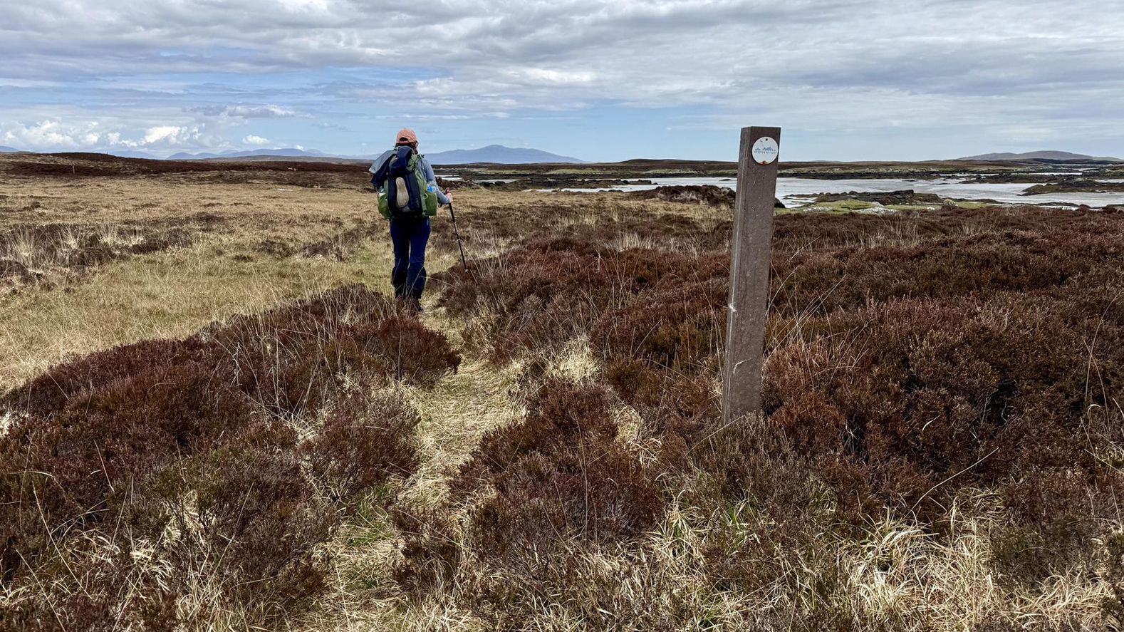
A loop of Scalpay Island offers a diverse hiking experience across rugged coastline and open moorland in the Outer Hebrides. This moderate route covers 6.3 miles (10.2 km) with an elevation gain of 443 feet (135 metres), typically taking about 2 hours and 44 minutes to complete. You will encounter a mix of established paths and more varied ground, including boggy sections, especially after rain. From higher points like Beinn Scorabhaig, you can enjoy panoramic views across the mountains of Harris and the north end of Skye, with the Storr visible across the Minch. The trail also features numerous freshwater lochs and views of the empty Pairc area of South East Lewis.
For your visit, be prepared for varied terrain. While some parts use good paths, other sections can be boggy, so sturdy shoes and sure-footedness are recommended. Waymarker posts are present to help with navigation, particularly where the path might be indistinct. The trail is generally considered moderate, requiring good fitness, but parts are easily accessible for different skill levels. Scalpay is connected to the Isle of Harris by a bridge, making access straightforward.
One of the significant highlights of the route is the Eilean Glas Lighthouse, one of Scotland's first four lighthouses, originally built in 1787-1789. Scalpay is also a great spot for wildlife viewing; you might see seals, otters, sea eagles, and various seabirds. The island has a rich history as a fishing and seafaring community, and you will pass by deserted crofts, offering glimpses into its past. The continuous shift between coastal paths, open moorland, and historical sites makes this loop particularly engaging.
4.4
(23)
208
hikers
6.65km
01:46
60m
60m
Embark on an easy hike through the stunning landscapes of North Harris, leading you to the renowned Eagle Observatory and further to Loch Scourst. This route covers 4.1 miles (6.6 km) with a gentle elevation gain of 207 feet (63 metres), making it suitable for all fitness levels. You can expect to complete the journey in about 1 hour and 45 minutes, traversing well-maintained tracks that give way to rugged mountains, expansive moorlands, and a dramatic coastline. As you hike, you will encounter a peaty river, dried heather underfoot, and bog cotton, all set against the backdrop of ancient Lewisian Gneiss bedrock forming the peaks and contributing to a largely treeless, remote, and open feel.
To begin your adventure, park at the designated car park; the initial 1.2 miles (2 km) to the Eagle Observatory is a straightforward walk along a track, taking approximately 30 minutes. The path remains well-developed for a significant portion of the route beyond the observatory, ensuring an accessible experience. The Outer Hebrides can experience varied weather, so it is always wise to check forecasts before you set out. This trail is part of the broader Outer Hebrides Bird of Prey Trail, offering excellent opportunities for wildlife spotting throughout the year.
The primary highlight of this trail is the North Harris Eagle Observatory, Scotland's only purpose-built viewing facility for golden eagles. Located in an area with one of Europe's highest densities of breeding golden eagles, the observatory provides an exceptional chance to observe these magnificent birds in their natural habitat. Inside the attractive timber hide, you will find large windows offering commanding views up Glen Meavaig and informational panels. Beyond golden eagles, you might also spot white-tailed sea eagles, merlins, golden plovers, greenshanks, red deer, and unique plants like sundews and butterworts, especially during autumn and winter.

Sign up for free
4.6
(34)
182
hikers
5.39km
01:27
70m
70m
Embark on the Scalpay Heritage Trail, an easy hike that guides you through a landscape of rugged coastline and open moorland. You'll cover 3.4 miles (5.4 km) with a gentle elevation gain of 227 feet (69 metres), making it a comfortable journey for most. The route offers expansive views across the Outer Hebrides and towards Skye, providing a sense of island adventure. As you hike, keep an eye out for the historic Eilean Glas Lighthouse, a prominent landmark with its distinctive red and white stripes. This trail promises a refreshing outdoor experience, taking approximately 1 hour and 27 minutes to complete.
Before you set out, be aware that the trail features mixed terrain, including rough tracks and gravel paths. Some sections can be quite wet and boggy, so good waterproof boots are highly recommended for your comfort and safety. Although the route is waymarked, carrying a map or using a GPS device is nearly essential for navigation, especially if you encounter poor weather conditions. This preparation will ensure you have a smooth and enjoyable hike on Scalpay.
Beyond the scenic beauty, the trail offers a chance to spot local wildlife in their natural habitat. Look out for seals basking on the rocks, playful otters near the water's edge, and even eagles soaring overhead. The island's unique ecosystem and the historical significance of landmarks like the Eilean Glas Lighthouse add depth to your outdoor exploration, making this route a memorable part of your visit to the Outer Hebrides.
4.6
(15)
83
hikers
10.2km
02:44
110m
110m
Embark on the Bhaltos Peninsula Loop, a moderate hike covering 6.3 miles (10.2 km) with an elevation gain of 373 feet (114 metres), typically taking 2 hours and 43 minutes. You will discover captivating coastal views and varied landscapes as you traverse hillsides and grassy machair, vibrant with wildflowers. Look out for the white shell sands of Reef Beach and Cliff Beach, offering picturesque spots along the way. The route also provides views of Loch Roag and its islands, adding to the scenic experience. You will find rocky paths as well as softer ground.
The Bhaltos Peninsula Loop is generally accessible, making it easy to plan your visit. Parking is usually available close to the trailhead, so you can start your adventure without delay. While some parts of the trail are suitable for all skill levels, be ready for varied ground underfoot. If you choose to explore off the main road, you might encounter some boggy sections. This route offers a choice between following a circular road or venturing onto more rugged beaches and rocky paths.
This hike is set within the South Lewis, Harris and North Uist National Scenic Area, highlighting the rugged beauty of the Isle of Lewis. As you explore, you can also discover 'An Suileachan', a unique art structure that reflects local history and adds an interesting cultural element to your journey. The diverse terrain and coastal features make this loop a notable experience in the region.
4.5
(4)
13
hikers
14.8km
03:43
420m
420m
Start your hike on the Toe Head & Ceapabhal loop from Northton, a moderate 9.2-mile (14.8 km) route that takes about 3 hours and 42 minutes to complete. You will gain 1387 feet (423 metres) in elevation, offering diverse terrain and incredible views. The trail begins with a beautiful coastal stroll along pristine white sand bays, where you can enjoy views of deserted beaches and a mostly rocky shore. As you continue, you will pass three cream-colored sand beaches before reaching a small headland with a ruined medieval chapel. The path then leads to a steep but relatively short ascent to the summit of Ceapabhal, where you can expect panoramic 360-degree views. From the top, you might spot North Harris, the western beaches, the Uists, and even St. Kilda on a clear day. The machair, a fertile low-lying grassland, is also a prominent feature, often flowering in summer. Keep an eye out for wildlife like lapwings, oystercatchers, skylarks, and even golden and sea eagles. This trail is consistently described as one of the best viewpoints in the Outer Hebrides.
This trail is considered moderate, requiring good fitness, but it is generally suitable for all skill levels. While the initial coastal paths can be intermittent and sandy, the hill itself starts pathless before a track emerges as you ascend. The best route up Ceapabhal isn't always obvious, and you might encounter knee-deep heather in some sections. Be prepared for potentially very windy conditions at the exposed summit. The total distance is approximately 9.2 miles (14.8 km) with an ascent of around 1387 feet (423 metres), and it should take you about 3 hours and 42 minutes.
The isolated position of Ceapabhal makes it an exceptional viewpoint in the Outer Hebrides, combining glorious coastal scenery with a satisfying hill climb. Historically, the area around Toe Head also holds significant archaeological interest, with evidence of prehistoric settlement mounds, buildings, defense structures, graves, and cup marks dating back to Mesolithic, Neolithic, Beaker, Bronze Age, and Iron Age periods. Near the trailhead, you will find Croft 36, a charming honesty shop selling pies and treats, which is a unique local touch. Many consider this hike to be a life-affirming experience due to the stunning variety of views and the feeling of being on top of such a beautiful location.
Get access to more routes and recommendations from other explorers.
Sign up for free
Already have an account?
Our route recommendations are based on thousands of hikes, rides, and runs completed by other people on komoot.
Start today with a free account
Your next adventure awaits.
Login or Signup
Other adventures in South Lewis, Harris And North Uist


Tips from the Community

Beaches almost like in the Caribbean, only a little colder
0
0

Pleasant walk, either along the coast (with appropriate walking equipment) or on a passable path.
0
0


Beautiful views of Cliff Beach. When walking down, be sure to stay on the paths to avoid damaging the fragile natural environment.
0
0

Despite the information on the website, the café is open on sundays too. The owner loves to chat and the cakes are yummy. https://www.eileanglas.co.uk/your-visit
0
0

An Suileachan is a public art structure created by Will Maclean and Marian Leven that reflects the local and historical events of South Lewis in Scotland's Outer Hebrides. The three main events the structure is said to represent are; the 19th century Lewis Land Clearances, the 20th century land raids by the Reef Raiders, and the changes in Scottish Land Reform and community ownership of the Bhaltos Peninsula.
1
0
Pause for a moment and enjoy the breathtaking scenes of Reef Beach from this viewpoint in South Lewis.
1
0
Another fine example of the unique white sand and turquoise water beaches that are habitual to the stunning Outer Hebrides of Scotland.
2
0
Frequently Asked Questions
How many family-friendly hiking trails are available in South Lewis, Harris, and North Uist?
There are 24 family-friendly hiking trails in South Lewis, Harris, and North Uist. These include 10 easy routes perfect for younger children or those seeking a gentle stroll, and 12 moderate options for families looking for a bit more adventure. There are also 2 more challenging routes for experienced family hikers.
What kind of landscapes can we expect on family hikes in this region?
The region offers incredibly diverse and dramatic landscapes. You'll find stunning white sandy beaches like Luskentyre, often backed by machair bursting with wildflowers. There are also rugged, mountainous areas, deep sea lochs resembling fjords, and ancient peatlands. The underlying geology of Lewisian Gneiss, some of the oldest rock in Europe, gives the landscape a unique character.
Are there any easy, short walks suitable for families with very young children or strollers?
Yes, there are several easy options. The Scalpay Heritage Trail is a great choice, offering a pleasant walk with coastal views. Another excellent easy option for families is exploring the stunning surroundings of Luskentyre Sands, known for its beautiful beaches.
What are some notable natural features or landmarks we can see along the trails?
The region is rich in natural beauty and historical sites. You can explore the unique fjardic sea loch Loch a'Mhorghain, or visit the impressive Huisinis Beach and Gateway. For historical interest, the mysterious Callanish Standing Stones and the well-preserved Carloway Broch are also nearby, offering glimpses into ancient history.
Are there any circular routes suitable for families?
Yes, many of the trails are designed as loops, which are ideal for families. For a moderate circular walk with coastal views and historical sites, consider the Bhaltos Peninsula Loop on the Isle of Lewis. Another great option is A loop of Scalpay Island, which follows the coastline.
What is the best time of year to visit South Lewis, Harris, and North Uist for family hiking?
The spring and summer months (May to September) are generally considered the best time for family hiking. During this period, the machair coastal grasslands are vibrant with wildflowers, and the weather is typically milder and more stable. This also increases the chances of spotting local wildlife.
Can we spot any wildlife on these family-friendly trails?
Absolutely! The islands are a haven for wildlife. Keep an eye out for seals, otters, and various seabirds along the coastlines. In North Harris, you might even be lucky enough to spot golden eagles. The North Harris Eagle Observatory & Loch Scourst trail is specifically designed for wildlife spotting opportunities.
Are the family trails accessible by public transport, or is a car necessary?
While some trailheads might be accessible by local bus services, having a car generally offers more flexibility for exploring the diverse range of family-friendly trails across South Lewis, Harris, and North Uist. Public transport options can be limited, especially to more remote starting points.
What do other hikers enjoy most about family hiking in this region?
The area is highly rated by the komoot community, with an average score of 4.6 stars from 282 ratings. Reviewers often praise the stunning, unspoiled natural beauty, the sense of tranquility, and the variety of trails that cater to different family abilities, from gentle coastal strolls to more adventurous loops.
Are there any specific safety considerations for families hiking in the Outer Hebrides?
When hiking with family, always be prepared for changeable weather conditions, even in summer. Carry appropriate waterproof clothing, extra layers, and sufficient food and water. Some coastal paths can be exposed, so check tide times if walking near beaches or sea lochs. Always let someone know your planned route and estimated return time.
Are dogs allowed on the family-friendly hiking trails?
Many trails in South Lewis, Harris, and North Uist are dog-friendly, but it's crucial to keep dogs under close control, especially in areas with livestock or ground-nesting birds. Always follow the Scottish Outdoor Access Code, which advises keeping dogs on a lead or under close control around farm animals and wildlife. Be mindful of local signage.
Most popular routes in South Lewis, Harris And North Uist
Most popular attractions in South Lewis, Harris And North Uist

Get inspired with the komoot mobile app


Explore more
Browse the best Hikes in other regions.
