The best traffic-free bike rides around Bückeberg
4.7
(40)
227
riders
60
rides
Gravel biking around Bückeberg offers a dynamic environment for cyclists seeking engaging off-road experiences. This small hill range, situated within the Calenberg Uplands and Weser Uplands, is characterized by extensive mixed woods and varied topography. The region features unique geological sites, including 140-million-year-old dinosaur tracks, and offers numerous panoramic viewpoints across the Schaumburg region. Its diverse terrain, with hills peaking at approximately 375 meters, provides a range of inclines and descents suitable for no traffic gravel bike trails.
Best no…
Last updated: May 17, 2026
5.0
(1)
7
riders
Moderate gravel ride. Good fitness required. Mostly paved surfaces. Suitable for all skill levels.
5.0
(1)
5
riders
47.8km
03:14
840m
840m
Hard gravel ride. Very good fitness required. Mostly paved surfaces. Suitable for all skill levels.

Sign up for free
5.0
(2)
28
riders
Hard gravel ride. Very good fitness required. You may need to push your bike for some segments of this route.
4.0
(2)
7
riders
39.3km
02:21
220m
220m
Hard gravel ride. Good fitness required. You may need to push your bike for some segments of this route.
4.5
(4)
9
riders
55.4km
02:42
130m
130m
Moderate gravel ride. Good fitness required. Mostly paved surfaces. Suitable for all skill levels.
Get access to more routes and recommendations from other explorers.
Sign up for free
Already have an account?
Our route recommendations are based on thousands of hikes, rides, and runs completed by other people on komoot.
Start today with a free account
Your next adventure awaits.
Login or Signup
Other adventures around Bückeberg

Tips from the Community

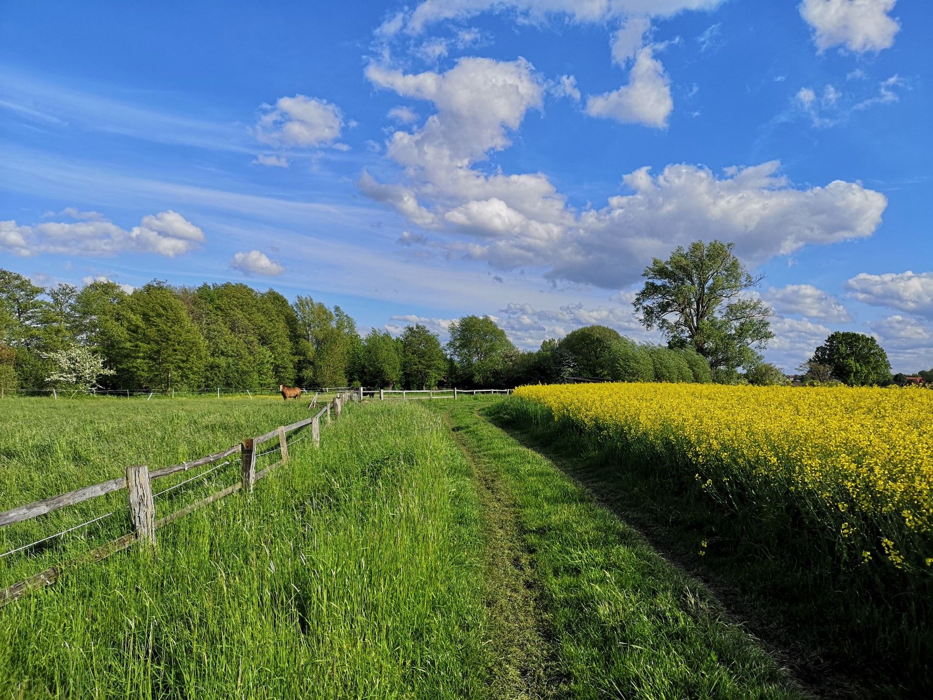
At this point, the highest point is reached and a reward follows in the form of the view on the ridge trail into the Auetal.
0
0

Great view of the canal. The paths by the water are great. I prefer riding there in the evening.
0
0

The ponds in Loccum are part of the historic monastery landscape and are located near Loccum Abbey. They are part of a system of ditches, canals, ponds, and streams that are related to the medieval monastery complex. These waters shape the landscape and are part of the "Kleiner Klosterlandschaftsweg" (Little Monastery Landscape Trail), which leads to these mysterious and enchanted places.
0
0

I always enjoy boating on the canal. Especially in the evenings when the weather is nice! It's quiet and not too crowded!
0
0

The Mittelland Canal is the longest artificial waterway in Germany and plays a central role in the European inland navigation network. It runs from the Dortmund-Ems Canal near Hörstel (North Rhine-Westphalia) to the Elbe River near Magdeburg (Saxony-Anhalt) and stretches for approximately 325 kilometers. The canal is one of the most important east-west connections for inland navigation in Germany. It links numerous rivers and canals, including the Rhine, the Weser, the Elbe, and, via further connections, the Oder. This allows for the transport of goods across northern Germany without ships being dependent on the fluctuating water levels of natural rivers. Bulk goods such as coal, ore, building materials, grain, and containers are primarily transported via the Mittelland Canal. It thus contributes significantly to relieving road and rail traffic and is a major factor for the economy and logistics in Germany.
1
0

Historic Von-Woyna Bridge in the Schloss Ricklingen district, The bridge over the Leine River, opened in 1895, owes its name to the then district administrator Wilhelm Dewitz von Woyna.
0
0
I generally enjoy cycling along the canal. The roads aren't quite as scenic, but they get significantly better toward Hanover.
0
0
Frequently Asked Questions
How many traffic-free gravel bike trails are available in Bückeberg?
Bückeberg offers a wide selection of traffic-free gravel bike trails, with over 60 routes available. These range from easy to difficult, ensuring options for various skill levels.
What do other gravel bikers say about the traffic-free routes in Bückeberg?
The komoot community highly rates the gravel biking experience in Bückeberg, with an average score of 4.7 stars. Riders often praise the peaceful mixed forests, varied topography, and the unique historical and geological sites found along the routes.
What kind of terrain and difficulty can I expect on Bückeberg's traffic-free gravel trails?
The Bückeberg region features diverse terrain, from extensive mixed woods to hilly sections with inclines and descents. You'll find routes catering to different fitness levels, from moderate to challenging. For example, the Ida Tower in the Harrl – View from Paschenburg loop from Ahnsen is a difficult route with over 800 meters of elevation gain, while the View of the Auetal Valley – View of the Auetal Valley loop from Landkreis Schaumburg offers a moderate challenge.
Are there any notable landmarks or viewpoints along the traffic-free gravel routes?
Yes, Bückeberg's trails lead to several interesting landmarks and offer panoramic views. You can visit the Brandshof Shelter, a popular resting spot, or enjoy expansive vistas from the Birkenhöhe Viewpoint. The Ida Tower, though not directly on a gravel route listed here, is a prominent feature in the region offering stunning views.
Can I see unique natural features while gravel biking in Bückeberg?
Absolutely. The Bückeberg is known for its unique geological sites, including the 140-million-year-old dinosaur tracks found within the Obernkirchen Sandstone Quarries. While not directly linked to a gravel route in this guide, these fossilized traces are a natural monument worth exploring in the region. The diverse forested hills themselves offer a rich natural experience.
Is parking available near the traffic-free gravel trails in Bückeberg?
Yes, parking is generally available. For instance, the An der Eulenburg Hiking Car Park is a known facility in the area, often serving as a starting point for various forest tours. Many trailheads and popular access points will have designated parking areas.
When is the best time of year to ride the traffic-free gravel trails in Bückeberg?
The Bückeberg region is beautiful year-round, but spring and autumn offer particularly pleasant conditions for gravel biking with comfortable temperatures and vibrant scenery. The mixed woods provide shade in summer, and while winter riding is possible, some trails might be affected by snow or ice, requiring appropriate gear.
Are there family-friendly traffic-free gravel routes in Bückeberg?
While many routes offer a challenge, there are easier options suitable for families. The guide includes 9 easy routes, which typically feature less elevation gain and smoother surfaces, making them more accessible for riders of varying experience levels. Always check the route details for specific difficulty and distance.
Can I bring my dog on the traffic-free gravel trails in Bückeberg?
Many of the natural trails in Bückeberg are dog-friendly, allowing you to enjoy the traffic-free gravel routes with your canine companion. However, it's always advisable to keep dogs on a leash, especially in forested areas where wildlife like roe deer, mouflon, and wild boar can be present, and to respect local regulations.
Are there places to rest or get refreshments along the traffic-free gravel routes?
Yes, you'll find several spots to rest and potentially refuel. The Brandshof Shelter is a well-known idyllic resting place. While specific cafes directly on every trail might be limited, many routes pass near villages or towns where you can find refreshments. Planning your route with komoot can help identify such points.
What options are there for experienced gravel bikers seeking challenging, quiet trails?
Experienced gravel bikers will find plenty of challenging, quiet trails in Bückeberg. The region offers 29 difficult routes, featuring significant elevation changes and longer distances. Routes like the View of the Weser Uplands – Wierser Tor Signpost loop from Habichhorst-Blyinghausen, with over 800 meters of ascent, provide a demanding and rewarding experience away from traffic.
Are the traffic-free gravel trails in Bückeberg suitable for winter riding?
Many trails remain accessible in winter, offering a unique experience through the snow-dusted forests. However, conditions can vary, with some paths potentially becoming muddy, icy, or covered in snow. It's recommended to check local weather conditions, wear appropriate gear, and choose routes known to be well-maintained or less exposed during colder months.
Most popular routes around Bückeberg
Most popular attractions around Bückeberg

Get inspired with the komoot mobile app


Explore more
Browse the best Gravel rides in other regions.
