The best hikes from bus stations around Werdersee
4.5
(4846)
30,794
hikers
1,090
hikes
Bus station hiking trails around Werdersee are characterized by flat, accessible paths winding around the extensive Werdersee lake and along the Kleine Weser. The region features kilometer-long dyke promenades and open meadows, offering a waterside environment with minimal elevation gain. Trails are generally easy, with many paved sections suitable for various activities. This area forms part of the green Stadtwerder peninsula, providing a recreational oasis close to the city.
Best bus station hiking trails around Werdersee
- The most popular bus…
Last updated: May 17, 2026
1.5
(2)
61
hikers
6.86km
01:45
20m
20m
Easy hike. Great for any fitness level. Easily-accessible paths. Suitable for all skill levels.
5.0
(2)
54
hikers
6.05km
01:32
20m
20m
Easy hike. Great for any fitness level. Easily-accessible paths. Suitable for all skill levels.

Sign up for free
4.3
(4)
50
hikers
7.47km
01:56
40m
40m
Easy hike. Great for any fitness level. Easily-accessible paths. Suitable for all skill levels.
3.3
(4)
34
hikers
6.20km
01:34
10m
10m
Easy hike. Great for any fitness level. Easily-accessible paths. Suitable for all skill levels.
4.5
(4)
30
hikers
4.08km
01:02
10m
10m
Easy hike. Great for any fitness level. Easily-accessible paths. Suitable for all skill levels.
Get access to more routes and recommendations from other explorers.
Sign up for free
Already have an account?
Our route recommendations are based on thousands of hikes, rides, and runs completed by other people on komoot.
Start today with a free account
Your next adventure awaits.
Login or Signup
Popular around Werdersee

Other adventures around Werdersee

Tips from the Community

The Kleine Weser is a fascinating, approximately 2-kilometer-long side arm of the Weser in Bremen. It separates the historic old town (or city center) from the Stadtwerder peninsula. It branches off the Weser above the Wilhelm-Kaisen-Brücke and runs parallel to the main stream. The Kleine Weser flows directly into the Werdersee. While the Werdersee appears more like an elongated lake, the Kleine Weser, due to its riverside development and bridges, has a more urban canal-like character.
0
0

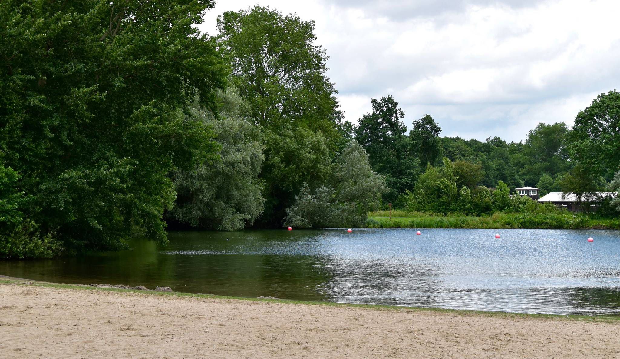
The bathing beach at Werdersee offers a great view and opportunities for stand-up paddleboarding.
0
0
Great view of the Werdersee
0
0
The Werdersee lake is perfect for swimming or stand-up paddleboarding.
0
0
Great view of the Weser Stadium with its iconic floodlights.
0
0
Round trip around the Weser and Werdersee
0
0

At Werdersee, you quickly get the impression that the city is a world away. This long, open stretch of water, up to 308 meters wide in places, is part of Bremen's flood protection system. It's a fantastic spot to observe the reflection of passing clouds.
0
0
Not far from the city, the riverside path along the Kleine Weser leads you right to the water's edge. Here you can relax and enjoy a break from the hustle and bustle. Along the Blau River, you'll wander through lush greenery.
0
0
Frequently Asked Questions
How many hiking trails are accessible from bus stations around Werdersee?
There are over 1100 hiking routes around Werdersee that are easily accessible via public transport. The area is well-connected, making it convenient to start your outdoor adventure directly from a bus stop.
What is the general difficulty and terrain like for bus-accessible hikes in Werdersee?
The hiking routes around Werdersee are generally rated as easy, with minimal elevation gain, making them suitable for all skill and fitness levels. Many paths are paved or along dykes, offering comfortable walking surfaces. The landscape features extensive dyke promenades, meadows, and waterside paths along the Werdersee and Kleine Weser.
Are there any circular hiking routes that start near a bus station?
Yes, many routes are circular, allowing you to return to your starting point easily. For example, the Lake Werdersee – Werdersee loop from Weserstadion is a popular circular option. Another great choice is the Werdersee – Lake Werdersee loop from Hemelingen, which also offers a complete circuit.
What interesting landmarks or natural features can I see along these bus-accessible trails?
The trails around Werdersee offer several points of interest. You can explore the expansive Lake Werdersee itself, walk along the dykes, and cross the charming Strawberry Bridge (Karl Carstens Bridge). The area is part of the green Stadtwerder peninsula, providing a refreshing natural environment close to the city.
Are the bus-accessible hiking trails around Werdersee suitable for families with children?
Absolutely. The trails are predominantly easy and flat, making them ideal for families. The diverse landscapes of dykes, meadows, and the lake provide plenty of space for children to explore. The Krimpelsee Circular Trail loop from Weserstadion is a shorter, easy option perfect for a family outing.
Can I bring my dog on the hiking trails around Werdersee?
Yes, the Werdersee area is generally dog-friendly, and many hikers enjoy the trails with their canine companions. Please ensure your dog is kept on a leash, especially in designated recreational areas and near other visitors, to respect local regulations and wildlife.
What is the best time of year to go hiking around Werdersee from a bus station?
Werdersee is enjoyable year-round, but spring and summer are particularly popular. In summer, the meadows are perfect for relaxation and barbecuing at designated sites. The easy, mostly paved paths also make it suitable for pleasant walks during autumn and even mild winter days.
Are there any places to get refreshments or food near the bus-accessible trails?
Yes, you can find options for refreshments. Café Sand is a well-known spot situated near Werdersee, offering a place to relax with a view of the Weser beach. Many routes also pass through or near urban areas where other cafes and restaurants are available.
How long do the bus-accessible hikes typically take?
The duration of hikes varies depending on the route and your pace. Many popular loops, such as the Werdersee Beach – View of the Werdersee loop from Weserstadion, can be completed in about 1.5 to 2 hours. Shorter options like the Krimpelsee Circular Trail loop from Weserstadion might take just over an hour.
What do other hikers enjoy most about the bus-accessible trails in Werdersee?
The area is highly rated by the komoot community, with an average score of 4.4 stars. Reviewers often praise the easy accessibility via public transport, the flat and well-maintained paths, and the refreshing waterside atmosphere of the Werdersee. The proximity to Bremen city center while offering a natural escape is also frequently highlighted.
Are there any longer bus-accessible routes that explore more of Bremen?
For those looking for a longer urban and natural blend, the Roland of Bremen – Bremen Market Square loop from Weserstadion extends beyond the immediate Werdersee area. This route allows you to combine the natural beauty with a visit to Bremen's historic city center, all starting conveniently from a bus-accessible point.
Most popular routes around Werdersee
Most popular attractions around Werdersee

Get inspired with the komoot mobile app


Explore more
Browse the best Hikes in other regions.
