The best hikes from bus stations around Stausee Losheim
4.6
(10456)
40,414
hikers
525
hikes
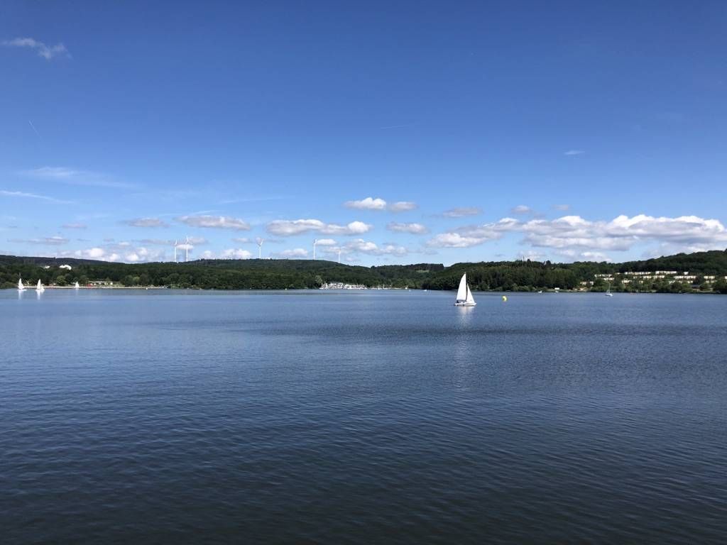
Bus station hiking trails around Stausee Losheim are situated within Germany's Saar-Hunsrück Nature Park, an area characterized by wooded hills, tranquil valleys, and the Losheim Reservoir itself. The lake, created by damming the Losheimer Bach, forms a central feature of the landscape. The region offers a network of trails that explore both the immediate lakeside and the broader natural park, providing varied terrain for hikers.
Best bus station hiking trails around Stausee Losheim
- The most popular bus station hiking route…
Last updated: June 29, 2026
4.8
(382)
1,478
hikers
Moderate hike. Good fitness required. Mostly accessible paths. Sure-footedness required.
4.7
(231)
997
hikers
Moderate hike. Good fitness required. Mostly accessible paths. Sure-footedness required.

Sign up for free
4.6
(252)
1,339
hikers
Easy hike. Great for any fitness level. Easily-accessible paths. Suitable for all skill levels.
4.6
(70)
309
hikers
4.61km
01:15
60m
60m
Easy hike. Great for any fitness level. Easily-accessible paths. Suitable for all skill levels.
2.8
(5)
59
hikers
3.86km
01:00
30m
30m
Easy hike. Great for any fitness level. Easily-accessible paths. Suitable for all skill levels.
Get access to more routes and recommendations from other explorers.
Sign up for free
Already have an account?
Our route recommendations are based on thousands of hikes, rides, and runs completed by other people on komoot.
Start today with a free account
Your next adventure awaits.
Login or Signup
Popular around Stausee Losheim
Other adventures around Stausee Losheim

Tips from the Community

Very nice Kneipp facility near the Losheim reservoir. There is a water treading basin and an arm bath. The water comes directly from a stream.
0
0

All dream loops start at a gate - great orientation and a bit of a finish line feeling when you arrive back.
0
0
Inflow to the reservoir, beautiful area
0
0

Take a break. Plenty of benches along the way on this lovely walk.
0
0

Here at this beautiful spot with a great view we took a longer break.
0
0

You can walk around the whole lake
0
0

A beautifully maintained Kneipp garden with benches, beautiful plants, and two Kneipp pools for the arms and legs! 🦵💪🏻🚰
0
0

A great place with wonderful hiking trails
0
0
Frequently Asked Questions
How many hiking trails are accessible from bus stations around Stausee Losheim?
There are over 500 hiking trails around Stausee Losheim that are easily accessible from various bus stations, offering a wide range of options for all skill levels.
What makes hiking around Stausee Losheim unique for bus travelers?
The Stausee Losheim area, nestled within the picturesque Saar-Hunsrück Nature Park, offers a diverse landscape of wooded hills, tranquil lake views, and well-developed trails. Many routes are designed as loops, making them convenient for bus travelers as you can start and end your hike at the same bus stop without needing to arrange return transport.
Are there easy hiking trails near bus stops suitable for beginners or families?
Yes, there are over 275 easy routes accessible from bus stations. A great option is the Losheim Reservoir – View of the Losheim Reservoir loop from Losheim am See, which is just under 5 km and offers pleasant lakeside views. The circular path directly around the lake is also largely paved and suitable for strollers in parts.
Are there longer, more challenging routes accessible from bus stations?
Absolutely. For those seeking a moderate challenge, there are over 245 routes available. Consider the Bridge Over the Losheimer Bach – Rodenbach Stream Near Bergen loop from Losheim am See, a 13.5 km hike with over 230 meters of elevation gain, offering a more extensive exploration of the surrounding nature.
What kind of natural attractions or viewpoints can I expect on these bus-accessible trails?
Many trails offer stunning views of Stausee Losheim and the surrounding Saar-Hunsrück Nature Park. You might encounter natural rock formations like the Teufelsfelsen (Devil's Rock) and Bärenfels on routes like the Losheimer Felsenweg. The Bench With View of the Valley loop from Losheim am See provides a lovely panorama. The SeeGarten, a beautiful garden park, is also easily accessible near the lake.
Are there any circular hiking routes that start and end at a bus station?
Yes, many of the trails around Stausee Losheim are designed as circular routes, which are ideal for public transport users. For example, the Boardwalks Over the Metzerbach – Losheim Reservoir loop from Losheim am See is a moderate 10.8 km loop that brings you back to your starting point.
What do other hikers enjoy the most about hiking in Stausee Losheim?
The area is highly rated by the komoot community, with an average score of 4.6 stars. Reviewers often praise the well-maintained paths, the scenic beauty of the lake and forests, and the variety of trails suitable for different fitness levels. The convenience of accessing these trails via public transport is also frequently highlighted.
Are the bus station hiking trails around Stausee Losheim dog-friendly?
Generally, the hiking trails in the Saar-Hunsrück Nature Park, including those around Stausee Losheim, are dog-friendly. However, it's always recommended to keep dogs on a leash, especially near the lake, in nature reserve areas, or when passing through agricultural land. Always check local regulations for specific routes.
What is the best time of year to hike around Stausee Losheim using public transport?
Spring and autumn are particularly beautiful for hiking around Stausee Losheim, with pleasant temperatures and vibrant natural colors. Summer offers opportunities to combine hiking with swimming in the lake, while winter can provide serene, snow-covered landscapes, though some paths might be slippery. Public transport generally operates year-round, but checking schedules for seasonal changes is advisable.
Are there facilities like cafes or restaurants near the bus-accessible hiking trails?
Yes, the area around Stausee Losheim is well-equipped with facilities. You'll find cafes and restaurants, particularly near the main lake area and in Losheim am See itself, which are often close to bus stops. These offer opportunities for refreshments before or after your hike.
Can I find trails that are part of longer-distance paths from bus stations?
Yes, Stausee Losheim serves as a starting point for sections of the renowned Saar-Hunsrück-Steig, a long-distance hiking trail. While this guide focuses on shorter, bus-accessible routes, you can use public transport to reach points where you can connect to or explore parts of this larger network.
Most popular routes around Stausee Losheim
Most popular attractions around Stausee Losheim

Get inspired with the komoot mobile app


Explore more
Browse the best Hikes in other regions.
