The best traffic-free bike rides around Paupitzscher Lake
4.5
(6678)
21,789
riders
263
rides
No traffic touring cycling routes around Paupitzscher Lake traverse a landscape transformed from former lignite mining areas into a renatured "New Lake District." The region is characterized by a network of cycling paths connecting various lakes, including Paupitzscher Lake itself, and the broader Goitsche landscape protection area. This area features generally gentle elevations and well-maintained surfaces, making it suitable for touring cyclists. The terrain includes diverse ecosystems, post-mining landscapes, and connections to other bodies of water.
Best no traffic touring…
Last updated: June 29, 2026
4.7
(10)
92
riders
22.7km
01:26
40m
40m
Easy bike ride. Great for any fitness level. Mostly paved surfaces. Suitable for all skill levels.
4.5
(6)
19
riders
Easy bike ride. Great for any fitness level. Mostly paved surfaces. Suitable for all skill levels.

Sign up for free
4.0
(5)
6
riders
10.0km
00:34
30m
30m
Easy bike ride. Great for any fitness level. Mostly paved surfaces. Suitable for all skill levels.
4.8
(8)
95
riders
7.59km
00:26
10m
10m
Easy bike ride. Great for any fitness level. Mostly paved surfaces. Suitable for all skill levels.
4.5
(11)
13
riders
18.1km
01:01
40m
40m
Easy bike ride. Great for any fitness level. Mostly paved surfaces. Suitable for all skill levels.
Get access to more routes and recommendations from other explorers.
Sign up for free
Already have an account?
Our route recommendations are based on thousands of hikes, rides, and runs completed by other people on komoot.
Start today with a free account
Your next adventure awaits.
Login or Signup
Popular around Paupitzscher Lake
Tips from the Community

Today, an developed network of cycle paths and hiking trails with viewing platforms and information boards on the formation of the landscape extends along the Neuhäuser See. The 120 km long Kohle-Dampf-Licht cycle path from Lutherstadt Wittenberg to Markkleeberg passes by the lake. Source https://de.wikipedia.org/wiki/Neuh%C3%A4user_See
1
0
In the mid-19th century, the first mining activities began in the southwest of Goitzsche, near the villages of Petersroda and Holzweißig.[3] Following the lignite seam, mining progressed from west to east. Favored by the opening of the current Magdeburg–Leipzig and Trebnitz–Leipzig railway lines, the sales market for lignite expanded to Halle and Leipzig, among other places. The increased demand for electrical energy and fossil fuels in the 19th and 20th centuries led in 1908 to the opening of the Leopold open-cast mine (from 1945 to 1962 Holzweißig–Ost) and in 1958 to the creation of the Holzweißig-West open-cast mine.[3] The Neuhäuser See originated from the former Holzweißig-West lignite open-cast mine. It is named after the Neuhaus estate, which was demolished in 1976 along with the village of Paupitzsch. The Holzweißig-West open-cast mine was operated from 1958 to 1980. Other sources report usage until 1991. The lake was flooded from 1993 to 2005.[1] Overflowing water is channeled via the Goitzsche into the Mulde. Since 1997, the area has been renatured and stable embankments have been created. Source https://de.wikipedia.org/wiki/Neuh%C3%A4user_See
1
0
The Neuhäuser See is located on the northwestern border of the Free State of Saxony with Saxony-Anhalt, at an altitude of about 78 m above sea level. NN. South of the lake is Benndorf, a district of the North Saxon district town of Delitzsch, and to the north is the unified municipality of Bitterfeld-Wolfen in Saxony-Anhalt. It is located in the Central German Lake District, south of the Großer Goitzschesee and the waters Ludwigsee and Paupitzscher See. Quelle https://de.wikipedia.org/wiki/Neuh%C3%A4user_See
1
0
The Neuhäuser See (also Neuhauser See) is an opencast mine residual lake of approximately 155 hectares, which was created by flooding the former Holzweißig-West opencast mine. The lake is located in the Central German Lake District, south of the Goitzsche nature reserve and north of the town of Delitzsch. Source https://de.wikipedia.org/wiki/Neuh%C3%A4user_See
1
0
The frost has taken hold of the connecting channel... beautiful
6
0
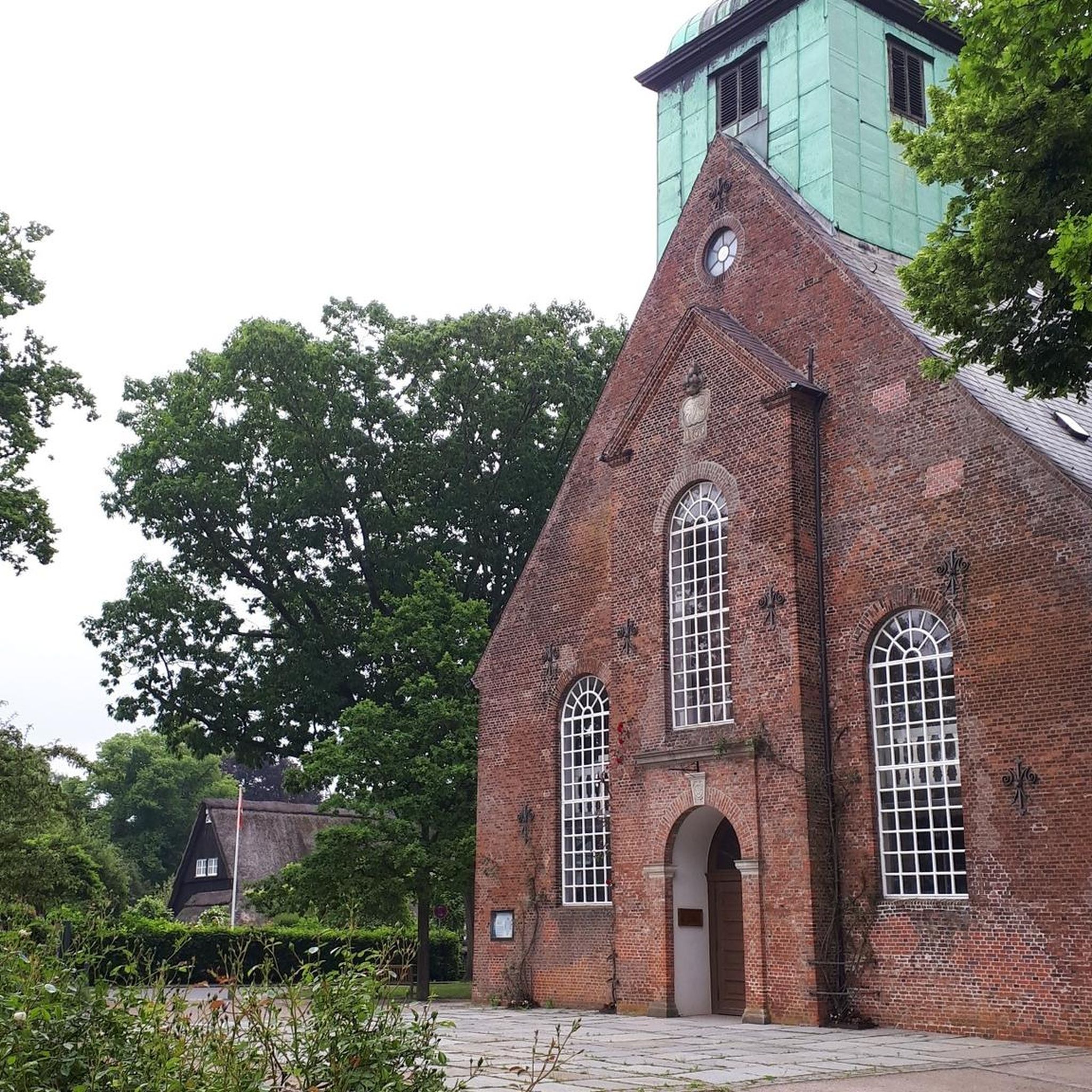
According to legend, Maria Neander blew trumpet signals here in 1637, calling the residents to arms. This enabled the citizens to successfully defend their town from the Swedish attackers. The neighboring gatehouse was demolished in 1867. Source: https://www.portalsaeule.de/index.php?cat=Mauern%2C%20Tore%20und%20T%C3%BCrme%2FStadtbefestigungen%20in%20Deutschland&page=Delitzsch
3
0
Frequently Asked Questions
What is the general difficulty level of no-traffic touring cycling routes around Paupitzscher Lake?
The majority of no-traffic touring cycling routes around Paupitzscher Lake are classified as easy. Out of 284 available routes, 187 are easy, making the area highly accessible for various fitness levels. These routes typically feature well-paved surfaces and gentle elevations, ideal for relaxed touring.
Are there any circular no-traffic touring routes available?
Yes, many routes around Paupitzscher Lake are designed as circular tours, allowing you to start and end at the same point. An example is the View of Neuhauser Lake – Lake Neuhauser loop from Paupitzscher See, which offers a scenic 10.9 km ride. Another option is the Cycle path at Paupitzscher Lake – Lober-Leine Bridge loop from Benndorf, covering just over 10 km.
What kind of terrain can I expect on these no-traffic cycling routes?
The terrain around Paupitzscher Lake is varied, reflecting its transformation from a former mining area. You can expect mostly flat to gently rolling paths, often well-paved, that wind through renatured landscapes, forested areas, and along the shores of various lakes. Some routes might include sections through former open-cast mining areas, showcasing the region's unique ecological recovery.
What are the best times of year for touring cycling around Paupitzscher Lake?
The region is enjoyable for touring cycling throughout the warmer months, typically from spring to autumn. Spring brings blooming flora, while summer offers lush greenery and pleasant temperatures. Autumn provides beautiful foliage. The well-maintained paths make cycling comfortable in most non-winter conditions.
Are the no-traffic touring cycling routes suitable for families with children?
Absolutely. Given the prevalence of easy routes and generally gentle elevations, the no-traffic paths around Paupitzscher Lake are very family-friendly. The absence of vehicle traffic ensures a safer and more relaxed experience for cyclists of all ages. Routes like the Lake Neuhauser – View of Neuhäuser See loop from Paupitzscher See are short and manageable for younger riders.
Can I bring my dog on the no-traffic touring cycling routes?
Yes, many of the paths are suitable for cycling with dogs, provided they are well-behaved and kept on a leash, especially in nature reserve areas. The diverse natural environment offers plenty of opportunities for your canine companion to enjoy the outdoors alongside you. Always be mindful of local regulations and other path users.
What natural features or viewpoints can I expect to see along the routes?
The routes offer views of the unique post-mining landscape, including the renatured Paupitzscher Lake itself, and connections to other bodies of water like the Great Goitsche Lake and Neuhäuser See. You'll cycle through areas rich in biodiversity, with opportunities for birdwatching and observing diverse plant species. The transformation of the landscape from industrial to natural is a key feature.
Are there places to stop for refreshments or food along the no-traffic routes?
While Paupitzscher Lake itself is a nature reserve with limited direct access, the broader Goitsche Lake District and nearby villages offer various options for refreshments. Cycling routes often connect to charming villages where you can find cafes or restaurants to refuel during your tour.
How can I get to the no-traffic cycling routes around Paupitzscher Lake using public transport?
The region is generally accessible by public transport, though specific connections to trailheads might require some planning. Depending on your starting point, you can often reach nearby towns or villages by train or bus, and then cycle a short distance to access the no-traffic routes. It's advisable to check local transport schedules for routes that accommodate bicycles.
Where can I park my car to access the no-traffic touring cycling routes?
Designated parking areas are typically available in towns and villages surrounding the Goitsche Lake District, which encompasses Paupitzscher Lake. Look for parking facilities near popular access points or trailheads. For example, starting points like Bitterfeld or Benndorf, as mentioned in routes like Goitzsche Beach – Bitterfeld Lake loop from Bitterfeld, often have convenient parking options.
Most popular routes around Paupitzscher Lake

Get inspired with the komoot mobile app


Explore more
Browse the best Cycling routes in other regions.
