The best hikes from bus stations around Dam Bautzen
4.5
(3451)
12,193
hikers
576
hikes
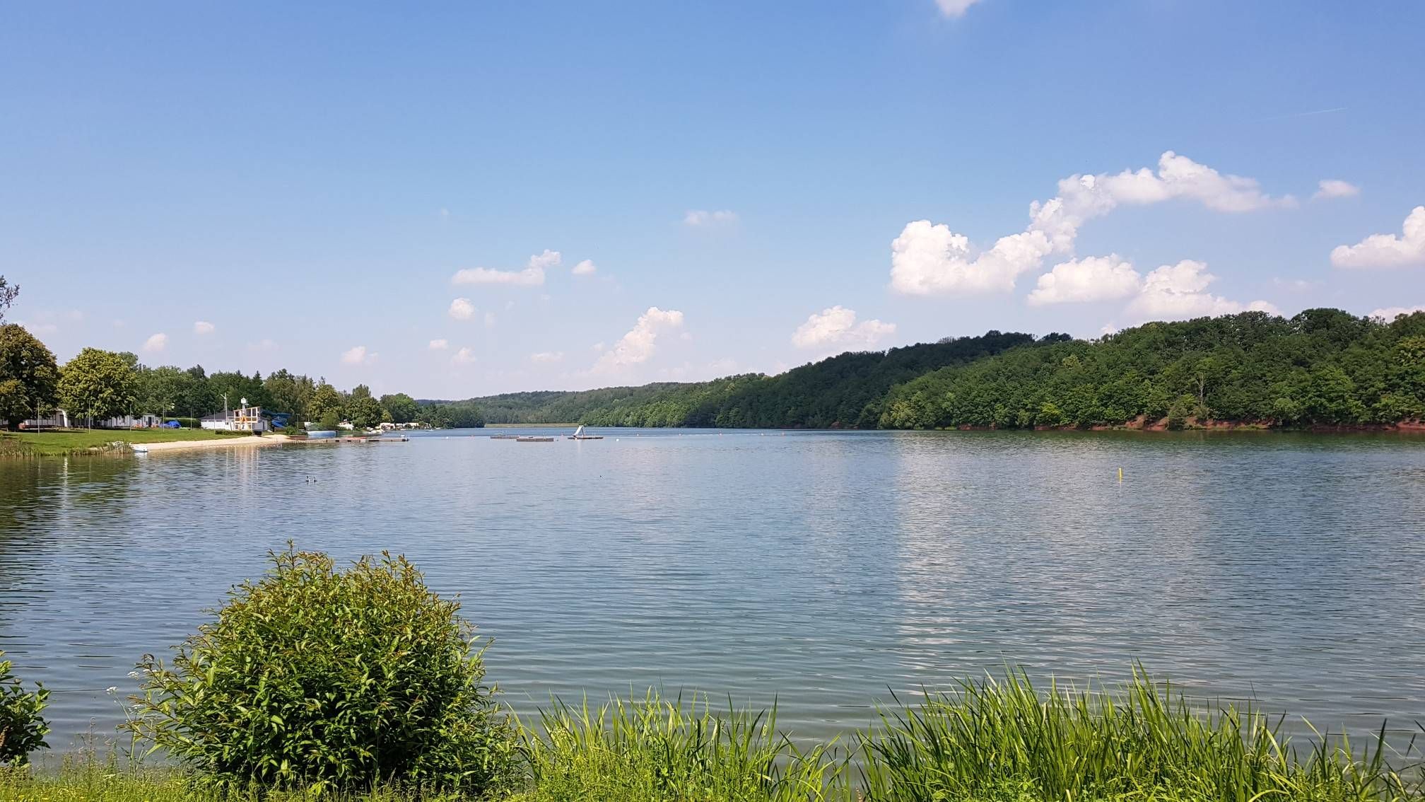
Hiking around Dam Bautzen offers diverse landscapes where the Lusatian highland meets the northern lowlands. The region is centered around the expansive Bautzen Reservoir, providing water views and recreational opportunities. To the north, the Upper Lusatian Heath and Pond Landscape, a UNESCO biosphere reserve, features an extensive network of ponds, forests, and moors. The surrounding terrain includes rolling hills and dense forests, with the Spree River winding through the area.
Best bus station hiking trails around Dam Bautzen
- The most…
Last updated: June 29, 2026
4.3
(238)
713
hikers
Moderate hike. Good fitness required. Easily-accessible paths. Suitable for all skill levels.
4.8
(109)
280
hikers
7.74km
01:58
10m
10m
Easy hike. Great for any fitness level. Easily-accessible paths. Suitable for all skill levels.

Sign up for free
4.9
(23)
102
hikers
Moderate hike. Good fitness required. Easily-accessible paths. Suitable for all skill levels.
4.6
(25)
93
hikers
Easy hike. Great for any fitness level. Easily-accessible paths. Suitable for all skill levels.
4.0
(5)
63
hikers
3.67km
00:58
30m
30m
Easy hike. Great for any fitness level. Easily-accessible paths. Suitable for all skill levels.
Get access to more routes and recommendations from other explorers.
Sign up for free
Already have an account?
Our route recommendations are based on thousands of hikes, rides, and runs completed by other people on komoot.
Start today with a free account
Your next adventure awaits.
Login or Signup
Popular around Dam Bautzen
Other adventures around Dam Bautzen


Tips from the Community

Super Tour! Sunshine and no mountains
0
0

Now that's what I call a truly idyllic path.
0
0

Bautzen is described as a beautiful and historic city, known for its architecture, especially its many towers, its cobblestone old town with colorful facades, as well as its cultural significance as the Sorbian capital and the home of the famous Bautzen mustard. The city offers a blend of historical sights, Sorbian culture, and culinary specialties.
3
0
The city center, or Nutřkowne město in Upper Sorbian, is a district of Bautzen, consisting of the historic old town and the city center. It is the historical nucleus of the city and the center of urban commerce and cultural life, and has a population of over 5,000. Large parts of it are protected as cultural monuments. The city center includes both the historic old town within the inner city walls, with multi-story buildings predominantly dating from the 15th to 18th centuries, and the so-called inner city between the inner and outer city walls. See: https://de.m.wikipedia.org/wiki/Innenstadt_(Bautzen)
3
0
A city with wealthy citizens like Bautzen had to be constantly prepared for defense in the Middle Ages. Therefore, powerful city fortifications were built to deter enemy attacks. The sieges by the Hussites in 1429 and 1431 demonstrated that the existing defenses were no longer sufficient to protect the city. The municipality subsequently had the city fortifications extensively modernized and expanded well into the 16th century, with their might serving as a deterrent to enemy attacks. An outer and an inner city wall, moats, ditches, ramparts, bastions, and towers protected the city. Seven gates in the outer ring of walls secured access to the suburbs. By the early 18th century, however, the fortifications were gradually losing their military function. Furthermore, they hampered the city's architectural development and transport growth.
3
0

Access to the dam from the B 156 with parking. From here, you can walk to the beach or circumnavigate the dam on foot or by bike. Cyclists who would like to continue their journey further can continue from the circumnavigate route to Bautzen or the surrounding area, for example, towards the Malschwitz Ponds, and then return here. The cycle paths are very well developed and signposted.
0
0

It's always nice to stroll along here.
0
1

I really liked it here in Bautzen. The old town center with the historical buildings, the city wall and not forgetting the market square. If you want to visit and explore everything in depth, one day is not enough.
3
0
Frequently Asked Questions
How many bus station hiking trails are available around Dam Bautzen?
There are over 580 hiking trails around Dam Bautzen that are easily accessible from bus stations. This includes a wide range of options, with more than 330 easy routes and over 230 moderate trails, ensuring there's something for every fitness level.
What kind of landscapes can I expect on bus-accessible hikes near Dam Bautzen?
The region offers a diverse landscape where the Lusatian highland meets the northern lowlands. You'll find expansive views of the Bautzen Reservoir, dense forests, rolling hills, and the unique Upper Lusatian Heath and Pond Landscape, which is a UNESCO biosphere reserve known for its extensive network of ponds and rich wildlife.
Are there any easy, family-friendly hikes accessible by bus around Dam Bautzen?
Yes, many routes are suitable for families. For a shorter, easy walk, consider the Bautzen Reservoir loop from Burk - Bórk, which is about 3.5 km. Another great option is the Emergency Spillway of the Dam loop from Burk - Bórk, offering pleasant views over the smaller dam section.
Can I find circular hiking routes starting from bus stops in the Dam Bautzen area?
Absolutely. Many of the trails are designed as circular routes, allowing you to start and end at the same bus stop. An excellent example is the View over the Bautzen Reservoir loop from Burk - Bórk, which provides comprehensive views of the lake and its surroundings.
What are some notable landmarks or points of interest along these bus-accessible trails?
Hikers can discover several interesting spots. The Causeway Through Bautzen Reservoir offers unique perspectives, especially during low water levels. You can also visit the Bautzen Intake Tower Memorial, commemorating the dam's construction. For nature lovers, the View of the Lake highlight provides scenic vistas.
Are there any hikes that feature the unique pond landscapes of the region?
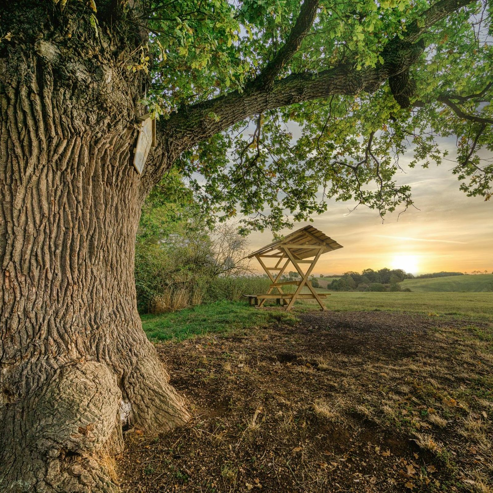
Yes, the Upper Lusatian Heath and Pond Landscape is a significant feature. The Niedergurig Manor – Pond View loop from Rieseneiche is an easy route that guides you through this distinctive area, allowing you to experience its ecological richness and observe local wildlife.
What is the best time of year to go hiking around Dam Bautzen using public transport?
The optimal time for hiking around Dam Bautzen is generally from late spring to early autumn, specifically from May to September. During these months, the weather is most favorable for outdoor activities, and the natural beauty of the reservoir and surrounding landscapes is at its peak.
What do other hikers say about the trails around Dam Bautzen?
The area is highly rated by the komoot community, with an average score of 4.5 stars from over 3,200 ratings. Reviewers often praise the well-maintained paths, the stunning reservoir views, and the peaceful atmosphere of the surrounding forests and pond landscapes.
Are there any moderate hikes accessible by bus that offer good views?
For a moderate challenge with rewarding views, consider the Forebay of the Bautzen Reservoir loop from Burk - Bórk. This 8 km route provides excellent perspectives over the reservoir and its forebay, showcasing the region's natural beauty.
Can I find places to swim or relax near the bus-accessible hiking trails?
Yes, the Swimming beach at Bautzen Reservoir is a popular spot for relaxation and swimming. It's easily accessible and provides a sandy area to unwind after your hike, or to cool off during warmer months.
Most popular routes around Dam Bautzen
Most popular attractions around Dam Bautzen

Get inspired with the komoot mobile app


Explore more
Browse the best Hikes in other regions.
