The best hikes from bus stations around Lac Dets Coubous
4.6
(1379)
16,876
hikers
62
hikes
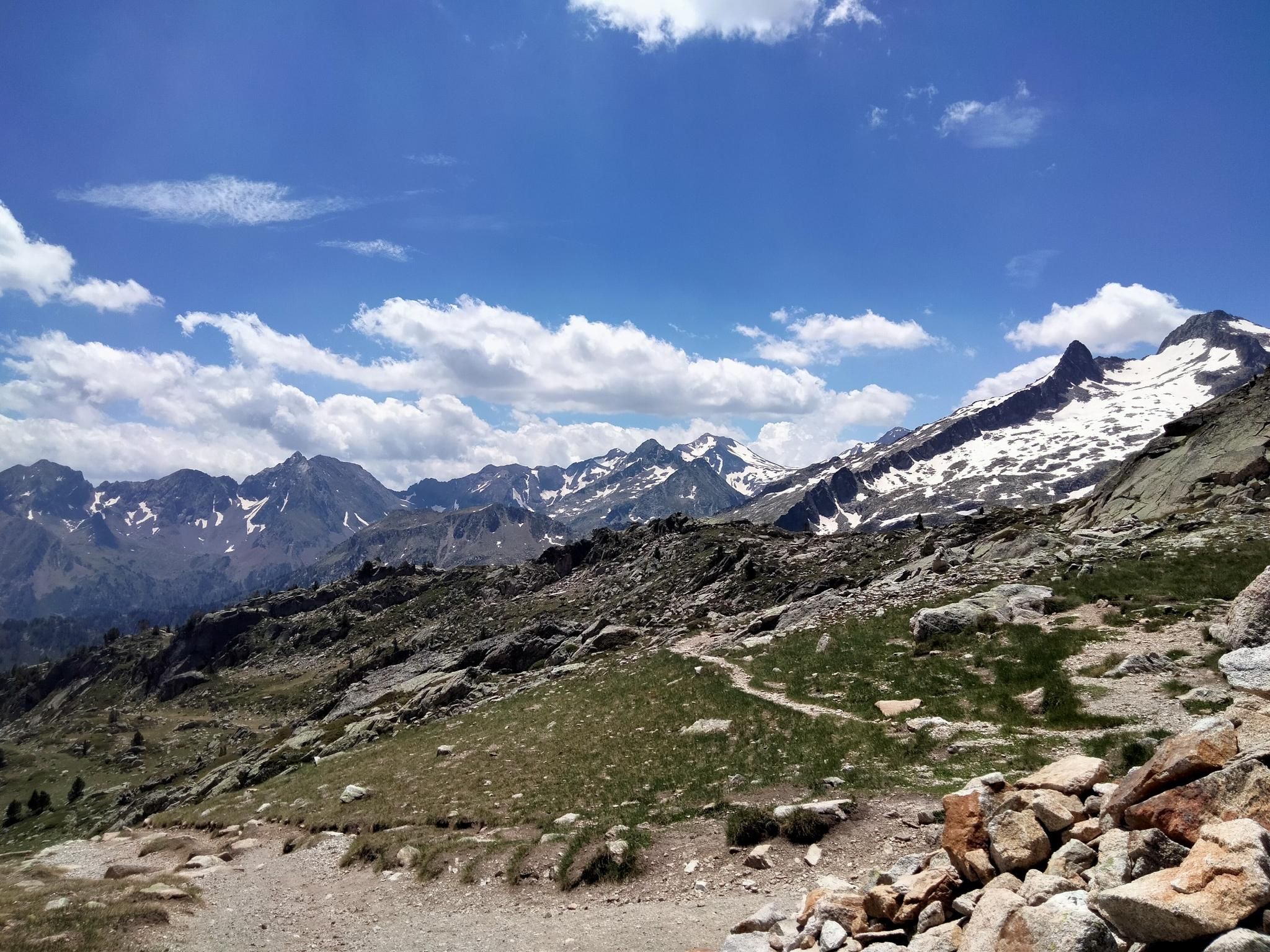
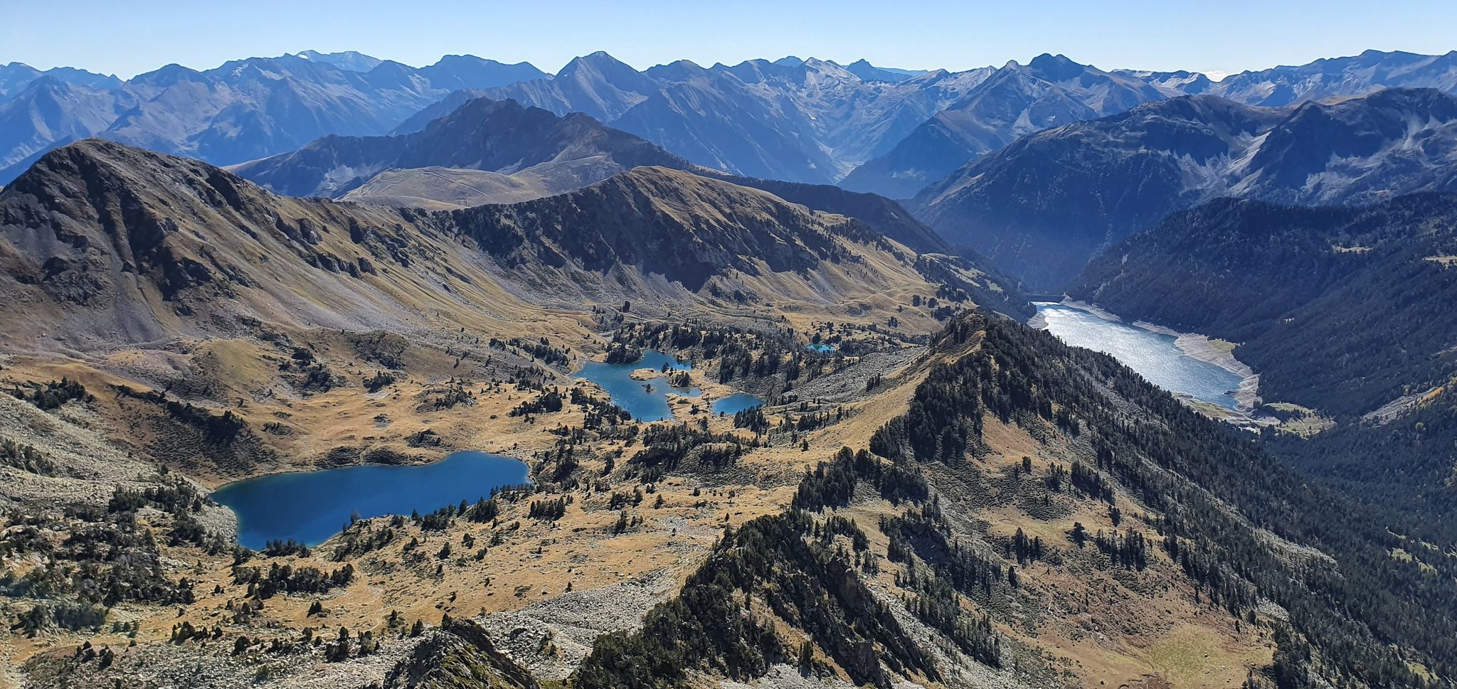
Bus station hiking trails around Lac Dets Coubous offer access to a high-altitude landscape characterized by numerous interconnected lakes, including Lac Dets Coubous itself, situated at 2,041 meters above sea level. The region is part of the Pyrénées, featuring high-altitude cirques, lush meadows, and imposing peaks that provide expansive mountain views. Terrain varies from accessible paths to stony sections that may require some climbing, all within or at the gateway to the Néouvielle National Nature Reserve.
Best bus station hiking…
Last updated: May 17, 2026
4.6
(46)
503
hikers
9.22km
03:55
590m
590m
Moderate hike. Good fitness required. Mostly accessible paths. Sure-footedness required.
4.9
(8)
138
hikers
23.2km
09:57
1,370m
1,370m
Hard hike. Very good fitness required. Mostly accessible paths. Sure-footedness required.

Sign up for free
12
hikers
12.4km
04:38
800m
800m
Moderate hike. Good fitness required. Mostly accessible paths. Sure-footedness required.
5.0
(1)
7
hikers
9.18km
03:30
530m
530m
Moderate hike. Good fitness required. Mostly accessible paths. Sure-footedness required.
5.0
(1)
18
hikers
18.0km
05:59
890m
890m
Hard hike. Very good fitness required. Easily-accessible paths. Suitable for all skill levels.
Get access to more routes and recommendations from other explorers.
Sign up for free
Already have an account?
Our route recommendations are based on thousands of hikes, rides, and runs completed by other people on komoot.
Start today with a free account
Your next adventure awaits.
Login or Signup

Tips from the Community


Large car park at the foot of the Tourmalet, there is a bike park here and there are opportunities to walk to the Néouveille lakes.
0
0

The Col du Tourmalet... a pass that was a real challenge for me! It climbs continuously for 20 km without any real respite... With the end getting a bit tougher, especially mentally!
0
0

Octave Lapize, the first to climb it on a bike during the tour. Check out the history, it's unmissable.
0
0

Very worth seeing, you have to see it
0
0


The succession of lakes in the opposite direction to what the majority of hikers do is a real eye-opener 🤩 Be careful, departure at 9am from the paid parking lot 🅿️ and we were far from being the first!
0
0
Frequently Asked Questions
How many bus-accessible hiking trails are available around Lac Dets Coubous?
There are over 60 hiking trails around Lac Dets Coubous that are accessible from bus stations, offering a wide range of options for all skill levels.
What kind of terrain can I expect on bus-accessible hikes in this region?
The terrain around Lac Dets Coubous is quite varied. You'll find a mix of accessible paths through lush meadows and high-altitude cirques, alongside more challenging, stony sections that may require some climbing. The region is part of the Pyrénées, so expect mountainous landscapes and stunning views.
Are there any easy, family-friendly hikes accessible by bus?
Yes, there are 8 easy routes suitable for families. While specific routes are not detailed here, these trails generally offer less elevation gain and shorter distances, allowing for a pleasant experience amidst the beautiful 'lake to lake' landscape.
What are some popular moderate bus-accessible loop hikes?
A popular moderate option is the Gaubie Valley – Lac Dets Coubous loop from Tournaboup, which covers about 9.1 km with around 584 meters of elevation gain. Another great choice is the Tournaboup – Lake Oncet loop from Tournaboup, spanning 12.2 km with approximately 799 meters of ascent.
Are there challenging bus-accessible hikes for experienced trekkers?
Absolutely. For those seeking a challenge, the region offers 14 difficult routes. An example is the demanding Lac d'Aubert – Lake Aumar loop from Tournaboup, which is over 23 km long with more than 1300 meters of elevation gain. Another challenging option is the Tourmalet Pass – Col du Tourmalet loop from Tournaboup, covering 18 km with nearly 900 meters of ascent.
What natural features can I expect to see on these trails?
Hikers can enjoy a stunning array of natural features, including numerous high-altitude lakes like Lac des Coubous, Lac de la Jonquère, and Lac de Tracens. The trails also wind through picturesque high-altitude cirques and lush meadows. In late July, these valleys are particularly vibrant with blooming irises, adding to the scenic beauty.
What do other hikers say about the bus-accessible trails around Lac Dets Coubous?
The komoot community highly rates the trails around Lac Dets Coubous, with an average score of 4.7 out of 5 stars from nearly 1400 ratings. Reviewers often praise the breathtaking 'lake to lake' scenery, the diverse terrain, and the sense of immersion in the pristine Néouvielle National Nature Reserve.
Is the Néouvielle National Nature Reserve accessible by bus-friendly routes?
Many of the bus-accessible routes either pass through or act as gateways to the Néouvielle National Nature Reserve. This protected area is known for its pristine natural beauty, and hikers should be aware of and respect the regulations in place to preserve its environment.
Are there any circular routes starting from bus stops?
Yes, many of the bus-accessible routes are designed as loops, allowing you to start and end at the same point, often near a bus station. Examples include the Gaubie Valley – Tournaboup loop from Tournaboup and the Gaubie Valley – Lac Dets Coubous loop from Tournaboup.
What is the best time of year to hike these bus-accessible trails?
The best time to hike around Lac Dets Coubous is generally from late spring to early autumn (June to October). Late July is particularly beautiful when the meadows are adorned with blooming irises. Always check local weather conditions before heading out, as high-altitude areas can experience rapid changes.
Are there any specific regulations for hiking in the Néouvielle Reserve, especially concerning dogs?
As Lac Dets Coubous is within or borders the Néouvielle National Nature Reserve, specific regulations apply to protect its pristine environment. This often includes rules regarding dogs, waste, and camping. It's advisable to check the official Néouvielle Reserve guidelines before your visit to ensure compliance.
Most popular routes around Lac Dets Coubous

Get inspired with the komoot mobile app


Explore more
Browse the best Hikes in other regions.
