The best hikes from bus stations around Parco Nazionale della Val Grande
4.5
(17917)
77,652
hikers
122
hikes
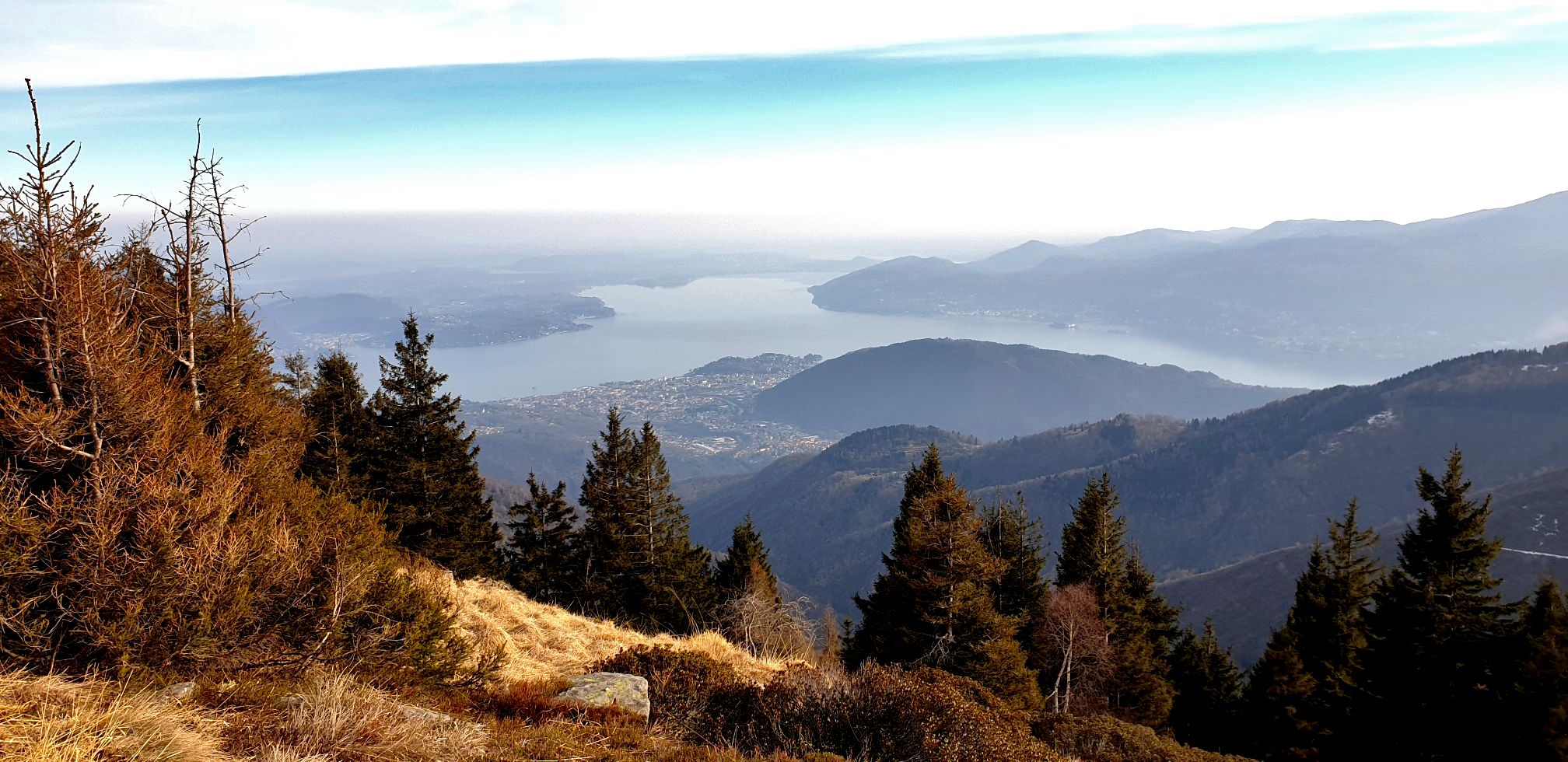
Bus station hiking trails around Parco Nazionale della Val Grande are situated within Italy's largest wilderness area, characterized by the rugged terrain of the Lepontine Alps. The landscape features steep, forested valleys, deep gorges, and numerous peaks, with ancient beech and chestnut woodlands dominating lower elevations. Rivers carve dramatic canyons through the metamorphic rock formations, transitioning to alpine meadows and rocky slopes at higher altitudes. The park's remote nature provides a diverse environment for outdoor exploration.
Best bus station hiking trails around Parco Nazionale della Val Grande
- The most popular bus station hiking route is Rifugio Monte Vecchio loop from Cursolo, a 3.5 miles (5.6 km) trail that takes 2 hours 4 minutes to complete. This moderate route features a steady ascent through forested terrain to a mountain hut.
- Another top favourite among local hikers is Rifugio Monte Vecchio – Pluni Bivouac loop from Cursolo, a moderate 8.0 miles (12.9 km) path. This longer loop offers sustained climbing and panoramic views of the surrounding valleys.
- Local hikers also love the Ancient Washhouse – Cardezza Village and Church loop from Pallanzeno, a 3.8 miles (6.1 km) trail leading through historical villages and woodlands, often completed in about 2 hours 9 minutes.
- Hiking around Parco Nazionale della Val Grande is defined by steep forested valleys, alpine meadows, and rugged mountainous terrain. The network of routes offers options for various ability levels, from moderate day hikes to more challenging ascents.
- The routes in Parco Nazionale della Val Grande are highly rated by the komoot community with an average score of 4.5 stars from more than 15,000 reviews. More than 69,000 hikers have used komoot to explore Parco Nazionale della Val Grande's varied terrain.
Last updated: June 28, 2026
4.5
(2)
17
hikers
2.54km
00:58
150m
150m
Moderate hike. Great for any fitness level. Mostly accessible paths. Sure-footedness required.
4.6
(18)
71
hikers
5.58km
02:05
360m
360m
Moderate hike. Good fitness required. Easily-accessible paths. Suitable for all skill levels.

Sign up for free
5.0
(4)
29
hikers
12.9km
04:51
820m
820m
Moderate hike. Good fitness required. Mostly accessible paths. Sure-footedness required.
4.3
(3)
20
hikers
6.14km
02:10
290m
290m
Moderate hike. Good fitness required. Mostly accessible paths. Sure-footedness required.
4.3
(3)
9
hikers
10.3km
04:40
760m
760m
Hard hike. Good fitness required. Sure-footedness, sturdy shoes and alpine experience required.
Get access to more routes and recommendations from other explorers.
Sign up for free
Already have an account?
Our route recommendations are based on thousands of hikes, rides, and runs completed by other people on komoot.
Start today with a free account
Your next adventure awaits.
Login or Signup
Popular around Parco Nazionale della Val Grande
Other adventures around Parco Nazionale della Val Grande

Tips from the Community

Entrance was barred (rock fall) on 23-05-2026! But the tunnel is short enough (lights mandatory)
0
0

Wonderful village easily reachable with the Toce cycle path. Don't miss the visit to the fortress and the church.
0
0


This old road, located on the slopes of the Cursolo mountains between the hamlets of Airetta and Creves, is perfect for avoiding a long tunnel, as well as being remarkably panoramic.
0
0

Hamlet of the municipality of Beura at an altitude of 450m above sea level
0
0
Path of the ancient gneiss quarries and road of Roman origin
0
0

This church in Vogogna is not dedicated to one of the countless saints - people who lived their Christian faith in an exemplary manner, or even died as martyrs (martyrs) for it - and whom we now venerate as intercessors at God's throne. Here, people have turned directly to Jesus Christ, our Savior and Redeemer: this church and parish have been entrusted to the Sacred Heart of Jesus.
2
0

Place of worship and prayer Via S. Martino, 1, 28805 Vogogna VB
1
0
Frequently Asked Questions
How many bus-accessible hiking trails are available in Parco Nazionale della Val Grande?
There are over 110 hiking trails in Parco Nazionale della Val Grande that are accessible from bus stations. These routes cater to various skill levels, with 35 easy, 54 moderate, and 21 difficult options.
What is the general difficulty level of bus-accessible hikes in this region?
The bus-accessible hikes in Parco Nazionale della Val Grande offer a range of difficulties. While many routes demand good fitness and sure-footedness due to the park's rugged terrain, there are also easier walks suitable for those seeking a less strenuous experience. The majority of routes are rated as moderate.
Are there family-friendly hiking options accessible by bus?
Yes, there are family-friendly options among the bus-accessible trails. For example, the Ancient Washhouse – Cardezza Village and Church loop from Pallanzeno is a moderate route that offers a glimpse into local history and culture, suitable for families with some hiking experience.
Can I bring my dog on these bus-accessible hiking trails?
Parco Nazionale della Val Grande is generally dog-friendly, but specific rules may apply to certain areas or during particular seasons to protect wildlife. It's always best to keep your dog on a leash, especially in areas where wildlife is present. Always check local regulations before heading out.
What kind of landscapes and natural features can I expect to see on these hikes?
Hikers can expect diverse and rugged landscapes. The park features steep, forested valleys, deep gorges, and towering peaks of the Lepontine Alps. You'll encounter ancient beech and chestnut woodlands, alpine meadows, and numerous streams. Many routes offer panoramic views of the surrounding mountains and valleys, with distant glimpses of Lago Maggiore and Lago d'Orta.
Are there any circular routes that start and end at a bus station?
Yes, many bus-accessible routes are circular, allowing you to return to your starting point without needing additional transport. An example is the Rifugio Monte Vecchio loop from Cursolo, a moderate hike offering scenic views and a return to the bus stop.
What historical sites or points of interest can be found along these trails?
The park is rich in history, with traces of human presence. You might encounter abandoned mountain villages like Pogallo Abandoned Village, old mule tracks, and even military fortifications. The Ancient Washhouse – Cardezza Village and Church loop from Pallanzeno, for instance, passes by historical structures.
When is the best time of year to hike these bus-accessible trails?
The best time to hike in Parco Nazionale della Val Grande is typically from late spring to early autumn (May to October). During these months, the weather is generally more stable, and trails are clear of snow, making for safer and more enjoyable hiking conditions. Autumn offers stunning foliage, while spring brings wildflowers.
What do other hikers enjoy most about hiking in Parco Nazionale della Val Grande?
The area is highly rated by the komoot community, with an average score of 4.5 stars. Reviewers often praise the park's untouched wilderness, the solitude it offers, and the breathtaking panoramic views from its peaks. The diverse trails and rich biodiversity are also frequently highlighted.
Are there any natural pools or wild swimming spots near bus-accessible trails?
Yes, the park's numerous streams and rivers carve dramatic canyons, and some areas offer opportunities for wild swimming. The Pogallo River Natural Pools are a notable spot where you can cool off, though accessibility by bus may require an additional walk from the nearest stop.
Are there any trails that lead to significant viewpoints or summits?
Many trails offer spectacular viewpoints. For instance, the region boasts 75 named peaks, including Monte Zeda summit and Laurasca Peak, which provide extensive vistas of the surrounding mountains and lakes. Routes like the Cava Cremosina – Alpe Marona loop from Pallanzeno offer significant elevation gain, leading to rewarding views.
Most popular routes around Parco Nazionale della Val Grande
Most popular attractions around Parco Nazionale della Val Grande

Get inspired with the komoot mobile app


Explore more
Browse the best Hikes in other regions.
