The best hikes from bus stations around National Park Douro Internacional
4.4
(216)
1,332
hikers
14
hikes
Hiking around National Park Douro Internacional is characterized by deep river valleys and canyons carved by the Douro and Águeda rivers, featuring steep cliffs and dramatic rock formations. The park also encompasses extensive plateaus reaching altitudes between 700 and 800 meters, contributing to varied microclimates. The landscape includes oak and cork oak forests, juniper, almond groves, vineyards, and olive trees. This diverse terrain offers a range of bus station hiking trails for exploration.
Best bus station hiking trails around National…
Last updated: July 12, 2026
4.6
(17)
64
hikers
19.0km
05:15
320m
320m
Hard hike. Very good fitness required. Easily-accessible paths. Suitable for all skill levels.
5.0
(3)
17
hikers
14.2km
04:01
310m
310m
Moderate hike. Good fitness required. Easily-accessible paths. Suitable for all skill levels.

Sign up for free
2
hikers
Hard hike. Very good fitness required. Easily-accessible paths. Suitable for all skill levels.
4.8
(6)
28
hikers
Moderate hike. Good fitness required. Easily-accessible paths. Suitable for all skill levels.
2.0
(1)
2
hikers
20.3km
05:48
470m
470m
Hard hike. Very good fitness required. Easily-accessible paths. Suitable for all skill levels.
Get access to more routes and recommendations from other explorers.
Sign up for free
Already have an account?
Our route recommendations are based on thousands of hikes, rides, and runs completed by other people on komoot.
Start today with a free account
Your next adventure awaits.
Login or Signup
Popular around National Park Douro Internacional
Other adventures around National Park Douro Internacional

Tips from the Community

Mirador do Penedo Amarelo. It is located on Rua do Penedo Amarelo, in the urban area of Miranda do Douro. It offers wide panoramic views of the Douro River surrounded by green hills, the dam, the historic center and the co-cathedral of Miranda do Douro. It is one of the most outstanding urban viewpoints in the area.
3
0
From the Vale de Águia hill fort, there is a natural viewpoint with spectacular views of one of the meanders of the Douro. At the São João das Arribas hermitage, you can also enjoy stunning panoramic views of the canyon and waterfalls on the Spanish slope. The landscape includes cliffs, meadows, oak groves, and pastures, with abundant flora and fauna.
5
0
The GR-36 trail in the Miranda do Douro area is one of the most spectacular routes in northern Portugal, especially for its views of the Douro Canyon, which forms the natural border with Spain.
6
0
The Miradouro da Cerca, located in the village of Urrós (municipality of Mogadouro, near Miranda do Douro), is one of the most spectacular viewpoints in the Douro International Natural Park and is part of a route that many consider worthy of the title of “Europe’s Grand Canyon.” It offers stunning views of the deep and rugged valley of the Douro River, which marks the natural border between Portugal and Spain.
4
0

The first bishops of Miranda had to live in the Castle. It was only in 1601 that construction began on the Episcopal Palace and the Seminary. When it was completed, more than a century later, its opulence was no less than that of the Cathedral, whose Renaissance style it imitated. The Palace was built around a central courtyard, surrounded by a cloister with lowered arcades, on monolithic columns. And, although badly damaged by successive fires during the 17th and 18th centuries, it was the definitive transfer of the seat of the Diocese to Bragança, in 1780, that caused it to fall into rapid ruin. The shadow of its monumentality can still be seen today in the cloister and on the portico of the Seminary. However, despite its state of ruin, its symbolic power remains because the bishops always continued to engrave their names on the respective memorial, at the entrance to the Renaissance portico of the first Episcopal Palace of the Diocese.
2
1
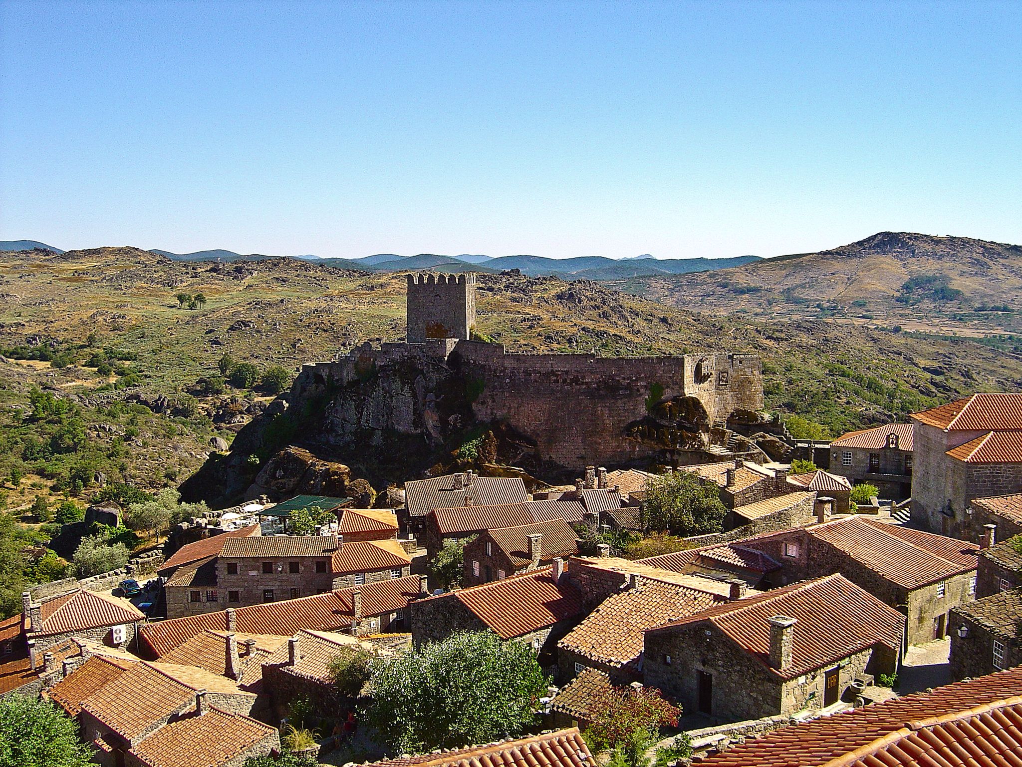
The castle of Miranda do Douro was built during a second period of settlement and ordering in Trás-os-Montes, which occurred during the reign of King Dinis. The first kings had provided this vast region with administrative units protected by Romanesque castles, called Terras, whose mission was to establish royal authority in an area of the kingdom that was notoriously peripheral. Over time, this power structure proved to be inadequate and King Afonso III initiated a different policy, the most visible of which was the founding of new urban towns. In the territory of Miranda do Douro, the new town was founded by King Dinis in 1286, thus culminating in the transfer of power from the old castle of Algoso, which had been the capital of the land until that date.
1
1

At the northern end of the Douro Internacional Natural Park, nature reveals itself in all its splendor. Approaching the course of the Fresno River, the trail takes you through breathtaking scenery, where the beauty of the landscape blends with echoes of the past and vibrant biodiversity.
1
0
Near the village of Urrós, the Cerca Viewpoint awaits you with a breathtaking view. From the top of an imposing rock, you are treated to a dramatic view of the Douro River Gorge, where the steep cliffs form the natural border between the Mirandese Plateau and the Spanish mainland. A magnificent view, impossible to forget!
2
0
Frequently Asked Questions
How many bus station hiking trails are available in National Park Douro Internacional?
There are 14 hiking routes accessible from bus stations in National Park Douro Internacional. These trails range in difficulty from easy to difficult, offering options for various fitness levels.
What types of landscapes can I expect to see on hikes accessible by bus?
Hikes from bus stations in National Park Douro Internacional offer a diverse range of landscapes. You'll encounter dramatic, deep river valleys and canyons carved by the Douro River, extensive plateaus, and forests of oak and cork oak. Many trails also pass through picturesque vineyards and olive groves, especially beautiful during the almond blossom season in February or March.
Are there any family-friendly hiking trails accessible by bus?
Yes, there are easy and moderate options suitable for families. While specific family-friendly routes from bus stations aren't detailed in this guide, the region generally offers easier options like the 3.5-mile (5.6 km) Trilho do Castro e do Contrabando (PR 6) which are suitable for all ages. Always check the route details for elevation and terrain to ensure it's appropriate for your family.
What are some notable viewpoints or attractions along these bus-accessible trails?
Many trails offer stunning panoramic views of the Douro River and its canyons. You might encounter viewpoints such as the Yellow Rock Viewpoint, São João das Arribas Viewpoint, or the View of the Douro Canyon. Some routes also pass by historical sites like Castro de São Paulo, offering a glimpse into the region's past.
Are there any long-distance or challenging routes starting from bus stations?
Yes, for experienced hikers, there are challenging routes. The São João das Arribas Trail (PR1 MDR) is a difficult 19 km route offering panoramic Douro valley views and historical sites. Another challenging option is the GR 14 Stage 42: La Fregeneda to Vega Terrón Trail, spanning over 20 km.
Can I find circular hiking routes that are accessible by bus?
Yes, several routes are designed as loops, allowing you to start and end at the same point, which is convenient when relying on public transport. An example is the longer Yellow Rock Viewpoint – View of the Douro Canyon loop from Miranda do Douro, which is a difficult 25.5 km circular hike.
What is the best time of year to hike from bus stations in National Park Douro Internacional?
The spring (February to May) and autumn (September to November) months are generally ideal. Spring offers pleasant temperatures and the spectacular sight of almond blossoms, while autumn provides cooler weather and beautiful fall colors. Summers can be very hot, especially in the river valleys, making early mornings or late afternoons preferable for hiking.
What do other hikers enjoy most about the trails in National Park Douro Internacional?
The area is highly rated by the komoot community, with an average score of 4.5 stars from 197 ratings. Reviewers often praise the dramatic river canyons, the rich birdlife, and the sense of tranquility found on these trails. The stunning viewpoints overlooking the Douro River are also frequently highlighted as a major draw.
Are there any moderate-difficulty trails accessible from bus stations?
Absolutely. Many trails fall into the moderate category, offering a good balance of challenge and accessibility. The São Fagundo Trail (PR3) is a moderate 14.2 km route. Another moderate option is the shorter Yellow Rock Viewpoint – View of the Douro Canyon loop from Miranda do Douro, which is 7.4 km long.
What kind of wildlife might I encounter while hiking in the park?
National Park Douro Internacional is a haven for birdwatchers, particularly known for its birds of prey. Keep an eye out for species like the Egyptian Vulture (the park's symbol), Iberian Griffon Vulture, Golden Eagle, and Black Stork soaring above the canyons. The park's diverse habitats also support various other wildlife.
Are there any trails that lead to waterfalls?
While not directly listed as bus-accessible routes in this guide, the region is known for natural attractions like the Faia da Água Alta waterfall. When planning your hike, check individual route descriptions for mentions of waterfalls or other specific natural features you wish to visit.
Most popular routes around National Park Douro Internacional
Most popular attractions around National Park Douro Internacional

Get inspired with the komoot mobile app


Explore more
Browse the best Hikes in other regions.
