The best traffic-free bike rides around Thierachern
4.7
(83)
613
riders
33
rides
Gravel biking around Thierachern offers diverse terrain within the Swiss Plateau, characterized by rolling hills, quiet forest roads, and pre-Alpine landscapes. The region provides continuous views of the Bernese Alps and features the serene waters of Lake Thun. This area is well-suited for no traffic gravel bike trails, blending relatively flat sections with more challenging ascents through fields and natural parks.
Best no traffic gravel bike trails around Thierachern
- The most popular no traffic gravel bike trail is Aare Lock…
Last updated: June 28, 2026
5.0
(2)
10
riders
88.0km
07:44
2,300m
2,300m
Hard gravel ride. Very good fitness required. You may need to push your bike for some segments of this route.
5.0
(3)
21
riders
54.4km
04:06
1,380m
1,380m
Hard gravel ride. Very good fitness required. Mostly paved surfaces. Suitable for all skill levels.

Sign up for free
4.3
(3)
38
riders
38.4km
02:17
380m
380m
Moderate gravel ride. Good fitness required. Mostly paved surfaces. Suitable for all skill levels.
5.0
(2)
18
riders
40.4km
03:12
1,140m
1,140m
Hard gravel ride. Very good fitness required. Mostly paved surfaces. Suitable for all skill levels.
5.0
(4)
31
riders
43.0km
02:51
500m
500m
Hard gravel ride. Very good fitness required. Mostly paved surfaces. Suitable for all skill levels.
Get access to more routes and recommendations from other explorers.
Sign up for free
Already have an account?
Our route recommendations are based on thousands of hikes, rides, and runs completed by other people on komoot.
Start today with a free account
Your next adventure awaits.
Login or Signup
Popular around Thierachern
Tips from the Community

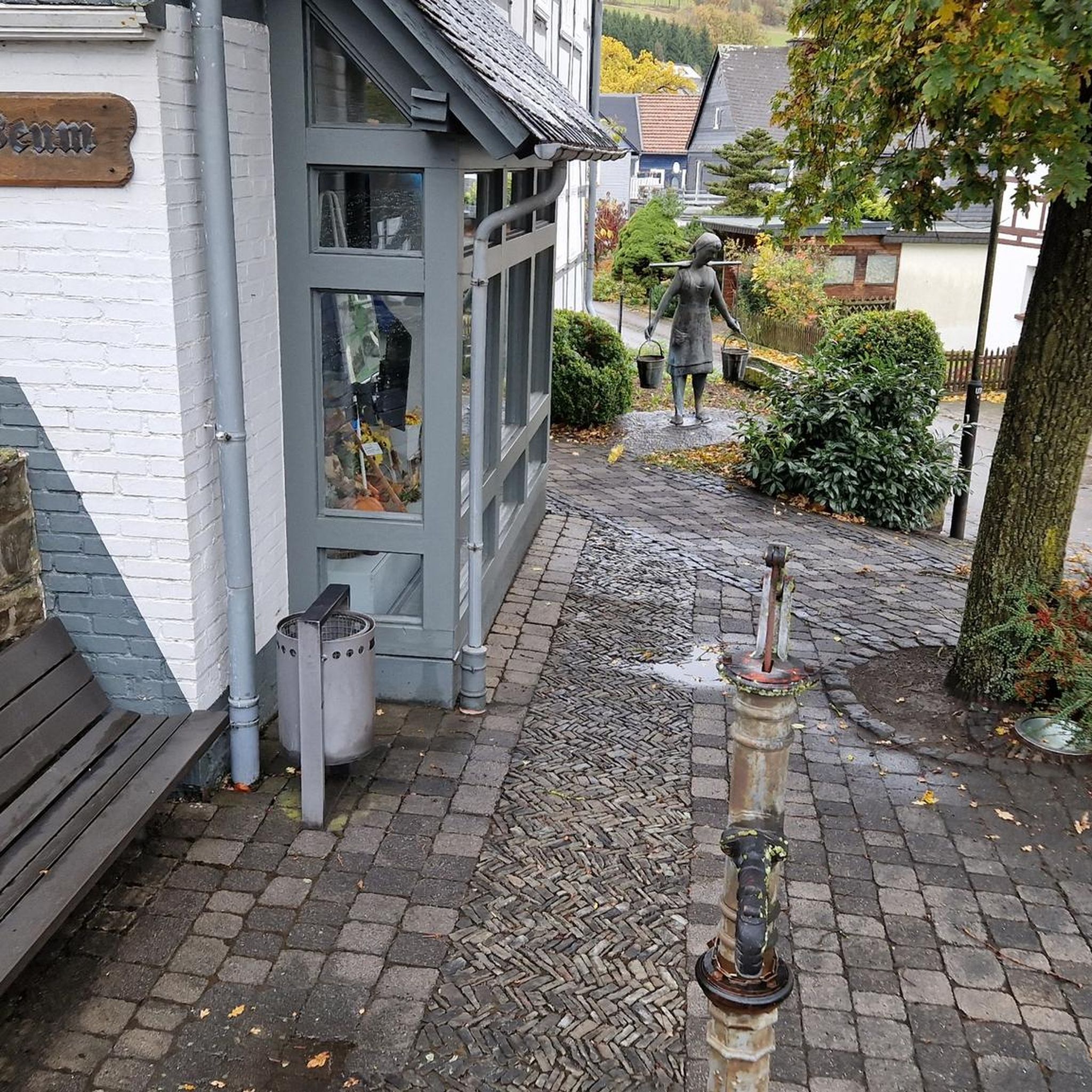
Very nice people and delicious sausage. Highly recommended cake.
0
0

The small village of Habkern lies seven kilometers from Interlaken in the direction of Lombachalp. Many stately wooden farmhouses stand around the village fountain, which is guarded by a hawk. Especially in spring and summer, when the red geraniums bloom in front of the windows, this creates a unique sight.
1
0
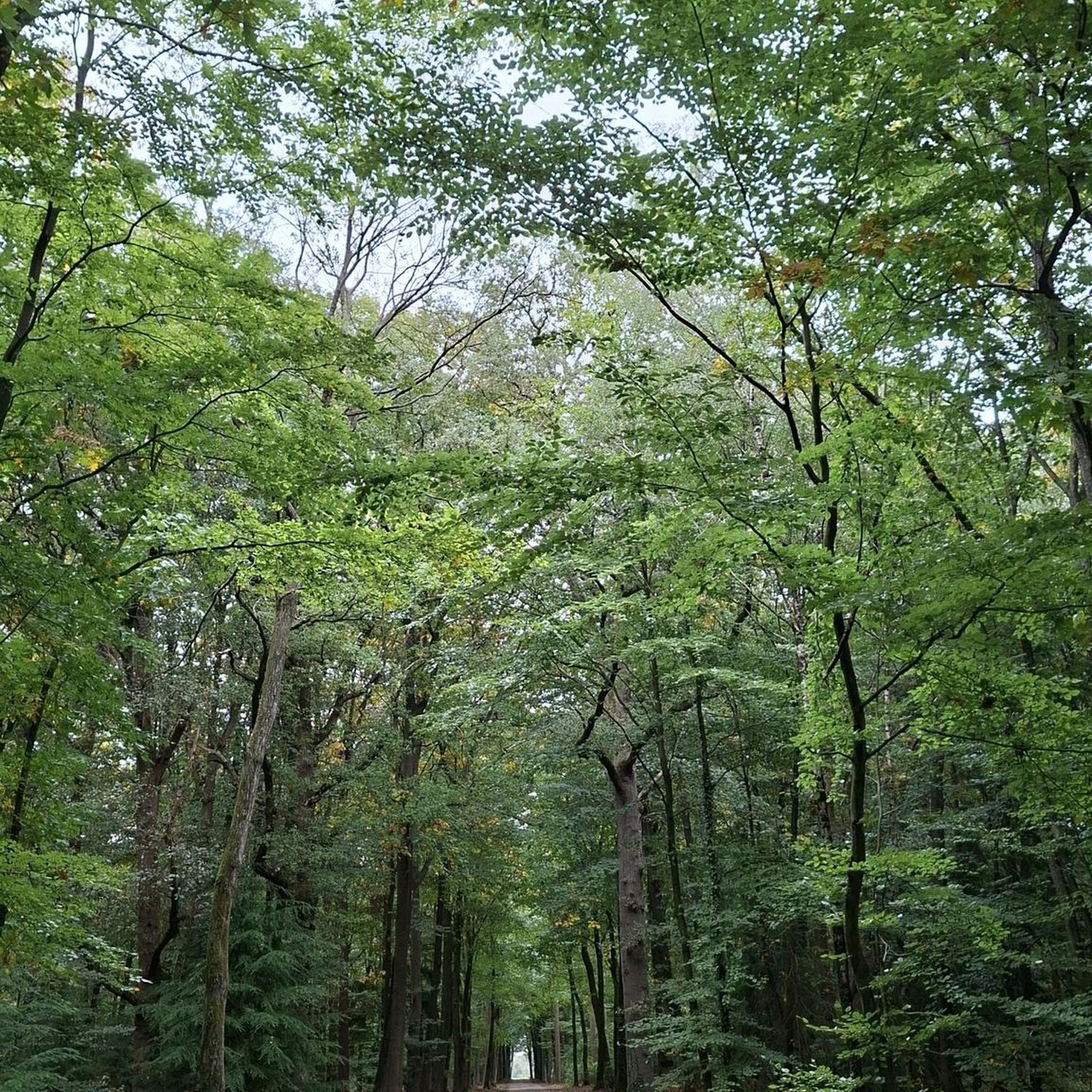
As you drive along the gravel roads, impressive views of the mighty Bernese Alps repeatedly open up. If the route continues straight, you can linger on the mountain peaks for a while, as there's no traffic.
0
0

🕍 Built in 1693–94, presumably according to plans by the renowned architect Abraham II Dünz. Unfortunately, the construction was also financed with confiscated Anabaptist property from the region. In 1871, the hall church received a neo-Romanesque front tower with an octagonal spire and three bells, designed by the architect Jakob Merz. The tower stands out vividly from the masonry with its twin windows, round-arch friezes, and cornices. During the renovation in 1977, the Baroque interior was restored in the style of the sermon hall, with a simple wooden ceiling and grisaille painting by Christian Stucki, as well as the original baptismal font (Dünz).
0
0

Lake Gerzensee is privately owned. It's not possible to walk around it. From Kirchdorf, there's a dirt road that leads to a wonderful seating area.
0
0

Lake Gerzen is a lake located between the villages of Gerzensee, Mühledorf, and Kirchdorf in the canton of Bern, Switzerland. Its water level is at an average elevation of 603 meters above sea level. At normal water levels, the lake is approximately 8.5 meters deep on average and reaches a maximum of 11 meters deep, and has a surface area of 0.25 km², making it one of the medium-sized pre-Alpine lakes in Switzerland.
1
0

This is truly a beautiful region. I can only agree with Roland, the fresh air addict. Have fun, everyone.
0
0

An architectural highlight! This bridge over the Simme River impresses with its enormous span and elegant wooden structure. It symbolizes innovation in harmony with nature. A must-see!
0
0
Frequently Asked Questions
How many no-traffic gravel bike trails are available around Thierachern?
There are over 30 dedicated no-traffic gravel bike trails around Thierachern. These routes offer a fantastic way to explore the diverse landscapes of the Bern region, from serene lakeside paths to challenging pre-Alpine climbs, all while minimizing encounters with vehicle traffic.
What do other gravel bikers enjoy most about the trails in Thierachern?
The komoot community highly rates the gravel biking experience around Thierachern, with an average score of 4.7 stars. Riders frequently praise the stunning views of the Bernese Alps and Lake Thun, the variety of terrain from forest paths to dedicated gravel routes, and the peaceful, traffic-free environment that allows for immersive rides through nature.
When is the best time to go gravel biking in Thierachern?
The best time for gravel biking in Thierachern is typically from spring through autumn. During these seasons, the weather is generally mild, and the trails are in excellent condition. Spring offers lush greenery, while autumn provides vibrant fall colors. While some routes may be accessible in winter, it's essential to check local conditions for snow and ice, especially in higher elevations or shaded forest sections.
Are there family-friendly no-traffic gravel routes in Thierachern?
Yes, Thierachern offers several family-friendly gravel routes that are largely traffic-free. The Glütschbachtal area, for instance, is known for its easy beginner routes, making it ideal for families with children. These routes typically feature gentler gradients and well-maintained surfaces, ensuring a pleasant and safe experience for all ages.
What kind of terrain and surfaces can I expect on these traffic-free gravel trails?
The traffic-free gravel trails around Thierachern offer a diverse range of surfaces. You can expect a mix of well-maintained gravel paths, compacted forest roads, and some paved sections that connect the off-road segments. The region's varied landscape, from the Swiss Plateau to pre-Alpine environments, ensures a dynamic riding experience with changing terrain under your tires.
Can I bring my dog on the gravel bike trails around Thierachern?
Many of the gravel bike trails around Thierachern are suitable for bringing dogs, especially those that follow forest paths or quiet rural roads. However, it's always recommended to keep your dog on a leash, particularly in nature reserves, agricultural areas, or where wildlife might be present. Please also be mindful of local regulations and other trail users.
Are there circular gravel bike routes without traffic in the Thierachern area?
Yes, many of the no-traffic gravel routes around Thierachern are designed as circular tours, allowing you to start and end at the same point without retracing your steps. An example is the Simmen Bridge – Amsoldingen Basilica loop from Thun, which offers a moderate challenge and beautiful scenery. These loops are perfect for exploring the region's diverse landscapes efficiently.
What natural features or landmarks can I see along these routes?
The gravel routes around Thierachern are rich with natural beauty and interesting landmarks. You can enjoy breathtaking views of the Bernese Alps and Lake Thun, explore the serene Zulgschwelle waterfall, or ride past the historic Amsoldingen Basilica. The region also features picturesque moraine lakes and sections of the Gantrisch Nature Park, offering continuous scenic delights.
Where can I find parking for these traffic-free gravel routes?
Parking is generally available at various starting points for gravel bike routes around Thierachern. Many routes begin near villages or towns like Thun or Steffisburg, where public parking facilities can be found. It's advisable to check specific route descriptions on komoot for recommended parking spots, especially for more remote trailheads.
How can I reach these trails using public transport?
Thierachern and the surrounding areas are well-connected by public transport, primarily by bus and train services from Thun. Many trailheads are accessible within a short ride from train stations or bus stops, making it convenient to reach the starting points of these traffic-free gravel routes without a car. Check local transport schedules for the most up-to-date information.
Are there any waterfalls near the gravel bike trails in Thierachern?
Yes, the region around Thierachern is home to several beautiful waterfalls that can be incorporated into or visited near your gravel biking adventures. Notable examples include the Cholerenschlucht Gorge and the Zulgschwelle waterfall. Some routes might even pass close to these natural attractions, offering a refreshing stop.
Are there places to stop for refreshments along the no-traffic gravel routes?
While many of these routes prioritize a traffic-free experience through nature, they often pass through or near charming villages and towns where you can find cafes, restaurants, or small shops for refreshments. Planning your route with komoot allows you to identify such points of interest, ensuring you can refuel and relax during your ride.
Most popular routes around Thierachern
Most popular attractions around Thierachern

Get inspired with the komoot mobile app


Explore more
Browse the best Gravel rides in other regions.
