Routes

Planner

Features

Updates

App

Login or Signup

Get the App

Login or Signup

Routes
Road cycling routes
United States

California

The best traffic-free bike rides in California

4.6

(6611)

240,369

riders

994

rides

Road cycling in California offers a diverse range of no traffic routes across varied landscapes. The state features extensive coastlines, significant mountain ranges like the Sierra Nevada, and numerous river valleys, providing a wide array of terrain for cyclists. From flat, paved paths along rivers to challenging climbs with substantial elevation gain, California's geography supports a comprehensive network of cycling opportunities. This makes it a destination for road cyclists seeking both leisurely rides and demanding ascents.

Best no traffic road cycling routes in California

  • The most popular no traffic road cycling route is Alpine Dam & Mount Tamalpais East Peak loop from Downtown San Rafael, a 40.6 miles (65.4 km) trail that takes 3 hours 40 minutes to complete, featuring significant climbs and panoramic views.
  • Another top favourite among local road cyclists is Santa Ana River Bicycle Path, a moderate 46.9 miles (75.5 km) path. This route offers a mostly flat, paved experience along the Santa Ana River.
  • Local road cyclists also love the Mount Diablo via Summit Road, a 30.1 miles (48.5 km) trail leading through mountainous terrain with substantial elevation gain, often completed in about 2 hours 57 minutes.
  • Road cycling in California is defined by coastal paths, river trails, and challenging mountain passes. The network offers options for various ability levels, from easy, flat rides to difficult, high-elevation routes.
  • The routes in California are highly rated by the komoot community with an average score of 4.6 stars from over 6,100 reviews. More than 234,000 road cyclists have used komoot to explore California's varied terrain.

Last updated: July 10, 2026

4.5

(13)

677

riders

#1.

Alpine Dam & Mount Tamalpais East Peak loop from Downtown San Rafael

65.4km

03:41

1,330m

1,330m

The Alpine Dam & Mount Tamalpais East Peak loop from Downtown San Rafael is a challenging road cycling route that delivers some of the best scenery in Marin County. You'll pedal through dense redwood and oak forests, past the serene Alpine Lake and Alpine Dam, before tackling the famous "Seven Sisters" rollers. The reward for your effort is a breathtaking panoramic view from Mount Tamalpais East Peak, stretching from San Francisco to the Pacific Ocean.

This difficult 40.6-mile (65.4 km) ride, with its 4348 feet (1325 metres) of elevation gain, is a serious undertaking, typically taking around 3 hours and 40 minutes. The route is primarily on paved roads, though some sections can be steep and twisty, particularly on Fairfax-Bolinas Road. It's a demanding ride best suited for experienced cyclists with excellent fitness levels.

Widely considered a "crown jewel" among Marin County road cycling routes, this loop is often cited as one of the most scenic ways to experience Mount Tamalpais. The journey itself, with its varied microclimates and iconic landmarks like the Seven Sisters, is as much a highlight as the destination. It's a true bucket-list ride for those seeking an advanced road cycling experience near Downtown San Rafael.

Navigate with device

Send to Phone

Save

Hard

4.0

(5)

485

riders

The Santa Ana River Bicycle Path offers a unique road cycling experience, transitioning from serene natural river channels with mountain views to bustling urban centers and finally to the Pacific coast. You'll ride on a well-maintained, wide asphalt path, enjoying varied scenery that includes shaded sections, glimpses of the San Gabriel Mountains, and iconic landmarks like Angel Stadium before reaching the beautiful Huntington State Beach.

This moderate 46.9-mile (75.5 km) route, with a gentle 415 feet (126 metres) of elevation gain, typically takes around 3 hours and 33 minutes. It's highly accessible with many starting points, making it easy to plan a ride that suits your fitness level. While largely flat, expect moderate climbs if you're heading inland, especially on the return journey.

Known as a "bicycle freeway" for its grade-separated intersections, this trail is a significant multi-use facility in Southern California. It was designated a National Recreation Trail in 1977, highlighting its importance and the diverse environments it connects, from riverbanks to cityscapes and coastal views.

Moderate
guide_signup
Let us show you the way with the komoot mobile app
With a free komoot account, you can easily find, customize, and navigate endless outdoor adventures.

Sign up for free

5.0

(9)

271

riders

48.5km

02:57

1,140m

1,140m

Mount Diablo via Summit Road offers a challenging and rewarding road cycling experience, taking you through diverse habitats to a peak with truly spectacular views. The route is primarily paved, but the terrain involves significant elevation changes and a twisty ascent, culminating in the panoramic vistas from Mount Diablo Summit. On a clear day, you can see for up to 200 miles, including distant sights like the Sierra Nevada and the Farallon Islands.

This is a difficult 30.1-mile (48.5 km) ride with 3745 feet (1141 metres) of elevation gain, typically completed in about 2 hours and 56 minutes. It's considered one of the most popular road cycling routes in the Bay Area, known for its strenuous climb with sections reaching 9% grade around Devil's Elbow and an even steeper final push to the summit. Water fountains and restrooms are available at various points along the way, including the Junction Ranger Station.

Mount Diablo is a highly regarded destination for advanced cyclists, even hosting a stage of the Tour of California. The road contour varies enough to keep the long ascent engaging, and the descent is fast and fun, though you should watch for gravel in the turns. The summit features an observation platform, a historic beacon tower, and a visitor center, providing a great reward for your effort.

Hard

5.0

(1)

255

riders

Embark on the San Gabriel, Rio Hondo & Los Angeles River Loop for a moderate racebike adventure spanning 51.5 miles (82.8 km). You'll experience a diverse ride, cycling through urban areas, alongside concrete channels, and into unexpected green spaces. The route offers glimpses of parks and recreational areas, with opportunities for birdwatching, particularly near the Rio Hondo Spreading Grounds. As you pedal, you'll find segments shaded by eucalyptus trees and riparian vegetation. With a gentle elevation gain of 367 feet (112 metres), this loop typically takes about 4 hours and 14 minutes to complete. On clear days, the northern sections of the San Gabriel River Trail provide scenic views of the majestic San Gabriel Mountains in the distance.

Planning your ride is straightforward, as the trails are largely flat and well-maintained, making them suitable for most racebike riders. You will find numerous access points along all three river trails, which allows you to join or leave the loop at various locations, offering flexibility for shorter excursions. Many parks situated along the route provide convenient amenities such as restrooms, water fountains, and picnic areas, ensuring you have everything you need for a comfortable journey. Consider starting early to enjoy cooler temperatures and fewer crowds on this popular route.

This extensive loop offers a unique way to explore a significant portion of Los Angeles County on two wheels, connecting three major river systems. The route highlights the transformation of urban waterways into accessible recreational corridors, showcasing how green infrastructure integrates with city life. You will observe a blend of engineered landscapes and surprising pockets of natural habitat, providing a distinct perspective on the region's environment. It's a testament to urban planning that provides a continuous path for active transportation and outdoor enjoyment.

Moderate

4.8

(10)

141

riders

49.7km

02:26

610m

610m

The Enchanted Hills Loop offers a classic Napa Valley road cycling experience, winding through a landscape defined by its famous vineyards and gentle rolling hills. You'll pedal past rows of grapevines, feeling the rhythm of the region, and even get a glimpse of the lively Napa downtown area. This moderate 30.9-mile (49.7 km) route features 2001 feet (610 metres) of elevation gain, making it a solid workout that typically takes around 2 hours and 26 minutes to complete.

Planning your ride is straightforward, with parking generally available in the Napa area. While the route is mostly on paved roads, be aware that some sections might have narrow or no shoulders, so stay alert. Traffic is usually light, allowing for a pleasant ride. You can even plan a stop at one of the many wineries along the way to enhance your experience.

What makes this route special is its unique blend of natural beauty and cultural highlights, offering an intimate look at the renowned wine region. It's a fantastic way to see the valley from a different perspective, combining a good physical challenge with the charm of Napa's iconic scenery and local attractions.

Moderate
Sign up for free to see 990 more rides in California.

Get access to more routes and recommendations from other explorers.

Sign up for free

Already have an account?

Our route recommendations are based on thousands of hikes, rides, and runs completed by other people on komoot.

Start today with a free account

Your next adventure awaits.

Login or Signup

Popular around California

Traffic-free bike rides in the Sierra Nevada
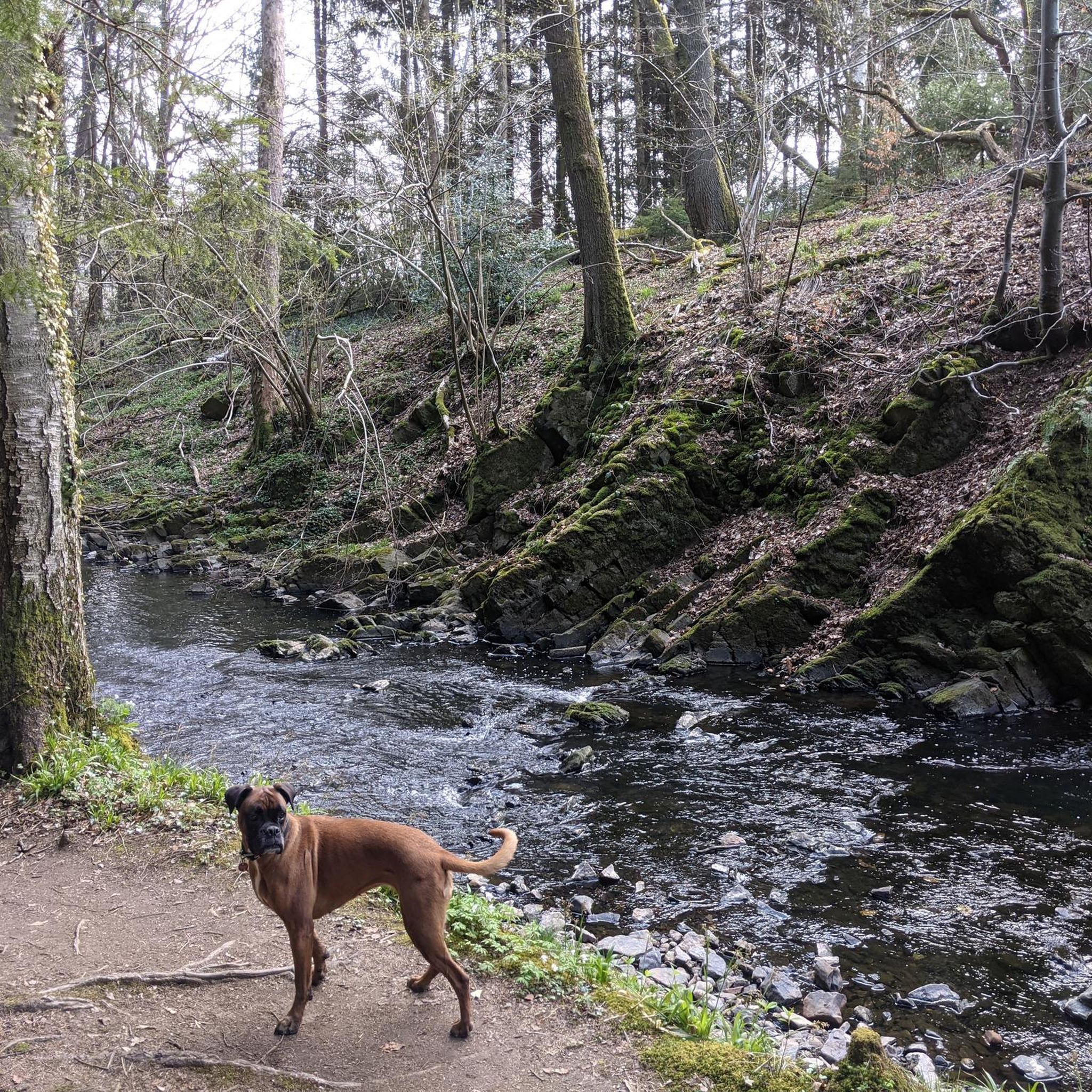
Traffic-free bike rides in Inyo County

Traffic-free bike rides in the Coast Range
Traffic-free bike rides in Santa Barbara County

Traffic-free bike rides in Contra Costa County

Traffic-free bike rides in Orange County

Traffic-free bike rides in Los Angeles County

Traffic-free bike rides in Sacramento County

Traffic-free bike rides in Santa Clara County

Traffic-free bike rides in Alameda County

Other adventures in California

Mountain roads and dirt of California — Central Coast Love

Road Cycling Collection by

Alison Tetrick

Tips from the Community

Leo Moya
November 18, 2025, Huntington State Beach

Rainy Ride & Coffe

0

0

Traveler
June 27, 2025, Seven Sisters

Paved section riding on the ridge between Pan Toll Road and Fairfax-Bolinas Road where it contains as Bolinas Ridge Trail, with spectacular views along the way toward the Pacific Ocean and Stinson Beach far below. The road is open during daylight hours only, in winter that means 9am to sunset.

0

0

Mount Tam East Peak offers some of the most majestic views north of the bay. From this vantage point, you can see all of Marin, along with Point Reyes to the north and Oakland and San Francisco to the south. The stunning panoramic vistas make the journey well worth the effort. There are restrooms and picnic tables, ideal for a snack or lunch while you capture some incredible photos.

0

0

Mount Diablo, is the Bay Area second-highest peak at 1173m (3849ft). The challenging climb features constantly fluctuating gradients averaging 8%, with tough sections up to 18% and a brutal 23% finish in the last 200m. The equally demanding descent requires good bike handling due to tight corners, potholes, and strong winds. The road to the top is open daily from 8 AM till sunset.

0

0

Andrus
May 26, 2025, Alpine Dam

Constructed in 1917 this dam forms Alpine Lake, which sites between Kent and Bon Tempe Lakes. The road across the top of the dam make it a great place to ride on a loop around the lake.

0

0

Andrus
May 25, 2025, Alpine Lake

This lake was formed by the building of Alpine Dam in 1917. It sits between Kent Lake and Bon Tempe Lake, and is popular for a variety of outdoor activities.

0

0

Often busy on weekends, this is a great spot to take moment before/after summiting Mt Tam. There are spigots to fill up water and bathrooms that are open during park hours. The parking lot is very close for those that drive up. There is access to MANY trails for those on foot/bike.

0

0

Limited cars use the roads so it is nice to get away from traffic

0

0

Frequently Asked Questions

How many no traffic road cycling routes are available in California?

Komoot offers nearly 1000 no traffic road cycling routes across California. These routes cater to various skill levels, with over 380 easy, 430 moderate, and 130 difficult options available.

What is the best time of year for no traffic road biking in California?

California's diverse climate means cycling is possible year-round, but the best time often depends on the region. Spring and fall generally offer pleasant temperatures statewide, ideal for exploring coastal paths and vineyard routes. Summer is perfect for high-altitude rides in the Sierra Nevada, while Southern California's mild winters are excellent for cycling along the coast.

Are there easy, family-friendly no traffic road bike trails in California?

Yes, California offers many easy, traffic-free routes suitable for families and beginners. The state's extensive network includes flat, paved paths perfect for a relaxed ride. For example, the Santa Ana River Bicycle Path provides a moderate, mostly flat experience along the river.

Are there challenging no traffic road cycling routes for advanced riders in California?

Absolutely. California's mountainous regions offer demanding climbs and significant elevation gains for experienced cyclists. Routes like the Alpine Dam & Mount Tamalpais East Peak loop in Marin County or the Figueroa Mountain loop are known for their challenging ascents and rewarding views.

What kind of terrain can I expect on California's traffic-free road cycling routes?

California's no traffic road cycling routes traverse an incredible variety of landscapes. You can expect everything from flat, paved coastal paths and river trails to rolling vineyard routes and challenging mountain passes with significant elevation changes. The state's diverse topography ensures a suitable route for every preference, from ocean views to redwood forests and desert vistas.

Are there any circular no traffic road bike loops in California?

Yes, many of California's traffic-free road cycling routes are designed as loops, allowing you to start and end at the same point. Examples include the challenging Alpine Dam & Mount Tamalpais East Peak loop or the scenic Figueroa Mountain loop. These loops often provide varied scenery and a comprehensive experience of the area.

What natural attractions can I see near no traffic road cycling routes in California?

California's routes often pass by stunning natural wonders. You might encounter majestic waterfalls like Vernal Fall or Nevada Fall, or even catch glimpses of iconic summits such as Half Dome Summit. The state is also home to unique natural monuments like the General Sherman Tree.

Are there any interesting landmarks or points of interest along California's car-free cycling paths?

Many routes offer proximity to notable landmarks. You could cycle near the iconic Golden Gate Bridge, explore historical sites like Fort Point, or enjoy the vibrant atmosphere around Pier 39 & Sea Lions in San Francisco. Some routes also lead to scenic viewpoints, such as the Back of the Hollywood Sign on Mount Lee.

What do other road cyclists enjoy most about no traffic road cycling in California?

The komoot community highly rates road cycling in California, with an average score of 4.6 stars from over 6,000 ratings. Cyclists frequently praise the diverse and breathtaking landscapes, the well-maintained car-free paths, and the opportunity to experience iconic California scenery without vehicle interference. The variety of routes, from challenging mountain climbs to serene coastal rides, is also a major draw.

Are there specific permits or seasonal considerations for car-free road cycling in California?

Generally, most car-free road cycling routes in California do not require specific permits for public access. However, some routes within national or state parks might have entrance fees or specific regulations. Seasonal considerations are important; mountain passes can be closed due to snow in winter, while coastal areas are often pleasant year-round. Always check local conditions and park websites before you go. For general information on California's outdoor adventures, you can visit Visit California.

Can I find routes that offer both challenging climbs and scenic views?

Yes, many of California's no traffic road cycling routes combine significant elevation gains with spectacular vistas. The Mount Diablo via Summit Road route, for instance, offers a substantial climb rewarded with panoramic views from the summit. Similarly, the Alpine Dam & Mount Tamalpais East Peak loop provides challenging ascents with stunning coastal and bay views.

Most popular routes in California

Hiking in California

Most popular attractions in California

Places to see

Store rating

Get inspired with the komoot mobile app

With a free komoot account, you can easily find, customize, and navigate endless outdoor adventures.

or

Join komoot Now

Store rating

Didn’t find what you were looking for?

Check out more Road cycling routes throughout California below and find the perfect route in your destination.

Coast RangeSanta Clara CountySacramento CountyLos Angeles CountyMarin CountyNapa CountyMendocino CountySolano CountySan Bernardino CountyContra Costa CountyTahoe National ForestAlpine CountyTulare CountyStanislaus CountyOrange CountyYolo CountyHumboldt CountyRiverside CountyKern CountySanta Cruz CountyGlenn CountySan Luis Obispo CountyMendocino National ForestTuolumne CountyMadera CountyVentura CountySan Mateo CountySan Diego CountyPlacer CountyEl Dorado CountyButte CountySiskiyou CountyImperial CountyShasta CountySierra NevadaFresno CountyAlameda CountyInyo CountySanta Barbara CountyMono CountyMonterey CountyNevada CountySan Joaquin CountySonoma CountySan Benito CountyAmador CountyCalaveras CountyShasta-Trinity National Forest

Explore more

Browse the best Road cycling routes in other regions.

ColoradoFloridaNorth CarolinaTexasWashingtonMaineSouth CarolinaIndianaArizonaGeorgiaMassachusettsHawaiiPennsylvaniaAppalachian MountainsNew YorkNew HampshireIllinoisWisconsinOregonMichiganHawaiʻi CountyMissouriTennesseeMinnesotaVirginiaUtahLouisianaMaui CountyHonolulu CountyIdahoIowaOhioMarylandKansasRhode IslandMontanaArkansasConnecticutKentuckySan FranciscoSan FranciscoNew JerseyVermontNorth DakotaAlabamaDelawareNew MexicoNevadaOklahomaSouth DakotaNebraskaPuerto RicoOregon Islands WildernessWashington D.CDistrict Of ColumbiaKauaʻi CountyToa Baja MunicipioToa BajaMississippiAlaskaWyomingWest VirginiaVega Alta MunicipioVega AltaDorado MunicipioDoradoVega Baja MunicipioVega BajaManat MunicipioManatíBarceloneta MunicipioBayamón MunicipioBayamónArecibo MunicipioAreciboToa Alta MunicipioToa AltaGuaynabo MunicipioSan Juan MunicipioSan JuanGuaynaboMorovis MunicipioCata O MunicipioCatañoCorozal MunicipioTrujillo Alto MunicipioFlorida MunicipioFloridaBarcelonetaSabana Grande MunicipioSabana GrandeMorovisTrujillo AltoCorozalYauco MunicipioGuanica MunicipioYaucoGuánicaSan Germán MunicipioSan GermánMoca MunicipioAguadilla MunicipioMocaAguadillaCarolina MunicipioCarolinaLoíza MunicipioLoízaJuana DíazPonce MunicipioPonceJuana DíazLajas MunicipioLajasGuayanillaCabo Rojo MunicipioCabo RojoGuayanilla MunicipioHormigueros MunicipioHormiguerosCoamo MunicipioSanta Isabel MunicipioSanta IsabelCoamoSalinasPeñuelas MunicipioPeñuelasMayagüezRío Grande MunicipioRío GrandeVillalba MunicipioVillalbaCiales MunicipioIsabelaIsabela MunicipioYabucoaLas PiedrasHumacaoHumacao MunicipioYabucoa MunicipioLas Piedras MunicipioCiales

Other places to explore

Nearby adventure guides

Things to Do around Coarsegold

background

Get ready to conquer new peaks

Sign up for Free

Explore
RoutesRoute plannerFeaturesHikesMTB TrailsRoad cycling routesBikepackingSitemap
Download the app
Follow Us on Socials

© komoot GmbH

Privacy Policy