The best hikes from bus stations in Distretto di Vallemaggia
4.6
(4904)
29,793
hikers
418
hikes
Bus station hiking trails in Distretto di Vallemaggia offer access to a landscape characterized by wild alpine scenery, numerous waterfalls, and varied terrain. The region features tranquil valley floors, rugged mountain areas, and a network of trails through untouched nature. Hikers can explore traditional stone villages nestled deep in the Alps, providing a cultural dimension to the natural exploration.
Best bus station hiking trails in Distretto di Vallemaggia
- The most popular bus station hiking route is Monti Legiuna and Gorges Loop, a 6.0 miles (9.6 km) trail that takes 3 hours 17 minutes to complete. This route features varied terrain including gorges and mountain views.
- Another top favourite among local hikers is Rustico di Cassinella – Pioda Chapel loop from Maggia, a moderate 5.5 miles (8.9 km) path. This trail ascends through forests to a rustic mountain hut and offers panoramic views.
- Local hikers also love the Biasca San Carlo - Capanna Cava Trail, a 8.7 miles (14.0 km) trail leading through alpine terrain, often completed in about 7 hours 50 minutes.
- Hiking in Distretto di Vallemaggia is defined by alpine scenery, waterfalls, and traditional stone villages. The extensive network offers options for various ability levels, from easy valley strolls to challenging mountain ascents.
- The routes in Distretto di Vallemaggia are highly rated by the komoot community with an average score of 4.6 stars from over 4500 reviews. More than 29000 hikers have used komoot to explore Distretto di Vallemaggia's varied terrain.
Last updated: June 28, 2026
3.1
(9)
30
hikers
9.58km
03:17
480m
480m
Explore the moderate 6.0-mile (9.6 km) Legiuna loop from Loderio, featuring the stunning Legiuna Gorge and views of Blenio Valley.
4.8
(154)
821
hikers
8.87km
04:06
570m
570m
Moderate hike. Good fitness required. Mostly accessible paths. Sure-footedness required.

Sign up for free
5.0
(1)
6
hikers
14.0km
07:50
1,350m
1,350m
Hike the difficult Biasca San Carlo - Capanna Cava Trail, covering 8.7 miles with 4445 feet of elevation gain through Swiss Alps scenery.
5.0
(2)
2
hikers
4.87km
01:59
390m
390m
Hike the moderate Loderio - Capanna Pian d'Alpe Trail through forests and pastures to a mountain hut with scenic views.
4.9
(96)
369
hikers
Moderate hike. Good fitness required. Easily-accessible paths. Suitable for all skill levels.
Get access to more routes and recommendations from other explorers.
Sign up for free
Already have an account?
Our route recommendations are based on thousands of hikes, rides, and runs completed by other people on komoot.
Start today with a free account
Your next adventure awaits.
Login or Signup
Popular around Distretto di Vallemaggia

Hikes from bus stations around Lake del Narèt
Hikes from bus stations around Lake Robiei
Hikes from bus stations around Lake Sfundau
Hikes from bus stations around Lake dei Cavagnöö
Hikes from bus stations in Monte San Giorgio
Hikes from bus stations around Lake del Zött

Hikes from bus stations around Lake del Sambuco

GTA North Piedmont – Among ancient Walser settlements
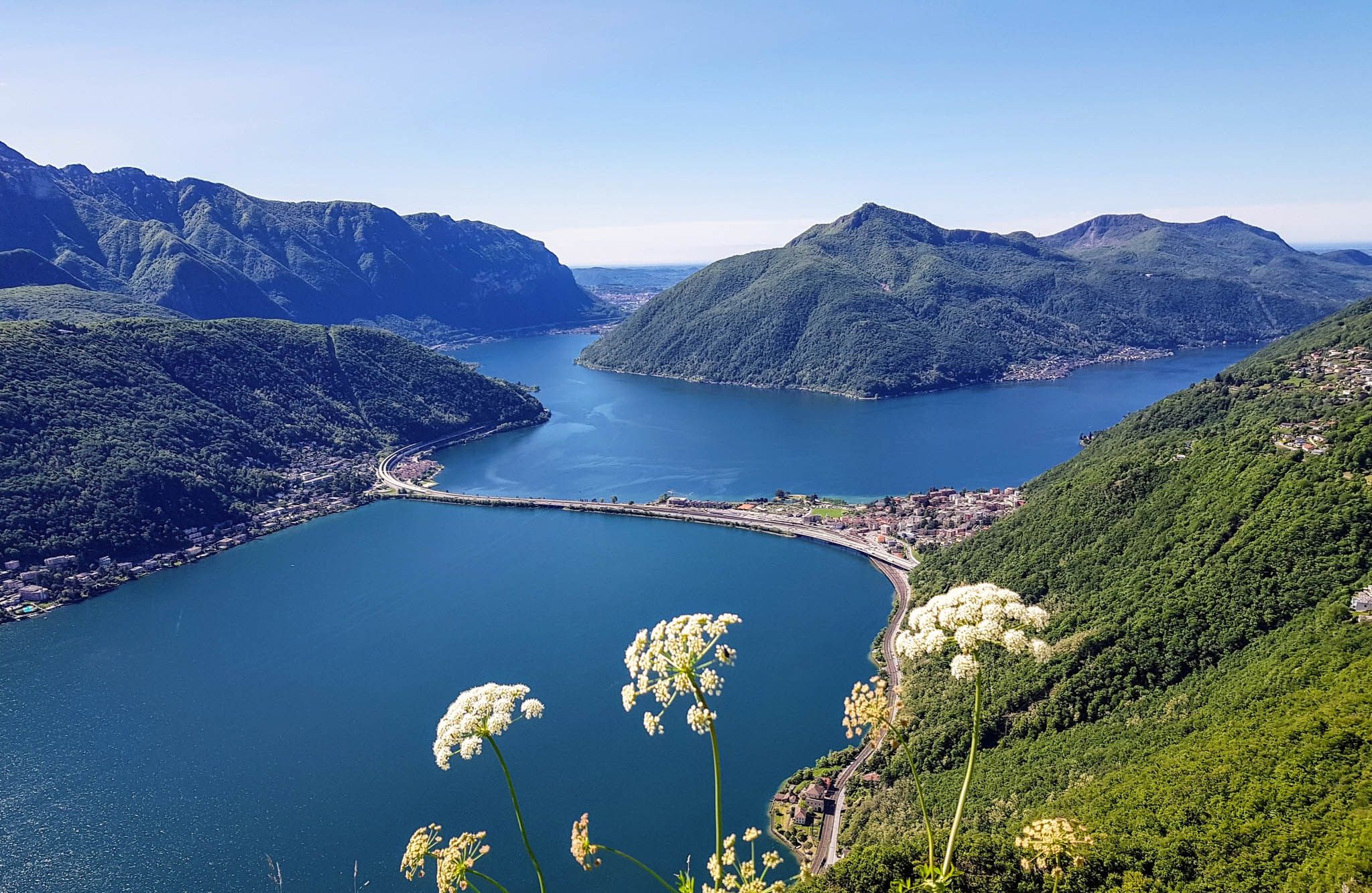
Sentiero Lago di Lugano – Between summits and lakes

Trans Swiss Trail – Hiking across Switzerland
Other adventures in Distretto di Vallemaggia


Tips from the Community

Superb gorge, for true enthusiasts. Stop to admire it by taking one of the many MTB tours in the region: www.komoot.com/it-it/collection/3576744/-blenio-bike-28-tour-mtb-in-valle-di-blenio-la-valle-del-sole Or visit our official website: www.bleniobike.ch
0
0

After visiting the church, the "Stations of the Cross" begins, starting next to the old 19th-century cemetery. It is a landscape of great value, consisting of 14 chapels, nestled in a beautiful chestnut grove, built in 1742 and restored in 1998.
2
0

Beautiful chapel with a magnificent view of the Maggia Valley
3
0
Beautiful stone bridge with a view into the depths
3
0
Beautiful bathing spot at the far end of the valley
4
0

At 380 meters, the Someo Pass is the longest suspension bridge in Ticino. It crosses the very wide Maggia Riverbed and the floodplain at a height of just a few meters. Crossing with dogs is no problem, provided they are already familiar with gratings.
0
0

With swimming trunks, a terry towel, good shoes 👟, strength in the legs and insensitivity to the cold, it's nice for a refreshing dip.
0
0

Frequently Asked Questions
How many bus station hiking trails are available in Distretto di Vallemaggia?
There are over 400 hiking routes in Distretto di Vallemaggia that are easily accessible by bus, offering a wide range of experiences for all skill levels.
What are the difficulty levels of bus-accessible hikes in Distretto di Vallemaggia?
The trails accessible by bus cater to all hikers. You'll find over 120 easy routes, more than 210 moderate trails, and around 90 difficult ascents, ensuring there's a suitable option for everyone.
Are there any family-friendly hikes accessible by bus in Distretto di Vallemaggia?
Yes, many routes are suitable for families. For a pleasant and relatively easy walk, consider the Giumaglio Bridge – Suspension bridge over the Maggia loop from Circolo della Maggia, which features minimal elevation gain and a fun suspension bridge.
Can I find circular hiking routes that start and end at a bus station?
Absolutely. Distretto di Vallemaggia offers numerous circular routes that are perfect for public transport users. The Monti Legiuna and Gorges Loop is a great example, allowing you to return to your starting point without needing a car.
Are there any hikes accessible by bus that feature waterfalls or wild swimming spots?
The region is known for its natural beauty, including numerous waterfalls and inviting swimming spots. While specific bus routes directly to swimming spots vary, many trails pass by rivers and cascades. The famous Foroglio village and waterfall is a must-see, often accessible via local bus services to the village itself, from where you can explore the area.
What kind of natural landscapes can I expect on bus-accessible trails?
Distretto di Vallemaggia boasts incredible 'wild beauty.' Expect diverse landscapes ranging from tranquil valley floors to rugged alpine scenery, with spectacular panoramas and breathtaking views. Many routes offer a sense of untouched nature and remoteness, providing an escape from mass tourism.
Are there any charming villages or cultural sights to explore along bus-accessible hiking trails?
Yes, the region is dotted with authentic, secluded mountain villages like Brontallo, Broglio, Prato, Peccia, and Fusio. These offer a glimpse into traditional Ticino architecture with their ancient stone houses. Many of these villages are served by local bus routes, making them excellent starting or ending points for hikes and cultural exploration.
What do other hikers enjoy most about hiking from bus stations in Distretto di Vallemaggia?
The komoot community highly rates the hiking experience in Distretto di Vallemaggia, with an average score of 4.6 stars. Reviewers often praise the stunning alpine scenery, the extensive network of well-maintained trails, and the convenience of accessing these beautiful areas via public transport.
Are there any huts or refuges accessible from bus station trails for overnight stays or refreshments?
Yes, several huts and refuges are located along or near bus-accessible trails. For example, the Cristallina Hut and Brogoldone Hut offer opportunities for refreshments or overnight stays, often reachable via connecting trails from bus stops.
Are there any long-distance or challenging bus-accessible trails for experienced hikers?
For adventurous and experienced hikers, the region offers significant challenges. While the full Alta Vallemaggia Route is a multi-stage trek, sections of it can be accessed via bus. For a challenging day hike, consider the Biasca San Carlo - Capanna Cava Trail, which involves substantial elevation gain and offers rewarding views.
What is the best time of year to hike from bus stations in Distretto di Vallemaggia?
The best time for hiking is generally from late spring to early autumn (May to October). During these months, the weather is most favorable, and most trails, including those at higher altitudes, are free of snow and fully accessible. Always check local weather conditions before heading out.
Most popular routes in Distretto di Vallemaggia
Most popular attractions in Distretto di Vallemaggia

Get inspired with the komoot mobile app


Didn’t find what you were looking for?
Check out more Hikes throughout Distretto di Vallemaggia below and find the perfect route in your destination.
Explore more
Browse the best Hikes in other regions.
