The best city hikes and walks in District de l'Ouest lausannois
4.5
(135)
1,668
hikers
45
hikes
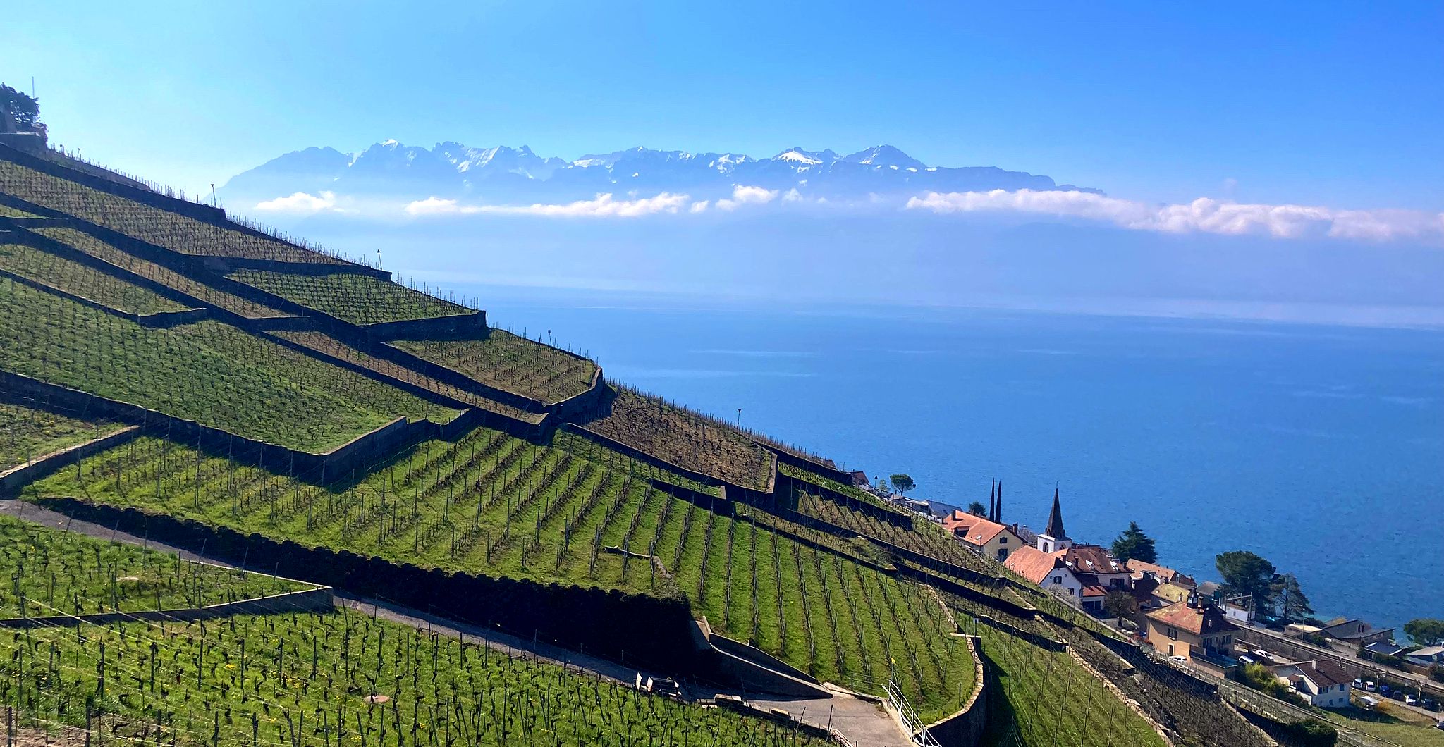
Urban hiking trails in District de l'Ouest lausannois offer a diverse landscape for outdoor activities. The region is characterized by its proximity to Lake Geneva, rolling hills, and extensive forests, providing varied terrain for exploration. Hikers can find paths along the lake shores, through urban parks, and into natural areas like the Jorat forest. The topography includes gentle slopes and some moderate ascents, catering to different fitness levels.
Best urban hiking trails in District de l'Ouest lausannois
- The most popular…
Last updated: May 15, 2026
5.0
(1)
15
hikers
18.8km
05:02
220m
220m
Hard hike. Very good fitness required. Easily-accessible paths. Suitable for all skill levels.
5.0
(1)
5
hikers
8.85km
02:22
100m
100m
Moderate hike. Good fitness required. Easily-accessible paths. Suitable for all skill levels.

Sign up for free
18
hikers
8.70km
02:32
240m
240m
Moderate hike. Good fitness required. Easily-accessible paths. Suitable for all skill levels.
4.0
(2)
6
hikers
9.38km
02:27
70m
70m
Moderate hike. Good fitness required. Easily-accessible paths. Suitable for all skill levels.
3
hikers
7.14km
01:56
90m
90m
Easy hike. Great for any fitness level. Easily-accessible paths. Suitable for all skill levels.
Get access to more routes and recommendations from other explorers.
Sign up for free
Already have an account?
Our route recommendations are based on thousands of hikes, rides, and runs completed by other people on komoot.
Start today with a free account
Your next adventure awaits.
Login or Signup
Popular around District de l'Ouest lausannois

Other adventures in District de l'Ouest lausannois


Tips from the Community

The tower is very specially constructed. Is definitely worth seeing!
0
0

Renens train station was opened in 1856 with the inauguration of the Occidentalbahn. It was located on the line towards Lausanne and was part of the growing Western Swiss railway network. The station building shows the typical architectural style of the Wilhelminian period with a symmetrical facade.
0
0
The Château Saint-Maire in Lausanne is a medieval castle that originally served as a bishop's residence. After the Bernese conquest in 1536, it was converted into an administrative center – a role it continues to hold today as the seat of the cantonal government.
0
0

The Romanesque church of St. Sulpice in the canton of Vaud was built by the Abbey of Cluny in the 11th and 12th centuries. It was initially dedicated to Saint Sulpice and later to Mary Magdalene. After the occupation by Bern in 1536, the church became Protestant and came into the possession of the city of Lausanne. The priory disappeared after 1536 or was repurposed. The nave collapsed after the Reformation and was not rebuilt. The church is today a national historical monument. (Source: www.notrehistoire.ch).
1
0
Small bridge over the Chamberonne River.
0
0

Renens VD train station since 1856: Lines of the OS opened on May 5, 1856. In 1856, traffic was opened in an easterly direction to Lausanne. The OS network expanded continuously on Lake Geneva. They were denied the opportunity to build a line to Geneva and thus connect to the French railway network. The short section on the Geneva cantonal territory was awarded to the Genf-Lyoner-Bahn, which founded its own company for the short railway line. This created the extremely unsatisfactory fact that three railway companies were involved on the route from Geneva to Neuchâtel. The individual Western Swiss railways were not particularly profitable. Therefore, the competing railway companies sought a joint operating company. Text / Source: https://www.bahnweb.ch/ Felix Meier https://www.bahnweb.ch/wp-content/cache/all/chemins-de-fer-de-la-suisse-occidentale-du-simplon/index.html
11
0

Very beautiful small temple in honor of King Bhumibol
0
0

Beautiful view of the Jura as well.
0
0
Frequently Asked Questions
How many urban hiking trails are available in District de l'Ouest lausannois?
There are nearly 50 urban hiking trails in the District de l'Ouest lausannois, offering a variety of experiences from easy strolls to more challenging routes. You'll find 26 easy, 20 moderate, and 1 difficult route to explore.
What are some popular landmarks or natural features to see along urban hikes in the District de l'Ouest lausannois?
Urban hikes in the District de l'Ouest lausannois often feature stunning views of Lake Geneva and the Alps. You can explore the iconic Rolex Learning Center and EPFL Lausanne, or discover historical sites like the Romanesque Church of Saint-Sulpice. For nature lovers, there's also a picturesque Waterfall on the Venoge River.
Are there any family-friendly urban hikes in the District de l'Ouest lausannois?
Yes, many urban trails are suitable for families. The region offers numerous easy paths, particularly around Lake Geneva's promenades and in parks like Sauvabelin. These routes are generally flat and well-maintained, perfect for all ages. Consider the View from the Signal de Sauvabelin – Sauvabelin Tower loop from Lausanne-Flon for a pleasant outing with scenic views.
Can I bring my dog on urban hikes in this region?
Many urban hiking trails in the District de l'Ouest lausannois are dog-friendly, especially those in parks and along lake promenades. It's always a good idea to keep your dog on a leash, especially in more populated areas or nature reserves, and to check local regulations for specific trails. The Port de Pierrettes – Parc du Pelican loop from Renens offers a lovely lakeside walk that's often enjoyed by dog owners.
What is the best time of year for urban hiking in District de l'Ouest lausannois?
The District de l'Ouest lausannois is enjoyable for urban hiking year-round. Spring and autumn offer pleasant temperatures and vibrant scenery, while summer is ideal for lakeside walks and enjoying outdoor cafes. Even in winter, many urban paths remain accessible, providing crisp air and unique views, especially along Lake Geneva.
Are there urban hikes with good viewpoints in the District de l'Ouest lausannois?
Absolutely. The region is known for its panoramic views. The Sauvabelin Tower, for instance, offers phenomenal vistas of Lausanne, Lake Geneva, and the Alps. Many trails winding through the hills above Lausanne also provide excellent lookout points. The Sauvabelin Tower – View from the Signal de Sauvabelin loop from Montelly is a great option for stunning scenery.
Are there any circular urban hiking routes available?
Yes, many urban hikes in the District de l'Ouest lausannois are designed as circular routes, allowing you to start and end at the same point without retracing your steps. This is convenient for exploring different areas. An example is the Vidy Beach – Vidy Promenade loop from Renens VD, which takes you along the scenic lakefront.
What do other hikers enjoy most about urban hiking in District de l'Ouest lausannois?
The area is highly rated by the komoot community, with an average score of 4.5 stars from over 100 ratings. Reviewers often praise the diverse landscapes, from lakeside promenades to forest paths, and the accessibility of trails within an urban setting. The combination of natural beauty and cultural landmarks is frequently highlighted.
How accessible are the urban hiking trails by public transport?
The District de l'Ouest lausannois has an excellent public transport network, making many urban hiking trails easily accessible. Lausanne and its surrounding municipalities are well-served by buses and trains, allowing you to reach trailheads conveniently and return from different points if desired. Many routes start directly from urban centers or near public transport stops.
Are there any longer, more challenging urban hikes in the District de l'Ouest lausannois?
While many urban hikes are easy to moderate, there are options for those seeking a longer challenge. For example, the Vidy Promenade – Ouchy Castle loop from UNIL-Chamberonne is classified as difficult, covering nearly 20 kilometers and offering a substantial urban exploration.
Are there urban hikes that pass by water features like lakes or waterfalls?
Yes, the region is rich in water features. Many urban trails run along the shores of Lake Geneva, offering beautiful lakeside promenades. You can also find routes that lead to natural attractions like the Waterfall on the Venoge River, providing a refreshing natural element within an urban context.
Most popular routes in District de l'Ouest lausannois
Most popular attractions in District de l'Ouest lausannois

Get inspired with the komoot mobile app


Explore more
Browse the best Hikes in other regions.
